Category:U.S. Route 189 in Utah
 | number: | (one hundred eighty-nine) |
|---|---|---|
| U.S. Highways in Utah: | 189 · 191 |
section of U.S. Numbered Highway in Utah, Wasatch, and Summit counites in Utah, United States  _map.svg) | |||||
| Upload media | |||||
| Instance of | |||||
|---|---|---|---|---|---|
| Part of | |||||
| Location |
| ||||
| Transport network | |||||
| Owned by |
| ||||
| Maintained by |
| ||||
| Length |
| ||||
| Terminus |
| ||||
| Partially coincident with | |||||
 | |||||
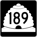
English: Media related to U.S. Route 189 in Utah (US 189), a 96.554-mile (155.389 km) section of U.S. Numbered Highway Utah, Wasatch, and Summit counties in Utah, United States, that connects Interstate 15 in Provo with Interstate 80 (I-80) / US 189 in Wyoming and is part of the National Highway System. From Provo Canyon Junction (in Heber City) and Silver Creek Junction (northeast of Park City) runs concurrent with U.S. Route 40 and from Silver Creek Junction to Wyoming runs concurrent with I-80.
From 1912 to 1977, the highway that ran along the (mostly) current corridor of US 189 in Utah between Provo and Provo Canyon Junction was designated by the Utah State Legislature as State Route 7. In Summit County, US 189 formerly roughly followed the current route of Utah State Route 32). Since 1977, the section of US 189 within Utah between Provo and Provo Canyon Junction has been designated by the Utah State Legislature as State Route 189, the section between Provo Canyon Junction and Silver Creek Junciton as State Route 40, and the section between Silver Creek Junction and Wyoming as State Route 189.
From 1912 to 1977, the highway that ran along the (mostly) current corridor of US 189 in Utah between Provo and Provo Canyon Junction was designated by the Utah State Legislature as State Route 7. In Summit County, US 189 formerly roughly followed the current route of Utah State Route 32). Since 1977, the section of US 189 within Utah between Provo and Provo Canyon Junction has been designated by the Utah State Legislature as State Route 189, the section between Provo Canyon Junction and Silver Creek Junciton as State Route 40, and the section between Silver Creek Junction and Wyoming as State Route 189.
Subcategories
This category has the following 6 subcategories, out of 6 total.
*
Media in category "U.S. Route 189 in Utah"
The following 5 files are in this category, out of 5 total.
-
 US 189 (UT) map.svg 1,180 × 688; 146 KB
-
 US 189 Utah 1926.svg 1,485 × 1,440; 28 KB
-
 Utah 189.svg 750 × 600; 73 KB
-
 Utah SR 189.svg 385 × 385; 9 KB
-
 WCNF Wilderness Map.jpg 700 × 513; 91 KB


