Category:U.S. Route 264
 | number: | (two hundred sixty-four) |
|---|---|---|
| U.S. Routes: | 250 · 258 · 259 · 260 · 264 · 266 · 270 · 271 · 275 · 276 · 277 · 278 · 280 · 281 · 283 |
highway in the United States  | |||||
| Upload media | |||||
| Instance of | |||||
|---|---|---|---|---|---|
| Location |
| ||||
| Transport network | |||||
| Owned by | |||||
| Maintained by | |||||
| Inception |
| ||||
| Length |
| ||||
| |||||
English: Media related to U.S. Route 264.
Subcategories
This category has only the following subcategory.
S
Pages in category "U.S. Route 264"
This category contains only the following page.
Media in category "U.S. Route 264"
The following 48 files are in this category, out of 48 total.
-
 15 Miles to Engelhard, U.S. 264 Near Lake Mattamuskeet, North Carolina (14444212491).jpg 4,000 × 3,000; 2.73 MB
-
 2010-11-09 US Route 264 Exit 60 to North Farmville.jpg 3,888 × 2,592; 3.32 MB
-
 Aerial View of Smoke Hovering Over Highway 264 (5754645331).jpg 2,500 × 1,875; 505 KB
-
 Dare County Bombing Range southern edge.jpg 6,016 × 4,000; 6.95 MB
-
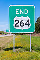
 End I-495 & US 264 Raleigh.jpg 5,520 × 3,105; 11.53 MB
-
 Engelhard post office 27824.jpg 6,016 × 4,000; 7.2 MB
-
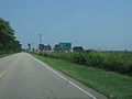
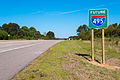 Future I-495-Knightdale.jpg 5,520 × 3,684; 6.94 MB
-
 George V. Credle House.jpg 6,016 × 4,000; 6.39 MB
-
 I-440 Exit 14 Gantry.jpg 5,520 × 3,684; 14.81 MB
-
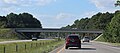
 I-495 South and US 264 West End.jpg 5,520 × 3,684; 14.83 MB
-
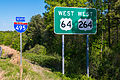
 I-495 US 64 US 264 Raleigh (2014).jpg 5,520 × 3,684; 9.68 MB
-
 I-495 US 64 US 264 Raleigh (2016).jpg 5,520 × 3,684; 17.49 MB
-
 I-540 Exit 26B Gantry.jpg 5,520 × 3,684; 10.47 MB
-
 I-587 West-I-795 North-US 264 West in Wilson County (September 2023) 01.jpg 6,000 × 3,282; 2.03 MB
-
 I-587 West-I-795 North-US 264 West in Wilson County (September 2023) 02.jpg 6,000 × 4,000; 7.14 MB
-
 I-587 West-I-795 North-US 264 West in Wilson County (September 2023) 03.jpg 5,944 × 2,855; 2.98 MB
-
 I-587 West-I-795 North-US 264 West in Wilson County (September 2023) 04.jpg 6,000 × 3,211; 3.07 MB
-
 I-587 West-I-795 North-US 264 West in Wilson County (September 2023) 05.jpg 5,944 × 2,634; 2.36 MB
-
 I-587 West-I-795 North-US 264 West in Wilson County (September 2023) 06.jpg 6,000 × 4,000; 11.76 MB
-
 I-587 West-I-795 North-US 264 West in Wilson County (September 2023) 07.jpg 6,000 × 4,000; 13.96 MB
-
 I-587 West-I-795 North-US 264 West in Wilson County (September 2023) 08.jpg 5,835 × 3,551; 3.18 MB
-
 I-587 West-I-795 North-US 264 West in Wilson County (September 2023) 09.jpg 6,000 × 3,136; 2.69 MB
-
 I-587 West-I-795 North-US 264 West in Wilson County (September 2023) 10.jpg 6,000 × 3,408; 3.41 MB
-
 I-587 West-I-795 North-US 264 West in Wilson County (September 2023) 11.jpg 6,000 × 4,000; 6.38 MB
-
 I-587 West-I-795 North-US 264 West in Wilson County (September 2023) 12.jpg 6,000 × 3,048; 1.94 MB
-
 I-587 West-I-795 North-US 264 West in Wilson County (September 2023) 13.jpg 6,000 × 4,000; 6.61 MB
-
 I-587 West-I-795 North-US 264 West in Wilson County (September 2023) 14 (cropped).jpg 4,472 × 3,899; 5.28 MB
-
 I-587 West-I-795 North-US 264 West in Wilson County (September 2023) 14.jpg 6,000 × 4,000; 6.58 MB
-
 I-587 West-I-795 North-US 264 West in Wilson County (September 2023) 15.jpg 6,000 × 3,813; 2.97 MB
-
 I-587 West-I-795 North-US 264 West in Wilson County (September 2023) 16.jpg 5,573 × 3,062; 1.87 MB
-
 I-587 West-I-795 North-US 264 West in Wilson County (September 2023) 17.jpg 6,000 × 4,000; 6.99 MB
-
 I-587 West-I-795 North-US 264 West in Wilson County (September 2023) 18.jpg 5,802 × 2,852; 2.02 MB
-
 I-795 and 587 Shields in NC 2.jpg 4,000 × 3,000; 1.33 MB
-
 I-795 and 587 Shields in NC.jpg 1,778 × 3,356; 914 KB
-
 I540endat64-264.jpg 2,848 × 2,136; 438 KB
-
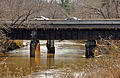 Knightdale Bypass Bridge.jpg 3,338 × 2,166; 2.22 MB
-
 Lake Landing farmhouse.jpg 6,016 × 4,000; 6.47 MB
-
 OhWikpedia2.jpg 1,244 × 1,436; 262 KB
-
 U.S. 264 Near Lake Mattamuskeet, North Carolina (14444221621).jpg 4,000 × 1,970; 4.39 MB
-
 U.S. 264, Between Belhaven and Swan Quarter, North Carolina (14260949098).jpg 4,000 × 3,000; 2.68 MB
-
 US 264 (1961).svg 600 × 600; 9 KB
-
 US 264 map.svg 1,180 × 688; 1.08 MB
-
 US 264 West End.jpg 3,684 × 5,520; 6.32 MB
-
 US 64 Exit 419 Diagrammatic Guide Sign.jpg 5,520 × 3,105; 10.31 MB
-
 US64 US264 I-495-Knightdale Ver 2.jpg 5,520 × 3,365; 11.8 MB
-
 US64 US264 I-495-Knightdale Ver 2A.jpg 5,520 × 3,684; 13.6 MB
-
 US64 US264 I-495-Knightdale.jpg 5,520 × 3,684; 7.79 MB
-
 Wynne's Folly.jpg 6,016 × 4,000; 6.41 MB
.jpg)

.jpg)


.jpg)
.jpg)

_01.jpg)
_02.jpg)
_03.jpg)
_04.jpg)
_05.jpg)
_06.jpg)
_07.jpg)
_08.jpg)
_09.jpg)
_10.jpg)
_11.jpg)
_12.jpg)
_13.jpg)
_14_(cropped).jpg)
_14.jpg)
_15.jpg)
_16.jpg)
_17.jpg)
_18.jpg)


.jpg)
.jpg)
.svg)


