Category:USGS isoseismal maps
Media in category "USGS isoseismal maps"
The following 36 files are in this category, out of 36 total.
-
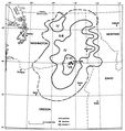
 1872 North Cascades Isoseismal Map.png 1,464 × 1,544; 508 KB
-
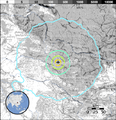
 1936 State Line earthquake isoseismal map.png 769 × 813; 228 KB
-
 1940 12 20 isoseismal map.PNG 646 × 531; 59 KB
-
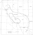
 1944 Cornwall Massena Isoseismal Map.png 651 × 530; 124 KB
-
 1968 Illinois earthquake.gif 644 × 615; 63 KB
-
 1968 Illinois earthquake.svg 394 × 360; 175 KB
-
 2009-September-Java-quake-shake-map-USGS.jpg 600 × 620; 58 KB
-
 2017 Nyingchi earthquake ShakeMap2.png 700 × 700; 227 KB
-
 2017 West Java earthquake ShakeMap2.png 700 × 699; 158 KB
-
 2018 Alaska Islands earthquake ShakeMap2.png 700 × 700; 125 KB
-
 2018 Alaska Islands earthquake ShakeMap3.png 700 × 700; 159 KB
-
 2018 Anchorage earthquake ShakeMap.png 700 × 700; 179 KB
-
 2018 Fiji earthquake ShakeMap2.png 700 × 699; 61 KB
-
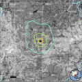
 2018 Hokkaido Eastern Iburi Earthquake ShakeMap.png 700 × 699; 178 KB
-
 2018 Lombok earthquake ShakeMap2.png 700 × 699; 160 KB
-
 2018 Oaxaca earthquake.png 700 × 699; 213 KB
-
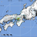 2018 Osaka earthquake ShakeMap.png 700 × 699; 215 KB
-
 2018 Shimane earthquake ShakeMap.png 700 × 699; 211 KB
-
 2018 Swan Islands earthquake ShakeMap2.png 700 × 700; 222 KB
-
 2018 Venezuela earthquake ShakeMap2.png 700 × 700; 175 KB
-

-
 2019 Changning Earthquake ShakeMap.png 700 × 699; 164 KB
-
 26 September 2019 5.7 - 20km Marmaraereglisi, Turkey earthquake.png 732 × 550; 506 KB
-
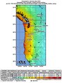
 9.0 Cascadia scenario (mean).jpg 612 × 729; 119 KB
-
 9.0 Cascadia scenario (median).pdf 1,168 × 1,564; 6.06 MB
-
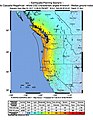 9.3 Cascadia scenario (mean).jpg 612 × 792; 127 KB
-
 Cairo 1992 Isoseismal Map-ar.png 1,458 × 1,727; 531 KB
-
 Cairo 1992 Isoseismal Map.PNG 1,458 × 1,727; 426 KB
-
 Exposure, Chabu earthquake 2013.png 540 × 558; 223 KB
-
 Isoseismal map of the 1946 Chatkal, Kyrgyzstan earthquake (M7.6).png 707 × 483; 151 KB
-
 Loma Prieta earthquake Isoseismal Map.gif 635 × 772; 52 KB
-
 M 5.5 - HINDU KUSH REGION, AFGHANISTAN.jpeg 600 × 607; 108 KB
-
 Mapa terremoto de Indonesia de 2012.png 540 × 558; 92 KB
-
 USGS - 1971 San Fernando earthquake - Isoseismal map.gif 658 × 557; 44 KB
-
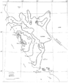
 USGS isoseismal map - 1857 Fort Tejon earthquake.gif 649 × 685; 33 KB
-
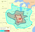
 USGS-FS017-03 madrid.jpg 683 × 449; 105 KB


.jpg)
.jpg)


.png)


