Category:Uferstraße (Amt Creuzburg)
| Object location | | View all coordinates using: OpenStreetMap |
|---|
street in Amt Creuzburg, Thuringia, Germany | |||||
| Upload media | |||||
| Instance of | |||||
|---|---|---|---|---|---|
| Location | Amt Creuzburg, Wartburgkreis, Thuringia, Germany | ||||
 | |||||
Media in category "Uferstraße (Amt Creuzburg)"
The following 5 files are in this category, out of 5 total.
-
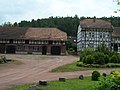
 Buchenau3.jpg 1,314 × 875; 859 KB
-
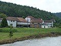
 WAK Buchenau 10.jpg 2,576 × 1,932; 1.21 MB
-
 WAK Buchenau 11.jpg 2,576 × 1,932; 1.31 MB
-
 WAK Buchenau 12.jpg 2,576 × 1,932; 1.23 MB
-
 WAK Buchenau2.jpg 2,576 × 1,932; 1.27 MB


