Category:Ufford, Cambridgeshire
English: Ufford is a civil parish in the city of Peterborough, Cambridgeshire in the United Kingdom. For electoral purposes it forms part of Glinton and Wittering ward in North West Cambridgeshire constituency.
village and civil parish in Peterborough, Cambridgeshire, England, UK  | |||||
| Upload media | |||||
| Instance of | |||||
|---|---|---|---|---|---|
| Location | City of Peterborough, Cambridgeshire, East of England, England | ||||
 | |||||
Subcategories
This category has the following 3 subcategories, out of 3 total.
A
- St. Andrew's Church, Ufford (35 F)
H
- Ufford Hall, Cambridgeshire (2 F)
W
- The White Hart Inn, Ufford (3 F)
Media in category "Ufford, Cambridgeshire"
The following 107 files are in this category, out of 107 total.
-
 Bridleway in The Severals near Ufford - geograph.org.uk - 4620838.jpg 4,320 × 3,240; 5.64 MB
-
 Churchyard wall - geograph.org.uk - 2445616.jpg 4,000 × 3,000; 4.38 MB
-
 Clarendon Cottage, Ufford (geograph 6895829).jpg 1,024 × 768; 162 KB
-
 Crest on Bridget Carre Memorial - geograph.org.uk - 3143458.jpg 2,256 × 1,504; 613 KB
-
 Entrance to Southey Wood - geograph.org.uk - 5366994.jpg 640 × 480; 101 KB
-
 Entrance to Southey Wood near Upton - geograph.org.uk - 3876639.jpg 4,320 × 3,240; 5.65 MB
-
 ETL crossing road - geograph.org.uk - 5366999.jpg 640 × 480; 44 KB
-
 Farm building on Stamford Road - geograph.org.uk - 3019684.jpg 640 × 480; 42 KB
-
 Farmland and pylon - geograph.org.uk - 3019689.jpg 640 × 480; 40 KB
-
 Farmland and trees south of Ufford - geograph.org.uk - 4620865.jpg 4,320 × 3,240; 5.75 MB
-
 Farmland near Ufford - geograph.org.uk - 2358078.jpg 640 × 480; 79 KB
-
 Farmland near Ufford - geograph.org.uk - 3019668.jpg 640 × 480; 73 KB
-
 Farmland off Stamford Road - geograph.org.uk - 3019685.jpg 640 × 480; 95 KB
-
 Farmland towards the Jubilee - geograph.org.uk - 3019682.jpg 640 × 480; 71 KB
-
 Farmland track from Southey Wood - geograph.org.uk - 4620899.jpg 4,320 × 3,240; 5.98 MB
-
 Field by Langley Bush Road - geograph.org.uk - 6159890.jpg 1,920 × 1,280; 732 KB
-

-
 Flood gates - geograph.org.uk - 4258119.jpg 4,320 × 3,240; 5.23 MB
-
 Flooded bridleway near Ufford - geograph.org.uk - 4258102.jpg 4,320 × 3,240; 5.9 MB
-
 Flowering hedgerows near Ufford, Peterborough - geograph.org.uk - 5016726.jpg 2,560 × 1,920; 2.21 MB
-
 Former barns at Walnut Tree Farm (geograph 6895754).jpg 1,024 × 768; 161 KB
-
 Former stables to Ufford Hall (geograph 6895822).jpg 1,024 × 768; 146 KB
-
 Glebeland in Ufford - geograph.org.uk - 5020606.jpg 640 × 480; 64 KB
-
 Hedgerow by Langley Bush Road - geograph.org.uk - 6139526.jpg 1,892 × 1,236; 1.35 MB
-
 High Field Road - geograph.org.uk - 997310.jpg 640 × 480; 45 KB
-
 High Field Road heading north to Ashton - geograph.org.uk - 3875302.jpg 4,320 × 3,240; 5.83 MB
-
 Horse and house in Ufford near Stamford - geograph.org.uk - 4577351.jpg 4,320 × 3,240; 5.51 MB
-
 Houses on Main Street, Ufford - geograph.org.uk - 3019674.jpg 640 × 480; 71 KB
-
 Inside St Andrew, Ufford (I) - geograph.org.uk - 5020566.jpg 480 × 640; 57 KB
-
 Inside St Andrew, Ufford (II) - geograph.org.uk - 5020567.jpg 480 × 640; 61 KB
-
 Inside St Andrew, Ufford (III) - geograph.org.uk - 5020568.jpg 640 × 480; 54 KB
-
 Inside St Andrew, Ufford (IV) - geograph.org.uk - 5020570.jpg 480 × 640; 53 KB
-
 Inside St Andrew, Ufford (V) - geograph.org.uk - 5020571.jpg 640 × 480; 41 KB
-
 Inside St Andrew, Ufford (VI) - geograph.org.uk - 5020573.jpg 480 × 640; 49 KB
-
 Lady Bridget Carre - geograph.org.uk - 4788092.jpg 1,024 × 683; 190 KB
-
 Lady Bridget Carre monument - geograph.org.uk - 4788091.jpg 1,024 × 683; 207 KB
-
 Lambpits Spinney near Ufford, Cambridgeshire - geograph.org.uk - 4258108.jpg 4,320 × 3,240; 5.65 MB
-
 Langdyke Bush Road - geograph.org.uk - 997259.jpg 640 × 480; 41 KB
-
 Langley Bush Road at the junction of Stamford Road - geograph.org.uk - 6134552.jpg 1,920 × 1,280; 1.74 MB
-
 Looking over the wall of Ufford Churchyard - geograph.org.uk - 2445619.jpg 4,000 × 3,000; 4.38 MB
-
 Main St running N from Ufford - geograph.org.uk - 3752747.jpg 1,024 × 768; 141 KB
-
 Main Street, Ufford - geograph.org.uk - 2445606.jpg 4,000 × 3,000; 4.43 MB
-
 Main Street, Ufford - geograph.org.uk - 5016732.jpg 2,560 × 1,920; 2.22 MB
-
 Main Street, Ufford, heading north - geograph.org.uk - 3019676.jpg 640 × 480; 47 KB
-

-
 Newport Way, Ufford - geograph.org.uk - 3019678.jpg 640 × 480; 53 KB
-
 On the outskirts of Bainton - geograph.org.uk - 2445761.jpg 4,000 × 3,000; 4.23 MB
-
 Oolitic limestone wall, Ufford - geograph.org.uk - 5016766.jpg 2,560 × 1,920; 2.39 MB
-
 Paddock and church in Ufford near Stamford - geograph.org.uk - 4577345.jpg 4,320 × 3,240; 5.57 MB
-
 Path towards Ufford - geograph.org.uk - 3019665.jpg 640 × 480; 69 KB
-
 Playground in Ufford - geograph.org.uk - 2445628.jpg 4,000 × 3,000; 4.13 MB
-
 Row of pylons by Langley Bush Road - geograph.org.uk - 6134697.jpg 1,920 × 1,280; 1.06 MB
-
 Rush hour in Ufford - geograph.org.uk - 5020608.jpg 640 × 480; 66 KB
-
 St Andrew's Parish Church, Ufford - geograph.org.uk - 5016748.jpg 2,560 × 1,920; 2.25 MB
-
 St Andrew, Ufford, cwgc grave - geograph.org.uk - 5020555.jpg 480 × 640; 71 KB
-
 St Andrew, Ufford, family plot - geograph.org.uk - 5020562.jpg 640 × 480; 126 KB
-
 St Andrew, Ufford, font - geograph.org.uk - 5020563.jpg 480 × 640; 63 KB
-
 St Andrew, Ufford, graves - geograph.org.uk - 5020557.jpg 640 × 480; 81 KB
-
 St Andrew, Ufford, gravestones - geograph.org.uk - 5020550.jpg 480 × 640; 81 KB
-
 St Andrew, Ufford, memorial (A) - geograph.org.uk - 5020575.jpg 480 × 640; 35 KB
-
 St Andrew, Ufford, memorial (B) - geograph.org.uk - 5020576.jpg 480 × 640; 50 KB
-
 St Andrew, Ufford, memorial (D) - geograph.org.uk - 5020579.jpg 640 × 480; 77 KB
-
 St Andrew, Ufford, memorial (E) - geograph.org.uk - 5020588.jpg 640 × 480; 73 KB
-
 St Andrew, Ufford, memorial (F) - geograph.org.uk - 5020589.jpg 480 × 640; 53 KB
-
 St Andrew, Ufford, memorial (G) - geograph.org.uk - 5020590.jpg 640 × 480; 66 KB
-
 St Andrew, Ufford, memorial (H) - geograph.org.uk - 5020591.jpg 640 × 480; 54 KB
-
 St Andrew, Ufford, memorial (I) - geograph.org.uk - 5020592.jpg 480 × 640; 40 KB
-
 St Andrew, Ufford, memorial (J) - geograph.org.uk - 5020593.jpg 480 × 640; 44 KB
-
 St Andrew, Ufford, memorial (K) - geograph.org.uk - 5020595.jpg 640 × 480; 64 KB
-
 St Andrew, Ufford, memorialS (C) - geograph.org.uk - 5020577.jpg 640 × 480; 57 KB
-
 St Andrew, Ufford, pulpit - geograph.org.uk - 5020574.jpg 640 × 480; 62 KB
-
 St Andrew, Ufford, rectory - geograph.org.uk - 5020545.jpg 640 × 480; 77 KB
-

-

-

-

-

-

-

-

-

-

-
 St Andrew, Ufford, tomb - geograph.org.uk - 5020547.jpg 480 × 640; 96 KB
-
 St Andrew, Ufford, tower - geograph.org.uk - 5020556.jpg 480 × 640; 94 KB
-
 St.Andrew's church - geograph.org.uk - 4788081.jpg 1,024 × 683; 204 KB
-
 St.Andrew's Church - geograph.org.uk - 5171425.jpg 1,600 × 1,067; 643 KB
-
 Stamford Road towards Marholm - geograph.org.uk - 3019687.jpg 640 × 480; 53 KB
-
 Stamford Road towards Marholm - geograph.org.uk - 3019688.jpg 640 × 480; 55 KB
-
 Stubble field at Bainton - geograph.org.uk - 6266024.jpg 1,024 × 768; 230 KB
-
 The edge of Fox Covert - geograph.org.uk - 4620820.jpg 4,320 × 3,240; 5.97 MB
-
 The Old Rectory, Ufford (geograph 6894548).jpg 1,024 × 768; 295 KB
-
 The Roost, Ufford (geograph 6895846).jpg 1,024 × 768; 325 KB
-
 Track and barrier in Southey Wood - geograph.org.uk - 3876637.jpg 4,320 × 3,240; 5.67 MB
-
 Traffic jam in Ufford - geograph.org.uk - 5012392.jpg 640 × 480; 64 KB
-
 Ufford - geograph.org.uk - 2358082.jpg 640 × 480; 64 KB
-
 Ufford - geograph.org.uk - 4788069.jpg 1,024 × 683; 207 KB
-
 Ufford Church - geograph.org.uk - 4021943.jpg 1,600 × 1,200; 296 KB
-
 Ufford Hall - geograph.org.uk - 4021950.jpg 1,600 × 1,067; 439 KB
-
 Ufford Hall - geograph.org.uk - 5171538.jpg 1,600 × 1,067; 423 KB
-
 Ufford Heath Farm, Ufford - geograph.org.uk - 5016723.jpg 2,560 × 1,807; 2.28 MB
-
 Ufford village - geograph.org.uk - 2445623.jpg 4,000 × 3,000; 3.92 MB
-
 Ufford village, Peterborough - geograph.org.uk - 94740.jpg 640 × 480; 250 KB
-
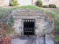
 Ufford Well - geograph.org.uk - 4788085.jpg 1,024 × 683; 406 KB
-
 Ufford Well, Peterborough - geograph.org.uk - 171356.jpg 640 × 480; 304 KB
-
 Ufford Well, Peterborough - geograph.org.uk - 171359.jpg 640 × 480; 406 KB
-
 Woodlands Cottage, Ufford (geograph 6895766).jpg 1,024 × 768; 161 KB
-
 Marholm Road, Ufford, Peterborough - geograph.org.uk - 94742.jpg 640 × 480; 310 KB


.jpg)


.jpg)
.jpg)


_-_geograph.org.uk_-_5020566.jpg)
_-_geograph.org.uk_-_5020567.jpg)
_-_geograph.org.uk_-_5020568.jpg)
_-_geograph.org.uk_-_5020570.jpg)
_-_geograph.org.uk_-_5020571.jpg)
_-_geograph.org.uk_-_5020573.jpg)


_-_geograph.org.uk_-_5020575.jpg)
_-_geograph.org.uk_-_5020576.jpg)
_-_geograph.org.uk_-_5020579.jpg)
_-_geograph.org.uk_-_5020588.jpg)
_-_geograph.org.uk_-_5020589.jpg)
_-_geograph.org.uk_-_5020590.jpg)
_-_geograph.org.uk_-_5020591.jpg)
_-_geograph.org.uk_-_5020592.jpg)
_-_geograph.org.uk_-_5020593.jpg)
_-_geograph.org.uk_-_5020595.jpg)
_-_geograph.org.uk_-_5020577.jpg)


_-_geograph.org.uk_-_5020597.jpg)
_-_geograph.org.uk_-_5020598.jpg)
_-_geograph.org.uk_-_5020599.jpg)
_-_geograph.org.uk_-_5020601.jpg)
_-_geograph.org.uk_-_5020602.jpg)
_-_geograph.org.uk_-_5020603.jpg)
_-_geograph.org.uk_-_5020605.jpg)


.jpg)
.jpg)


.jpg)
