Category:Unemployment rate maps of Germany
Media in category "Unemployment rate maps of Germany"
The following 24 files are in this category, out of 24 total.
-
 Arbeitslosenquote Kreisebene 2021.svg 946 × 1,253; 686 KB
-
 Arbeitslosenquote Mecklenburg-Vorpommern 12.07.PNG 763 × 566; 29 KB
-
 Arbeitslosenquote Mecklenburg-Vorpommern.PNG 763 × 566; 59 KB
-
 Arbeitslosigkeit 2010-10.png 2,814 × 3,841; 471 KB
-
 Arbeitslosigkeit 2011-10.png 2,814 × 3,841; 721 KB
-
 Arbeitslosigkeit 2012-10.png 2,814 × 3,841; 718 KB
-
 Arbeitslosigkeit 2013-10.png 2,814 × 3,841; 718 KB
-
 Arbeitslosigkeit 2014-10.png 2,814 × 3,841; 1.42 MB
-
 Arbeitslosigkeit 2015-10.png 2,814 × 3,841; 1.41 MB
-
 Arbeitslosigkeit 2017-10.png 2,814 × 3,841; 1.31 MB
-
 Arbeitslosigkeit 2018-10.png 2,814 × 3,841; 1.3 MB
-
 Arbeitslosigkeit 2019-10.png 2,814 × 3,841; 1.17 MB
-
 Arbeitslosigkeit 2020-10.png 2,814 × 3,841; 1.17 MB
-
 Arbeitslosigkeit 2021-10.png 2,814 × 3,841; 1.31 MB
-
 Arbeitslosigkeit 2022-10.png 2,814 × 3,841; 1.31 MB
-
 Arbeitslosigkeit 2023-10.png 2,814 × 3,841; 1.31 MB
-
 ArbeitslosigkeitInDeutschland1997.png 920 × 1,336; 340 KB
-
 ArbeitslosigkeitInDeutschland1997Lat.PNG 920 × 1,336; 217 KB
-
 Germany Laender Arbeitslos.png 668 × 910; 25 KB
-
 Optionskarte Stand 01.01.2012f-mit Kreisnamen.jpg 2,197 × 3,076; 3.37 MB
-
 Optionskarte Stand 01.01.2012f-ohne Kreisnamen.jpg 2,197 × 3,076; 2.69 MB
-
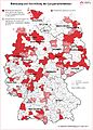
 SoziodemographieDeutschlandsNachDerWiedervereinigung.png 1,637 × 986; 487 KB
-
 Arbeitslosigkeit TH 0407.PNG 710 × 606; 75 KB
-
 Unemployment in Germany 2003 by states.png 522 × 729; 112 KB


