Category:United Kingdom photographs taken on 2003-04-12
Countries of Europe: Austria · Czech Republic · Germany · Poland · Russia‡ · Spain‡ · United Kingdom · Vatican City
‡: partly located in Europe
‡: partly located in Europe
| ← | 12 April 2003 | → | ||
| ← | April 2003 | → | ||

United Kingdom photographs taken on 12 April 2003.
Image files should be categorized here automatically using {{taken on}} template. Direct categorisation is also possible, if automatic is impossible.
Media in category "United Kingdom photographs taken on 2003-04-12"
The following 65 files are in this category, out of 65 total.
-
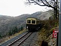 A train heading for Devils Bridge (geograph 5659167).jpg 640 × 480; 109 KB
-

-
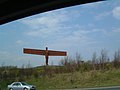 Angel of the North, Gateshead - geograph.org.uk - 1408.jpg 640 × 480; 26 KB
-
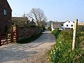 Bradley Farm and Cottages - geograph.org.uk - 65364.jpg 640 × 480; 105 KB
-
 Bridge over the East Lyn - geograph.org.uk - 460198.jpg 640 × 480; 74 KB
-

-
 Cows with calves in the Weaver Valley - geograph.org.uk - 62569.jpg 640 × 480; 104 KB
-
 Dog and Cow by the Frodsham Cut - geograph.org.uk - 65369.jpg 640 × 480; 85 KB
-
 Faulkner Street, Chinatown, Manchester - geograph.org.uk - 3701.jpg 420 × 640; 53 KB
-
 Fernworthy forest - Dartmoor - geograph.org.uk - 68058.jpg 640 × 425; 103 KB
-
 Fernworthy forest - geograph.org.uk - 15271.jpg 640 × 425; 118 KB
-
 Fountains Abbey - geograph.org.uk - 85950.jpg 640 × 480; 84 KB
-
 G-BXWE 2 Fokker 100 bmi british midland MAN 12APR03 (8375042689).jpg 4,460 × 2,973; 1.17 MB
-
 G-JEAM B.Ae 146-300 British European MAN 12APR03 (8376115874).jpg 4,499 × 2,999; 1.26 MB
-
 Great Varracombe - geograph.org.uk - 15236.jpg 640 × 425; 84 KB
-
 Harbour, Lynmouth - geograph.org.uk - 239573.jpg 640 × 480; 180 KB
-
 Longwood Junction, Rushall Canal - panoramio (1).jpg 2,048 × 1,536; 1.21 MB
-
 Longwood Junction, Rushall Canal - panoramio.jpg 2,048 × 1,536; 1.25 MB
-
 Lynmouth Flood Memorial Hall - geograph.org.uk - 460178.jpg 640 × 480; 178 KB
-
 Lynton-Lynmouth cliff railway - geograph.org.uk - 460209.jpg 480 × 640; 67 KB
-
 Old lighthouse, Port Logan - geograph.org.uk - 359133.jpg 480 × 640; 68 KB
-

-
 Rushall Canal - panoramio (1).jpg 2,048 × 1,536; 1.22 MB
-
 Rushall Canal - panoramio.jpg 2,048 × 1,536; 1.31 MB
-
 S Peter, Thornton, Leics - geograph.org.uk - 386645.jpg 418 × 640; 147 KB
-
 S Peter, Thornton, Leics - geograph.org.uk - 386647.jpg 390 × 640; 130 KB
-
 South Pier - geograph.org.uk - 567370.jpg 640 × 456; 80 KB
-
 Spitfire Hanger, Walsall Airport - panoramio.jpg 2,048 × 1,536; 1.32 MB
-
 St Allen Church, Cornwall - geograph.org.uk - 85585.jpg 640 × 480; 112 KB
-
 St James the Great, Twycross, Leics - geograph.org.uk - 387614.jpg 640 × 483; 75 KB
-
 St Margaret, Stoke Golding - Arcade - geograph.org.uk - 387608.jpg 640 × 425; 99 KB
-
 St Margaret, Stoke Golding - Capital - geograph.org.uk - 387600.jpg 425 × 640; 99 KB
-
 St Margaret, Stoke Golding - Capital - geograph.org.uk - 387606.jpg 465 × 640; 98 KB
-
 St Margaret, Stoke Golding - East end - geograph.org.uk - 387593.jpg 434 × 640; 100 KB
-
 St Margaret, Stoke Golding - Font - geograph.org.uk - 387595.jpg 438 × 640; 97 KB
-
 St Margaret, Stoke Golding - Roof feature - geograph.org.uk - 387610.jpg 506 × 640; 107 KB
-

-
 St Margaret, Stoke Golding - Window - geograph.org.uk - 387609.jpg 425 × 640; 118 KB
-
 St Margaret, Stoke Golding, Leics - geograph.org.uk - 386651.jpg 442 × 640; 144 KB
-
 St Mary, Elmsthorpe, Leics - geograph.org.uk - 386642.jpg 640 × 425; 116 KB
-
 St Mary, Lutterworth, Leics - geograph.org.uk - 386336.jpg 435 × 640; 87 KB
-
 St Mary, Lutterworth, Leics - geograph.org.uk - 386337.jpg 421 × 640; 95 KB
-
 St Peter, Claybrooke Parva - Doorways - geograph.org.uk - 386629.jpg 463 × 640; 114 KB
-
 St Peter, Claybrooke Parva - geograph.org.uk - 386624.jpg 419 × 640; 94 KB
-
 St Peter, Claybrooke Parva - geograph.org.uk - 386626.jpg 640 × 619; 102 KB
-
 St Peter, Claybrooke Parva - geograph.org.uk - 386630.jpg 640 × 425; 83 KB
-

-

-
 St Peter, Claybrooke Parva, Leics - geograph.org.uk - 386339.jpg 640 × 440; 135 KB
-

-
 St Michael, Stoney Stanton, Leics - geograph.org.uk - 386635.jpg 502 × 640; 109 KB
-
 St Michael, Stoney Stanton, Leics - geograph.org.uk - 386640.jpg 640 × 540; 153 KB
-

-
 Thatched cottage - geograph.org.uk - 460186.jpg 640 × 480; 179 KB
-
 The Tors Hotel - geograph.org.uk - 239566.jpg 640 × 480; 241 KB
-
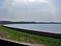 Top Hill Low Nature Reserve - geograph.org.uk - 897232.jpg 640 × 480; 130 KB
-
 Top Hill Low Nature Reserve - geograph.org.uk - 897235.jpg 640 × 426; 222 KB
-
 Union of South Africa - geograph.org.uk - 101632.jpg 640 × 447; 92 KB
-
 Vale of Rheidol Railway - geograph.org.uk - 482176.jpg 640 × 480; 153 KB
-
 Whitehorse Hill - geograph.org.uk - 15272.jpg 640 × 425; 96 KB
-
 Limestone shaft - geograph.org.uk - 61833.jpg 640 × 480; 101 KB
-
 Lorbottle Weststeads - geograph.org.uk - 726.jpg 640 × 480; 41 KB
-
 Lydebrook (Loamhole) Dingle - geograph.org.uk - 161827.jpg 640 × 480; 145 KB
-
 Rothbury - geograph.org.uk - 727.jpg 640 × 480; 49 KB
-
 South Pier - geograph.org.uk - 567360.jpg 639 × 425; 81 KB
.jpg)


.jpg)
.jpg)


.jpg)


.jpg)


_Dingle_-_geograph.org.uk_-_161827.jpg)

