Category:United Kingdom photographs taken on 2004-07-07
Countries of Europe: Belgium · Croatia · Finland · France‡ · Germany · Greece · Republic of Ireland · Italy · Netherlands‡ · Norway · Poland · Russia‡ · Slovakia · Spain‡ · Sweden · Switzerland · United Kingdom
‡: partly located in Europe
‡: partly located in Europe
| ← | 7 July 2004 | → | ||
| ← | July 2004 | → | ||

United Kingdom photographs taken on 7 July 2004.
Image files should be categorized here automatically using {{taken on}} template. Direct categorisation is also possible, if automatic is impossible.
Media in category "United Kingdom photographs taken on 2004-07-07"
The following 55 files are in this category, out of 55 total.
-

-
 70.299 BF1666 Large Emerald, Geometra papilionaria (3120191525).jpg 2,272 × 1,704; 1.03 MB
-
 B5130 going into Farndon - geograph.org.uk - 12516.jpg 640 × 480; 157 KB
-
 Bridge over the Aldford Brook - geograph.org.uk - 12515.jpg 640 × 480; 176 KB
-
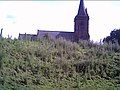
 Bruera, St. Marys Parish Church - geograph.org.uk - 12513.jpg 640 × 480; 113 KB
-
 Bruera, St. Marys Parish Church Gate - geograph.org.uk - 12514.jpg 640 × 480; 169 KB
-
 Castleford Lock Junction - geograph.org.uk - 11127.jpg 640 × 480; 109 KB
-
 Clogau Mawr - geograph.org.uk - 62358.jpg 640 × 480; 88 KB
-
 Conduit Mews, Paddington - geograph.org.uk - 3724.jpg 640 × 480; 70 KB
-

-
 Ditsworthy Warren House - geograph.org.uk - 9814.jpg 640 × 480; 133 KB
-
 Dry Wath on the River Nidd - geograph.org.uk - 466711.jpg 640 × 480; 77 KB
-
 East Wharves, Manchester - geograph.org.uk - 727748.jpg 640 × 480; 231 KB
-
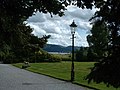
 Garden at Thwaite House - geograph.org.uk - 466712.jpg 640 × 480; 77 KB
-
 Glenwhan Garden - geograph.org.uk - 331062.jpg 540 × 396; 88 KB
-
 Glenwhan Garden - geograph.org.uk - 331064.jpg 570 × 418; 99 KB
-
 Grimes Graves, near Thetford, Norfolk - geograph.org.uk - 40466.jpg 640 × 427; 62 KB
-
 Grimes Graves, near Thetford, Norfolk - geograph.org.uk - 41510.jpg 640 × 427; 87 KB
-
 Kishorn Seafood Bar - geograph.org.uk - 372046.jpg 640 × 479; 155 KB
-
 Letter Box, Baybridge - geograph.org.uk - 77497.jpg 427 × 640; 157 KB
-
 Loch Lomond Golf Club - geograph.org.uk - 61821.jpg 480 × 640; 93 KB
-
 Lofthouse Post Office - geograph.org.uk - 466720.jpg 640 × 480; 78 KB
-
 Lofthouse War Memorial 1914-1919 - geograph.org.uk - 466730.jpg 640 × 480; 76 KB
-
 Manchester airport - geograph.org.uk - 50714.jpg 640 × 480; 125 KB
-
 Manchester Ship Canal - geograph.org.uk - 727741.jpg 640 × 380; 129 KB
-
 Old Barn at upper Coberley - geograph.org.uk - 1508091.jpg 640 × 480; 65 KB
-
 Old dairy Upper Coberley farm. - geograph.org.uk - 1543997.jpg 640 × 480; 77 KB
-
 Old Stables Upper Coberley farm - geograph.org.uk - 1544006.jpg 640 × 480; 80 KB
-
 Riddlehamhope - geograph.org.uk - 77506.jpg 640 × 427; 77 KB
-
 Rossdhu Bay, Loch Lomond - geograph.org.uk - 61814.jpg 640 × 480; 95 KB
-
 Ruined Engine House near Blanchland - geograph.org.uk - 77643.jpg 640 × 427; 182 KB
-
 Sheep Fold, Riddlehamhope - geograph.org.uk - 77510.jpg 640 × 427; 184 KB
-
 Shooting House above Thrope Edge - geograph.org.uk - 466717.jpg 640 × 480; 37 KB
-

-
 St John the Baptist Church - geograph.org.uk - 11190.jpg 640 × 480; 122 KB
-
 St. James, Acton Trussell - geograph.org.uk - 119868.jpg 640 × 427; 73 KB
-
 St. John, Stretton - geograph.org.uk - 119819.jpg 640 × 427; 95 KB
-
 Stafford town centre.jpg 640 × 480; 194 KB
-
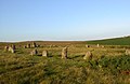 Stone Circle at Brisworthy - geograph.org.uk - 9820.jpg 640 × 416; 61 KB
-
 The Chesterfield Canal at Turnerwood - geograph.org.uk - 1548807.jpg 640 × 480; 81 KB
-
 Thwaite House - geograph.org.uk - 466714.jpg 640 × 480; 66 KB
-
 Towards Derwent Water - geograph.org.uk - 35621.jpg 640 × 480; 102 KB
-
 Trafford Wharf Road, Manchester - geograph.org.uk - 727752.jpg 640 × 403; 127 KB
-
 Wall on Bulbeck Common - geograph.org.uk - 77622.jpg 640 × 427; 89 KB
-
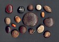 Western Isles, drift seeds - geograph.org.uk - 1745719.jpg 1,280 × 918; 351 KB
-
 Blanchland - geograph.org.uk - 78687.jpg 640 × 427; 188 KB
-
 Gravel Lane - geograph.org.uk - 86018.jpg 640 × 480; 72 KB
-
 Main Road Farndon near Chester - geograph.org.uk - 10521.jpg 640 × 480; 109 KB
-
-
 Milestone, Baybridge to Riddlehamhope - geograph.org.uk - 77504.jpg 640 × 427; 167 KB
-
 River Dee - geograph.org.uk - 101826.jpg 640 × 480; 134 KB
-
 Shooter's Hut on Hope Fell - geograph.org.uk - 77536.jpg 640 × 427; 83 KB
-
 Shops on the B5130 on the way into Farndon - geograph.org.uk - 12518.jpg 640 × 480; 122 KB
-

-
 View over loch a'Chairn Bhain - geograph.org.uk - 32259.jpg 640 × 480; 44 KB

.jpg)


