Category:United Kingdom photographs taken on 2004-07-17
Countries of Europe: Azerbaijan‡ · Belgium · Bosnia and Herzegovina · Croatia · Czech Republic · Denmark · Finland · France‡ · Germany · Greece · Hungary · Italy · Norway · Poland · Russia‡ · Slovakia · Spain‡ · Sweden · Ukraine · United Kingdom
‡: partly located in Europe
‡: partly located in Europe
| ← | 17 July 2004 | → | ||
| ← | July 2004 | → | ||

United Kingdom photographs taken on 17 July 2004.
Image files should be categorized here automatically using {{taken on}} template. Direct categorisation is also possible, if automatic is impossible.
Media in category "United Kingdom photographs taken on 2004-07-17"
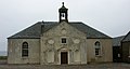
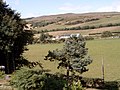
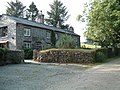
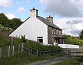
The following 40 files are in this category, out of 40 total.
-
 421885 clapham junction station.jpg 1,280 × 960; 312 KB
-
 Adventure Island, Southend seafront - geograph.org.uk - 299302.jpg 499 × 376; 179 KB
-
 Bat's Head - geograph.org.uk - 55736.jpg 640 × 480; 95 KB
-
 Battle Remains, Lulworth Camp - geograph.org.uk - 51115.jpg 640 × 480; 123 KB
-
 Bays Water - geograph.org.uk - 433195.jpg 640 × 480; 119 KB
-
 Bays Water Shun - geograph.org.uk - 433184.jpg 640 × 480; 124 KB
-
 Brackagh - valley and farmland - geograph.org.uk - 247097.jpg 640 × 480; 177 KB
-
 Claggan Public Elementary School - geograph.org.uk - 247075.jpg 640 × 480; 147 KB
-
 Clovelly strata - geograph.org.uk - 18503.jpg 640 × 425; 160 KB
-
 Coo.jpg 2,580 × 1,932; 1.76 MB
-
 Drovers Road to Soar y Mynydd - geograph.org.uk - 359824.jpg 640 × 447; 96 KB
-
 Four BAs at Heathrow.jpg 1,024 × 704; 219 KB
-
 Harbour at Gardenstown - geograph.org.uk - 110325.jpg 640 × 415; 86 KB
-
 Houlls Water - geograph.org.uk - 433207.jpg 640 × 480; 114 KB
-
-
 Looking west from Seaton beach - geograph.org.uk - 1516.jpg 640 × 480; 39 KB
-
 Maumbury Rings - geograph.org.uk - 46599.jpg 640 × 427; 80 KB
-
 Penmaenpool signal box - 2004-07-17.jpg 2,048 × 1,536; 1.36 MB
-
 Sailing past Davaar Island - geograph.org.uk - 74773.jpg 640 × 480; 50 KB
-
 Seaton from the beach - geograph.org.uk - 1515.jpg 640 × 480; 50 KB
-
 Slievemoyle - geograph.org.uk - 247086.jpg 640 × 480; 194 KB
-
 Stair Hole - geograph.org.uk - 55755.jpg 640 × 480; 166 KB
-
 Stanhope Station on the Weardale Railway.jpg 640 × 416; 408 KB
-
 Sunset on Cleveleys Beach - geograph.org.uk - 252621.jpg 480 × 640; 37 KB
-
 Tanronnen Inn at Beddgelert - geograph.org.uk - 122132.jpg 640 × 480; 99 KB
-
 The Ouse from Lindisfarne Castle - geograph.org.uk - 1650486.jpg 640 × 452; 57 KB
-
 Tin miners cottage - geograph.org.uk - 1524337.jpg 640 × 480; 124 KB
-

-
 Tully Bay - geograph.org.uk - 39267.jpg 640 × 480; 53 KB
-
-
 Vicars' Close Wells - geograph.org.uk - 774436.jpg 640 × 480; 118 KB
-
 View of Wittenham Clumps - geograph.org.uk - 12602.jpg 640 × 480; 127 KB
-
 Black Ven - geograph.org.uk - 7023.jpg 640 × 480; 147 KB
-
 Chesil beach - geograph.org.uk - 7243.jpg 640 × 480; 110 KB
-

-

-
 Kippielaw with Traprain - geograph.org.uk - 353597.jpg 640 × 473; 167 KB
-

-

-
 Track at Loscombe Down. - geograph.org.uk - 82304.jpg 640 × 480; 160 KB


