Category:United Kingdom photographs taken on 2004-09-01
Countries of Europe: Austria · Belgium · Denmark · Finland · Germany · Greece · Italy · Netherlands‡ · Poland · Russia‡ · Switzerland · Ukraine · United Kingdom
‡: partly located in Europe
‡: partly located in Europe
| ← | 1 September 2004 | → | ||
| ← | September 2004 | → | ||

United Kingdom photographs taken on 1 September 2004.
Image files should be categorized here automatically using {{taken on}} template. Direct categorisation is also possible, if automatic is impossible.
Media in category "United Kingdom photographs taken on 2004-09-01"
The following 42 files are in this category, out of 42 total.
-
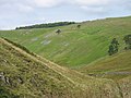
 Ashen Hill Barrows - geograph.org.uk - 74748.jpg 640 × 480; 115 KB
-
 Baling silage in Salcombe - geograph.org.uk - 276471.jpg 640 × 480; 103 KB
-
 Bealach a' Chornaidh, Quinag - geograph.org.uk - 61815.jpg 640 × 480; 43 KB
-
-
 Bumblebee on Sedum - geograph.org.uk - 665960.jpg 640 × 536; 146 KB
-
 Cadbury Castle - geograph.org.uk - 990888.jpg 640 × 426; 108 KB
-
 Canning Half Tide Dock - geograph.org.uk - 979613.jpg 640 × 480; 89 KB
-
 Cash Burn and Black Burn (confluence) - geograph.org.uk - 107388.jpg 640 × 480; 65 KB
-
 Drayton Manor Park - geograph.org.uk - 1617203.jpg 640 × 480; 79 KB
-
 Drystone Wall near Lower Pitts Farm - geograph.org.uk - 91535.jpg 640 × 480; 115 KB
-
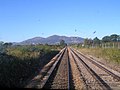
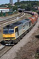 EWS Freight Train - geograph.org.uk - 360436.jpg 426 × 640; 125 KB
-
 Greencastle - geograph.org.uk - 107384.jpg 640 × 480; 89 KB
-
 Grouse Shooting, Slape Wath Moor - geograph.org.uk - 78044.jpg 640 × 427; 82 KB
-
 Island Sailing Club - geograph.org.uk - 18430.jpg 640 × 480; 168 KB
-
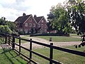 Lee Park Lodge, Lee - geograph.org.uk - 854899.jpg 500 × 375; 44 KB
-
 Powis Lodge, College Bounds - geograph.org.uk - 118523.jpg 640 × 480; 81 KB
-
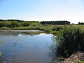 Priddy Pool - geograph.org.uk - 74745.jpg 640 × 480; 90 KB
-
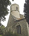 Sedgeford church - geograph.org.uk - 167365.jpg 512 × 640; 108 KB
-
 Silage making in Salcombe - geograph.org.uk - 276472.jpg 640 × 480; 70 KB
-

-
 Smitham station - geograph.org.uk - 856155.jpg 640 × 480; 97 KB
-

-
 St Mildred's church Tenterden - geograph.org.uk - 175316.jpg 480 × 640; 119 KB
-
 Stanway House - geograph.org.uk - 40125.jpg 480 × 640; 120 KB
-
 The Cockan Cross - geograph.org.uk - 75765.jpg 640 × 427; 132 KB
-
 The Coulsdon Inner Relief Road - geograph.org.uk - 856160.jpg 640 × 480; 127 KB
-
 The Liver Building - geograph.org.uk - 922287.jpg 480 × 640; 73 KB
-
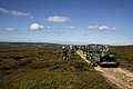
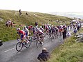 Tour of Britain - geograph.org.uk - 1069875.jpg 640 × 480; 88 KB
-
 Two Icons together^ - geograph.org.uk - 674087.jpg 640 × 434; 76 KB
-
 White Cross, Hereford. - geograph.org.uk - 231512.jpg 480 × 640; 78 KB
-
 Worcester Cathedral and river Severn - geograph.org.uk - 5687.jpg 640 × 480; 49 KB
-
 Aberdeenshire Harvest, Udny - geograph.org.uk - 143622.jpg 640 × 480; 65 KB
-
 Bealach na Ba - geograph.org.uk - 684303.jpg 640 × 482; 138 KB
-
 Cash Force Waterfall - geograph.org.uk - 107377.jpg 480 × 640; 125 KB
-
 Kilberry Parish Church, Carse, Argyll - geograph.org.uk - 15046.jpg 640 × 480; 142 KB
-
 Lanyon Quoit - geograph.org.uk - 117634.jpg 640 × 427; 83 KB
-
 Roel Gate - geograph.org.uk - 40126.jpg 640 × 480; 136 KB
-
 St Cathan's Church, Isle of Gigha - geograph.org.uk - 15078.jpg 640 × 397; 131 KB
-
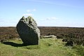 The Cammon Stone, Rudland Rigg - geograph.org.uk - 75768.jpg 640 × 427; 88 KB
-
 The Malvern Hills from Newland East - geograph.org.uk - 5683.jpg 640 × 480; 61 KB
-
 Union Mill, Cranbrook, Kent - geograph.org.uk - 175319.jpg 480 × 640; 84 KB
-
 View from The Solent - geograph.org.uk - 18437.jpg 640 × 480; 139 KB


_-_geograph.org.uk_-_107388.jpg)


