Category:United Kingdom photographs taken on 2005-04-20
Countries of Europe: Armenia‡ · Czech Republic · Finland · France‡ · Germany · Netherlands‡ · Russia‡ · Spain‡ · Turkey‡ · United Kingdom
‡: partly located in Europe
‡: partly located in Europe
| ← | 20 April 2005 | → | ||
| ← | April 2005 | → | ||

United Kingdom photographs taken on 20 April 2005.
Image files should be categorized here automatically using {{taken on}} template. Direct categorisation is also possible, if automatic is impossible.
Media in category "United Kingdom photographs taken on 2005-04-20"
The following 118 files are in this category, out of 118 total.
-

-
 A few of the many - geograph.org.uk - 95579.jpg 640 × 426; 149 KB
-
 Aberdeen Mercat Cross.jpg 640 × 479; 99 KB
-
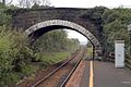
 Ballycarry Station - geograph.org.uk - 312345.jpg 640 × 426; 137 KB
-
 BBC White City - geograph.org.uk - 587490.jpg 640 × 480; 81 KB
-
 Ben Vrackie - geograph.org.uk - 1196277.jpg 640 × 480; 75 KB
-
 Ben Vrackie's western slopes - geograph.org.uk - 1592019.jpg 640 × 536; 146 KB
-
 Berrow Church and Cross - geograph.org.uk - 4986.jpg 640 × 479; 68 KB
-
 Bewdley Bridge - geograph.org.uk - 1153377.jpg 640 × 480; 231 KB
-
 Birtsmorton Church - geograph.org.uk - 4978.jpg 640 × 479; 98 KB
-
 Bottesford Church - geograph.org.uk - 285056.jpg 640 × 475; 76 KB
-
 Chickengrove Bottom - geograph.org.uk - 301456.jpg 640 × 409; 133 KB
-
-
 Com Head and Pengirt Cove - geograph.org.uk - 226072.jpg 640 × 480; 91 KB
-
 Cowslips - geograph.org.uk - 301465.jpg 640 × 435; 168 KB
-
 Devil's Water, near Corbridge - geograph.org.uk - 124353.jpg 640 × 480; 155 KB
-
 Devil's Water, near Hexham - geograph.org.uk - 124352.jpg 640 × 480; 148 KB
-
 Didcot Parkway Station - geograph.org.uk - 15381.jpg 640 × 480; 88 KB
-
 Dilston Park, near Corbridge - geograph.org.uk - 124211.jpg 640 × 311; 60 KB
-
 Down train to Caterham - geograph.org.uk - 56906.jpg 640 × 480; 123 KB
-
 Entrance to the Wakefield Europort. - geograph.org.uk - 5362.jpg 640 × 426; 27 KB
-

-
 Fingle Bridge - geograph.org.uk - 31543.jpg 640 × 467; 165 KB
-

-

-
 Gilda Brook, Eccles, Manchester - geograph.org.uk - 5324.jpg 640 × 480; 117 KB
-
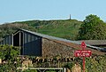
 Hampton Loade Ferry - geograph.org.uk - 1153386.jpg 640 × 480; 352 KB
-
 Headstone.motorbike.arp.jpg 1,500 × 1,086; 536 KB
-
 Holy Trinity Church, Milton Regis - geograph.org.uk - 4979.jpg 640 × 480; 133 KB
-
 Hurst Point View - geograph.org.uk - 702727.jpg 640 × 480; 101 KB
-
 Island of Eigg - geograph.org.uk - 151342.jpg 640 × 480; 74 KB
-
 Kings Road Lock - geograph.org.uk - 5356.jpg 640 × 426; 72 KB
-
 Kinloch Castle, Rum - geograph.org.uk - 151435.jpg 640 × 480; 98 KB
-
 Larch Flower - geograph.org.uk - 1277628.jpg 480 × 640; 143 KB
-

-
 Linnels Bridge near Corbridge - geograph.org.uk - 124357.jpg 640 × 480; 135 KB
-
 Linnels Mill - geograph.org.uk - 124355.jpg 640 × 480; 135 KB
-
 Linnels near Corbridge - geograph.org.uk - 124360.jpg 640 × 480; 145 KB
-
 Longdon Church - geograph.org.uk - 4965.jpg 640 × 479; 55 KB
-

-

-

-

-
 Milton recreation ground - geograph.org.uk - 4961.jpg 640 × 480; 79 KB
-
 Mythe Bridge Toll House - geograph.org.uk - 4939.jpg 640 × 479; 83 KB
-
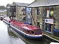
 Narrow boats, Skipton Canal (1) - geograph.org.uk - 869653.jpg 640 × 479; 70 KB
-
 Narrow boats, Skipton Canal (10) - geograph.org.uk - 871385.jpg 640 × 479; 66 KB
-
 Narrow boats, Skipton Canal (2) - geograph.org.uk - 871373.jpg 640 × 479; 83 KB
-
 Narrow boats, Skipton Canal (3) - geograph.org.uk - 871374.jpg 640 × 479; 85 KB
-
 Narrow boats, Skipton Canal (4) - geograph.org.uk - 871376.jpg 640 × 479; 73 KB
-
 Narrow boats, Skipton Canal (5) - geograph.org.uk - 871378.jpg 640 × 479; 87 KB
-
 Narrow boats, Skipton Canal (6) - geograph.org.uk - 871379.jpg 640 × 479; 63 KB
-
 Narrow boats, Skipton Canal (7) - geograph.org.uk - 871381.jpg 640 × 479; 83 KB
-
 Narrow boats, Skipton Canal (8) - geograph.org.uk - 871382.jpg 640 × 479; 67 KB
-
 Narrow boats, Skipton Canal (9) - geograph.org.uk - 871383.jpg 640 × 479; 71 KB
-
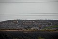 Normanton tip. - geograph.org.uk - 5355.jpg 640 × 426; 29 KB
-
 Old brick kiln, Powerstock Common - geograph.org.uk - 94291.jpg 640 × 480; 274 KB
-
 Path to Ben Vrackie - geograph.org.uk - 1591993.jpg 640 × 485; 150 KB
-
 Pentireglaze cottages - geograph.org.uk - 226071.jpg 640 × 480; 73 KB
-
 Renny Slip and The Bench - geograph.org.uk - 866031.jpg 640 × 424; 66 KB
-

-
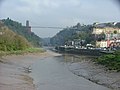
 Road Bridge - geograph.org.uk - 312343.jpg 640 × 426; 149 KB
-
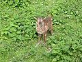
 Roe Deer Buck - geograph.org.uk - 297404.jpg 640 × 462; 120 KB
-
 RossHouse-117156-Richard Slessor.jpg 640 × 480; 85 KB
-
 Rownham Ferry - geograph.org.uk - 102446.jpg 640 × 480; 79 KB
-
 Salford Quays - modern apartments - geograph.org.uk - 5008.jpg 640 × 480; 64 KB
-
 Holy Trinity Church, Sittingbourne - geograph.org.uk - 4963.jpg 640 × 480; 141 KB
-
-
-
 Stoke under ham hill.jpg 515 × 347; 74 KB
-
 Stoke-sub-Hamdon - geograph.org.uk - 31545.jpg 640 × 612; 162 KB
-
 The Court Hall, Milton Regis - geograph.org.uk - 4969.jpg 640 × 480; 113 KB
-

-
 The London Eye and the River Thames - geograph.org.uk - 132367.jpg 640 × 480; 104 KB
-
 The Mouls - geograph.org.uk - 226075.jpg 640 × 480; 66 KB
-
 The Mythe Bridge - geograph.org.uk - 4938.jpg 640 × 479; 75 KB
-
 The pinnacles of Sgurr nan Gillean - geograph.org.uk - 487963.jpg 800 × 600; 269 KB
-
 Threshing Barn, Sledge Green. - geograph.org.uk - 4983.jpg 640 × 479; 56 KB
-
 Trans Pennine Trail - geograph.org.uk - 1747368.jpg 480 × 640; 35 KB
-
 Trig Point, Winsford Hill - geograph.org.uk - 54618.jpg 640 × 396; 63 KB
-
 View south east from Coire Riabhach - geograph.org.uk - 610419.jpg 800 × 600; 206 KB
-
 Walled Garden, Bewdley Museum - geograph.org.uk - 1153351.jpg 640 × 480; 360 KB
-

-
 Wild Daffodils on Tullos Hill - geograph.org.uk - 94126.jpg 640 × 480; 136 KB
-
 Withernsea Pier towers - geograph.org.uk - 1747203.jpg 640 × 480; 58 KB
-
 Woodland Path - geograph.org.uk - 308178.jpg 640 × 409; 148 KB
-
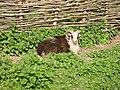
 Woolley Sheep, Skipton.jpg 512 × 383; 60 KB
-
 A Countryman's Cottage - geograph.org.uk - 333194.jpg 640 × 480; 125 KB
-
 Adisham Green - geograph.org.uk - 4982.jpg 640 × 480; 118 KB
-
 Am Basteir and Coire a' Bhasteir - geograph.org.uk - 487934.jpg 800 × 600; 268 KB
-
 Ant Hills at Chickengrove Bottom - geograph.org.uk - 301458.jpg 640 × 408; 70 KB
-
 Basking adder - geograph.org.uk - 283558.jpg 640 × 567; 211 KB
-
 Berrow Village Hall and Village Green - geograph.org.uk - 4987.jpg 640 × 479; 60 KB
-
 Bucklebury Common (Nature Reserve) - geograph.org.uk - 4850.jpg 640 × 480; 410 KB
-
 Bucklebury Common Nature Reserve - geograph.org.uk - 4849.jpg 640 × 480; 543 KB
-
 Cutthorne valley - geograph.org.uk - 249263.jpg 450 × 318; 53 KB
-
-
 From Willan to Baldock - geograph.org.uk - 16402.jpg 640 × 480; 61 KB
-
 Gardiner Wood - geograph.org.uk - 308182.jpg 640 × 408; 130 KB
-
 High Town Farm, near Corbridge - geograph.org.uk - 124350.jpg 640 × 480; 76 KB
-
 Lower Coire a' Bhasteir - geograph.org.uk - 487951.jpg 800 × 600; 367 KB
-
 Marsh End Farm - geograph.org.uk - 4973.jpg 640 × 479; 95 KB
-
 Pole Barn, Berrow - geograph.org.uk - 4936.jpg 640 × 479; 53 KB
-
 Pollarded Trees, Longdon Marsh - geograph.org.uk - 4972.jpg 640 × 479; 67 KB
-
 Pond incorporated into housing development - geograph.org.uk - 4985.jpg 640 × 480; 110 KB
-
 Pump House, Sledge Green. - geograph.org.uk - 4981.jpg 640 × 479; 67 KB
-
 Rectory Farm, Longdon - geograph.org.uk - 4968.jpg 640 × 479; 74 KB
-
 River entering Loch Gainmheach, Argyll - geograph.org.uk - 49945.jpg 640 × 480; 60 KB
-
 Road to Low Luckens - geograph.org.uk - 156049.jpg 640 × 480; 167 KB
-
 Sgurr Dubh from the Loch an Eion path. - geograph.org.uk - 7066.jpg 640 × 432; 39 KB
-
 Statues at Trago Mills - geograph.org.uk - 8071.jpg 373 × 293; 24 KB
-
 Summit area above Tom Smith's Stone - geograph.org.uk - 173425.jpg 640 × 468; 123 KB
-
 The Basteir Gorge - geograph.org.uk - 487967.jpg 800 × 600; 340 KB
-
 Wall leading SW from Grey Nag summit - geograph.org.uk - 173417.jpg 640 × 480; 115 KB
-
 West Coast Main Line, Lower Ince - geograph.org.uk - 85997.jpg 640 × 426; 132 KB
-
 Whitby Abbey - geograph.org.uk - 10924.jpg 480 × 640; 39 KB
-
 Whitby Harbour - geograph.org.uk - 10923.jpg 640 × 480; 47 KB
-
 Wide Hope - geograph.org.uk - 115553.jpg 640 × 480; 125 KB


.jpg)


_-_geograph.org.uk_-_869653.jpg)
_-_geograph.org.uk_-_871385.jpg)
_-_geograph.org.uk_-_871373.jpg)
_-_geograph.org.uk_-_871374.jpg)
_-_geograph.org.uk_-_871376.jpg)
_-_geograph.org.uk_-_871378.jpg)
_-_geograph.org.uk_-_871379.jpg)
_-_geograph.org.uk_-_871381.jpg)
_-_geograph.org.uk_-_871382.jpg)
_-_geograph.org.uk_-_871383.jpg)


_-_geograph.org.uk_-_4850.jpg)


