Category:United Kingdom photographs taken on 2006-01-07
Countries of Europe: Armenia‡ · Austria · Belarus · Belgium · Croatia · Finland · France‡ · Germany · Greece · Italy · Latvia · Netherlands‡ · Norway · Poland · Russia‡ · Slovakia · Slovenia · Spain‡ · Sweden · Ukraine · United Kingdom
‡: partly located in Europe
‡: partly located in Europe
| ← | 7 January 2006 | → | ||
| ← | January 2006 | → | ||

United Kingdom photographs taken on 7 January 2006.
Image files should be categorized here automatically using {{taken on}} template. Direct categorisation is also possible, if automatic is impossible.
Subcategories
This category has only the following subcategory.
Media in category "United Kingdom photographs taken on 2006-01-07"
The following 200 files are in this category, out of 272 total.
(previous page) (next page)-
 10 Downing Street (3098819496).jpg 1,600 × 1,200; 420 KB
-
 A cottage in Naphill - geograph.org.uk - 103366.jpg 640 × 480; 85 KB
-

-
 A Long Way Back to Shore - geograph.org.uk - 102290.jpg 640 × 398; 46 KB
-
 A small island in Loch Awe - geograph.org.uk - 102448.jpg 640 × 474; 198 KB
-
 A view of Loch Awe - geograph.org.uk - 102454.jpg 640 × 477; 205 KB
-
 A350 - geograph.org.uk - 104497.jpg 640 × 480; 73 KB
-
 Aonach Eagach - geograph.org.uk - 102347.jpg 640 × 480; 78 KB
-
 Barn, Near Dell Farm - geograph.org.uk - 102607.jpg 640 × 482; 48 KB
-
 South Bank with Fish Eye Lens - geograph.org.uk - 716941.jpg 640 × 448; 59 KB
-
 Beach Near Flimby - geograph.org.uk - 102284.jpg 640 × 427; 43 KB
-
 Bestwall Park near Wareham, Dorset - geograph.org.uk - 102716.jpg 600 × 450; 161 KB
-
 Birchanger Farm - geograph.org.uk - 102658.jpg 640 × 480; 78 KB
-
 Bomb damage - geograph.org.uk - 102977.jpg 640 × 463; 110 KB
-
-
 Bridge Over A46(T) - geograph.org.uk - 102589.jpg 640 × 482; 43 KB
-
 Bridge over the Parkway - geograph.org.uk - 102514.jpg 640 × 480; 92 KB
-
 Bridge under B840 - geograph.org.uk - 102410.jpg 640 × 480; 197 KB
-
 Buckingham bench - Flickr - bicccio.jpg 548 × 640; 155 KB
-
 Bullington Cross Inn - geograph.org.uk - 102657.jpg 640 × 480; 95 KB
-
 Bus Shelter, Hickling Pastures - geograph.org.uk - 102598.jpg 640 × 482; 54 KB
-
 Cairnscluse Farm - geograph.org.uk - 102913.jpg 640 × 449; 62 KB
-
 Canary Wharf at night - geograph.org.uk - 112122.jpg 595 × 640; 99 KB
-
 Capstone Parade - geograph.org.uk - 102435.jpg 640 × 480; 47 KB
-
 Car park full Ogmore - panoramio.jpg 2,048 × 1,536; 676 KB
-
 Cemetery at St Budeaux Church - geograph.org.uk - 719161.jpg 640 × 480; 146 KB
-
 Chester Cathedral from Rufus Court - geograph.org.uk - 103146.jpg 640 × 480; 129 KB
-
 Christ Church - geograph.org.uk - 102699.jpg 480 × 640; 63 KB
-
 Clach Ard - geograph.org.uk - 102357.jpg 640 × 480; 67 KB
-
 Co-op, Westbury - geograph.org.uk - 104502.jpg 640 × 480; 77 KB
-
 Commercial Reclamation Centre - geograph.org.uk - 719138.jpg 640 × 480; 114 KB
-
 Corbar Road, Christchurch - geograph.org.uk - 102519.jpg 640 × 480; 93 KB
-
 Corbar Road, Christchurch - geograph.org.uk - 102522.jpg 640 × 480; 96 KB
-
 Cottages near Crondall - geograph.org.uk - 102345.jpg 640 × 480; 87 KB
-
 Cottages on Heath Lane, Warren Corner - geograph.org.uk - 102342.jpg 640 × 480; 94 KB
-

-
 Crownhill Fort.jpg 640 × 457; 101 KB
-
 Curzon Street Station - geograph.org.uk - 103131.jpg 640 × 480; 85 KB
-
 Curzon Street Station - geograph.org.uk - 103133.jpg 640 × 480; 105 KB
-
 Disused works, High Wycombe - geograph.org.uk - 103112.jpg 480 × 640; 85 KB
-
 Drive to Lord Wandsworth College - geograph.org.uk - 102368.jpg 640 × 480; 98 KB
-
 Dryburgh Crescent - geograph.org.uk - 719237.jpg 640 × 480; 107 KB
-
 Edgeworth Parish Church - geograph.org.uk - 102671.jpg 640 × 480; 132 KB
-

-
 Ernesettle - geograph.org.uk - 102492.jpg 640 × 434; 88 KB
-
 Fields near Valley Farm, Edgeworth - geograph.org.uk - 102673.jpg 640 × 480; 153 KB
-
 Forestry road junction with B840 - geograph.org.uk - 102409.jpg 640 × 480; 207 KB
-
 Fountains Crescent, Pennycross - geograph.org.uk - 102508.jpg 640 × 449; 83 KB
-
 Garage forecourt - geograph.org.uk - 104501.jpg 640 × 480; 69 KB
-
 Glen Bernisdale - geograph.org.uk - 102384.jpg 640 × 480; 91 KB
-
 Green lane at Well Green. - geograph.org.uk - 102355.jpg 640 × 480; 88 KB
-
 Ham Green Shops - geograph.org.uk - 102506.jpg 640 × 480; 135 KB
-
 Harcourt Hill Campus - geograph.org.uk - 102655.jpg 640 × 480; 122 KB
-
 How much graffiti can a lamppost take^ - geograph.org.uk - 102512.jpg 479 × 640; 145 KB
-
 Industrial Units on the A350 - geograph.org.uk - 104504.jpg 640 × 480; 55 KB
-
 John Kitto Community College - geograph.org.uk - 719257.jpg 640 × 480; 85 KB
-
 Lane in Edgeworth - geograph.org.uk - 102672.jpg 640 × 480; 146 KB
-
 Lewis Statue - geograph.org.uk - 102642.jpg 480 × 640; 73 KB
-
 Little Chalfont, Church Grove - geograph.org.uk - 102227.jpg 640 × 480; 125 KB
-
 Little Chalfont, Lodge Lane - geograph.org.uk - 102231.jpg 640 × 480; 138 KB
-
 Little Chalfont, Long Walk - geograph.org.uk - 102234.jpg 640 × 480; 129 KB
-
 Little Chalfont, Nightingales Corner - geograph.org.uk - 102239.jpg 640 × 480; 80 KB
-

-
 Loading 6 inch gun HMS Belfast Geograph 1695654 587c3213.jpg 640 × 453; 148 KB
-
 Loch an Tuim - geograph.org.uk - 202045.jpg 640 × 480; 90 KB
-
 Loch Dhughaill - geograph.org.uk - 202018.jpg 640 × 480; 78 KB
-
 Loch nan Uamh - geograph.org.uk - 202011.jpg 640 × 480; 68 KB
-
 Loch of Craiglush in winter - geograph.org.uk - 102643.jpg 640 × 480; 112 KB
-
 Loch Snizort Beag from Park Bernisdale - geograph.org.uk - 102460.jpg 640 × 480; 122 KB
-
 Lochside trees - geograph.org.uk - 102439.jpg 480 × 640; 199 KB
-
 Long Craigs. - geograph.org.uk - 102405.jpg 640 × 480; 82 KB
-
 Long House in Bernisdale - geograph.org.uk - 102430.jpg 640 × 480; 128 KB
-
 Lych Gate at Edgeworth Church - geograph.org.uk - 102678.jpg 640 × 480; 116 KB
-
 Mother and Child, by Shape Design. - geograph.org.uk - 102803.jpg 480 × 640; 110 KB
-
 Naphill Common - geograph.org.uk - 103363.jpg 480 × 640; 94 KB
-
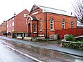
 Naphill Methodist Church - geograph.org.uk - 103118.jpg 640 × 480; 95 KB
-
 Nature Reserve Inhabitant^ - geograph.org.uk - 102494.jpg 480 × 640; 115 KB
-
 New Housing Development - geograph.org.uk - 102521.jpg 640 × 480; 78 KB
-
 Newsham South Farm - geograph.org.uk - 102336.jpg 640 × 480; 87 KB
-

-
 Noss Mayo - geograph.org.uk - 363684.jpg 640 × 480; 124 KB
-
 Ogmore - panoramio.jpg 2,048 × 1,536; 418 KB
-
 Old Road - New Road - geograph.org.uk - 102469.jpg 640 × 480; 68 KB
-
 Paragon Hall - geograph.org.uk - 102660.jpg 640 × 480; 77 KB
-
 Peel Villas - geograph.org.uk - 102702.jpg 640 × 480; 98 KB
-
 Peel Villas - geograph.org.uk - 102703.jpg 640 × 480; 100 KB
-
 Pen Cowlyd from Pen Llithrig y Wrach - geograph.org.uk - 223920.jpg 640 × 427; 38 KB
-
-

-
 Plymouth Parkway - geograph.org.uk - 719176.jpg 640 × 480; 82 KB
-
 Pond on Edgeworth Mill Farm - geograph.org.uk - 102677.jpg 640 × 480; 100 KB
-
 Postwar housing, Whitleigh - geograph.org.uk - 102432.jpg 640 × 470; 104 KB
-
 Railway Viaduct Wickwar - geograph.org.uk - 102276.jpg 640 × 425; 154 KB
-

-
 River Holme, Thongsbridge - geograph.org.uk - 102745.jpg 640 × 480; 176 KB
-
 Road across the Valley - geograph.org.uk - 102449.jpg 640 × 463; 74 KB
-
 Road improvements on the B840 - geograph.org.uk - 102452.jpg 640 × 480; 196 KB
-
 Road junction in Naphill - geograph.org.uk - 103119.jpg 640 × 480; 81 KB
-
 Rufus Court Shopping - geograph.org.uk - 103147.jpg 640 × 480; 116 KB
-
 Rugby - Hillmorton - geograph.org.uk - 102358.jpg 640 × 480; 108 KB
-
 Rugby - Hillmorton - geograph.org.uk - 102364.jpg 640 × 480; 85 KB
-
 Rugby - Hillmorton - geograph.org.uk - 102437.jpg 640 × 480; 81 KB
-
 Rugby - St Peters Rd - geograph.org.uk - 102453.jpg 640 × 480; 97 KB
-
 Ruined cottage near Ardchonnell.jpg 640 × 480; 195 KB
-
 Sand Bar Siddick - geograph.org.uk - 102279.jpg 640 × 427; 39 KB
-
 School and Houses - geograph.org.uk - 102516.jpg 640 × 419; 75 KB
-
 Seashore off Workington Harbour - geograph.org.uk - 102264.jpg 640 × 427; 82 KB
-
 Seat, Back Lane, Willoughby - geograph.org.uk - 102572.jpg 640 × 482; 77 KB
-
 Seat, Widmerpool Road Junction - geograph.org.uk - 102559.jpg 640 × 482; 78 KB
-
 Shore of Loch Awe - geograph.org.uk - 102436.jpg 640 × 429; 41 KB
-
 Shores of Loch Awe - geograph.org.uk - 102400.jpg 640 × 480; 200 KB
-
 Shores of Loch Awe - geograph.org.uk - 102412.jpg 640 × 480; 200 KB
-

-
 Slag Heap - geograph.org.uk - 102254.jpg 640 × 427; 78 KB
-
 St Andrew's Church, Kirk Ella - geograph.org.uk - 392852.jpg 425 × 567; 205 KB
-
 St Budeaux Church and porch.jpg 480 × 640; 101 KB
-
 St Budeaux Church and yard.jpg 640 × 480; 165 KB
-

-
 St Matthew's Church - geograph.org.uk - 102704.jpg 480 × 640; 66 KB
-
 St Paul's, Wooburn - geograph.org.uk - 103122.jpg 640 × 480; 83 KB
-
 St Robert Bellarmine - geograph.org.uk - 102764.jpg 640 × 480; 67 KB
-
 Stairway to heaven - Flickr - recursion see recursion.jpg 1,000 × 667; 123 KB
-
 Stile Style - Mind the Step - geograph.org.uk - 102331.jpg 640 × 480; 102 KB
-
 Suburban Housing, Kings Tamerton - geograph.org.uk - 102496.jpg 640 × 434; 74 KB
-
 Suburban Road near Crownhill - geograph.org.uk - 102420.jpg 640 × 386; 67 KB
-
 Suburban Street, West Park, Plymouth - geograph.org.uk - 102455.jpg 640 × 395; 76 KB
-
 Tamarside Community College - geograph.org.uk - 719201.jpg 640 × 406; 79 KB
-
 The B840 near Finchairn - geograph.org.uk - 102391.jpg 640 × 480; 183 KB
-
 The Black Bull - geograph.org.uk - 102627.jpg 521 × 456; 178 KB
-
 The Black Cliffs of Workington - geograph.org.uk - 102251.jpg 640 × 480; 87 KB
-
 The Black Horse - geograph.org.uk - 102696.jpg 640 × 480; 125 KB
-
 The Disraeli Monument, High Wycombe - geograph.org.uk - 103114.jpg 480 × 640; 87 KB
-
 The end of Castle Drive - geograph.org.uk - 103258.jpg 640 × 480; 122 KB
-
 The ford at Yate Rocks - geograph.org.uk - 102236.jpg 640 × 425; 135 KB
-
 The Linacre - geograph.org.uk - 102706.jpg 640 × 480; 73 KB
-

-

-

-
 The Stanley Arms - geograph.org.uk - 102697.jpg 640 × 480; 81 KB
-

-
 Thick Wood, near Edgeworth - geograph.org.uk - 102675.jpg 480 × 640; 168 KB
-
 Tree in Tortworth Court grounds - geograph.org.uk - 116927.jpg 640 × 480; 152 KB
-
 Underneath the Power Lines - geograph.org.uk - 719124.jpg 639 × 460; 69 KB
-
-
 Upper Broughton Station.jpg 640 × 482; 59 KB
-

-
 View towards Loch Awe - geograph.org.uk - 102426.jpg 640 × 412; 191 KB
-
 Walton Parish Church - geograph.org.uk - 102695.jpg 480 × 640; 87 KB
-
 Waterfall at head of Garenig tributary - geograph.org.uk - 102649.jpg 640 × 480; 198 KB
-
 Westminster College Sports Centre - geograph.org.uk - 102654.jpg 640 × 480; 89 KB
-
 Weston Mill Cemetery - geograph.org.uk - 102501.jpg 640 × 480; 114 KB
-
 Weston Mill Cemetery - geograph.org.uk - 719230.jpg 640 × 480; 96 KB
-
 Weston Mill Drive - geograph.org.uk - 719212.jpg 640 × 480; 109 KB
-
 Weston Mill Recycling Centre - geograph.org.uk - 719223.jpg 640 × 386; 82 KB
-
 Whitehall farm road - geograph.org.uk - 102906.jpg 640 × 480; 67 KB
-
 Whitleigh Green - geograph.org.uk - 102427.jpg 640 × 480; 144 KB
-
 Wickwar Brewery - geograph.org.uk - 102278.jpg 640 × 425; 118 KB
-

-
 Widmerpool Railway Station.jpg 640 × 482; 64 KB
-

-
 Woodland North of Chingford Plain - geograph.org.uk - 102470.jpg 640 × 480; 133 KB
-
 Wrecked Craigs. - geograph.org.uk - 102402.jpg 640 × 446; 58 KB
-
 Wysall Wesleyan Methodist Chapel - geograph.org.uk - 102548.jpg 640 × 482; 60 KB
-
 Yate Rocks - geograph.org.uk - 102233.jpg 640 × 425; 188 KB
-

-
 Archerfield Woods - geograph.org.uk - 102415.jpg 640 × 480; 102 KB
-
 Ardchonnel Primary School - geograph.org.uk - 102424.jpg 480 × 640; 196 KB
-
 Ardray picnic site - geograph.org.uk - 102401.jpg 640 × 480; 205 KB
-
 Ballimeanoch - geograph.org.uk - 102440.jpg 640 × 480; 206 KB
-
 Beach at Flimby - geograph.org.uk - 102299.jpg 640 × 427; 50 KB
-
 Ben Roishader - geograph.org.uk - 102389.jpg 640 × 480; 61 KB
-
 Bernisdale Croft House - geograph.org.uk - 102403.jpg 640 × 480; 157 KB
-
 Blarghour - geograph.org.uk - 102434.jpg 640 × 480; 188 KB
-
 Boulders at Peinmore - geograph.org.uk - 102374.jpg 640 × 480; 125 KB
-
 Bridge at Durran - geograph.org.uk - 102413.jpg 640 × 480; 191 KB
-
 Bridge over Cam Brook - geograph.org.uk - 102292.jpg 480 × 640; 117 KB
-
 Carolina Hill - geograph.org.uk - 102379.jpg 640 × 480; 53 KB
-
 Communication Mast, above Holybourne Down - geograph.org.uk - 102385.jpg 480 × 640; 136 KB
-
 Compton Berkshire disused railway track - geograph.org.uk - 118426.jpg 640 × 480; 140 KB
-
 Cookshall Farm - geograph.org.uk - 103359.jpg 640 × 480; 89 KB
-
 Cookshall Farm House - geograph.org.uk - 103116.jpg 640 × 480; 73 KB
-
 Cottages next to Downley Common - geograph.org.uk - 103357.jpg 640 × 480; 93 KB
-
 Creag Liath - geograph.org.uk - 102398.jpg 640 × 480; 197 KB
-
 Crow Island - geograph.org.uk - 102447.jpg 640 × 471; 192 KB
-
 Cumbria Coastal Way - geograph.org.uk - 102282.jpg 640 × 480; 79 KB
-
 Damaged parapet on bridge at Eredine - geograph.org.uk - 102419.jpg 640 × 480; 198 KB
-
 Downley Methodist Church - geograph.org.uk - 103115.jpg 640 × 480; 91 KB
-

-
 Entrance to Thorpe Plantation - geograph.org.uk - 102565.jpg 640 × 482; 78 KB
-
 Epping Forest near Wake Valley Pond - geograph.org.uk - 102438.jpg 640 × 480; 163 KB
-
 Eroded Slag Cliff - geograph.org.uk - 102350.jpg 640 × 480; 48 KB
-

-
 Farmland Littledale - geograph.org.uk - 102281.jpg 640 × 480; 111 KB
-
 Farmland near Yarnhams Farm - geograph.org.uk - 102373.jpg 640 × 480; 90 KB
-
 Felled forestry - geograph.org.uk - 102431.jpg 480 × 640; 206 KB
-
 Felled forestry at Loch Awe - geograph.org.uk - 102421.jpg 640 × 480; 192 KB
-
 Field Off Station Road - geograph.org.uk - 102583.jpg 640 × 482; 58 KB
-

-

-
 Footbridge Marshaw Wyre - geograph.org.uk - 102263.jpg 640 × 480; 134 KB
.jpg)


_-_geograph.org.uk_-_102589.jpg)


