Category:United Kingdom photographs taken on 2006-09-20
Countries of Europe: Austria · Belgium · Bosnia and Herzegovina · Croatia · Finland · France‡ · Germany · Greece · Republic of Ireland · Italy · Netherlands‡ · Norway · Portugal‡ · Romania · Russia‡ · Spain‡ · Sweden · Turkey‡ · Ukraine · United Kingdom
‡: partly located in Europe
‡: partly located in Europe
| ← | 20 September 2006 | → | ||
| ← | September 2006 | → | ||

United Kingdom photographs taken on 20 September 2006.
Image files should be categorized here automatically using {{taken on}} template. Direct categorisation is also possible, if automatic is impossible.
Subcategories
This category has only the following subcategory.
Media in category "United Kingdom photographs taken on 2006-09-20"
The following 200 files are in this category, out of 372 total.
(previous page) (next page)-

-

-
 A1079 beverley eastbound enh.png 300 × 225; 120 KB
-
 A1079 beverley eastbound.jpg 1,695 × 1,225; 252 KB
-
 A252 through Longbeech Wood - geograph.org.uk - 245447.jpg 640 × 480; 123 KB
-
 A413 - geograph.org.uk - 250096.jpg 600 × 450; 91 KB
-
 Abhainn Srath Ascaig at Fernaig - geograph.org.uk - 1194962.jpg 640 × 480; 52 KB
-
 Adderstone Hall - geograph.org.uk - 245157.jpg 640 × 449; 126 KB
-

-

-
 Arch Farm, Tostock - geograph.org.uk - 245513.jpg 640 × 427; 77 KB
-
 Balloch Wood Community Project, Creetown - geograph.org.uk - 259221.jpg 640 × 480; 119 KB
-
 Barn at Monkery Farm - geograph.org.uk - 245473.jpg 640 × 480; 95 KB
-
 Barn below High Houses - geograph.org.uk - 244565.jpg 640 × 480; 103 KB
-
 Barn Farm - geograph.org.uk - 245647.jpg 640 × 422; 28 KB
-
 Barns at Bell's Forstal Farm - geograph.org.uk - 247416.jpg 640 × 480; 117 KB
-
 Beach at Newton Farm - geograph.org.uk - 1420045.jpg 640 × 480; 75 KB
-
 Bedford Road, Brafield on the Green - geograph.org.uk - 244498.jpg 640 × 434; 134 KB
-
 Bell's Forstal - geograph.org.uk - 247415.jpg 640 × 480; 119 KB
-
 Bend in road - geograph.org.uk - 244357.jpg 640 × 480; 78 KB
-
 Black Loch - geograph.org.uk - 429010.jpg 640 × 306; 46 KB
-
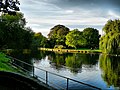 Boating lake, Beddington Park - geograph.org.uk - 1212630.jpg 640 × 479; 419 KB
-
 Boggy land by a stream. - geograph.org.uk - 1040505.jpg 640 × 426; 95 KB
-
 Bradfield and Rougham Baptist Church - geograph.org.uk - 245476.jpg 640 × 427; 97 KB
-
 Bridge and seat on Oughtonhead Common - geograph.org.uk - 245109.jpg 640 × 480; 176 KB
-
 Bridleway 59CR at Pondtail Cottage - geograph.org.uk - 244465.jpg 640 × 511; 79 KB
-
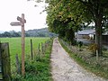 Bridleway and sign - geograph.org.uk - 244209.jpg 640 × 480; 119 KB
-
 Bridleway to Rushbrook - geograph.org.uk - 245274.jpg 640 × 427; 75 KB
-

-
 Burdon - Thistley House Farm.jpg 640 × 384; 70 KB
-
 Carved stone, Revelstoke church - geograph.org.uk - 312813.jpg 640 × 480; 120 KB
-

-
 Challock Livery Yard - geograph.org.uk - 246759.jpg 640 × 480; 104 KB
-
 Challock Manor - geograph.org.uk - 247290.jpg 640 × 480; 128 KB
-
 Clints of Dromore - geograph.org.uk - 259334.jpg 640 × 480; 60 KB
-
 Cochno Road - geograph.org.uk - 434158.jpg 640 × 480; 55 KB
-
 Collingham - Foorpath, Linton.jpg 640 × 480; 107 KB
-
 Coming in to land - geograph.org.uk - 246309.jpg 640 × 480; 37 KB
-
 Commemorative Stone, Creetown - geograph.org.uk - 259223.jpg 640 × 480; 114 KB
-
 Converted Windmill (Windmill Farm) - geograph.org.uk - 250093.jpg 600 × 450; 131 KB
-
 Copsale Village Hall - geograph.org.uk - 244496.jpg 640 × 346; 71 KB
-
 Cottage at Drumore. - geograph.org.uk - 244317.jpg 640 × 426; 117 KB
-

-
 Cottages at Spindlestone - geograph.org.uk - 245148.jpg 640 × 443; 111 KB
-
 Country Style Indian Restaurant - geograph.org.uk - 246300.jpg 640 × 480; 117 KB
-

-
 Crossroads near Bognafuaran. - geograph.org.uk - 244212.jpg 640 × 426; 56 KB
-

-
 Daws Farm at Daws Cross, Essex - geograph.org.uk - 245040.jpg 640 × 480; 61 KB
-

-
 Dorking, Chalkpit Lane railway bridge - geograph.org.uk - 806153.jpg 640 × 480; 126 KB
-
 Dunes and lighthouse - geograph.org.uk - 244635.jpg 640 × 480; 88 KB
-
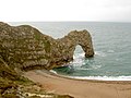 Durdle Door - geograph.org.uk - 372438.jpg 640 × 480; 88 KB
-
 Edge of the wood - geograph.org.uk - 1474185.jpg 640 × 486; 124 KB
-
 Entering Lumby from the South - geograph.org.uk - 244478.jpg 640 × 408; 46 KB
-
 Entrance to Chalkney Wood - geograph.org.uk - 246317.jpg 640 × 480; 100 KB
-
 Entrance to Rougham Park Estate - geograph.org.uk - 245462.jpg 640 × 427; 118 KB
-
 Faifley - geograph.org.uk - 434153.jpg 640 × 480; 59 KB
-
 Fallow Field - geograph.org.uk - 244081.jpg 640 × 480; 89 KB
-
 Farm buildings at Bradford - geograph.org.uk - 245149.jpg 640 × 443; 107 KB
-
 Farm buildings on Sidnye Farm - geograph.org.uk - 244459.jpg 640 × 407; 54 KB
-
 Farm by Househill, Nairnshire. - geograph.org.uk - 244206.jpg 640 × 426; 63 KB
-
 Fetcham, Cannon Way railway bridge - geograph.org.uk - 806199.jpg 640 × 480; 87 KB
-
 Field at Cabbage Moor - geograph.org.uk - 244384.jpg 640 × 480; 98 KB
-
 Field by Whin Lane - geograph.org.uk - 244491.jpg 640 × 480; 50 KB
-
 Field Copse - geograph.org.uk - 244075.jpg 640 × 480; 91 KB
-
 Field near Countess Cross, Essex - geograph.org.uk - 244495.jpg 640 × 480; 74 KB
-
 Fields to the North of Lumby - geograph.org.uk - 244485.jpg 640 × 428; 29 KB
-
 Fingerpost for footpath 32CR - geograph.org.uk - 244440.jpg 495 × 640; 153 KB
-
 Folly in the grounds of Tyes Place - geograph.org.uk - 244453.jpg 640 × 575; 89 KB
-

-
-

-
 Footpath and railway line at Elmswell - geograph.org.uk - 245515.jpg 640 × 427; 98 KB
-
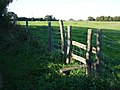
 Footpath Stile - geograph.org.uk - 244071.jpg 640 × 480; 123 KB
-
 Footpath to Rougham Green - geograph.org.uk - 245275.jpg 640 × 427; 76 KB
-
 Footpath to Rougham Green - geograph.org.uk - 245289.jpg 640 × 427; 96 KB
-
 Footpath to Rougham Green - geograph.org.uk - 245472.jpg 640 × 427; 121 KB
-
 Forest track near Moneypool Burn - geograph.org.uk - 1474242.jpg 640 × 480; 104 KB
-
 Forest track, near Moneypool Burn - geograph.org.uk - 259326.jpg 640 × 480; 99 KB
-
 Former Portsoy Railway Station - geograph.org.uk - 1690868.jpg 1,600 × 1,200; 382 KB
-
 Gate into Witton Park - geograph.org.uk - 349288.jpg 640 × 425; 344 KB
-
 Great Massingham village sign - geograph.org.uk - 244521.jpg 484 × 640; 98 KB
-
 Great Massingham village well - geograph.org.uk - 244525.jpg 444 × 640; 95 KB
-
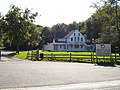
 Great Paddock Farmhouse - geograph.org.uk - 245469.jpg 640 × 480; 81 KB
-
 Green lane beside Longbeech Wood - geograph.org.uk - 245451.jpg 480 × 640; 161 KB
-
 Green Lane, Challock - geograph.org.uk - 246730.jpg 640 × 482; 118 KB
-
 Harrowing at Cadman's Farm - geograph.org.uk - 247389.jpg 640 × 480; 121 KB
-
 Harthope Burn, near Langleeford - geograph.org.uk - 367268.jpg 640 × 480; 108 KB
-
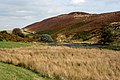
 Heather moorland - geograph.org.uk - 1474262.jpg 640 × 480; 74 KB
-
 Heavy Power Lines - geograph.org.uk - 244073.jpg 640 × 480; 67 KB
-
 High Weald Landscape Trail - geograph.org.uk - 244472.jpg 640 × 548; 104 KB
-
 Hugh llewelyn 43 024 (5609839738).jpg 2,592 × 1,944; 1.12 MB
-

-
 Kelly Street, Kentish Town - geograph.org.uk - 244464.jpg 480 × 640; 79 KB
-
 Kent Gliding Club, Challock - geograph.org.uk - 246312.jpg 640 × 478; 82 KB
-
 Kentish Town - geograph.org.uk - 244481.jpg 640 × 480; 99 KB
-
 Kincardine Bridge - geograph.org.uk - 245175.jpg 640 × 426; 62 KB
-

-
 Knutsford-Mobberley - Birkin Brook - geograph.org.uk - 255535.jpg 640 × 480; 242 KB
-
 Lane in the Ted valley - geograph.org.uk - 244377.jpg 640 × 480; 110 KB
-
 Lane to Achnatone Farm. - geograph.org.uk - 244258.jpg 640 × 426; 117 KB
-
 Lane to Binne Ford - geograph.org.uk - 244415.jpg 640 × 480; 101 KB
-
 Lane to Laikenbuie holiday cottages. - geograph.org.uk - 244236.jpg 640 × 426; 134 KB
-
 Leatherhead Bridge - geograph.org.uk - 244353.jpg 640 × 480; 130 KB
-
 Leigh, Flanchford Bridge - geograph.org.uk - 244974.jpg 640 × 480; 128 KB
-
 Little Paddock Cottage, Sicklinghall - geograph.org.uk - 244251.jpg 640 × 480; 103 KB
-
 Littlemill Post Office, Nairnshire. - geograph.org.uk - 244249.jpg 640 × 426; 93 KB
-
 Loch Shell - geograph.org.uk - 623549.jpg 640 × 480; 54 KB
-
 Loch Soy, Portsoy - geograph.org.uk - 1690876.jpg 1,600 × 1,200; 378 KB
-
 Loch Tamnabhaigh - geograph.org.uk - 633233.jpg 640 × 433; 57 KB
-
 Lochan - geograph.org.uk - 1474231.jpg 640 × 476; 82 KB
-

-

-

-
 Meadow near Throwley Forstal - geograph.org.uk - 247421.jpg 640 × 480; 126 KB
-
 Meldon Railway Station.jpg 640 × 480; 87 KB
-
 Middleton Church - geograph.org.uk - 244763.jpg 640 × 478; 86 KB
-
 Middleton Church - geograph.org.uk - 244765.jpg 478 × 640; 76 KB
-
 Middleton Hall 05.jpg 640 × 478; 68 KB
-
 Milestone on the A939 Southbound. - geograph.org.uk - 244263.jpg 640 × 426; 128 KB
-

-
-
 Milltown lane. - geograph.org.uk - 244330.jpg 640 × 426; 88 KB
-
 Ministry of Defence from Horse Guards Avenue (off Whitehall).jpg 2,048 × 1,536; 1.04 MB
-
 MOD pier - geograph.org.uk - 245184.jpg 640 × 426; 75 KB
-
 Near Medland Manor - geograph.org.uk - 244397.jpg 640 × 480; 128 KB
-
 Neglected footpath - geograph.org.uk - 247596.jpg 480 × 640; 100 KB
-
 New growth - geograph.org.uk - 244296.jpg 640 × 480; 94 KB
-
 Newbold tunnel - geograph.org.uk - 1499675.jpg 479 × 640; 19 KB
-

-
 Noddles Hill - geograph.org.uk - 244080.jpg 640 × 480; 86 KB
-

-
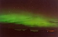 Northern Lights over Portnaguran - geograph.org.uk - 359552.jpg 640 × 416; 23 KB
-
 Old Courthouse Hawkshead.JPG 2,288 × 1,712; 801 KB
-
 Old Quarry Road - geograph.org.uk - 244480.jpg 640 × 407; 49 KB
-
 Oohhh a Bunny Rabbit! - geograph.org.uk - 245178.jpg 640 × 480; 199 KB
-
 OS Benchmark on drain culvert - geograph.org.uk - 277863.jpg 640 × 480; 151 KB
-
 OS Benchmark. St Andrew's Church - geograph.org.uk - 277864.jpg 640 × 480; 127 KB
-
 Oughtonhead Common - geograph.org.uk - 245111.jpg 640 × 480; 220 KB
-
 Oxford shire countryside - geograph.org.uk - 711236.jpg 640 × 480; 76 KB
-
 Part-ploughed field at Foxholes - geograph.org.uk - 245150.jpg 640 × 480; 153 KB
-
 Pickerel weed (Pontederia cordata) - geograph.org.uk - 245413.jpg 480 × 640; 129 KB
-
 Pipp Brook in Dorking - geograph.org.uk - 280296.jpg 640 × 480; 151 KB
-
 Pipp Brook in Dorking - geograph.org.uk - 806163.jpg 640 × 480; 138 KB
-
 Pirton Footpath Waymarker - geograph.org.uk - 245098.jpg 640 × 480; 134 KB
-
 Pixham, Footpath to Boxhill Farm - geograph.org.uk - 806213.jpg 640 × 480; 104 KB
-

-
 Point of Ayr lighthouse - geograph.org.uk - 244626.jpg 480 × 640; 97 KB
-
 Point of Ayr lighthouse - geograph.org.uk - 244632.jpg 640 × 474; 94 KB
-
 Railway Bridge looking North West - geograph.org.uk - 258286.jpg 640 × 480; 55 KB
-
 Railway crossing at Elmswell - geograph.org.uk - 245519.jpg 640 × 427; 87 KB
-
 Revelstoke Church - geograph.org.uk - 313243.jpg 480 × 640; 92 KB
-
 River Mole at Deepdene Bridge (1) - geograph.org.uk - 806256.jpg 640 × 480; 94 KB
-
 River Mole at Deepdene Bridge (2) - geograph.org.uk - 806264.jpg 640 × 480; 106 KB
-
 River Mole at Kinnersley Manor - geograph.org.uk - 280288.jpg 640 × 480; 131 KB
-
 River Mole from Flanchford Bridge - geograph.org.uk - 244970.jpg 640 × 480; 88 KB
-
 River Mole in Leatherhead - geograph.org.uk - 806182.jpg 640 × 480; 94 KB
-
 River Mole in Pixham - geograph.org.uk - 806239.jpg 640 × 480; 112 KB
-

-
 RN Ammunition Depot, Throsk.jpg 640 × 426; 65 KB
-
 Road junction at Rehaurie. - geograph.org.uk - 244294.jpg 640 × 426; 92 KB
-
 Road sign with Grid Reference - geograph.org.uk - 244304.jpg 640 × 480; 132 KB
-

-
 Rougham church - geograph.org.uk - 245465.jpg 640 × 427; 86 KB
-
 Rougham Gospel Hall - geograph.org.uk - 245475.jpg 640 × 427; 76 KB
-
 Rougham Sports Hall - geograph.org.uk - 245278.jpg 640 × 427; 92 KB
-

-
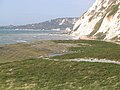
 Samphire Hoe - geograph.org.uk - 506207.jpg 640 × 480; 259 KB
-
 Samphire Hoe looking west - geograph.org.uk - 506227.jpg 640 × 480; 257 KB
-
 Sea-buckthorn on Samphire Hoe, Kent - geograph.org.uk - 506215.jpg 640 × 480; 322 KB
-
 Sicklinghall village pond - geograph.org.uk - 244259.jpg 640 × 480; 142 KB
-
 Sidnye Farm - geograph.org.uk - 244448.jpg 640 × 296; 51 KB
-

-

-
 South door, Challock church - geograph.org.uk - 247206.jpg 531 × 640; 94 KB
-
 Spice of Bengal, Charing Hill - geograph.org.uk - 245435.jpg 640 × 482; 88 KB
-
 Ss Cosmas and Damian, Challock - geograph.org.uk - 245481.jpg 482 × 640; 64 KB
-
 St John's Church, Elmswell - geograph.org.uk - 245521.jpg 640 × 420; 82 KB
-
 St Mary's Church, Beddington - geograph.org.uk - 1212624.jpg 640 × 469; 122 KB
-
 Stables in Middleton - geograph.org.uk - 244786.jpg 640 × 478; 102 KB
-
 Steaming into the Canal tunnel - geograph.org.uk - 1499668.jpg 640 × 479; 101 KB
-
 Stile into Oldpark Wood - geograph.org.uk - 244339.jpg 640 × 480; 134 KB
-
 Stile onto footpath - geograph.org.uk - 247378.jpg 640 × 482; 85 KB
-
 Stockeld Park.jpg 640 × 480; 95 KB
-
 StockwoodGate.jpg 528 × 640; 165 KB
-
 StockwoodMuseum.jpg 640 × 478; 135 KB
-
 Stockwoodpark.jpg 640 × 426; 172 KB
-
 Stonewall and hillside - geograph.org.uk - 1040519.jpg 640 × 426; 96 KB
-
 Straw bales - geograph.org.uk - 244299.jpg 640 × 480; 117 KB
-
 Stubble at Oughtonhead - geograph.org.uk - 245106.jpg 640 × 480; 162 KB
-
 Stubble field near Court Lodge Farm - geograph.org.uk - 245538.jpg 640 × 480; 149 KB
-
 The Assembly House, Kentish Town - geograph.org.uk - 245004.jpg 640 × 480; 92 KB
-
 The Belfry - Brabazon 10th - 244803 9cce9144.jpg 640 × 478; 95 KB
-
 The Belfry - Brabazon 18th - geograph.org.uk - 244802.jpg 640 × 478; 95 KB
-
 The Belfry Golf Centre - geograph.org.uk - 244779.jpg 640 × 478; 132 KB
-
 The Bull and Gate, Kentish Town - geograph.org.uk - 245564.jpg 640 × 480; 155 KB
-
 The Chequers, Challock - geograph.org.uk - 246744.jpg 640 × 480; 93 KB
-
 The edge of the loch - geograph.org.uk - 1474214.jpg 640 × 480; 149 KB
-
 The Kelvingrove Art Gallery - geograph.org.uk - 433891.jpg 457 × 640; 70 KB


_-_geograph.org.uk_-_250093.jpg)


.jpg)


.jpg)


_-_geograph.org.uk_-_245413.jpg)


_-_geograph.org.uk_-_806256.jpg)
_-_geograph.org.uk_-_806264.jpg)


