Category:United Kingdom photographs taken on 2007-04-22
Countries of Europe: Armenia‡ · Austria · Belgium · Bosnia and Herzegovina · Bulgaria · Croatia · Czech Republic · Denmark · Estonia · Finland · France‡ · Georgia‡ · Germany · Greece · Hungary · Republic of Ireland · Italy · Malta · Montenegro · Netherlands‡ · Norway · Poland · Portugal‡ · Romania · Russia‡ · Slovakia · Spain‡ · Sweden · Switzerland · Turkey‡ · Ukraine · United Kingdom
‡: partly located in Europe
‡: partly located in Europe
| ← | 22 April 2007 | → | ||
| ← | April 2007 | → | ||

United Kingdom photographs taken on 22 April 2007.
Image files should be categorized here automatically using {{taken on}} template. Direct categorisation is also possible, if automatic is impossible.
Subcategories
This category has the following 3 subcategories, out of 3 total.
Media in category "United Kingdom photographs taken on 2007-04-22"
The following 200 files are in this category, out of 920 total.
(previous page) (next page)-
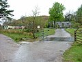
 "Dukies" - geograph.org.uk - 411562.jpg 640 × 480; 65 KB
-
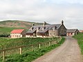
 Summerlee renovation - geograph.org.uk - 414289.jpg 640 × 480; 98 KB
-
 1939-1945 War Memorial - geograph.org.uk - 412202.jpg 640 × 467; 101 KB
-
 3 Ellipses for 3 Locks.jpg 640 × 427; 70 KB
-
 350120 kingsthorpe 220407 d adkins.jpg 2,304 × 1,728; 914 KB
-
-

-

-
 A5, Shrewsbury Bypass at Woodcote - geograph.org.uk - 410043.jpg 600 × 600; 96 KB
-
 A701 Edinburgh Road in Milton Bridge.jpg 640 × 480; 64 KB
-
 A823 - geograph.org.uk - 411310.jpg 640 × 480; 75 KB
-
 A8238 Junction to Tullibardine - geograph.org.uk - 411321.jpg 640 × 480; 110 KB
-
 A824 - geograph.org.uk - 410722.jpg 640 × 480; 58 KB
-
 A9 - geograph.org.uk - 411220.jpg 640 × 480; 97 KB
-
 Abandoned Sheepfold - geograph.org.uk - 409636.jpg 640 × 480; 202 KB
-
 Acharacle Primary School - geograph.org.uk - 413957.jpg 640 × 480; 88 KB
-
 Achosnich.jpg 640 × 480; 66 KB
-
 Addictions Treatment Unit, Omagh - geograph.org.uk - 410188.jpg 640 × 339; 40 KB
-
 Akeld - geograph.org.uk - 409755.jpg 640 × 480; 105 KB
-
 Akeld - geograph.org.uk - 411292.jpg 640 × 480; 151 KB
-
 Albany Mews - geograph.org.uk - 409341.jpg 479 × 640; 135 KB
-

-
 Ancient tree - geograph.org.uk - 409315.jpg 640 × 480; 151 KB
-

-
 And...^ - geograph.org.uk - 409728.jpg 640 × 480; 108 KB
-
 Approaching Hawksworth Village - geograph.org.uk - 410417.jpg 640 × 480; 41 KB
-
 Army housing - geograph.org.uk - 412786.jpg 640 × 480; 102 KB
-
 Ashenden - geograph.org.uk - 412280.jpg 640 × 428; 358 KB
-

-
 Azaleas at Kew Gardens - geograph.org.uk - 423513.jpg 640 × 480; 347 KB
-
 B8062 - geograph.org.uk - 411192.jpg 640 × 480; 100 KB
-
 B8062 - geograph.org.uk - 411200.jpg 640 × 480; 137 KB
-
 Backbury Hill from the Pentaloe Brook - geograph.org.uk - 467413.jpg 640 × 480; 156 KB
-
 Balerno to Nine Mile Burn path - geograph.org.uk - 411559.jpg 640 × 450; 53 KB
-
 Bay Farm inlet - Munlochy Bay - geograph.org.uk - 410098.jpg 640 × 444; 123 KB
-
 Beach and Railings - geograph.org.uk - 409408.jpg 640 × 479; 174 KB
-
 Beacon Hill - geograph.org.uk - 409963.jpg 640 × 288; 55 KB
-
 Beacon Hill - geograph.org.uk - 409967.jpg 640 × 472; 107 KB
-
 Beacon Hill - geograph.org.uk - 409971.jpg 640 × 380; 95 KB
-
 Beacon Hill - geograph.org.uk - 409976.jpg 640 × 424; 94 KB
-
 Beacon Hill - geograph.org.uk - 409982.jpg 521 × 640; 109 KB
-
 Beacon Hill - geograph.org.uk - 409984.jpg 480 × 640; 133 KB
-
 Beacon Hill Country Park - geograph.org.uk - 409999.jpg 640 × 435; 120 KB
-
 Beacon Hill Earthworks - geograph.org.uk - 409990.jpg 640 × 555; 132 KB
-
 Beal Point - geograph.org.uk - 410079.jpg 640 × 480; 101 KB
-
 Beal Point - geograph.org.uk - 410265.jpg 640 × 480; 104 KB
-
 Beal Point - geograph.org.uk - 414588.jpg 640 × 480; 68 KB
-
 Bell's Hill - geograph.org.uk - 412616.jpg 480 × 640; 77 KB
-
 Benscliffe Road near Leicester - geograph.org.uk - 409908.jpg 633 × 640; 188 KB
-
 Bilbster railway station in 2007.jpg 480 × 640; 138 KB
-
 Biscuit lorry - geograph.org.uk - 412638.jpg 640 × 480; 77 KB
-
 Bishopbriggs Cross - geograph.org.uk - 409245.jpg 640 × 480; 111 KB
-
 Bishopbriggs railway station.jpg 640 × 480; 120 KB
-
 Black 5 45407 at Llandevenny - geograph.org.uk - 1617382.jpg 640 × 480; 74 KB
-
 Black 5 near Pengam, Cardiff - geograph.org.uk - 1617346.jpg 640 × 480; 75 KB
-
 Bluebell wood - geograph.org.uk - 410083.jpg 640 × 153; 47 KB
-
 Bluebells in Lassington Wood - geograph.org.uk - 435531.jpg 640 × 426; 175 KB
-
 Boot and Shoe pub, Gawthorpe - geograph.org.uk - 409916.jpg 640 × 480; 78 KB
-
 A welcome sign of Spring, Primroses - geograph.org.uk - 410997.jpg 640 × 480; 118 KB
-
 Bluebells in Fox Wood - geograph.org.uk - 410992.jpg 640 × 480; 159 KB
-

-
 Bovone Farm, Tibberton - geograph.org.uk - 435922.jpg 640 × 426; 103 KB
-
 Bowmont Water - geograph.org.uk - 410776.jpg 640 × 480; 86 KB
-
 Bratch - steam pumping engines - geograph.org.uk - 409770.jpg 427 × 640; 111 KB
-
 Bratch Pumping Station - geograph.org.uk - 409722.jpg 640 × 427; 70 KB
-
 Bratch Pumping Station - geograph.org.uk - 409740.jpg 427 × 640; 93 KB
-
 Bratch Pumping Station - geograph.org.uk - 409748.jpg 427 × 640; 101 KB
-
 Bridge over railway and stream - geograph.org.uk - 487702.jpg 640 × 477; 91 KB
-
 Bridge over stream and railway - geograph.org.uk - 487697.jpg 640 × 477; 107 KB
-
 Bridge over the Logan Burn - geograph.org.uk - 411543.jpg 640 × 480; 73 KB
-
 Bridge over the River Glen at Coupland - geograph.org.uk - 409790.jpg 480 × 640; 132 KB
-
 Bridges over the River Severn - geograph.org.uk - 435072.jpg 640 × 426; 103 KB
-

-

-
 Broadeng Bridge - geograph.org.uk - 487684.jpg 640 × 477; 101 KB
-
 Bunker, Beal Point - geograph.org.uk - 411979.jpg 480 × 640; 172 KB
-

-
 Burnsall Primary School - geograph.org.uk - 409384.jpg 640 × 480; 82 KB
-
 Bush House, Aldwych, London WC2 - geograph.org.uk - 412669.jpg 479 × 640; 127 KB
-
 Camas an t-Salainn - geograph.org.uk - 413098.jpg 640 × 480; 92 KB
-
 Canal footbridge - geograph.org.uk - 412028.jpg 480 × 640; 100 KB
-
 Cap Law plantation - geograph.org.uk - 411567.jpg 640 × 480; 59 KB
-
 Car rally - geograph.org.uk - 487335.jpg 640 × 477; 79 KB
-
 Carnethy Hill - geograph.org.uk - 412604.jpg 640 × 480; 72 KB
-

-
 Castle Street, Stamford - geograph.org.uk - 487491.jpg 477 × 640; 69 KB
-
 Castlehead Rocks, Holy Island - geograph.org.uk - 409819.jpg 640 × 480; 105 KB
-
 Castlehead Rocks, Holy Island - geograph.org.uk - 411888.jpg 640 × 480; 66 KB
-
 Cattle grid - geograph.org.uk - 409633.jpg 640 × 480; 253 KB
-

-
 Cereal crop west of Obthorpe - geograph.org.uk - 487266.jpg 640 × 477; 100 KB
-
 Chapel Jane, near Gurnard's Head - geograph.org.uk - 660267.jpg 640 × 480; 116 KB
-
 Cherry Orchard Road, Thornhill - geograph.org.uk - 410342.jpg 640 × 479; 104 KB
-
 Cherry Trees, Dollar - geograph.org.uk - 411350.jpg 640 × 480; 171 KB
-
 Chimneys of Bath - geograph.org.uk - 421129.jpg 640 × 436; 184 KB
-
 Chipping Warden - geograph.org.uk - 409690.jpg 640 × 429; 132 KB
-
 Chipping Warden - geograph.org.uk - 409799.jpg 640 × 428; 122 KB
-

-
 Clootie Well - geograph.org.uk - 410112.jpg 640 × 558; 173 KB
-
 Closeup of kiln in front of quarry - geograph.org.uk - 413389.jpg 640 × 427; 134 KB
-
 Clydeport Crane - geograph.org.uk - 454146.jpg 502 × 640; 82 KB
-
 Coatbridge Sunnyside - geograph.org.uk - 412008.jpg 640 × 402; 87 KB
-
 Collegiate Church Stained Glass - geograph.org.uk - 444336.jpg 495 × 640; 60 KB
-
 Commemoration stone - geograph.org.uk - 409879.jpg 640 × 480; 86 KB
-
 Conwy castle at night. - geograph.org.uk - 510831.jpg 640 × 512; 75 KB
-
 Coombe Farm - geograph.org.uk - 487275.jpg 640 × 477; 132 KB
-
 Cottage in Clifford's Mesne - geograph.org.uk - 435947.jpg 640 × 426; 130 KB
-
 Cottages in Clifford's Mesne - geograph.org.uk - 436718.jpg 640 × 426; 127 KB
-

-
 Course of former railway, Rudford - geograph.org.uk - 435920.jpg 640 × 426; 128 KB
-
 Craigeach Fell - geograph.org.uk - 409296.jpg 640 × 480; 42 KB
-
 Craigmillar Park golf course - geograph.org.uk - 1150888.jpg 600 × 428; 116 KB
-
 Crawley village and war memorial - geograph.org.uk - 409125.jpg 640 × 480; 96 KB
-
 Crichton Castle Main Entrance - geograph.org.uk - 444272.jpg 640 × 424; 76 KB
-
 Crichton Castle Stables - geograph.org.uk - 444278.jpg 640 × 433; 85 KB
-
 Cricket practice on Kew Green - geograph.org.uk - 423523.jpg 640 × 480; 127 KB
-
 Crookhouse - geograph.org.uk - 411240.jpg 640 × 480; 78 KB
-
 Crossed wires - geograph.org.uk - 487418.jpg 640 × 477; 59 KB
-
 Crown and Anchor, Holy Island - geograph.org.uk - 410669.jpg 640 × 480; 92 KB
-
 Dales Way approaching Burnsall - geograph.org.uk - 409395.jpg 640 × 480; 73 KB
-
 Darby and Joan Welfare Hall - geograph.org.uk - 409938.jpg 640 × 480; 62 KB
-
 Dean Forest Railway - geograph.org.uk - 415768.jpg 640 × 471; 128 KB
-
 Derelict Cottage at Edgebold - geograph.org.uk - 410053.jpg 480 × 640; 96 KB
-
 St Matthews Church, Derrington - geograph.org.uk - 410305.jpg 640 × 429; 104 KB
-
 Dick Whittington's, Gloucester - geograph.org.uk - 435085.jpg 426 × 640; 118 KB
-
 Dovecote at Surrey House - geograph.org.uk - 411112.jpg 480 × 640; 118 KB
-

-
 Driveway north of Greatford - geograph.org.uk - 487298.jpg 640 × 477; 134 KB
-
 Driveway to Dunton Lodge Farm - geograph.org.uk - 409369.jpg 640 × 480; 84 KB
-
 Driveway to New England Farm - geograph.org.uk - 409128.jpg 640 × 480; 64 KB
-
 Earlsheaton Cemetery - geograph.org.uk - 415484.jpg 640 × 480; 86 KB
-
 Tree shelter, East Claydon - geograph.org.uk - 410040.jpg 640 × 480; 197 KB
-
 East Kip - geograph.org.uk - 411575.jpg 640 × 480; 47 KB
-
 Easton war memorial - geograph.org.uk - 487718.jpg 640 × 477; 65 KB
-
 Easton's hill - geograph.org.uk - 487734.jpg 640 × 477; 81 KB
-
 Easton-on-the-Hill - geograph.org.uk - 487714.jpg 640 × 477; 76 KB
-
 Eastside - geograph.org.uk - 411579.jpg 640 × 480; 62 KB
-

-
 Egg stones from the Isle of Eigg. - geograph.org.uk - 620702.jpg 640 × 502; 116 KB
-
 Eilean nan Coinean - geograph.org.uk - 409803.jpg 640 × 480; 84 KB
-
 Embankment to east of A697, near Akeld - geograph.org.uk - 409762.jpg 640 × 480; 115 KB
-
 Emmanuel Head - geograph.org.uk - 410544.jpg 640 × 480; 79 KB
-
 Emmanuel Head - geograph.org.uk - 411951.jpg 640 × 445; 72 KB
-
 Emanuel Church, Laindon Road, Billericay - geograph.org.uk - 586461.jpg 622 × 640; 130 KB
-
 Empingham church - geograph.org.uk - 488191.jpg 640 × 477; 86 KB
-
-
 Entrance drive to Shillingthorpe Park - geograph.org.uk - 487326.jpg 640 × 477; 124 KB
-

-

-
 Estuary at Beal Point - geograph.org.uk - 410086.jpg 640 × 480; 82 KB
-
 Ewart Newtown - geograph.org.uk - 409595.jpg 640 × 480; 77 KB
-
 Ewart Newtown - geograph.org.uk - 409603.jpg 640 × 480; 115 KB
-
 Ewart Park - geograph.org.uk - 409590.jpg 640 × 480; 102 KB
-
 Excalibur Drive, Thornhill - geograph.org.uk - 410420.jpg 640 × 480; 217 KB
-
 Farm buildings, Woodbridge - geograph.org.uk - 409673.jpg 640 × 480; 104 KB
-
 Farm cottage at Newhouse - geograph.org.uk - 409524.jpg 640 × 480; 140 KB
-
 Farm road to Heathfield - geograph.org.uk - 409521.jpg 640 × 480; 122 KB
-
 Farm road to Mc Cheynston - geograph.org.uk - 409446.jpg 640 × 480; 131 KB
-
 Farmland near Benscliffe Road - geograph.org.uk - 409898.jpg 545 × 640; 121 KB
-
 Farmland near Greatford - geograph.org.uk - 487294.jpg 640 × 477; 99 KB
-
 Faweather Cottage - geograph.org.uk - 410482.jpg 640 × 480; 65 KB
-
 Ferone Drive, Omagh - geograph.org.uk - 410179.jpg 640 × 295; 30 KB
-
 Field of dandelions - geograph.org.uk - 435927.jpg 640 × 426; 140 KB
-
 First bus, 22 April 2007 (2).jpg 2,048 × 1,536; 944 KB
-
 First bus, 22 April 2007.jpg 2,048 × 1,536; 884 KB
-
 Flamborough Head Lighthouse - geograph.org.uk - 1192154.jpg 640 × 480; 64 KB
-
 Flora in Lassington Wood - geograph.org.uk - 435540.jpg 640 × 426; 168 KB
-
 Fly-tipping in Llanddewi Brefi, Ceredigion, Wales..jpg 640 × 428; 113 KB
-
 Footpath towards Wilsthorpe - geograph.org.uk - 487286.jpg 640 × 477; 96 KB
-
 Forest Fawr, nr Tongwynlais - geograph.org.uk - 410440.jpg 480 × 640; 234 KB
-
 Forest road and rock outcrop - geograph.org.uk - 409289.jpg 640 × 480; 117 KB
-
 Former farmland - geograph.org.uk - 488023.jpg 640 × 477; 87 KB
-
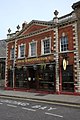
 Former Savings Bank.jpg 399 × 640; 85 KB
-
-
 Furniture Outlet - geograph.org.uk - 412196.jpg 640 × 480; 80 KB
-

-
 Gate and steps on to Shop Lane - geograph.org.uk - 844824.jpg 640 × 480; 88 KB
-

-
 Gate stile on the Pennine Way - geograph.org.uk - 844753.jpg 640 × 480; 121 KB
-
 Gates to Caledonian Cottage - geograph.org.uk - 409548.jpg 640 × 480; 135 KB
-
 Gawthorpe Conservative Club - geograph.org.uk - 409889.jpg 640 × 480; 98 KB
-

-
 Gledwood Drive, Hayes - geograph.org.uk - 409221.jpg 640 × 480; 75 KB
-
 Glencorse Burn. - geograph.org.uk - 412657.jpg 640 × 480; 123 KB
-
 Glencorse Reservoir - geograph.org.uk - 412620.jpg 640 × 480; 74 KB
-
 Gleneagles railway station footbridge.jpg 640 × 480; 113 KB
-
 Gleneagles railway station.jpg 640 × 480; 104 KB
-
 Gleneagles Station Plaque - geograph.org.uk - 409533.jpg 640 × 465; 98 KB
-
 Glenoe waterfall (15) - geograph.org.uk - 411635.jpg 640 × 426; 183 KB
-
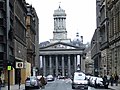 GOMA.jpg 640 × 480; 94 KB
-
 Gospel gardens, Lindisfarne - geograph.org.uk - 412509.jpg 640 × 480; 119 KB
-

-
 Grass path to Thirlings - geograph.org.uk - 409617.jpg 640 × 480; 131 KB
-
 Grassy Path, Holy Island - geograph.org.uk - 410549.jpg 640 × 480; 69 KB
-
 Great Wanney Crag - geograph.org.uk - 1091084.jpg 640 × 480; 84 KB
-
 Green Fields - geograph.org.uk - 411226.jpg 640 × 480; 81 KB
-
 Green lane, north of South Creake - geograph.org.uk - 409204.jpg 640 × 480; 114 KB
-
 Hallgarth Manor Hotel - geograph.org.uk - 410561.jpg 640 × 480; 127 KB
-
 Orchard House - geograph.org.uk - 409789.jpg 640 × 427; 62 KB
-
 Hare Hill - geograph.org.uk - 411538.jpg 640 × 480; 61 KB


.jpg)


_-_geograph.org.uk_-_411635.jpg)


