Category:United Kingdom photographs taken on 2007-11-10
Countries of Europe: Austria · Czech Republic · Denmark · France‡ · Germany · Greece · Italy · Netherlands‡ · Poland · Portugal‡ · Russia‡ · Spain‡ · Sweden · Turkey‡ · Ukraine · United Kingdom · Vatican City
‡: partly located in Europe
‡: partly located in Europe
| ← | 10 November 2007 | → | ||
| ← | November 2007 | → | ||

United Kingdom photographs taken on 10 November 2007.
Image files should be categorized here automatically using {{taken on}} template. Direct categorisation is also possible, if automatic is impossible.
Subcategories
This category has the following 2 subcategories, out of 2 total.
S
Media in category "United Kingdom photographs taken on 2007-11-10"
The following 200 files are in this category, out of 838 total.
(previous page) (next page)-
 "House For Sale" signs - geograph.org.uk - 609063.jpg 640 × 480; 80 KB
-

-
 24 Southcote Road - geograph.org.uk - 609159.jpg 640 × 477; 91 KB
-
 A1 Cloghogue Roundabout.jpg 640 × 399; 49 KB
-
 Access Track Great Hograh Moor - geograph.org.uk - 609523.jpg 640 × 427; 58 KB
-
 Activity along the Thames - geograph.org.uk - 609606.jpg 640 × 477; 96 KB
-
 Afon Clydach, nr Pont Clydach A4069 - geograph.org.uk - 1032115.jpg 640 × 480; 62 KB
-

-

-
 All Saints' Church, Bryher - geograph.org.uk - 1765206.jpg 640 × 480; 55 KB
-
 Alleyway by Park Gate Police Station - geograph.org.uk - 609549.jpg 640 × 480; 91 KB
-
 An impressive pile - geograph.org.uk - 609655.jpg 640 × 477; 77 KB
-
 Apartments - Scott Hall Road - geograph.org.uk - 609634.jpg 640 × 439; 46 KB
-
 Appletree Eyot - geograph.org.uk - 610137.jpg 640 × 477; 89 KB
-
 Approaching Appletree Eyot - geograph.org.uk - 610117.jpg 640 × 477; 112 KB
-
 Approaching Scours Lane - geograph.org.uk - 609857.jpg 640 × 477; 104 KB
-
 Arbutusunedo03.jpg 2,816 × 2,112; 2.02 MB
-
 Ardachie Fell - geograph.org.uk - 609915.jpg 640 × 480; 69 KB
-
 Arriving at Craig Cwm Silyn Summit. - geograph.org.uk - 611729.jpg 640 × 480; 20 KB
-

-
 Athens of the North - geograph.org.uk - 612043.jpg 640 × 479; 62 KB
-
 Awaiting the end of the season clean - geograph.org.uk - 609305.jpg 640 × 480; 92 KB
-
 Bakers Lock in autumn. - geograph.org.uk - 611047.jpg 640 × 480; 195 KB
-
 Bangor, fountain and harbour - geograph.org.uk - 611250.jpg 640 × 480; 66 KB
-
 Bangor, harbour and buoy - geograph.org.uk - 611251.jpg 640 × 480; 79 KB
-
 Bangor, harbour wall - geograph.org.uk - 611253.jpg 640 × 510; 96 KB
-
 Bangor, lifeboat station - geograph.org.uk - 611259.jpg 640 × 480; 59 KB
-
 Bangor, McKee Clock - geograph.org.uk - 611249.jpg 480 × 640; 70 KB
-
 Bangor, mural on Eisenhower Pier - geograph.org.uk - 612412.jpg 640 × 480; 85 KB
-
 Bangor, Northern Bank - geograph.org.uk - 611260.jpg 640 × 480; 49 KB
-
 Bangor, railway station - geograph.org.uk - 611268.jpg 640 × 480; 67 KB
-
 Bangor, sunset over North Pier - geograph.org.uk - 611258.jpg 640 × 480; 62 KB
-
 Bangor, the Sea Bangor - geograph.org.uk - 611264.jpg 640 × 480; 69 KB
-

-

-
 Bangor, Ulster Bank - geograph.org.uk - 611262.jpg 480 × 640; 60 KB
-
 Barrow Hill (2791907221).jpg 2,048 × 1,365; 709 KB
-
 Beacon Bottom, looking east. - geograph.org.uk - 609472.jpg 640 × 480; 77 KB
-
 Beccles Quay - geograph.org.uk - 727690.jpg 640 × 480; 76 KB
-

-

-
 Belfast, Queen's Bridge by night - geograph.org.uk - 612421.jpg 640 × 480; 49 KB
-

-
 Belfast, Waterfront Hall by night - geograph.org.uk - 611287.jpg 640 × 480; 66 KB
-
 Belfast, Wheel and City Hall by night - geograph.org.uk - 611285.jpg 640 × 480; 84 KB
-
 Ben Damph Estate, Torridon - geograph.org.uk - 612299.jpg 640 × 427; 131 KB
-
 Ben Damph Estate, Torridon - geograph.org.uk - 612307.jpg 427 × 640; 111 KB
-
 Bernard Meadows TUC London.jpg 2,448 × 3,264; 2.83 MB
-
 Big Top - geograph.org.uk - 612047.jpg 640 × 479; 41 KB
-
 Black and white or white and black - geograph.org.uk - 609208.jpg 640 × 480; 83 KB
-
 Boat repair Yard Wakefield - geograph.org.uk - 609002.jpg 640 × 395; 76 KB
-
 Boathouse on the Thames - geograph.org.uk - 609630.jpg 640 × 477; 128 KB
-
 Boletus - geograph.org.uk - 609982.jpg 480 × 640; 123 KB
-
 Boundary wall - geograph.org.uk - 611849.jpg 640 × 480; 146 KB
-

-
-

-
 Brick hut on the Thames path - geograph.org.uk - 610161.jpg 640 × 477; 138 KB
-
 Bridge over the railway - geograph.org.uk - 611098.jpg 640 × 477; 102 KB
-
 British Sugar at Bury St Edmunds - geograph.org.uk - 609034.jpg 640 × 480; 104 KB
-
 Bronte House Flats - Scott Hall Road - geograph.org.uk - 609800.jpg 640 × 357; 31 KB
-
 Brook, Omagh - geograph.org.uk - 608813.jpg 640 × 300; 36 KB
-

-
 Bus stop for services to Locks Heath - geograph.org.uk - 609410.jpg 640 × 480; 79 KB
-
 Bus stop in Market Parade - geograph.org.uk - 612635.jpg 640 × 480; 71 KB
-
 Bus stops in Locks Road - geograph.org.uk - 610560.jpg 640 × 480; 72 KB
-
 Busking for Arty, High Street, Omagh - geograph.org.uk - 608550.jpg 640 × 297; 37 KB
-
 Busking for Arty, High Street, Omagh - geograph.org.uk - 608817.jpg 640 × 275; 40 KB
-
 Busking for Arty, High Street, Omagh - geograph.org.uk - 608829.jpg 640 × 330; 43 KB
-
-

-

-
 Camden town house.JPG 2,272 × 1,704; 1.62 MB
-
 Camera Shy Sheep - geograph.org.uk - 609991.jpg 640 × 412; 102 KB
-
 Cantharellus infundibuliformis - geograph.org.uk - 609956.jpg 480 × 640; 150 KB
-
 Car Park near Havant Station - geograph.org.uk - 612789.jpg 640 × 480; 65 KB
-
 Car park near village centre - geograph.org.uk - 608680.jpg 640 × 480; 83 KB
-
 Car Wash - North Street - geograph.org.uk - 609817.jpg 640 × 372; 24 KB
-
 Cardiff Road - geograph.org.uk - 609205.jpg 640 × 477; 100 KB
-
 Carlsberg Tetley - Crown Point Road - geograph.org.uk - 609379.jpg 640 × 480; 25 KB
-

-
 Carving, Llanrhaeadr Church - geograph.org.uk - 608903.jpg 640 × 463; 82 KB
-
 Castle Cannon Battery - geograph.org.uk - 612127.jpg 640 × 397; 64 KB
-

-
 Chazey Court Farm - geograph.org.uk - 609782.jpg 640 × 477; 80 KB
-
 Chimney at Cwm Birgwm - geograph.org.uk - 608578.jpg 640 × 480; 79 KB
-
 Chimney Court, Tilehurst Road - geograph.org.uk - 611895.jpg 640 × 477; 92 KB
-
 Classic car show NEC 2007 IMG 3873 - Flickr - tonylanciabeta.jpg 3,456 × 2,304; 3.58 MB
-
 Clevedon Road - geograph.org.uk - 611125.jpg 640 × 477; 99 KB
-
 Cley visitor centre - geograph.org.uk - 612795.jpg 640 × 480; 45 KB
-
 Clock - geograph.org.uk - 612035.jpg 640 × 468; 69 KB
-
 Clock on industrial unit - geograph.org.uk - 608596.jpg 640 × 480; 68 KB
-
 Closing the gates at Damems station - geograph.org.uk - 864740.jpg 640 × 480; 96 KB
-
 Clouded Agaric - geograph.org.uk - 608760.jpg 640 × 482; 101 KB
-
 Club Lancia Sport stand NEC classic car show 2007 IMG 3885 - Flickr - tonylanciabeta.jpg 3,456 × 2,304; 4.17 MB
-
 Control Tower, Gatwick Airport - geograph.org.uk - 615426.jpg 640 × 428; 91 KB
-
 Corn drying kiln, Aird Mhor - geograph.org.uk - 611780.jpg 640 × 427; 102 KB
-
 Cow Lane - geograph.org.uk - 609213.jpg 640 × 477; 134 KB
-
 Cow Lane - geograph.org.uk - 609569.jpg 640 × 477; 123 KB
-
 Cow Lane - geograph.org.uk - 609595.jpg 640 × 477; 132 KB
-
 Cow Lane bridges - geograph.org.uk - 609193.jpg 640 × 477; 111 KB
-
 Cow Lane bridges - geograph.org.uk - 609201.jpg 640 × 477; 64 KB
-
 Cow Lane bridges - geograph.org.uk - 609203.jpg 640 × 477; 70 KB
-
 Cricket Pitch - Scott Hall Road - geograph.org.uk - 609705.jpg 640 × 430; 20 KB
-
 Cruising on the Thames - geograph.org.uk - 611090.jpg 640 × 477; 112 KB
-

-
 Cwm Silyn Track to Llynnau Cwm Silyn - geograph.org.uk - 611687.jpg 640 × 480; 62 KB
-
 Danger men at work - geograph.org.uk - 611119.jpg 640 × 477; 69 KB
-
 Dell in north-eastern corner of square - geograph.org.uk - 609500.jpg 640 × 480; 130 KB
-
 Descending Dove Crag - geograph.org.uk - 648268.jpg 640 × 480; 76 KB
-
 Descending High Hartsop Dodd - geograph.org.uk - 646061.jpg 640 × 480; 68 KB
-
 Detached house in Stalybridge Close - geograph.org.uk - 609514.jpg 640 × 480; 96 KB
-
 Dinton Hall, Dinton south elevation - geograph.org.uk - 1621274.jpg 640 × 428; 158 KB
-
 Dis-used lime kiln near Rhosesmor - geograph.org.uk - 625277.jpg 640 × 480; 88 KB
-
 Disused Newry canal at Newry - geograph.org.uk - 608715.jpg 640 × 428; 111 KB
-
 Doon the hill - geograph.org.uk - 612061.jpg 640 × 499; 106 KB
-
 Double glazing firm on Locks Road - geograph.org.uk - 610557.jpg 640 × 480; 70 KB
-
 Dove Gardens, Park Gate - geograph.org.uk - 610655.jpg 640 × 480; 105 KB
-
 Dyke beside the Tempar Burn - geograph.org.uk - 610228.jpg 640 × 480; 94 KB
-
 Dynamic Earth entrance - geograph.org.uk - 612041.jpg 640 × 479; 73 KB
-
 Edinburgh Castle and Redcoat Café - geograph.org.uk - 612108.jpg 640 × 488; 114 KB
-
 Edinburgh Organ Studio - geograph.org.uk - 612055.jpg 640 × 491; 100 KB
-
 Edinburgh Waverley - geograph.org.uk - 612116.jpg 640 × 458; 92 KB
-

-
 Entrance at Sweetheart Abbey - geograph.org.uk - 609973.jpg 447 × 640; 94 KB
-
 Entrance to McIlroy Park - geograph.org.uk - 612000.jpg 640 × 477; 95 KB
-
 Entrance, King George V Field, Omagh - geograph.org.uk - 608540.jpg 640 × 480; 62 KB
-
 Extreme Defenestration - geograph.org.uk - 643568.jpg 480 × 640; 76 KB
-

-
 Farm buildings at Upper Lacon Farm - geograph.org.uk - 609220.jpg 640 × 480; 63 KB
-
 Fence to Railway cutting - geograph.org.uk - 608992.jpg 404 × 640; 96 KB
-
 Ferndale Close - geograph.org.uk - 611121.jpg 640 × 477; 91 KB
-
 Field of emerging winter barley - geograph.org.uk - 609163.jpg 640 × 480; 58 KB
-

-
 Fleshmarket Close - geograph.org.uk - 710423.jpg 482 × 640; 66 KB
-
 Flodden Wall - geograph.org.uk - 612141.jpg 640 × 485; 109 KB
-
 Flotsam and jetsam - geograph.org.uk - 609017.jpg 640 × 494; 107 KB
-
 Flowers inside Gloucester Cathedral - geograph.org.uk - 609578.jpg 640 × 480; 95 KB
-
 Fodder Beet harvesting - geograph.org.uk - 1241327.jpg 640 × 480; 84 KB
-
 Footbridge next to the ford - geograph.org.uk - 614550.jpg 640 × 480; 105 KB
-
 Footbridge over Soulton Brook - geograph.org.uk - 609172.jpg 640 × 480; 145 KB
-
 Footpath alongside Rookery Avenue - geograph.org.uk - 610155.jpg 640 × 480; 121 KB
-

-
 Ford on the track in Wark Forest - geograph.org.uk - 614561.jpg 640 × 480; 80 KB
-
 Ford on the track through Wark Forest - geograph.org.uk - 614548.jpg 640 × 480; 70 KB
-
 Forest track south of the ford - geograph.org.uk - 614552.jpg 640 × 480; 58 KB
-
 Former Griffin Hotel - Boar Lane - geograph.org.uk - 609840.jpg 576 × 640; 52 KB
-
 Free to good home - geograph.org.uk - 789487.jpg 480 × 640; 92 KB
-
 Galbraith Terrace, Omagh - geograph.org.uk - 608797.jpg 640 × 238; 24 KB
-

-
 Garages on Western Elms Avenue - geograph.org.uk - 609178.jpg 640 × 477; 68 KB
-
 Garden - Kirkgate - geograph.org.uk - 609907.jpg 640 × 480; 57 KB
-
 Garden - Kirkgate - geograph.org.uk - 609916.jpg 640 × 434; 59 KB
-
 General Grocer - geograph.org.uk - 612070.jpg 640 × 479; 117 KB
-
 George Heriot's - geograph.org.uk - 612123.jpg 640 × 469; 104 KB
-
 Gies a swatch - geograph.org.uk - 710357.jpg 640 × 478; 84 KB
-
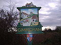 Gimingham Village Sign 10 Nov 2007 (3).JPG 2,560 × 1,920; 1,009 KB
-
 Glen Turret - geograph.org.uk - 661144.jpg 640 × 480; 68 KB
-

-

-
 Gloucester Cathedral (Cloisters) - geograph.org.uk - 609584.jpg 640 × 480; 78 KB
-
 Gloucester Cathedral (interior) - geograph.org.uk - 609571.jpg 640 × 480; 77 KB
-

-

-

-
 Gloucester Cathedral (Stone gargoyle) - geograph.org.uk - 609600.jpg 640 × 480; 95 KB
-

-
 Gloucester Cathedral Yard - geograph.org.uk - 609566.jpg 640 × 480; 70 KB
-
 Gloucester Docks - Biddle Warehouse - geograph.org.uk - 609649.jpg 640 × 480; 72 KB
-

-

-

-

-

-

-

-
 Gloucester Docks - Vinings Warehouse - geograph.org.uk - 609618.jpg 640 × 480; 61 KB
-
 GMPTE - Hadfield Railway Station, November 2007 - panoramio.jpg 2,048 × 1,536; 569 KB
-
 Governor's House - Calton Hill Jail - geograph.org.uk - 612074.jpg 479 × 640; 62 KB
-
 Graffiti - geograph.org.uk - 612063.jpg 479 × 640; 62 KB
-
 Graffiti - geograph.org.uk - 612064.jpg 484 × 640; 60 KB
-
 Graffiti - geograph.org.uk - 612067.jpg 479 × 640; 63 KB
-
 Graffiti at 242 The Royal Mile - geograph.org.uk - 612066.jpg 487 × 640; 77 KB
-
 Grange Farm and Riding School - geograph.org.uk - 609312.jpg 640 × 480; 66 KB
-
 Grassmarket - geograph.org.uk - 612146.jpg 640 × 479; 118 KB
-
 Grazing pony at Pig Bush, New Forest - geograph.org.uk - 608880.jpg 640 × 480; 139 KB
-
 Great Western main line at Tilehurst - geograph.org.uk - 611102.jpg 640 × 477; 96 KB
-
 Great Western main line west of Tilehurst - geograph.org.uk - 611106.jpg 640 × 477; 107 KB
-
 Greatorex Shop, Ulverston - geograph.org.uk - 767197.jpg 457 × 640; 54 KB
-
 Grebe on the river - geograph.org.uk - 610148.jpg 640 × 477; 105 KB
-
 Green courtyard - geograph.org.uk - 710385.jpg 479 × 640; 100 KB
-
 Green lane on Upper Lacon Farm - geograph.org.uk - 609297.jpg 640 × 480; 98 KB
-
 Greyfriar's Bobby - geograph.org.uk - 612096.jpg 527 × 640; 57 KB
-
 Greyfriar's Churchyard - geograph.org.uk - 612138.jpg 640 × 479; 91 KB
-
 Greyfriar's Kirk - geograph.org.uk - 612120.jpg 640 × 467; 101 KB
-

-
 Hair by Alfie - geograph.org.uk - 710464.jpg 487 × 640; 95 KB
-
 Halfway House - geograph.org.uk - 710418.jpg 640 × 479; 82 KB
-
 Hampton Towers, Southcote Road - geograph.org.uk - 609157.jpg 640 × 477; 113 KB
-
 Havant Park - geograph.org.uk - 612642.jpg 640 × 480; 46 KB

_sheephole_near_Lynnshield_-_geograph.org.uk_-_614581.jpg)


.jpg)


_-_geograph.org.uk_-_738823.jpg)


.JPG)

_-_geograph.org.uk_-_609605.jpg)
_-_geograph.org.uk_-_609607.jpg)
_-_geograph.org.uk_-_609584.jpg)
_-_geograph.org.uk_-_609571.jpg)
_-_geograph.org.uk_-_609590.jpg)
_-_geograph.org.uk_-_609593.jpg)
_-_geograph.org.uk_-_609612.jpg)
_-_geograph.org.uk_-_609600.jpg)
_-_geograph.org.uk_-_609599.jpg)


_-_geograph.org.uk_-_609633.jpg)
_and_dry_dock_-_geograph.org.uk_-_609638.jpg)


