Category:United Kingdom photographs taken on 2009-04-14
Countries of Europe: Austria · Belgium · Czech Republic · Denmark · Estonia · Finland · France‡ · Georgia‡ · Germany · Greece · Hungary · Republic of Ireland · Italy · Moldova · Netherlands‡ · Poland · Portugal‡ · Romania · Russia‡ · Slovakia · Slovenia · Spain‡ · Sweden · Switzerland · Ukraine · United Kingdom
‡: partly located in Europe
‡: partly located in Europe
| ← | 14 April 2009 | → | ||
| ← | April 2009 | → | ||

United Kingdom photographs taken on 14 April 2009.
Image files should be categorized here automatically using {{taken on}} template. Direct categorisation is also possible, if automatic is impossible.
Subcategories
This category has the following 3 subcategories, out of 3 total.
Media in category "United Kingdom photographs taken on 2009-04-14"
The following 200 files are in this category, out of 962 total.
(previous page) (next page)-
 (2243) Early Grey (Xylocampa areola) (3444416764).jpg 1,500 × 1,004; 1.46 MB
-
 2009 at Bodmin Parkway - platform 1.jpg 1,024 × 768; 272 KB
-
 2009 at Bodmin Parkway - platform sign.jpg 1,024 × 768; 370 KB
-
 2009 at Bodmin Parkway - signal box cafe.JPG 1,024 × 768; 386 KB
-
 2009 at Bodmin Parkway - signal box rear.JPG 1,366 × 910; 295 KB
-
 2009 at Par railway station - exterior.jpg 1,024 × 512; 154 KB
-
 2009 at Saltash station - 1984 plaque.jpg 800 × 424; 168 KB
-
 2009 at Saltash station - view from the west.jpg 800 × 600; 169 KB
-
 2009 at St Austell station - 1882 footbridge.jpg 800 × 445; 151 KB
-
 2009 at St Austell station - footbridge interior.jpg 768 × 1,024; 269 KB
-
 2009 at St Austell station - platform 2 signs.jpg 800 × 600; 133 KB
-
 2009 at St Austell station - signs for Eden Project.jpg 800 × 600; 207 KB
-
 2009 at St Austell station - up side building.jpg 1,024 × 768; 310 KB
-
 2009 at St Austell station - up side from car park.jpg 1,024 × 614; 204 KB
-

-
 2009 on the Royal Albert Bridge - Cornwall portal.jpg 800 × 600; 177 KB
-
 2009 on the Royal Albert Bridge - Devon portal.jpg 600 × 800; 200 KB
-
 2009 on the Royal Albert Bridge - view point.jpg 800 × 600; 238 KB
-
 66519 Danesmoor (3444397432).jpg 3,000 × 2,000; 4.2 MB
-
 A busy Wardour St, Chinatown - geograph.org.uk - 1269157.jpg 640 × 430; 72 KB
-

-
 A lonely larch - geograph.org.uk - 1266564.jpg 640 × 427; 88 KB
-

-
 A narrow path through the heath - geograph.org.uk - 1253091.jpg 587 × 600; 142 KB
-
 A sea of yellow - geograph.org.uk - 1253080.jpg 620 × 588; 129 KB
-
 A stand of birches - geograph.org.uk - 1253103.jpg 640 × 480; 138 KB
-
 A WD 2-10-0 90775 locomotive - geograph.org.uk - 1252884.jpg 640 × 526; 83 KB
-
 A1 looking north - geograph.org.uk - 1343090.jpg 640 × 480; 101 KB
-
 A1 South - geograph.org.uk - 1343079.jpg 640 × 480; 104 KB
-
 A1000 and Old Signpost - geograph.org.uk - 1255683.jpg 430 × 640; 169 KB
-
 A168 and the old A1 - geograph.org.uk - 1343049.jpg 640 × 480; 110 KB
-
 A168 South - geograph.org.uk - 1343054.jpg 640 × 480; 96 KB
-
 A614 Through Haisthorpe.jpg 640 × 480; 42 KB
-
 A712 lane junction - geograph.org.uk - 1255989.jpg 640 × 480; 82 KB
-
 Abandoned quarry buildings - geograph.org.uk - 1255570.jpg 640 × 480; 108 KB
-
 Abandoned quarry buildings - geograph.org.uk - 1255574.jpg 640 × 480; 114 KB
-
 Abandoned vans, Belfast (2) - geograph.org.uk - 1254633.jpg 640 × 323; 70 KB
-
 Abandoned vans, Belfast (3) - geograph.org.uk - 1254684.jpg 640 × 353; 38 KB
-
 Aberglaslyn Pass - geograph.org.uk - 1381957.jpg 640 × 480; 118 KB
-
 About to dock at Cairnryan - geograph.org.uk - 1255948.jpg 640 × 427; 57 KB
-
 Above Nant Dynyn - geograph.org.uk - 1251237.jpg 640 × 427; 88 KB
-
 Across the crossroads, Cornwood - geograph.org.uk - 1273100.jpg 640 × 427; 92 KB
-
 Action for Children - geograph.org.uk - 1252632.jpg 640 × 428; 95 KB
-
 Adamson Wharf - geograph.org.uk - 1274476.jpg 640 × 563; 153 KB
-
 Adit in the Aberglaslyn Pass - geograph.org.uk - 1383940.jpg 480 × 640; 105 KB
-
 Afon Colwyn from the Glaslyn bridge - geograph.org.uk - 1384204.jpg 640 × 480; 125 KB
-
 Afon Glaslyn - geograph.org.uk - 1382152.jpg 640 × 480; 131 KB
-
 Afon Glaslyn from Glaslyn Bridge - geograph.org.uk - 1384151.jpg 640 × 480; 106 KB
-

-
 Afon Gwy - River Wye - geograph.org.uk - 1251762.jpg 640 × 480; 68 KB
-
 Afon Gwy - River Wye - geograph.org.uk - 1251899.jpg 640 × 480; 101 KB
-

-
 Afon Pemprys - geograph.org.uk - 1251126.jpg 640 × 427; 85 KB
-
 After exercise, Whitsbury - geograph.org.uk - 1251088.jpg 640 × 480; 174 KB
-
 Albion Way - geograph.org.uk - 1284655.jpg 624 × 463; 121 KB
-

-
 All Hallows Convent - geograph.org.uk - 2146750.jpg 640 × 480; 103 KB
-
 Allt Coire Lair - geograph.org.uk - 1268327.jpg 640 × 480; 250 KB
-
 Alpacas at Toft Hill - geograph.org.uk - 1252294.jpg 640 × 426; 96 KB
-
 An unexpected pool, Pemprys - geograph.org.uk - 1251615.jpg 640 × 416; 52 KB
-
 Ancient heathland - geograph.org.uk - 1253046.jpg 640 × 480; 88 KB
-
 And the path is where^ - geograph.org.uk - 1251159.jpg 640 × 427; 87 KB
-
 Antique cairn on Bwlch Corog - geograph.org.uk - 1251181.jpg 640 × 427; 61 KB
-
 Approaching Pedn-myin - geograph.org.uk - 1267043.jpg 640 × 425; 73 KB
-
 Approaching Windpump crossing - geograph.org.uk - 1252856.jpg 640 × 502; 124 KB
-
 Arable Land North Of The Grove - geograph.org.uk - 1251689.jpg 640 × 480; 104 KB
-
 Arrival at Cairnryan ferry terminal - geograph.org.uk - 1255954.jpg 485 × 640; 77 KB
-
 Askham Richard - geograph.org.uk - 1343132.jpg 640 × 480; 101 KB
-
 Atlantic Airlines G-LOFB L.Electra CVT 14-04-09 (20187438290).jpg 3,504 × 2,336; 1.22 MB
-
 Attractive flint and brick cottage - geograph.org.uk - 1251925.jpg 640 × 480; 93 KB
-
 Automasters Site - geograph.org.uk - 1274655.jpg 640 × 490; 129 KB
-
 B83 to Seskinore - geograph.org.uk - 1255586.jpg 640 × 479; 64 KB
-
 Bachelors Walk, Lisburn (1) - geograph.org.uk - 1254546.jpg 640 × 383; 73 KB
-
 Bachelors Walk, Lisburn (2) - geograph.org.uk - 1254575.jpg 640 × 390; 74 KB
-
 Baker Street - geograph.org.uk - 1263543.jpg 640 × 427; 187 KB
-
 Ballylumford power station - geograph.org.uk - 1255836.jpg 503 × 640; 54 KB
-
 Bank Street, Jackson Bridge - geograph.org.uk - 1257111.jpg 640 × 488; 123 KB
-
 Bare trees and fields - geograph.org.uk - 1251666.jpg 640 × 493; 97 KB
-
 Barmston Sands (North) - geograph.org.uk - 1251597.jpg 640 × 480; 19 KB
-
 Barn, Breamore Down - geograph.org.uk - 1263844.jpg 640 × 480; 173 KB
-

-
 Basset Lawn Tennis Club, Wilton Road - geograph.org.uk - 1252593.jpg 640 × 427; 105 KB
-
 Beddgelert Bridge - geograph.org.uk - 1382346.jpg 640 × 427; 94 KB
-
 Beddgelert village green - geograph.org.uk - 1384133.jpg 640 × 427; 99 KB
-

-
 Beldcraig Glen from Craig Fell - geograph.org.uk - 1264027.jpg 640 × 428; 58 KB
-
 Beltany Townland - geograph.org.uk - 1255531.jpg 640 × 479; 84 KB
-
 Beltany Townland - geograph.org.uk - 1255537.jpg 640 × 479; 55 KB
-
 Bentley Heath - geograph.org.uk - 1261405.jpg 640 × 420; 204 KB
-
 Between the river and the railway - geograph.org.uk - 1382579.jpg 640 × 480; 112 KB
-
 Bijou digger-ette - geograph.org.uk - 1251635.jpg 640 × 480; 111 KB
-
 Birches and gorse - geograph.org.uk - 1253067.jpg 640 × 480; 100 KB
-
 Birchwoods at Craggie. - geograph.org.uk - 1252635.jpg 640 × 480; 196 KB
-
 Birmingham - panoramio (51).jpg 2,816 × 2,112; 2.95 MB
-
 Birmingham Spring - panoramio.jpg 2,816 × 2,112; 2.38 MB
-
 Black Bog Road, Skeagh Townland - geograph.org.uk - 1251355.jpg 640 × 480; 58 KB
-
 Black Bull Inn - geograph.org.uk - 1264432.jpg 640 × 480; 51 KB
-
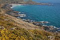
 Black Head - geograph.org.uk - 1268011.jpg 640 × 425; 71 KB
-
 Blackfriars - geograph.org.uk - 1255169.jpg 640 × 480; 89 KB
-
 Bloodstock, Whitsbury Manor Stud - geograph.org.uk - 1281451.jpg 640 × 481; 166 KB
-

-
 Bluebells, Whitsbury - geograph.org.uk - 1281441.jpg 640 × 481; 245 KB
-
 Boats for hire at Newbridge - geograph.org.uk - 1252049.jpg 640 × 427; 84 KB
-
 Bondgate - Harrogate Road - geograph.org.uk - 1251443.jpg 640 × 480; 240 KB
-
 Boots - Castle Meadow - geograph.org.uk - 2133167.jpg 640 × 455; 159 KB
-
 Boots - geograph.org.uk - 2146790.jpg 630 × 457; 118 KB
-
 Boulders, Coire Lair - geograph.org.uk - 1268328.jpg 640 × 480; 219 KB
-
 Boundary stone - geograph.org.uk - 1359458.jpg 474 × 640; 138 KB
-

-
 Detail, Breamore House - geograph.org.uk - 1279981.jpg 640 × 480; 141 KB
-
 Mizmaze, Breamore - geograph.org.uk - 1264706.jpg 640 × 480; 168 KB
-
 Mizmaze, Breamore - geograph.org.uk - 1264727.jpg 640 × 480; 169 KB
-
 The Church of St Mary, Breamore - geograph.org.uk - 1279858.jpg 640 × 480; 173 KB
-
 Wall, Breamore - geograph.org.uk - 1280015.jpg 640 × 480; 198 KB
-
 Breamore House - geograph.org.uk - 1279809.jpg 640 × 480; 132 KB
-
 Breamore House - geograph.org.uk - 1279835.jpg 640 × 480; 118 KB
-
 Breamore Wood - geograph.org.uk - 1276590.jpg 640 × 479; 242 KB
-
 Bridge across leat - geograph.org.uk - 1259671.jpg 640 × 426; 92 KB
-
 Bridge and embankment - geograph.org.uk - 1382553.jpg 640 × 480; 128 KB
-
 Bridge near Penrose - geograph.org.uk - 1251471.jpg 640 × 427; 142 KB
-
 Bridge over the River Crimple - geograph.org.uk - 1343039.jpg 640 × 480; 121 KB
-
 Bridleway in Breamore Woods - geograph.org.uk - 1279711.jpg 640 × 480; 199 KB
-
 Bridleway junction near Whitsbury - geograph.org.uk - 1281400.jpg 640 × 481; 227 KB
-
 Bridleway junction, Breamore - geograph.org.uk - 1281130.jpg 640 × 480; 238 KB
-
 Bridleway near Breamore - geograph.org.uk - 1281115.jpg 480 × 640; 224 KB
-
 Bridleway near Whitsbury - geograph.org.uk - 1252336.jpg 640 × 481; 185 KB
-
 Bridleway near Whitsbury - geograph.org.uk - 1252351.jpg 640 × 481; 177 KB
-
 Bridleway near Whitsbury - geograph.org.uk - 1281381.jpg 640 × 481; 169 KB
-
 Bridleway to Breamore - geograph.org.uk - 1276484.jpg 640 × 480; 202 KB
-
 Bridleway to Breamore - geograph.org.uk - 1276494.jpg 640 × 481; 217 KB
-
 Bridleway to Gallows Hill - geograph.org.uk - 1263934.jpg 640 × 482; 200 KB
-
 Bridleway, Whitsbury - geograph.org.uk - 1251102.jpg 640 × 480; 117 KB
-
 Bridleway, Whitsbury - geograph.org.uk - 1252323.jpg 640 × 480; 179 KB
-
 Bridleway, Whitsbury - geograph.org.uk - 1281407.jpg 640 × 480; 201 KB
-
 Bridleway, Whitsbury - geograph.org.uk - 1281430.jpg 640 × 480; 204 KB
-
 Bristol Airport short-stay car park - geograph.org.uk - 1251809.jpg 640 × 480; 160 KB
-
 Broad Road - geograph.org.uk - 1251267.jpg 480 × 640; 73 KB
-

-
 Broadclyst , The Red Lion Inn - geograph.org.uk - 1259311.jpg 640 × 480; 62 KB
-
 Broadclyst , The Red Lion Inn - geograph.org.uk - 1259825.jpg 640 × 474; 72 KB
-
 Broadway, Potters Bar - geograph.org.uk - 1263555.jpg 640 × 427; 138 KB
-
 Burton parkland - geograph.org.uk - 1253302.jpg 640 × 426; 93 KB
-
 Burton parkland - geograph.org.uk - 1253315.jpg 640 × 426; 45 KB
-
 Bus Lane - geograph.org.uk - 2124349.jpg 624 × 463; 139 KB
-
 Bus Shelter - Harrogate Road - geograph.org.uk - 1251506.jpg 640 × 480; 334 KB
-
 Bus shelter, Tullycorker Road - geograph.org.uk - 1255581.jpg 640 × 479; 82 KB
-

-
 Cable tensioner for aerial cableway - geograph.org.uk - 1384030.jpg 480 × 640; 135 KB
-
 Caernarfon Castle - geograph.org.uk - 1619617.jpg 640 × 480; 83 KB
-
 Caernarfon, Castle Square - geograph.org.uk - 1619565.jpg 640 × 480; 107 KB
-
 Cairn Point lighthouse and Cairnryan - geograph.org.uk - 1255896.jpg 640 × 400; 46 KB
-
 Caloptilia rufipennella (3443598459).jpg 1,500 × 1,004; 1.44 MB
-
 Camping beside the Colwyn - geograph.org.uk - 1382511.jpg 640 × 480; 128 KB
-
 Canal Street, Blists Hill - geograph.org.uk - 1252084.jpg 640 × 480; 80 KB
-
 Canal Street, Blists Hill - geograph.org.uk - 1265158.jpg 640 × 480; 78 KB
-
 Candlemaker's House, Blists Hill - geograph.org.uk - 1265186.jpg 640 × 480; 80 KB
-
 Capel Soar Chapel - geograph.org.uk - 1275160.jpg 480 × 640; 77 KB
-
 Carlyon Bridge.jpg 800 × 600; 158 KB
-

-
 Castlecroft Bridge - geograph.org.uk - 1252455.jpg 600 × 450; 208 KB
-
 Castlewood Close - Church Lane - geograph.org.uk - 1251482.jpg 640 × 464; 181 KB
-
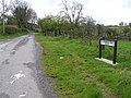
 Centre of Login Village - geograph.org.uk - 1254176.jpg 640 × 466; 78 KB
-
 Charing Cross Station - geograph.org.uk - 1269796.jpg 640 × 430; 76 KB
-
 Chinatown, Gerrard St - geograph.org.uk - 1269149.jpg 640 × 430; 85 KB
-
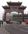 Chinese Arch, St. Andrews Street - geograph.org.uk - 1255186.jpg 526 × 640; 78 KB
-
 Chinese gate, Gerrard St - geograph.org.uk - 1269136.jpg 640 × 430; 103 KB
-

-
 Church Lane - Harrogate Road - geograph.org.uk - 1251473.jpg 640 × 446; 197 KB
-
 Churchyard, High Ercall - geograph.org.uk - 1251422.jpg 640 × 480; 85 KB
-
 Churchyard, High Ercall - geograph.org.uk - 1251426.jpg 640 × 480; 113 KB
-
 Chynhalls Cliff - geograph.org.uk - 1267996.jpg 640 × 425; 103 KB
-
 Cilowen Uchaf Farm near Login - geograph.org.uk - 1254212.jpg 640 × 447; 85 KB
-
 Cilymaenllwyd Parish Church, Login - geograph.org.uk - 1251533.jpg 640 × 479; 124 KB
-
 Cilymaenllwyd Parish Church, Login - geograph.org.uk - 1251539.jpg 640 × 480; 112 KB
-
 Cilymaenllwyd Parish Church, Login - geograph.org.uk - 1251544.jpg 640 × 480; 130 KB
-

-
 Claremore Road, Beltany - geograph.org.uk - 1255534.jpg 640 × 479; 71 KB
-
 Clematis (3442018784).jpg 2,388 × 2,178; 3.2 MB
-
 Clematis 2 (3441210437).jpg 2,168 × 3,160; 3.44 MB
-
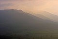 Cleveland Hills - geograph.org.uk - 1263892.jpg 640 × 427; 16 KB
-
 Clock tower, Breamore House - geograph.org.uk - 1279779.jpg 480 × 640; 150 KB
-
 Clock, Lisburn (1) - geograph.org.uk - 1253468.jpg 640 × 436; 51 KB
-
 Clock, Lisburn (2) - geograph.org.uk - 1253480.jpg 590 × 477; 138 KB
-
 Cloneblaugh Townland - geograph.org.uk - 1255541.jpg 640 × 479; 53 KB
-
 Cloneblaugh Townland - geograph.org.uk - 1255542.jpg 640 × 479; 57 KB
-
 Coast road north of Larne - geograph.org.uk - 1255757.jpg 640 × 485; 85 KB
-
 Cold Hill Lane, New Mill - geograph.org.uk - 1251721.jpg 640 × 480; 148 KB
-
 Compton Moorings - geograph.org.uk - 1252460.jpg 600 × 450; 299 KB
-

-

-
 Coniston - the Sun Hotel - geograph.org.uk - 1255579.jpg 640 × 480; 94 KB
-
 Cookley Tunnel - geograph.org.uk - 1252427.jpg 600 × 450; 358 KB
-
 Cormore Road - geograph.org.uk - 1254350.jpg 640 × 479; 81 KB
-
 Cormore Road - geograph.org.uk - 1254352.jpg 640 × 479; 53 KB
-
 Cormore Townland - geograph.org.uk - 1255563.jpg 640 × 479; 59 KB
-
 Cormore Townland - geograph.org.uk - 1255567.jpg 640 × 479; 73 KB
-
 Cormore Townland - geograph.org.uk - 1255578.jpg 640 × 479; 75 KB
-

-
 Cottages at Coverack - geograph.org.uk - 1267098.jpg 425 × 640; 78 KB
-
 Cottages by the Coast Road - geograph.org.uk - 1255770.jpg 640 × 437; 63 KB
_Early_Grey_(Xylocampa_areola)_(3444416764).jpg)


.jpg)


.jpg)


_-_geograph.org.uk_-_1254633.jpg)
_-_geograph.org.uk_-_1254684.jpg)


.jpg)


_-_geograph.org.uk_-_1254546.jpg)
_-_geograph.org.uk_-_1254575.jpg)


_-_geograph.org.uk_-_1251597.jpg)


.jpg)


.jpg)


.jpg)
.jpg)


_-_geograph.org.uk_-_1253468.jpg)
_-_geograph.org.uk_-_1253480.jpg)


