Category:United States Senate election maps of South Carolina
States of the United States: Alabama · Alaska · Arizona · Arkansas · California · Colorado · Connecticut · Delaware · Florida · Hawaii · Idaho · Illinois · Indiana · Iowa · Kansas · Kentucky · Louisiana · Maine · Maryland · Massachusetts · Michigan · Minnesota · Mississippi · Missouri · Montana · Nebraska · Nevada · New Hampshire · New Jersey · New Mexico · New York · North Carolina · North Dakota · Ohio · Oklahoma · Oregon · Pennsylvania · Rhode Island · South Carolina · South Dakota · Tennessee · Texas · Utah · Vermont · Virginia · Washington · West Virginia · Wisconsin · Wyoming
Subcategories
This category has only the following subcategory.
Media in category "United States Senate election maps of South Carolina"
The following 11 files are in this category, out of 11 total.
-
 1950 South Carolina Senate Democratic primary election results map by county.png 2,560 × 2,048; 367 KB
-
 2022 SC Senate.svg 810 × 648; 10.49 MB
-
 2022 US Senate Election in South Carolina by Congressional District.svg 810 × 648; 1.17 MB
-
 Map (2).svg 800 × 636; 861 KB
-
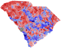
 SC SEN 2022 SH.svg 800 × 636; 1.29 MB
-
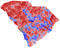
 SC Senate 2020.svg 810 × 648; 16.64 MB
-
 South Carolina 1998 Senate Election.png 315 × 233; 22 KB
-
 South Carolina 2004 Senate Election.png 315 × 233; 20 KB
-
 South Carolina Senate Democratic primary runoff, 2022.svg 810 × 648; 53 KB
-
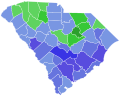
 South Carolina Senate Democratic primary, 2022.svg 810 × 648; 53 KB
-
 South Carolina Senatorial Election Results by county, 2008.png 752 × 599; 98 KB


.svg)


