Category:Upper Sheringham
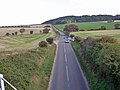
English: Upper Sheringham is a village and a civil parish in the English county of Norfolk . The village is from the town of Sheringham. The nearest railway station is at Sheringham for the Bittern Line which runs between Sheringham, Cromer and Norwich. The nearest airport is Norwich International Airport. Nearby road connections are the A149 King's Lynn to Great Yarmouth road to the north of the village and the A148 King's Lynn to Cromer road just to the south. The parish of Upper Sheringham in the 2001 census, a population of 214. For the purposes of local government, the parish falls within the district of North Norfolk.
village in the United Kingdom   | |||||
| Upload media | |||||
| Instance of | |||||
|---|---|---|---|---|---|
| Location | North Norfolk, Norfolk, East of England, England | ||||
| Area |
| ||||
 | |||||
Subcategories
This category has the following 9 subcategories, out of 9 total.
Media in category "Upper Sheringham"
The following 200 files are in this category, out of 335 total.
(previous page) (next page)-
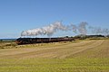
 6619 on its way to Weybourne - geograph.org.uk - 1417280.jpg 640 × 480; 42 KB
-
 9F 92212 on an afternoon train - geograph.org.uk - 2050105.jpg 800 × 531; 83 KB
-
 9F 92212 on the NNR - geograph.org.uk - 2050076.jpg 800 × 532; 80 KB
-
 9F 92212 on the North Norfolk Coast - geograph.org.uk - 2050071.jpg 800 × 531; 77 KB
-

-

-
 A path in Sheringham Wood, Sheringham - geograph.org.uk - 2112790.jpg 640 × 480; 192 KB
-
 A1082 - geograph.org.uk - 3835108.jpg 640 × 430; 35 KB
-
 A148 - geograph.org.uk - 3835098.jpg 640 × 430; 76 KB
-
 A148 lay-by at Gibbet Plantation - geograph.org.uk - 3625064.jpg 640 × 480; 68 KB
-
 A148 westbound near Mill Farm - geograph.org.uk - 3625066.jpg 640 × 481; 56 KB
-
 A148, eastbound - geograph.org.uk - 3835215.jpg 640 × 430; 85 KB
-
 A149 approaching Weybourne - geograph.org.uk - 3155424.jpg 1,024 × 693; 235 KB
-
 A149 by Oak Wood - geograph.org.uk - 4847129.jpg 1,600 × 1,200; 432 KB
-
 A149 east of Oak Wood - geograph.org.uk - 3619602.jpg 640 × 480; 37 KB
-
 A149 to Weybourne - geograph.org.uk - 4783884.jpg 1,920 × 1,193; 791 KB
-
 A149 towards Sheringham - geograph.org.uk - 3681720.jpg 640 × 480; 111 KB
-
 All Saints, Upper Sheringham - geograph.org.uk - 4616268.jpg 1,600 × 1,105; 452 KB
-
 Approaching Sheringham - geograph.org.uk - 6229419.jpg 2,000 × 1,333; 298 KB
-

-
 Barn devoted to Humphrey Repton - geograph.org.uk - 4253323.jpg 4,912 × 2,760; 5.5 MB
-
 Barn near Dead Man's Hill - geograph.org.uk - 4792953.jpg 1,920 × 1,078; 675 KB
-
 Beach - geograph.org.uk - 3942869.jpg 640 × 430; 75 KB
-
 Beach west of Sheringham - geograph.org.uk - 3942880.jpg 640 × 430; 73 KB
-
 Beach west of Sheringham - geograph.org.uk - 4616364.jpg 1,600 × 900; 352 KB
-
 Beach west of Sheringham - geograph.org.uk - 4616375.jpg 1,067 × 1,600; 446 KB
-
 Beach, below the cliff - geograph.org.uk - 3942885.jpg 640 × 430; 61 KB
-
 Bee pollinating a flower - geograph.org.uk - 5858409.jpg 1,024 × 683; 130 KB
-

-
 Beech trees in Sheringwood - geograph.org.uk - 4203338.jpg 1,125 × 1,500; 2.67 MB
-
 Beet field, Sheringham Park - geograph.org.uk - 4792852.jpg 1,920 × 1,280; 847 KB
-
 Blind corner on the brow of a hill, on Sheringham Road, A149 - geograph.org.uk - 6097373.jpg 3,264 × 2,448; 1.82 MB
-

-
 By the North Norfolk Railway - geograph.org.uk - 3681684.jpg 640 × 480; 94 KB
-
 Car park at Pretty Corner - geograph.org.uk - 4199429.jpg 1,500 × 1,125; 2.11 MB
-

-
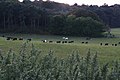
 Cattle grazing in Sheringham Park - geograph.org.uk - 4191182.jpg 640 × 427; 53 KB
-
 Christmas Cheer on the A148 - geograph.org.uk - 2744213.jpg 1,024 × 575; 99 KB
-
 Cliff erosion - geograph.org.uk - 3942866.jpg 430 × 640; 70 KB
-
 Cliff erosion - geograph.org.uk - 3942902.jpg 640 × 430; 84 KB
-
 Cliff top erosion - geograph.org.uk - 3942864.jpg 640 × 430; 73 KB
-
 Cliff west of Sheringham - geograph.org.uk - 3942948.jpg 430 × 640; 48 KB
-
 Cliffs and shingle beach - geograph.org.uk - 5629262.jpg 800 × 449; 95 KB
-
 Clifftop field west of Sheringham - geograph.org.uk - 3725883.jpg 640 × 480; 56 KB
-
 Clifftop oak tree - geograph.org.uk - 4851048.jpg 1,600 × 1,134; 499 KB
-
 Coast path north of Dead Man's Hill - geograph.org.uk - 4793126.jpg 1,920 × 1,280; 679 KB
-
 Coast Road (A149) towards Sheringham - geograph.org.uk - 5559448.jpg 640 × 480; 50 KB
-

-
 Coastal crop field - geograph.org.uk - 5559446.jpg 640 × 480; 60 KB
-
 Coastal erosion near Weybourne - geograph.org.uk - 4851079.jpg 1,600 × 1,200; 471 KB
-
 Contorted Drift - geograph.org.uk - 4851088.jpg 1,200 × 1,600; 559 KB
-
 Copse by Cranfield Road - geograph.org.uk - 4871091.jpg 1,600 × 1,200; 651 KB
-
 Cottages. Weybourne Road Upper Sheringham - geograph.org.uk - 6138844.jpg 4,590 × 3,434; 5.38 MB
-
 Crossing the Railway Line - geograph.org.uk - 5449883.jpg 640 × 433; 101 KB
-
 Dead Man's Hill - geograph.org.uk - 3942872.jpg 640 × 430; 35 KB
-
 Debris on the beach - geograph.org.uk - 5365130.jpg 1,600 × 1,200; 405 KB
-

-
-
 Descent into the valley on Sheringham Road, the A149 - geograph.org.uk - 6097371.jpg 3,264 × 2,448; 1.7 MB
-

-
 Double Header - geograph.org.uk - 2049942.jpg 800 × 531; 106 KB
-

-
 Earth movement showing on cliff face - geograph.org.uk - 5931332.jpg 4,608 × 3,456; 4.32 MB
-
 Entrance kiosk at Sheringham Park - geograph.org.uk - 6097394.jpg 3,264 × 2,448; 2.42 MB
-
-
 Farm building near the railway line - geograph.org.uk - 6097380.jpg 3,264 × 2,448; 1.65 MB
-

-
 Farmland by the A149 - geograph.org.uk - 4016451.jpg 640 × 354; 23 KB
-
 Farmland north of the A149 - geograph.org.uk - 4016480.jpg 640 × 430; 31 KB
-
 Farmland, Dead Man's Hill - geograph.org.uk - 4793024.jpg 1,920 × 1,200; 869 KB
-
 Farmland, North Norfolk - geograph.org.uk - 4016464.jpg 640 × 493; 31 KB
-
 Farmland, Upper Sheringham - geograph.org.uk - 4792431.jpg 1,920 × 799; 282 KB
-

-
 Field near Upper Sheringham - geograph.org.uk - 4871101.jpg 1,600 × 1,200; 378 KB
-

-
 Footpath Bridge - geograph.org.uk - 5633127.jpg 640 × 425; 34 KB
-
 Gazebo, Sheringham Park - geograph.org.uk - 2570156.jpg 427 × 640; 194 KB
-
 Gazebo, Sheringham Park - geograph.org.uk - 4783771.jpg 1,920 × 1,180; 735 KB
-
-
 Grassland by the railway - geograph.org.uk - 4270585.jpg 640 × 480; 90 KB
-

-
 Heading west on the Norfolk Coast Path - geograph.org.uk - 5931325.jpg 4,608 × 3,456; 4.83 MB
-
 Hedge and wheat by the track - geograph.org.uk - 6229411.jpg 1,804 × 1,274; 371 KB
-
 Hedge, Dead Man's Hill - geograph.org.uk - 3942863.jpg 640 × 430; 37 KB
-
 Holt Rd - geograph.org.uk - 3835100.jpg 640 × 430; 63 KB
-
 Holway Road from Cranefield Road - geograph.org.uk - 6097432.jpg 3,264 × 2,448; 1.58 MB
-
 Holway Road, near Pretty Corner - geograph.org.uk - 4644681.jpg 640 × 480; 438 KB
-
 Housing in Upper Sheringham from Weybourne Road - geograph.org.uk - 6138840.jpg 4,508 × 3,320; 5.5 MB
-
 J15 on the Quad Art Set - geograph.org.uk - 2098063.jpg 800 × 531; 83 KB
-
 Lake at Sheringham Park - geograph.org.uk - 3003359.jpg 2,272 × 1,704; 2.5 MB
-
 Leaving Upper Sheringham on Weybourne Road - geograph.org.uk - 6138834.jpg 3,942 × 2,965; 5.02 MB
-
 Little Train - geograph.org.uk - 2050002.jpg 800 × 531; 81 KB
-
 Little Train - geograph.org.uk - 2050055.jpg 800 × 532; 71 KB
-

-
 Lodge Cottage to the Dales - geograph.org.uk - 4129859.jpg 4,320 × 3,240; 3.97 MB
-
 Lodge Farm - geograph.org.uk - 4990594.jpg 1,600 × 1,200; 523 KB
-
 Low Bridge ahead warning sign - geograph.org.uk - 6097400.jpg 3,264 × 2,448; 1.61 MB
-
 Mace Hill - geograph.org.uk - 4815716.jpg 1,920 × 1,147; 698 KB
-
 Meadow, trees and sea - geograph.org.uk - 4047860.jpg 640 × 483; 57 KB
-
 More wheat fields - geograph.org.uk - 6229415.jpg 2,000 × 1,333; 303 KB
-

-

-
 National Trust giving away electricity - geograph.org.uk - 6097155.jpg 3,264 × 2,448; 1.79 MB
-
 New housing estate off Holway Road, Sheringham - geograph.org.uk - 6097434.jpg 3,264 × 2,448; 1.57 MB
-
 Norfolk Coast Path - geograph.org.uk - 3942900.jpg 640 × 430; 35 KB
-
 Norfolk Coast Path - geograph.org.uk - 3942949.jpg 640 × 430; 54 KB
-
 Norfolk Coast Path - geograph.org.uk - 3942956.jpg 640 × 430; 32 KB
-
 Norfolk Coast Path - geograph.org.uk - 4793036.jpg 1,920 × 1,280; 800 KB
-
 Norfolk Coast path - geograph.org.uk - 4793057.jpg 1,920 × 1,156; 869 KB
-
 Norfolk Coast path - geograph.org.uk - 4851045.jpg 1,600 × 1,200; 515 KB
-
 Norfolk coast path - geograph.org.uk - 5028192.jpg 1,600 × 1,200; 787 KB
-
 Norfolk Coast Path - geograph.org.uk - 5028199.jpg 1,600 × 1,200; 770 KB
-
 Norfolk Coast Path 047 - geograph.org.uk - 4092278.jpg 640 × 425; 88 KB
-
 Norfolk Coast Path 048 - geograph.org.uk - 4092282.jpg 640 × 425; 81 KB
-
 Norfolk Coastal Path - geograph.org.uk - 4616354.jpg 1,600 × 900; 526 KB
-
 North Norfolk farmland near Sheringham - geograph.org.uk - 5620290.jpg 800 × 600; 131 KB
-
 North Norfolk Railway - geograph.org.uk - 4016445.jpg 640 × 333; 28 KB
-
 North Norfolk Railway - geograph.org.uk - 4783421.jpg 1,920 × 1,440; 529 KB
-
 North Norfolk Railway - geograph.org.uk - 4792957.jpg 1,920 × 1,166; 658 KB
-
 North Norfolk Railway - geograph.org.uk - 4792959.jpg 1,920 × 1,117; 555 KB
-
 North Norfolk Railway at Weybourne - geograph.org.uk - 4783755.jpg 1,920 × 1,371; 624 KB
-
 North Norfolk Railway from the Gazebo - geograph.org.uk - 4687026.jpg 4,000 × 3,000; 4.68 MB
-

-
 November flowering azalea - geograph.org.uk - 4253332.jpg 4,912 × 2,760; 6.69 MB
-
 Oak Wood - geograph.org.uk - 4253353.jpg 4,912 × 2,760; 5.19 MB
-
 Oak Wood - geograph.org.uk - 4792857.jpg 1,920 × 1,102; 580 KB
-
 Oak Wood - geograph.org.uk - 4792859.jpg 1,626 × 971; 418 KB
-
 Oak Wood - geograph.org.uk - 5559443.jpg 640 × 367; 46 KB
-
 On the edge - geograph.org.uk - 747703.jpg 640 × 480; 145 KB
-
 Pale Close Hill - geograph.org.uk - 4792856.jpg 1,920 × 1,037; 596 KB
-
 Park Road to Sheringham Park - geograph.org.uk - 4871115.jpg 1,600 × 1,200; 798 KB
-
 Past flowering shrubs - geograph.org.uk - 747672.jpg 640 × 480; 204 KB
-
 Path in Sheringham Park - geograph.org.uk - 4687052.jpg 4,000 × 3,000; 4.78 MB
-
-
 Path off Coast Road (A149) - geograph.org.uk - 5559445.jpg 640 × 480; 95 KB
-
 Path through Sheringham Wood - geograph.org.uk - 2112784.jpg 640 × 450; 185 KB
-
 Path to the Beach - geograph.org.uk - 1417253.jpg 640 × 480; 71 KB
-
 Pedestrian entrance to Sheringham Park - geograph.org.uk - 4871107.jpg 1,600 × 1,200; 437 KB
-
 Permissive path to Oak Wood - geograph.org.uk - 5028205.jpg 1,600 × 1,200; 951 KB
-
 Permissive path to the coast - geograph.org.uk - 4793029.jpg 1,920 × 2,250; 1.22 MB
-
 Pillbox at Bridge 304 - geograph.org.uk - 2049899.jpg 800 × 531; 208 KB
-
 Pillbox Interior - geograph.org.uk - 2049918.jpg 800 × 531; 104 KB
-
 Pond in Sheringham Park - geograph.org.uk - 5016901.jpg 1,600 × 1,200; 1.02 MB
-
 Pretty corner - geograph.org.uk - 2217658.jpg 2,048 × 1,536; 1.46 MB
-
 Pretty Corner cafe and tea gardens - geograph.org.uk - 4871158.jpg 1,600 × 1,200; 661 KB
-

-
 Railway cutting - geograph.org.uk - 1387162.jpg 640 × 480; 98 KB
-
 Railway tracks - geograph.org.uk - 747652.jpg 640 × 480; 156 KB
-
 Rainbow out at sea - geograph.org.uk - 3942933.jpg 640 × 430; 22 KB
-

-
 Raised pond with water trough, Upper Sheringham Church - geograph.org.uk - 4616274.jpg 1,600 × 1,067; 525 KB
-
 Raised pond, Upper Sheringham - geograph.org.uk - 4616283.jpg 1,600 × 1,067; 591 KB
-
 Red sky - geograph.org.uk - 3942916.jpg 640 × 430; 27 KB
-
 Red sky - geograph.org.uk - 3942919.jpg 640 × 430; 28 KB
-
 Red Sky - geograph.org.uk - 3942925.jpg 640 × 430; 22 KB
-
 Red Sky - geograph.org.uk - 3942928.jpg 640 × 430; 25 KB
-
 Red sunset - geograph.org.uk - 3942935.jpg 640 × 430; 27 KB
-
 Rhododendron in Sheringham Park - geograph.org.uk - 314426.jpg 640 × 480; 131 KB
-
 Rhododendron maze - geograph.org.uk - 3003349.jpg 2,272 × 1,704; 2.25 MB
-
 Rhododendrons in Sheringham Park - geograph.org.uk - 4941607.jpg 640 × 427; 57 KB
-
 Ring Haw on the Quads - geograph.org.uk - 2049884.jpg 800 × 531; 91 KB
-
 Rough grassland - geograph.org.uk - 3942938.jpg 640 × 430; 42 KB
-
 Rough grazing - geograph.org.uk - 3942893.jpg 640 × 430; 36 KB
-

-
 Rough grazing west of Sheringham - geograph.org.uk - 3942896.jpg 640 × 430; 41 KB
-
 Ruin beside footpath - geograph.org.uk - 747642.jpg 640 × 466; 138 KB
-
 Seat beside footpath - geograph.org.uk - 747675.jpg 480 × 640; 187 KB
-
 Seaview - geograph.org.uk - 2577241.jpg 1,000 × 667; 113 KB
-
 Sheringham - 2013 - geograph.org.uk - 4081368.jpg 640 × 480; 56 KB
-
 Sheringham - 2013 - geograph.org.uk - 4081375.jpg 3,648 × 2,736; 962 KB
-
 Sheringham - 2013 - geograph.org.uk - 4081380.jpg 3,648 × 2,736; 1.17 MB
-
 Sheringham - 2013 - geograph.org.uk - 4081447.jpg 3,648 × 2,736; 3.52 MB
-
 Sheringham - 2013 - geograph.org.uk - 4082066.jpg 3,648 × 2,736; 3.44 MB
-
 Sheringham - 2013 - geograph.org.uk - 4082067.jpg 3,648 × 2,736; 3.44 MB
-
 Sheringham Golf Club - geograph.org.uk - 3368902.jpg 4,000 × 3,000; 4.97 MB
-
 Sheringham Golf course - geograph.org.uk - 1387181.jpg 640 × 480; 48 KB
-
 Sheringham Golf Course - geograph.org.uk - 3942953.jpg 640 × 430; 33 KB
-
 Sheringham Golf Course - geograph.org.uk - 3942954.jpg 640 × 430; 28 KB
-
 Sheringham Golf Course - geograph.org.uk - 3942959.jpg 640 × 430; 35 KB
-
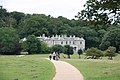
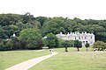
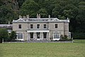
 Sheringham Hall - geograph.org.uk - 2577210.jpg 1,000 × 667; 183 KB
-
 Sheringham Hall - geograph.org.uk - 2577220.jpg 1,000 × 667; 178 KB
-
 Sheringham Hall - geograph.org.uk - 2577224.jpg 1,000 × 667; 160 KB
-
 Sheringham Hall - geograph.org.uk - 2577237.jpg 1,000 × 667; 176 KB
-
 Sheringham Hall - geograph.org.uk - 4687039.jpg 4,000 × 3,000; 4.68 MB
-
 Sheringham Hall - geograph.org.uk - 4783402.jpg 3,041 × 1,945; 1.21 MB
-
 Sheringham Hall ^ Farm - geograph.org.uk - 2577307.jpg 1,000 × 667; 121 KB
-
 Sheringham Hall, Sheringham Park - geograph.org.uk - 5416383.jpg 640 × 480; 95 KB
-
 Sheringham Park (1) - geograph.org.uk - 5179163.jpg 4,320 × 3,240; 3.9 MB
-
 Sheringham Park (10) - geograph.org.uk - 5179299.jpg 4,320 × 3,240; 3.4 MB
-
 Sheringham Park (11) - geograph.org.uk - 5180014.jpg 4,320 × 3,240; 4.76 MB
-
 Sheringham Park (12) - geograph.org.uk - 5180017.jpg 4,320 × 3,240; 5 MB
-
 Sheringham Park (13) - geograph.org.uk - 5180018.jpg 4,121 × 3,091; 2.24 MB
-
 Sheringham Park (14) - geograph.org.uk - 5180019.jpg 4,320 × 3,240; 5.15 MB
-
 Sheringham Park (15) - geograph.org.uk - 5180020.jpg 4,320 × 3,240; 2.26 MB
-
 Sheringham Park (16) - geograph.org.uk - 5180023.jpg 3,221 × 4,293; 2.48 MB
-
 Sheringham Park (17) - geograph.org.uk - 5180026.jpg 4,320 × 3,240; 4.75 MB
-
 Sheringham Park (18) - geograph.org.uk - 5180029.jpg 4,320 × 3,240; 4.64 MB
-
 Sheringham Park (19) - geograph.org.uk - 5180036.jpg 4,320 × 3,240; 5.1 MB
-
 Sheringham Park (2) - geograph.org.uk - 5179168.jpg 4,311 × 3,233; 3.87 MB
-
 Sheringham Park (20) - geograph.org.uk - 5180041.jpg 4,289 × 3,217; 2.46 MB


_-_geograph.org.uk_-_1749162.jpg)


_towards_Sheringham_-_geograph.org.uk_-_5559448.jpg)


_-_geograph.org.uk_-_5559445.jpg)


_-_geograph.org.uk_-_5179163.jpg)
_-_geograph.org.uk_-_5179299.jpg)
_-_geograph.org.uk_-_5180014.jpg)
_-_geograph.org.uk_-_5180017.jpg)
_-_geograph.org.uk_-_5180018.jpg)
_-_geograph.org.uk_-_5180019.jpg)
_-_geograph.org.uk_-_5180020.jpg)
_-_geograph.org.uk_-_5180023.jpg)
_-_geograph.org.uk_-_5180026.jpg)
_-_geograph.org.uk_-_5180029.jpg)
_-_geograph.org.uk_-_5180036.jpg)
_-_geograph.org.uk_-_5179168.jpg)
_-_geograph.org.uk_-_5180041.jpg)