Category:Valid SVG created with ArcGIS
Media in category "Valid SVG created with ArcGIS"
The following 29 files are in this category, out of 29 total.
-
 Baneh, Kurdistan Province locator map.svg 1,980 × 1,530; 3.34 MB
-
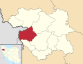
 Bijar, Kurdistan Province locator map.svg 1,980 × 1,530; 3.34 MB
-
 Dehgolan, Kurdistan Province locator map.svg 1,980 × 1,530; 3.34 MB
-
 Diocese of Morombe in Madagascar map.svg 765 × 1,260; 991 KB
-
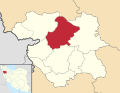 Divandarreh, Kurdistan Province locator map.svg 1,980 × 1,530; 3.34 MB
-
 Ghorveh, Kurdistan Province locator map.svg 1,980 × 1,530; 3.34 MB
-
 Kamyran, Kurdistan Province locator map.svg 1,980 × 1,530; 3.34 MB
-
 Kurdistan Province districts map (blank).svg 1,980 × 1,530; 3.33 MB
-
 Kurdistan Province districts map (with labels).svg 1,980 × 1,530; 3.35 MB
-
 London Underground Northern line extension map.svg 1,175 × 807; 207 KB
-
 Madagascar districts location map.svg 765 × 1,260; 992 KB
-
 Marivan, Kurdistan Province locator map.svg 1,980 × 1,530; 3.34 MB
-
 Sanandaj, Kurdistan Province locator map.svg 1,980 × 1,530; 3.34 MB
-
 Saqqez, Kurdistan Province locator map.svg 1,980 × 1,530; 3.34 MB
-
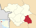
 Sarvabad, Kurdistan Province locator map.svg 1,980 × 1,530; 3.34 MB
-
 Tehran District 10.svg 1,489 × 1,053; 1,003 KB
-
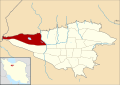
 Tehran District 11.svg 1,489 × 1,053; 1,003 KB
-
 Tehran District 2.svg 1,489 × 1,053; 1,001 KB
-
 Tehran District 22.svg 1,489 × 1,053; 1.01 MB
-
 Tehran District 3.svg 1,489 × 1,053; 1,003 KB
-
 Tehran District 4.svg 1,489 × 1,053; 1,003 KB
-
 Tehran District 5.svg 1,489 × 1,053; 1,003 KB
-
 Tehran District 6.svg 1,489 × 1,053; 1,003 KB
-
 Tehran District 7.svg 1,489 × 1,053; 1,003 KB
-
 Tehran District 8.svg 1,489 × 1,053; 1,003 KB
-
 Tehran District 9.svg 1,489 × 1,053; 1,003 KB
-
 Tehran district map (blank).svg 1,489 × 1,053; 1,002 KB
-
 Tehran Province location map (with labels).svg 1,980 × 1,035; 324 KB
-
 Zonotrichia albicollis map.svg 709 × 531; 6.73 MB


.svg)


.svg)

.svg)
.svg)