Category:Ventnor
town and civil parish on the Isle of Wight, in England, UK  | |||||
| Upload media | |||||
| Instance of | |||||
|---|---|---|---|---|---|
| Location | Isle of Wight, South East England, England | ||||
| Different from | |||||
| official website | |||||
 | |||||
Subcategories
This category has the following 21 subcategories, out of 21 total.
- Bus stops in Ventnor (35 F)
- Buses in Ventnor (80 F)
A
- Artworks of Ventnor (5 F)
C
- Cottage Hospital, Ventnor (5 F)
G
I
- Isle of Arts Festival (8 F)
P
R
- Restaurants in Ventnor (6 F)
S
- St Boniface Down (14 F)
- Steephill Cove (47 F)
V
- Ventnor Beach (76 F)
- Ventnor Clock Tower (5 F)
- Ventnor Esplanade (17 F)
- Ventnor Haven (52 F)
- Ventnor Park (12 F)
- Ventnor railway station (3 F)
W
- Wheelers Bay (6 F)
Media in category "Ventnor"
The following 200 files are in this category, out of 859 total.
(previous page) (next page)-
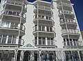
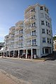
 "Metropole" building, Ventnor Esplanade, Isle of Wight, England (2).jpg 4,000 × 3,000; 4.63 MB
-
 "Metropole" building, Ventnor Esplanade, Isle of Wight, England.jpg 3,920 × 2,890; 3.62 MB
-
 "Oi you, get down" - geograph.org.uk - 2330482.jpg 640 × 480; 57 KB
-
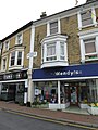
 01, High Street - geograph.org.uk - 5095607.jpg 480 × 640; 85 KB
-
 17, the shortest day- or is it^ - geograph.org.uk - 5632768.jpg 640 × 480; 154 KB
-
 18, the shortest day- or is it^ - geograph.org.uk - 5632770.jpg 640 × 480; 114 KB
-
 19, the shortest day- or is it^ - geograph.org.uk - 5632773.jpg 640 × 480; 85 KB
-
 20, the shortest day- or is it^ - geograph.org.uk - 5632777.jpg 640 × 480; 111 KB
-
 21, the shortest day- or is it^ - geograph.org.uk - 5632786.jpg 442 × 640; 62 KB
-
 22, the shortest day- or is it^ - geograph.org.uk - 5632789.jpg 640 × 480; 110 KB
-
 70a, 119 and 121 Leeson Road, Bonchurch - geograph.org.uk - 5123276.jpg 640 × 480; 142 KB
-
 A shop with no name, High Street - geograph.org.uk - 5096008.jpg 480 × 640; 63 KB
-
 A splendid, splendid sight - geograph.org.uk - 2330488.jpg 640 × 480; 67 KB
-
 A3055 Leeson Road - geograph.org.uk - 5351287.jpg 640 × 428; 178 KB
-
 A3055 Steephill Road - geograph.org.uk - 3759718.jpg 640 × 480; 339 KB
-
 A3055, High Street, Ventnor - geograph.org.uk - 3759739.jpg 640 × 480; 289 KB
-
 A3055, Ventnor - geograph.org.uk - 3759724.jpg 640 × 480; 333 KB
-
 Above St. Lawrence - geograph.org.uk - 1897599.jpg 640 × 426; 264 KB
-
 Above the old station area at Ventnor - geograph.org.uk - 6260441.jpg 1,024 × 576; 573 KB
-
 Above the Undercliff - geograph.org.uk - 1897592.jpg 640 × 427; 215 KB
-
 Albert Street in Ventnor - geograph.org.uk - 1925094.jpg 1,500 × 1,000; 131 KB
-
 All the world's a stage - geograph.org.uk - 4360564.jpg 1,600 × 1,064; 566 KB
-
 Along Ventnor High Street - geograph.org.uk - 5274810.jpg 640 × 427; 210 KB
-

-

-
 Anchor behind a seat on The Esplanade - geograph.org.uk - 2330570.jpg 640 × 480; 113 KB
-
 Anchor on the Esplanade, Ventnor - geograph.org.uk - 4729520.jpg 1,200 × 799; 465 KB
-
 Another Road Closure - geograph.org.uk - 4089551.jpg 640 × 427; 432 KB
-
 Apartments at Ventnor - geograph.org.uk - 4258199.jpg 800 × 531; 96 KB
-
 Apartments on the Esplanade , Ventnor - geograph.org.uk - 4729554.jpg 1,200 × 799; 251 KB
-
 Apartments on Ventnor Esplanade - geograph.org.uk - 4258186.jpg 531 × 800; 108 KB
-
 Approaching Rew Farm - geograph.org.uk - 3104182.jpg 640 × 480; 98 KB
-
 Approaching Stenbury Down - geograph.org.uk - 3279447.jpg 640 × 427; 233 KB
-
 Arriving at the coast - geograph.org.uk - 2008049.jpg 640 × 426; 249 KB
-
 Arriving at Ventnor Bay.jpg 4,000 × 3,000; 2.14 MB
-
 Bandstand - Ventnor Park - geograph.org.uk - 4349861.jpg 1,600 × 1,064; 521 KB
-
 Bandstand in Ventnor Park - geograph.org.uk - 4460555.jpg 640 × 427; 104 KB
-
 Bandstand, Ventnor - geograph.org.uk - 3306027.jpg 1,600 × 1,015; 219 KB
-
 Barbers in the High Street - geograph.org.uk - 5096063.jpg 480 × 640; 87 KB
-
 Barns at Monks Bay - geograph.org.uk - 1897797.jpg 640 × 427; 189 KB
-
 Bath Road in the springtime - geograph.org.uk - 2330551.jpg 640 × 480; 96 KB
-
 Bath Road leading to Ventnor Esplanade - geograph.org.uk - 2144891.jpg 480 × 640; 227 KB
-
 Bath Road, Ventnor - geograph.org.uk - 4547483.jpg 4,896 × 3,672; 7.03 MB
-
 Bathers at Ventnor, Isle of Wight, England.jpg 3,219 × 2,024; 2.56 MB
-
 Beach at Steephill Cove - geograph.org.uk - 4462259.jpg 640 × 427; 77 KB
-
 Beach cleaning, Binnel Bay - geograph.org.uk - 5689768.jpg 3,766 × 2,301; 1.93 MB
-
 Beach west of Steephill Cove - geograph.org.uk - 4462274.jpg 640 × 427; 98 KB
-
 Beachside Road Ventnor - geograph.org.uk - 925869.jpg 640 × 480; 91 KB
-
 Belgrave Road - geograph.org.uk - 5276507.jpg 640 × 427; 203 KB
-
 Belgrave Road Ventnor - geograph.org.uk - 5364720.jpg 3,456 × 2,592; 4.2 MB
-
 Below the Eastern Cliffs - geograph.org.uk - 5277255.jpg 640 × 427; 196 KB
-
 Bench and artwork - geograph.org.uk - 4360568.jpg 1,600 × 1,064; 672 KB
-
 Benches on Leeson Road - geograph.org.uk - 1925104.jpg 1,500 × 1,000; 250 KB
-
 Bend in the Coastal Path - geograph.org.uk - 5602644.jpg 424 × 640; 126 KB
-
 Biker in Church Street - geograph.org.uk - 5095585.jpg 640 × 480; 81 KB
-
 Binnel Point - geograph.org.uk - 5519251.jpg 3,899 × 2,924; 2.9 MB
-
 Bistro in Pier Street - geograph.org.uk - 5095561.jpg 640 × 480; 81 KB
-

-
 BLUE PLAQUES 023.jpg 1,024 × 768; 264 KB
-
 Bluebells and palm - geograph.org.uk - 1925068.jpg 1,500 × 1,000; 342 KB
-
 Boat entering Ventnor marina, Isle of Wight, England.jpg 3,986 × 2,982; 3.35 MB
-
 Boat slip at Wheelers Bay - geograph.org.uk - 2144837.jpg 640 × 480; 218 KB
-
 Boats on Ventnor Beach - geograph.org.uk - 2330578.jpg 640 × 480; 80 KB
-
 Ventnor BBodichon.jpg 700 × 462; 60 KB
-
 Bonchurch Bay, Isle of Wight - geograph.org.uk - 2002016.jpg 3,264 × 2,448; 2.54 MB
-
 Bonchurch Down - geograph.org.uk - 2008020.jpg 640 × 427; 200 KB
-
 Bonchurch Down - geograph.org.uk - 5381827.jpg 3,456 × 2,592; 4.3 MB
-
 Bonchurch Landslips - geograph.org.uk - 5623031.jpg 3,648 × 2,736; 2.68 MB
-
 Bonchurch Pottery Sign - geograph.org.uk - 2002019.jpg 3,264 × 2,448; 2.31 MB
-

-
 Boniface Arms - geograph.org.uk - 4637235.jpg 1,600 × 1,065; 470 KB
-
 Boniface Arms - geograph.org.uk - 4637239.jpg 1,600 × 1,065; 358 KB
-
 Bonshore foreshore, February 2013 - geograph.org.uk - 3353545.jpg 640 × 480; 62 KB
-
 Boots, High Street - geograph.org.uk - 5095592.jpg 640 × 480; 78 KB
-
 Bottom end of Esplanade Road - geograph.org.uk - 2330501.jpg 480 × 640; 65 KB
-

-
 Breakwater Ventnor - geograph.org.uk - 5364691.jpg 3,456 × 2,592; 4.38 MB
-
 Breakwater Ventnor - geograph.org.uk - 5364699.jpg 3,456 × 2,592; 4.35 MB
-
 Britain's Hottest Garden - geograph.org.uk - 5947135.jpg 800 × 1,200; 565 KB
-
 Building on Ventnor sea front - geograph.org.uk - 4638014.jpg 1,600 × 1,065; 529 KB
-
 Bungalows and hillside at Ventnor - geograph.org.uk - 53770.jpg 640 × 480; 129 KB
-
 Buoy out of water - geograph.org.uk - 4462272.jpg 640 × 427; 122 KB
-
 Burfields, High Street - geograph.org.uk - 5096037.jpg 480 × 640; 58 KB
-
 Businesses on the Esplanade, Ventnor - geograph.org.uk - 4729595.jpg 1,200 × 799; 374 KB
-
 Butchers in the High Street - geograph.org.uk - 5096012.jpg 480 × 640; 79 KB
-
 Cantina, High Street - geograph.org.uk - 5096004.jpg 480 × 640; 74 KB
-
 Car park just west of The Esplanade - geograph.org.uk - 2330465.jpg 640 × 480; 55 KB
-
 Carpark at Ventnor - geograph.org.uk - 4729507.jpg 1,200 × 799; 293 KB
-
 Carving of a Fisherman - geograph.org.uk - 2047491.jpg 1,000 × 1,500; 365 KB
-
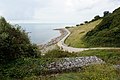
 Castle Cove - geograph.org.uk - 1897768.jpg 640 × 427; 198 KB
-
 Castle Cove Ventnor - geograph.org.uk - 5536715.jpg 2,592 × 1,944; 914 KB
-
 Castle Cove, Ventnor (10490252884).jpg 4,896 × 3,672; 5.04 MB
-
 Cattle Grazing - geograph.org.uk - 1459548.jpg 640 × 428; 131 KB
-
 Cattle in field near Rew Farm - geograph.org.uk - 4460539.jpg 640 × 427; 103 KB
-

-
 Central Car Park, Ventnor - geograph.org.uk - 5096091.jpg 640 × 480; 62 KB
-
 Chalk Cliffs - geograph.org.uk - 4073175.jpg 640 × 427; 452 KB
-
 Cheetah Marine, Ventnor - geograph.org.uk - 4729513.jpg 1,200 × 799; 311 KB
-

-
 Chivertons, High Street - geograph.org.uk - 5096075.jpg 480 × 640; 58 KB
-

-

-
 Clarence Buildings, High Street - geograph.org.uk - 5095602.jpg 480 × 640; 73 KB
-
 Cliff beside Woody Bay - geograph.org.uk - 2153190.jpg 480 × 640; 225 KB
-
 Close to Dunnose Point, Isle of Wight - geograph.org.uk - 5496447.jpg 3,179 × 2,384; 2.2 MB
-
 Co-Op, top of Pier Street - geograph.org.uk - 5095490.jpg 640 × 480; 68 KB
-
 Coast near Ventnor, Isle of Wight, England.jpg 3,956 × 2,940; 3.02 MB
-
 Coast west of Ventnor - geograph.org.uk - 5351310.jpg 640 × 480; 133 KB
-

-
 Coastal defences - geograph.org.uk - 5278595.jpg 427 × 640; 201 KB
-
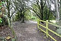
 Coastal footpath at East Dene - geograph.org.uk - 2144785.jpg 640 × 480; 321 KB
-
 Coastal footpath in Castle Cove - geograph.org.uk - 2153409.jpg 640 × 480; 221 KB
-
 Coastal footpath in The Landslip - geograph.org.uk - 2144774.jpg 480 × 640; 330 KB
-
 Coastal footpath in The Landslip - geograph.org.uk - 2144775.jpg 480 × 640; 333 KB
-

-

-
 Coastal footpath passing Woody Bay - geograph.org.uk - 2153197.jpg 640 × 480; 213 KB
-
 Coastal path approaching Woody Bay - geograph.org.uk - 5519256.jpg 3,672 × 2,591; 1.64 MB
-
 Coastal Path at Castle Cove - geograph.org.uk - 4627003.jpg 1,200 × 799; 457 KB
-
 Coastal path at St Richards Cove - geograph.org.uk - 4627133.jpg 1,200 × 799; 386 KB
-
 Coastal path at Steephill - geograph.org.uk - 4627097.jpg 1,200 × 799; 400 KB
-
 Coastal Path at the Undercliff - geograph.org.uk - 4073168.jpg 640 × 423; 362 KB
-
 Coastal path at Ventnor - geograph.org.uk - 1897630.jpg 640 × 427; 237 KB
-
 Coastal path at Ventnor - geograph.org.uk - 4729509.jpg 1,200 × 799; 329 KB
-
 Coastal path at Ventnor Holiday Villas - geograph.org.uk - 4728354.jpg 1,200 × 799; 358 KB
-
 Coastal path at Ventnor Holiday Villas - geograph.org.uk - 4728361.jpg 1,200 × 799; 310 KB
-
 Coastal path at Wheelers Bay, Ventnor - geograph.org.uk - 4728272.jpg 1,200 × 799; 229 KB
-
 Coastal path at Woody Bay - geograph.org.uk - 4627141.jpg 1,200 × 799; 395 KB
-
 Coastal path between Binnel Bay and Woody Bay - geograph.org.uk - 5519232.jpg 3,863 × 2,631; 3 MB
-
-
 Coastal path from Binnel Bay - geograph.org.uk - 5519253.jpg 3,933 × 2,702; 2.61 MB
-
 Coastal path leading to Horseshoe Bay - geograph.org.uk - 4727265.jpg 1,200 × 799; 539 KB
-
 Coastal path near Binnel Bay - geograph.org.uk - 5519248.jpg 3,835 × 2,568; 2.47 MB
-
 Coastal path sign at Ventnor - geograph.org.uk - 4626997.jpg 1,200 × 810; 173 KB
-
 Coastal path towards Bonchurch - geograph.org.uk - 4727241.jpg 1,200 × 799; 610 KB
-
 Coastal path towards Bonchurch - geograph.org.uk - 4727243.jpg 1,200 × 799; 670 KB
-
 Coastal path towards Bonchurch - geograph.org.uk - 4727245.jpg 1,200 × 799; 598 KB
-
 Coastal path towards Bonchurch - geograph.org.uk - 4727252.jpg 1,200 × 799; 416 KB
-
 Coastal path towards St Lawrence - geograph.org.uk - 4626999.jpg 1,200 × 799; 329 KB
-
 Coastal path towards Ventnor - geograph.org.uk - 4728260.jpg 1,200 × 799; 331 KB
-
 Coastal path towards Ventnor - geograph.org.uk - 4728263.jpg 1,200 × 799; 246 KB
-
 Coastal protection - geograph.org.uk - 1897792.jpg 426 × 640; 199 KB
-

-
 Construction of Ventnor Cheetah Marine development.JPG 3,072 × 2,304; 2.33 MB
-
 Convenience store in the High Street - geograph.org.uk - 5096035.jpg 640 × 480; 90 KB
-
 Cowslips in Ventnor Park - geograph.org.uk - 4460565.jpg 640 × 427; 94 KB
-
 Crab & lobster Inn - Ventnor - Isle of Wight (BM 1896,0918.7).jpg 1,448 × 859; 326 KB
-
 Cricket Field at Ventnor - geograph.org.uk - 2153387.jpg 640 × 480; 255 KB
-
-
 Derelict amusement arcade, Ventnor, Isle of Wight, England.jpg 3,943 × 2,954; 3.86 MB
-
 Derelict building, Ventnor Esplanade, Isle of Wight, England.jpg 3,924 × 2,898; 3.15 MB
-
 Descent of Wroxall Down - geograph.org.uk - 5381831.jpg 2,547 × 1,886; 2.43 MB
-
 Diabetes Research I.W, High Street - geograph.org.uk - 5095999.jpg 640 × 480; 73 KB
-
 Donkey on the path to Orchard Bay - geograph.org.uk - 2153219.jpg 640 × 480; 311 KB
-
 Down hill to Ventnor - panoramio.jpg 1,600 × 1,200; 812 KB
-
 Drill Hall - geograph.org.uk - 4089539.jpg 640 × 427; 379 KB
-
 Drill Hall - geograph.org.uk - 4089544.jpg 640 × 427; 431 KB
-

-

-
 East Dene - geograph.org.uk - 2144809.jpg 640 × 480; 285 KB
-
 East Dene - geograph.org.uk - 4232246.jpg 2,272 × 1,704; 1.98 MB
-
 East Dene activity centre - geograph.org.uk - 5686143.jpg 640 × 427; 82 KB
-
 El Toro Contento, Pier Street - geograph.org.uk - 5095570.jpg 480 × 640; 87 KB
-
 English Channel from Ventnor Whitwell Road during snow December 2010.JPG 4,592 × 3,056; 4.73 MB
-
 Entering National Trust land on St Boniface Down - geograph.org.uk - 6260378.jpg 1,024 × 576; 376 KB
-
 Entering Ventnor tunnel - geograph.org.uk - 5512794.jpg 1,611 × 1,023; 263 KB
-
 Entrance to the Devil's Chimney - geograph.org.uk - 5166364.jpg 480 × 640; 106 KB
-
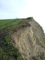
 Eroding cliff near Ventnor - geograph.org.uk - 168353.jpg 640 × 480; 98 KB
-
 Esplanade between Ventnor and Bonchurch, Isle of Wight, England.jpg 2,244 × 1,666; 1.61 MB
-
 Esplandade Ventnor - geograph.org.uk - 4547480.jpg 4,896 × 3,672; 6.54 MB
-
 Field as seen from Rew Lane - geograph.org.uk - 3104179.jpg 640 × 480; 104 KB
-
 Field Cow-wheat (Melampyrum arvense) - geograph.org.uk - 5410771.jpg 665 × 1,000; 590 KB
-
 Field Cow-wheat (Melampyrum arvense) - geograph.org.uk - 5410773.jpg 1,000 × 665; 912 KB
-
 Field near St Lawrence - geograph.org.uk - 5452923.jpg 1,000 × 665; 698 KB
-

-
 Fields above Woody Bay - geograph.org.uk - 5519254.jpg 3,825 × 2,443; 2.65 MB
-
 Fishing boats moored at Ventnor - geograph.org.uk - 4738090.jpg 640 × 480; 66 KB
-
 Five a Day, High Street - geograph.org.uk - 5096030.jpg 480 × 640; 69 KB
-
 Flats in Albert Street - geograph.org.uk - 5096116.jpg 640 × 480; 69 KB
-
 Flickr - ronsaunders47 - A good handbrake is essential around here.jpg 2,640 × 1,980; 878 KB
-
 Flickr - ronsaunders47 - A good place to test your brakes...jpg 2,640 × 1,980; 1.99 MB
-
 Flickr - ronsaunders47 - NAUTICAL BRIC-A-BRAC SHOP. VENTNOR IOW..jpg 2,640 × 1,980; 1.13 MB
-
 Flickr - ronsaunders47 - Seaside walks...jpg 3,648 × 2,736; 1.83 MB
-
 Flickr - ronsaunders47 - Spyglass Inn Ventnor. IOW..jpg 1,600 × 1,206; 719 KB
-
 Flickr - ronsaunders47 - The only tools a child will need to make a great holiday....jpg 3,648 × 2,736; 2.54 MB
-
 Flickr - ronsaunders47 - The steep walk up to Ventnor Town....jpg 3,648 × 2,736; 2.16 MB
-
 Flickr - ronsaunders47 - Time to have a sit down....jpg 3,648 × 2,736; 2.05 MB
-
 Flickr - ronsaunders47 - VENTNOR BEACH HUT. IOW.jpg 1,600 × 1,206; 527 KB
-
 Flickr - ronsaunders47 - VENTNOR BEACH ON THE ISLE OF WIGHT.UK..jpg 2,598 × 1,949; 1.04 MB
-
 Flickr - ronsaunders47 - Ventnor breakwater. Isle of Wight. UK.jpg 2,816 × 2,112; 1.01 MB
-
 Flickr - ronsaunders47 - VENTNOR FALLS. ISLE OF WIGHT UK..jpg 2,816 × 2,112; 2.14 MB
-
 Flickr - ronsaunders47 - VENTNOR IN MONOCHROME 1..jpg 3,005 × 2,109; 1.03 MB
-
 Flickr - ronsaunders47 - VENTNOR IN MONOCHROME 2..jpg 2,969 × 2,065; 917 KB
-
 Flickr - ronsaunders47 - VENTNOR IN MONOCHROME 3..jpg 3,054 × 2,282; 1.19 MB
-
 Flickr - ronsaunders47 - VENTNOR LONGSHOREMAN'S HUT..jpg 2,816 × 2,112; 999 KB
-
 Flickr - ronsaunders47 - Yesterday's amusements.jpg 2,526 × 2,043; 720 KB
-
 Flowers for you, High Street - geograph.org.uk - 5096025.jpg 480 × 640; 83 KB
-
 Fogg's, High Street - geograph.org.uk - 5095601.jpg 480 × 640; 55 KB
-

-
 Footpath leading up to St Boniface Down - geograph.org.uk - 6260383.jpg 1,024 × 576; 448 KB
.jpg)


_(14760310752).jpg)


.jpg)


.jpg)


_-_geograph.org.uk_-_5410771.jpg)
_-_geograph.org.uk_-_5410773.jpg)


