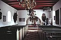
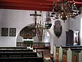
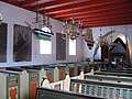
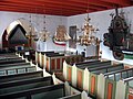
Category:Vesterø Kirke
| Object location | | View all coordinates using: OpenStreetMap |
|---|
church building in Læsø Municipality, Denmark  | |||||
| Upload media | |||||
| Instance of | |||||
|---|---|---|---|---|---|
| Location | Læsø Municipality, North Denmark Region, Denmark | ||||
| Street address |
| ||||
| Diocese | |||||
| Inception |
| ||||
| Religion or worldview | |||||
 | |||||
Media in category "Vesterø Kirke"
The following 23 files are in this category, out of 23 total.
-
 Nordenskirker Vestero(01).jpg 800 × 539; 65 KB
-
 Vesterø Kirke.jpg 2,288 × 1,712; 758 KB
-
 Den ny kirke i Vesterø.JPG 2,592 × 1,944; 902 KB
-
 Nordenskirker Vestero(06).jpg 800 × 521; 87 KB
-
 Vesterø kirke2.JPG 2,288 × 1,712; 807 KB
-
 Vesteroe Kirke, Laesoe 2011 ubt-1.JPG 3,072 × 2,304; 2.35 MB
-
 Vesteroe Kirke, Laesoe 2011 ubt-18.JPG 3,072 × 2,304; 2.15 MB
-
 Vesteroe Kirke, Laesoe 2011 ubt-19.JPG 3,072 × 2,304; 2.52 MB
-
 Vesteroe Kirke, Laesoe 2011 ubt-2.JPG 3,072 × 2,090; 2.47 MB
-
 Vesterø Kirke3.JPG 2,288 × 1,712; 840 KB
-
 Nordenskirker Vestero(07).jpg 800 × 545; 161 KB
-
 Nordenskirker Vestero(10).jpg 402 × 600; 90 KB
-
 Chrzcielnica, Vesteroe Kirke, Laesoe, Dania 2011 ubt.JPG 2,304 × 3,072; 2.22 MB
-
 Kirche Vesterø.jpg 4,896 × 3,672; 7.09 MB
-
 Nordenskirker Vestero(26).jpg 962 × 644; 302 KB
-
 Nordenskirker Vestero(42).jpg 962 × 644; 300 KB
-
 Nordenskirker Vestero(43).jpg 644 × 950; 252 KB
-
 Nordenskirker Vestero(45).jpg 644 × 962; 296 KB
-
 Nordenskirker Vestero(46).jpg 637 × 951; 330 KB
-
 Nordenskirker Vestero(47).jpg 636 × 896; 231 KB
-
 Vesteroe Kirke, Laesoe 2011 ubt-15.JPG 3,072 × 2,304; 2.72 MB
-
 Vesterø Kirke - Kalkmalerier.jpg 2,288 × 1,712; 902 KB
-
 Vesterø kirke5.jpg 2,288 × 1,712; 894 KB
.jpg)


.jpg)


.jpg)
.jpg)

.jpg)
.jpg)
.jpg)
.jpg)
.jpg)
.jpg)


