Category:Via dei Monti Lariani - sezione 3
|
Via dei Monti Lariani - sezione 3 has an entry on OpenStreetMap (show). |
part of Via dei Monti Lariani  .jpg) | |||||
| Upload media | |||||
| Instance of |
| ||||
|---|---|---|---|---|---|
| Part of | |||||
| Location | |||||
| Start point | |||||
| Destination point |
| ||||
| Mountain range |
| ||||
 | |||||
Subcategories
This category has the following 25 subcategories, out of 25 total.
A
B
F
- Fontana a 3 archi (Plesio) (4 F)
G
L
- La Pendula (4 F)
M
- Monti Dacca (2 F)
- Monti di Bracco (13 F)
- Mutadello (Garzeno) (13 F)
P
- Pian del Lac (8 F)
- Piazza di Prott (San Siro) (5 F)
R
- Rifugio La Preda (11 F)
S
V
- Via Gera (Plesio) (10 F)
- Via per Breglia (San Siro) (10 F)
Media in category "Via dei Monti Lariani - sezione 3"
The following 200 files are in this category, out of 201 total.
(previous page) (next page)-
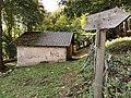
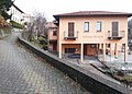 Albergo Breglia.jpg 1,817 × 1,299; 695 KB
-
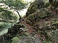
 Alberi caduti lungo la VML3.jpg 5,444 × 2,852; 4.75 MB
-
 Approaching San Bernardo along VML3.jpg 4,092 × 3,213; 6.21 MB
-
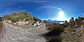
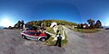
 Area picnic vicino a La Piazza (fotosfera).jpg 5,376 × 2,688; 4.62 MB
-
 Area picnic vicino a La Piazza.jpg 7,144 × 5,208; 7.35 MB
-
 Arrival at Monti di Naro coming from Piazzucco.jpg 7,296 × 5,472; 11.58 MB
-
 Arrivo a La Piazza da Barna.jpg 7,296 × 5,472; 8.3 MB
-
 Arrivo a Maggino (nucleo abitato occidentale di Breglia).jpg 1,515 × 1,365; 781 KB
-
 Assisted trail between Piazzucco and Naro (2).jpg 7,296 × 5,472; 12.75 MB
-
 Assisted trail between Piazzucco and Naro.jpg 7,296 × 5,472; 14.7 MB
-
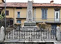 Barna ai suoi caduti.jpg 4,739 × 3,446; 3.43 MB
-
 Beginning in Monte di Treccione of the road towards Montuglio.jpg 3,648 × 2,736; 6.19 MB
-
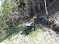 Bench between Mutadello and Monte Cortesello.jpg 4,608 × 3,456; 10.88 MB
-
 Bivio per Ligomena sopra Barna, in direzione di Barna.jpg 6,544 × 4,992; 13.29 MB
-
 Bivio per Ligomena sopra Barna, in direzione di Breglia.jpg 6,112 × 4,416; 8.5 MB
-
 Bivio Via al Tröi - Via della Piazza (Peglio).jpg 1,207 × 1,041; 548 KB
-
 Branching to Cremesino along road to Monte Cortesella.jpg 4,608 × 3,456; 8.05 MB
-
 Bridge over stream Valle Miro, direction towards Barì.jpg 1,750 × 1,157; 889 KB
-
 Bridge over stream Valle Miro, direction towards Breglia.jpg 6,892 × 4,876; 10.47 MB
-
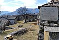
 Capela del Bergum (La Piazza, Plesio).jpg 3,264 × 2,448; 1.89 MB
-
 Cartello di località Barna 563.jpg 1,767 × 1,164; 907 KB
-
 Cartello di località La Piazza.jpg 5,918 × 5,133; 5.26 MB
-
 Circular view from picnic site at San Bernardo (Dongo).jpg 23,090 × 3,323; 46.79 MB
-
 Climbing on VML3 to the houses of Mutadello.jpg 4,608 × 3,456; 5.37 MB
-
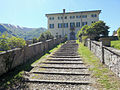
 Codogna con Villa Camozzi.jpg 3,103 × 2,385; 1.13 MB
-
 Como Lake view from Alpe di Nalcim.jpg 23,511 × 4,456; 43.95 MB
-
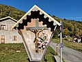 Crocifisso a Montuglio.jpg 6,044 × 4,608; 7.18 MB
-
 Crossing along VML3, between Rifugio La Preda and wayshrine Madonna della Valle.jpg 7,296 × 5,472; 11.62 MB
-
 Crossing of stream in Beller valley.jpg 7,296 × 5,472; 13.04 MB
-
 Dipinto su facciata di edificio (Barna, Plesio).jpg 3,264 × 2,448; 1.3 MB
-
 Drinking fountain along VML3 in Dongo.jpg 4,608 × 3,456; 9.77 MB
-
 Drinking fountain and benches on mule track between Carcente and Monti di Carcente.jpg 7,296 × 5,472; 11.74 MB
-
 Drinking fountain and guideposto in Monti di Giugallo.jpg 7,296 × 5,472; 9 MB
-
 Drinking fountain at Monti di Giugallo.jpg 7,296 × 5,472; 11.6 MB
-
 Drinking fountain in Monti di Carcente.jpg 7,296 × 5,472; 10.59 MB
-
 End of road in Monti di Treccione.jpg 6,475 × 4,319; 9.61 MB
-
 Exiting Monte Piazze towards San Bernardo, on VML3.jpg 4,608 × 3,456; 6.83 MB
-
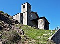
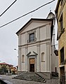 Facciata di Santa Maria Maddalena (Plesio).jpg 2,409 × 3,087; 1.91 MB
-
 Fianco nord di Santa Maria Maddalena a Barna.jpg 3,764 × 1,882; 2.64 MB
-
 Fontana a La Piazza (2).jpg 1,739 × 1,038; 553 KB
-
 Fontana a La Piazza.jpg 1,817 × 1,105; 829 KB
-
 Fontana a Montuglio.jpg 5,432 × 4,960; 8.64 MB
-
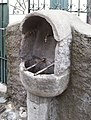
 Fontana di Barna 01.jpg 1,233 × 826; 371 KB
-
 Fontanella in Via della Piazza (Breglia).jpg 1,117 × 1,469; 409 KB
-
 Forestry road Breglia - Carcente, seen in Carcente towards Breglia.jpg 7,296 × 5,472; 11.64 MB
-
 Forestry road Breglia - Carcente, seen in Carcente.jpg 7,296 × 5,472; 12.86 MB
-
 Fotosfera a Piazza del Tavolo (Barna).jpg 3,764 × 1,882; 2.72 MB
-
 Fotosfera Mulino Chioderia allevameto trote.jpg 3,764 × 1,882; 3.01 MB
-
 Fountain at Monti di Naro.jpg 7,296 × 5,472; 11.06 MB
-
 Fountain in Monte Piazze (Garzeno) along VML3.jpg 4,608 × 3,456; 9 MB
-
 Guidepost along VML3 up towards San Domenico.jpg 7,296 × 5,472; 13.86 MB
-
 Guidepost and information board for Rifugio La Canua, in Montuglio.jpg 7,296 × 5,472; 9.98 MB
-
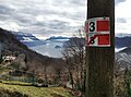
 Guidepost and route marker VML3 above Bracco.jpg 7,296 × 5,472; 14.35 MB
-
 Guidepost in Monti di Giugallo.jpg 7,296 × 5,472; 9.59 MB
-
 Guidepost north of Alpe di Nalcim 01.jpg 7,296 × 5,472; 12.9 MB
-
 Guidepost north of Alpe di Nalcim 02.jpg 7,296 × 5,472; 11.8 MB
-
 Guidepost on VML3 at fork between Alpe di Nalcim and Monti Dacca 01.jpg 7,296 × 5,472; 10.74 MB
-
 Guidepost on VML3 at fork between Alpe di Nalcim and Monti Dacca 02.jpg 7,296 × 5,472; 12.07 MB
-
 Guidepost to Carcente in Monti di Carcente - 2.jpg 6,006 × 3,729; 8.99 MB
-
 Guidepost to Carcente in Monti di Carcente.jpg 6,791 × 4,783; 12.66 MB
-
 Hiking map of Cremia.jpg 7,192 × 4,848; 10.3 MB
-
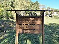
 Information board along track to Rifugio La Canua.jpg 7,296 × 5,472; 10 MB
-
 Information board near San Domenico.jpg 5,088 × 5,116; 8.49 MB
-
 Inizio di Via al Tröi (Maggino).jpg 1,648 × 1,500; 816 KB
-
 Inizio sentiero per Barna, arrivando da La Piazza - 2.jpg 5,808 × 4,392; 7.29 MB
-
 Inizio sentiero per Barna, arrivando da La Piazza.jpg 7,268 × 4,276; 7.11 MB
-
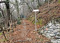
 Inizio VML3 a Cardano.jpg 7,296 × 5,472; 6.34 MB
-
 Lavatoio a Barì (Plesio) - 2.jpg 2,048 × 1,536; 850 KB
-
 Lavatoio a Barì (Plesio).jpg 1,694 × 961; 705 KB
-
 Leaving Monti di Naro towards Piazzucco.jpg 7,296 × 5,472; 11.46 MB
-
 Leaving Montuglio towards Monti Luina.jpg 6,064 × 4,560; 9.09 MB
-
 Leaving San Bernardo towards Labbio, on VML3.jpg 4,608 × 3,456; 9.86 MB
-
 Località La Piazza (Plesio) - fotosfera.jpg 3,764 × 1,882; 2.34 MB
-
 Map of Via dei Monti Lariani, in Piazza della Chiesa (Garzeno).jpg 4,609 × 2,289; 2.63 MB
-
 Mappa ciclopedonale Menaggio - Porlezza.jpg 4,282 × 3,530; 4.07 MB
-
 Mappa in località La Piazza.jpg 6,168 × 4,332; 2.49 MB
-
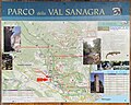
 Mappa Parco Val Sanagra - fascia bassa.jpg 4,386 × 3,642; 5.49 MB
-
 Mappa Parco Val Sanagra a Codogna.jpg 6,056 × 4,852; 5.18 MB
-
 Mappa parco Val Sanagra alla Vecchia Chioderia.jpg 6,030 × 5,108; 7.34 MB
-
 Monte Legnone and Croce di Muggio seen from Monti di Naro.jpg 6,712 × 3,692; 5.61 MB
-
 Monte Piazze seen from VML3 (cropped).jpg 1,017 × 438; 421 KB
-
 Monte Pidaggia.jpg 1,397 × 610; 313 KB
-
 Monti di Carcente 01.jpg 7,296 × 5,472; 10.78 MB
-
 Monti di Carcente 02.jpg 7,296 × 5,472; 10.46 MB
-
 Monti di Carcente 03.jpg 7,296 × 5,472; 10.19 MB
-
 Monti di Carcente 04.jpg 7,296 × 5,472; 7.83 MB
-
 Monti di Carcente 05.jpg 7,296 × 5,472; 10.24 MB
-
 Monti di Carcente 06.jpg 7,296 × 5,472; 6.65 MB
-
 Monti di Naro seen coming from Alpe di Nalcim.jpg 7,296 × 5,472; 10.26 MB
-
 Monumento ai caduti a Codogna.jpg 5,840 × 5,376; 4.93 MB
-
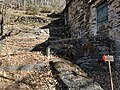
 Mulino Chioderia.jpg 4,670 × 3,730; 7.4 MB
-
 Mutadello, VML3 towards Garzeno.jpg 4,608 × 3,456; 8.31 MB
-
 Mutadello, VML3 towards Monte Piazze.jpg 4,608 × 3,456; 6.81 MB
-
 Name sign Monti di Carcente 1897m.jpg 7,296 × 5,472; 10.79 MB
-
 Name sign Monti di Carcente.jpg 389 × 243; 69 KB
-
 Panoramic view from Monti di Naro.jpg 20,043 × 4,862; 40.85 MB
-
 Panoramic view from Monti di Treccione.jpg 18,224 × 5,092; 40 MB
-
 Panoramic view on church San Bernardo Dongo).jpg 16,611 × 2,931; 25.95 MB
-
 Panoramic view on Como Lake from Monti di Naro.jpg 15,139 × 4,276; 24.41 MB
-
 Panoramic view on Monte Piazze from VML3.jpg 10,236 × 2,984; 17.23 MB
-
 Panoramic view on Monti di Treccione and Como Lake.jpg 17,705 × 4,806; 30.94 MB
-
 Panoramic view on Valle Albano, from Via dei Monti Lariani.jpg 8,427 × 2,815; 15.7 MB
-
 Photosphere approaching Monti di Carcente.jpg 5,322 × 2,661; 8.99 MB
-
 Photosphere approaching San Bernardo from Labbio on VML3.jpg 5,322 × 2,661; 5.39 MB
-
 Photosphere arriving at San Bernardo on VML3.jpg 5,322 × 2,661; 7.05 MB
-
 Photosphere at a junction over Bracco on VML3.jpg 5,322 × 2,661; 7.01 MB
-
 Photosphere at crossing of VML3 with road to La Canua.jpg 5,322 × 2,661; 5.42 MB
-
 Photosphere at intersection on VML3 between San Bernardo and Torrente Lami Rosso.jpg 5,322 × 2,661; 5.4 MB
-
 Photosphere at Monti di Giugallo.jpg 5,322 × 2,661; 5.21 MB
-
 Photosphere at Monti di Naro.jpg 5,322 × 2,661; 6.71 MB
-
 Photosphere at parking place in Montuglio.jpg 5,322 × 2,661; 5.26 MB
-
 Photosphere between church San Bernardo and Bocchetta of San Bernardo.jpg 5,322 × 2,661; 6.59 MB
-
 Photosphere in Monti di Carcente.jpg 5,322 × 2,661; 6.11 MB
-
 Photosphere in Monti di Treccione 01.jpg 5,322 × 2,661; 6.87 MB
-
 Photosphere in Monti di Treccione 02.jpg 5,322 × 2,661; 6.48 MB
-
 Photosphere in Monti di Treccione 03.jpg 5,322 × 2,661; 5.38 MB
-
 Photosphere of crossing of road to Alpe Rescanscia and trail to Luina.jpg 5,322 × 2,661; 7.64 MB
-
 Photosphere of ford of stream on Vallone Cremia, VML3.jpg 5,322 × 2,661; 5.91 MB
-
 Photosphere on VML3 arriving in Labbio from Brecchio.jpg 5,322 × 2,661; 7.32 MB
-
 Photosphere on VML3 between Brecchio and Labbio.jpg 5,322 × 2,661; 5.59 MB
-
 Photosphere on VML3 between Labbio and San Bernardo.jpg 5,322 × 2,661; 7.2 MB
-
 Photosphere on VML3, high path between Labbio and San Bernardo.jpg 5,322 × 2,661; 7.04 MB
-
 Piazza del Tavolo (Barna, Plesio).jpg 3,264 × 2,448; 1.62 MB
-
 Piazza della Chiesa a Barna (fotosfera).jpg 5,376 × 2,688; 4.98 MB
-
 Piazza della Chiesa a Barna, dal lato nord (fotosfera).jpg 3,764 × 1,882; 2.72 MB
-
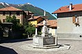
 Piazza della Chiesa a Barna.jpg 4,647 × 2,559; 3.49 MB
-
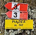 Piazza m. 747.jpg 3,855 × 3,699; 2.49 MB
-
 Pista da Prato Stella in direzione di Breglia.jpg 1,741 × 1,521; 1.17 MB
-
 Place name sign at Monti di Naro.jpg 3,024 × 1,316; 805 KB
-
 Place name sign Cremesino.jpg 4,608 × 3,456; 7.23 MB
-
 Place name sign Monti di Treccione (cropped).jpg 1,989 × 1,640; 842 KB
-
 Place name sign Monti di Treccione.jpg 6,026 × 4,093; 6.75 MB
-
 Road from Monte Piazze towards Catasco.jpg 4,608 × 3,456; 8.91 MB
-
 Road signs at the beginning o f Monte di Treccione.jpg 6,757 × 5,440; 8.99 MB
-
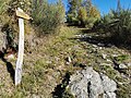
 Route marker of VML3 in Pian del Lac.jpg 7,296 × 5,472; 11.85 MB
-
 Route marker VML3 along road towards Alpe Rescanscia.jpg 7,296 × 5,472; 11.13 MB
-
 Route marker VML3 at Monti di Giugallo.jpg 7,296 × 5,472; 8.5 MB
-
 Santella tra Barna e il Mulino Chioderia.jpg 2,669 × 3,015; 4.43 MB
-
 Scorciatoia per Prato Stella.jpg 2,048 × 1,536; 876 KB
-
 Segnavia per Breglia a Barì.jpg 7,296 × 5,472; 9.53 MB
-
 Sight from Prato Stella.jpg 2,964 × 947; 1.62 MB
-
 Sottopassaggio in Via al Tröi.jpg 886 × 1,502; 227 KB
-
 Spring box along VML3.jpg 7,296 × 5,472; 12.46 MB
-
 Street sign Via Carcente (San Siro).jpg 6,817 × 5,519; 11.13 MB
-
 Traks towards Monti Luina 01.jpg 7,296 × 5,472; 11.45 MB
-
 Traks towards Monti Luina 02.jpg 3,648 × 2,736; 3.62 MB
-
 Uscita da Piazza del Tavolo (Barna).jpg 5,127 × 5,376; 7.45 MB
-
 Via al Tröi (Breglia).jpg 1,323 × 1,456; 481 KB
-
 Via Carcente, seen from intersection with Via per Breglia and Vicolo alla Chiesa.jpg 7,296 × 5,472; 7.72 MB
-
 Via del Pozzo Bernasco (Barna, Plesio).jpg 1,218 × 1,624; 408 KB
-
 View from Prato Stella.jpg 2,435 × 911; 1.31 MB
-
 View on Como Lake and Grignone, from Monti di Treccione.jpg 7,296 × 5,472; 6.21 MB
-
 View on Como Lake from Carcente (wide).jpg 3,152 × 2,118; 4.49 MB
-
 View on Como Lake from Carcente.jpg 2,966 × 2,271; 3.55 MB
-
 View on Como Lake from Valle Costoni.jpg 7,164 × 4,384; 10.52 MB
-
 View on Como Lake through Val Grande.jpg 6,256 × 4,844; 7.89 MB
-
 View on Monte Piazze and Valle Albano, from VML3.jpg 4,608 × 3,456; 10.05 MB
-
 View on Monti di Treccione.jpg 3,648 × 2,736; 4.57 MB
-
 Villa Camozzi in Codogna (Grandola ed Uniti).jpg 1,606 × 1,204; 518 KB
-
 Vista da Barì.jpg 3,482 × 949; 1.31 MB
-
 Vista invernale sul lago di Como da Maggino.jpg 1,854 × 1,379; 629 KB
-
 VLM3 route marker near Labbio.jpg 4,608 × 3,456; 8.4 MB
-
 VML follows the road between Torrente Albano and Catasco.jpg 4,608 × 3,456; 7.33 MB
-
 VML3 along the road towards the bridge on Torrente Albano.jpg 4,608 × 3,456; 7.26 MB
-
 VML3 along track between Guaggio and Monte Piazze.jpg 4,608 × 3,456; 4.3 MB
-
 VML3 approaching Monti di Naro.jpg 7,296 × 5,472; 13.5 MB
-
 VML3 arrives at San Bernardo.jpg 3,785 × 2,816; 4.83 MB
-
 VML3 between Bracco and San Domenico.jpg 7,296 × 5,472; 12.76 MB
-
 VML3 between Val Beller and Monti di Naro (2).jpg 7,296 × 5,472; 13.9 MB
-
 VML3 between Val Beller and Monti di Naro (3).jpg 7,296 × 5,472; 13.04 MB
-
 VML3 between Val Beller and Monti di Naro.jpg 7,296 × 5,472; 14.22 MB
-
 VML3 da Barna si innesta sulla pista per La Piazza.jpg 7,096 × 4,196; 7.8 MB
-
 VML3 detour between Breglia and Rifugio La Preda 01.jpg 5,120 × 3,840; 12.5 MB
-
 VML3 detour between Breglia and Rifugio La Preda 02.jpg 7,296 × 5,472; 10.42 MB
-
 VML3 detour between Breglia and Rifugio La Preda 03.jpg 7,296 × 5,472; 10.57 MB
-
 VML3 detour between Breglia and Rifugio La Preda 04.jpg 7,296 × 5,472; 10.34 MB
-
 VML3 detour between Breglia and Rifugio La Preda 05.jpg 7,296 × 5,472; 12.07 MB
-
 VML3 detour between Breglia and Rifugio La Preda 06.jpg 7,296 × 5,472; 8.54 MB
-
 VML3 detour between Breglia and Rifugio La Preda 07.jpg 7,296 × 5,472; 12.18 MB
-
 VML3 detour between Breglia and Rifugio La Preda 08.jpg 10,613 × 5,208; 26.19 MB
-
 VML3 down towards Bracco.jpg 7,296 × 5,472; 14.71 MB
-
 VML3 leaving Brecchio towards Labbio.jpg 4,608 × 3,456; 10.48 MB
-
 VML3 leaving Monti di Naro.jpg 7,296 × 5,472; 12.8 MB
-
 VML3 route marker at Monti di Naro.jpg 7,296 × 5,472; 12.88 MB
-
 VML3 route marker between Bracco and San Domenico.jpg 7,296 × 5,472; 12.94 MB
-
 VML3 route markers between Monti di Giugallo and Monti Luina 01.jpg 7,296 × 5,472; 12.15 MB
-
 VML3 route markers between Monti di Giugallo and Monti Luina 02.jpg 7,296 × 5,472; 11.12 MB
-
 VML3 route markers between Monti di Giugallo and Monti Luina 03.jpg 7,296 × 5,472; 13.07 MB
-
 VML3 runs between fenced areas, between Barì and Breglia.jpg 1,866 × 1,421; 1.26 MB
-
 VML3 tra Barì e Maggino - 1.jpg 1,930 × 1,387; 949 KB
-
 VML3 tra Barì e Maggino - 2.jpg 1,588 × 1,461; 1.11 MB
-
 VML3 up towards San Domenico.jpg 7,296 × 5,472; 13.98 MB
-
 VML3, directional route marker between Mutadello and Monte Piazze.jpg 4,608 × 3,456; 8.2 MB
-
 VML3, heading towards Luina after leaving tthe road to Alpe Rescanscia.jpg 7,296 × 5,472; 11.78 MB
-
 VML3, path from Monte Piazze towards Mutadello.jpg 4,608 × 3,456; 9.13 MB
-
 VML3, view on Monte Piazze, arriving from Mutadello.jpg 4,608 × 3,456; 7.92 MB
-
 Wayside cross in Monti di Treccione.jpg 5,807 × 4,922; 11.19 MB
-
 Wayside crosso along VML3 between Labbio and San Bernardo.jpg 4,224 × 3,284; 10.76 MB
-
 Wayside shrine between Carcente and Monti di Carcente 01.jpg 4,855 × 5,204; 7.62 MB
-
 Wayside shrine between Carcente and Monti di Carcente 02.jpg 5,120 × 3,840; 12.32 MB


.jpg)


.jpg)
.jpg)


.jpg)


.jpg)


.jpg)


.jpg)

.jpg)


.jpg)


.jpg)


_along_VML3.jpg)


.jpg)


_-_2.jpg)
.jpg)


_-_fotosfera.jpg)


.jpg)


.jpg)
.jpg)
.jpg)


.jpg)


.jpg)


.jpg)
.jpg)

.jpg)

.jpg)


.jpg)


.jpg)
.jpg)


.jpg)
.jpg)