Category:Via dei Monti Lariani - sezione 4
|
Via dei Monti Lariani - sezione 4 has an entry on OpenStreetMap (show). |
part of Via dei Monti Lariani .jpg) | |||||
| Upload media | |||||
| Instance of |
| ||||
|---|---|---|---|---|---|
| Part of | |||||
| Location | |||||
| Start point |
| ||||
| Destination point |
| ||||
| Mountain range |
| ||||
 | |||||
Subcategories
This category has the following 11 subcategories, out of 11 total.
B
- Badongheno (7 F)
C
- Combé (Gravedona ed Uniti) (3 F)
L
N
- Nessa (Stazzona) (11 F)
P
- Ponte di Budanghel (13 F)
S
Media in category "Via dei Monti Lariani - sezione 4"
The following 95 files are in this category, out of 95 total.
-
 Building in Iévia, with a yellow place name plate on the wall.jpg 4,020 × 2,871; 4.53 MB
-
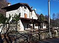 Buildings in Sant'Anna di Germasino (Gravedona ed Uniti) 01.jpg 4,434 × 3,242; 6.42 MB
-
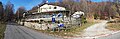 Buildings in Sant'Anna di Germasino (Gravedona ed Uniti) 02.jpg 9,190 × 3,008; 18.78 MB
-
 Buildings in Sant'Anna di Germasino (Gravedona ed Uniti) 03.jpg 4,608 × 3,456; 8.46 MB
-
 Buildings with paintings in Livo, along VML4.jpg 6,540 × 6,808; 11.81 MB
-
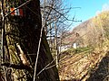
 Crucifix along VML4, between Monte Stabiè and Lévia.jpg 4,220 × 3,596; 5.79 MB
-
 Detail of a route marker VML3 between waterworks building over Garzeno and L'Avolo.jpg 4,608 × 3,456; 4.63 MB
-
 Directional route marker VML4 between waterworks building over Garzeno and L'Avolo.jpg 4,608 × 3,456; 10.15 MB
-
 Ford along VML4 between Badalucco and bridge of Budanghel.jpg 5,322 × 2,661; 6.67 MB
-
 Ford crossing Valle di Margine along VML4.jpg 5,322 × 2,661; 5.62 MB
-
 Ford on minor stream along VML4 between Badalucco and bridge of Budanghel.jpg 5,322 × 2,661; 6.58 MB
-
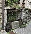
 Fountain by church Sant'Anna (Gravedona ed Uniti).jpg 4,113 × 3,219; 6.38 MB
-
 Fountain in Lake Como Adventure Park along VML4.jpg 4,608 × 3,456; 8 MB
-
 Fountain in Livo (Lombardy).jpg 4,464 × 4,880; 6.05 MB
-
 Map of Via dei Monti Lariani, in Piazza della Chiesa (Garzeno).jpg 4,609 × 2,289; 2.63 MB
-
 Painting on a building wall in Livo 01.jpg 2,057 × 2,370; 1.92 MB
-
 Painting on building wall in Livo 02.jpg 2,768 × 3,731; 2.74 MB
-
 Panoramic of mountains from Sciee.jpg 5,670 × 3,152; 9.06 MB
-
 Panoramic view of Sciee.jpg 5,797 × 2,064; 6.98 MB
-
 Panoramic views on mountains, from VML4 between Monte Stabiè and Iévia.jpg 9,587 × 2,759; 13.8 MB
-
 Path intersection in Stabiè, along VML4.jpg 4,234 × 3,546; 8.36 MB
-
 Path VML4 coming from Nessa, joins the track for L'Agnone.jpg 4,608 × 3,456; 10.23 MB
-
 Path VML4 to Nessa, departs from the track from L'Agnone.jpg 4,608 × 3,456; 10.41 MB
-
 Photosphere along VML4 between Badalucco and bridge of Budanghel, by a route marker.jpg 5,322 × 2,661; 6.22 MB
-
 Photosphere along VML4 between Badalucco and bridge of Budanghel.jpg 5,322 × 2,661; 6.65 MB
-
 Photosphere along VML4 crossing Lake Como Adventure Park.jpg 5,322 × 2,661; 6 MB
-
 Photosphere along VML4 in Garzeno.jpg 5,322 × 2,661; 4.46 MB
-
 Photosphere along VML4, parallel to Liro near bridge of Budanghel.jpg 5,322 × 2,661; 6.48 MB
-
 Photosphere at a route marker VML4 between L'Agnone and Badalucco 01.jpg 5,322 × 2,661; 6.74 MB
-
 Photosphere at a route marker VML4 between L'Agnone and Badalucco 02.jpg 5,322 × 2,661; 6.82 MB
-
 Photosphere at a stream crossing along VML4 between L'Agnone and Badalucco 01.jpg 5,322 × 2,661; 6.34 MB
-
 Photosphere at a stream crossing along VML4 between L'Agnone and Badalucco 04.jpg 5,322 × 2,661; 6.53 MB
-
 Photosphere at a stream crossing along VML4 between L'Agnone and Badalucco 05.jpg 5,322 × 2,661; 6.13 MB
-
 Photosphere at a stream crossing along VML4 between L'Agnone and Badalucco 06.jpg 5,322 × 2,661; 6.86 MB
-
 Photosphere at a stream crossing along VML4 between L'Agnone and Badalucco 07.jpg 5,322 × 2,661; 6.66 MB
-
 Photosphere at bridge of Budanghel, seen from right bank of Liro.jpg 5,322 × 2,661; 5.89 MB
-
 Photosphere at crossing of bridge of Budanghel, seen from left bank of Liro.jpg 5,322 × 2,661; 6.06 MB
-
 Photosphere at crossing of bridge of Budanghel, seen from right bank of Liro.jpg 5,376 × 2,688; 5.1 MB
-
 Photosphere at VML4 route marker in locality La Costa.jpg 5,322 × 2,661; 6.57 MB
-
 Photosphere crossing bridge of Budanghel.jpg 5,322 × 2,661; 4.96 MB
-
 Photosphere in Cragno along VML4.jpg 5,322 × 2,661; 5.06 MB
-
 Photosphere in Livio, along VML4 01.jpg 5,322 × 2,661; 4.43 MB
-
 Photosphere in Livio, along VML4 02.jpg 5,322 × 2,661; 4.34 MB
-
 Photosphere in Livio, along VML4 03.jpg 5,322 × 2,661; 4.43 MB
-
 Photosphere in Livio, along VML4 05.jpg 5,322 × 2,661; 4.28 MB
-
 Photosphere in Livio, along VML4 06.jpg 5,322 × 2,661; 4.41 MB
-
 Photosphere in Sant'Anna (Germasino), along VML4, just before passing aside the chruch.jpg 5,322 × 2,661; 6.92 MB
-
 Photosphere in Sant'Anna (Germasino), where VML4 hits the road 01.jpg 5,322 × 2,661; 5.82 MB
-
 Photosphere of bridge of Budanghel seen from left bank of Liro.jpg 5,322 × 2,661; 6.16 MB
-
 Photosphere on VML4 in locality Cragno.jpg 5,322 × 2,661; 5.69 MB
-
 Photosphere VML exiting the upper part of Garzeno.jpg 5,322 × 2,661; 5.23 MB
-
 Photosphere VML4 between Nessa and L'Agnone 01.jpg 5,322 × 2,661; 7.18 MB
-
 Photosphere VML4 between Nessa and L'Agnone 02.jpg 5,322 × 2,661; 5.98 MB
-
 Photosphere VML4 between Nessa and L'Agnone 04.jpg 5,322 × 2,661; 7.25 MB
-
 Photosphere VML4 between Nessa and L'Agnone 05.jpg 5,322 × 2,661; 7.85 MB
-
 Photosphere VML4 between Nessa and L'Agnone 06.jpg 5,322 × 2,661; 7.4 MB
-
 Photosphere VML4 ford between Nessa and L'Agnone 03.jpg 5,322 × 2,661; 6.34 MB
-
 Photosphere VML4 ford between Nessa and L'Agnone 07.jpg 5,322 × 2,661; 6.87 MB
-
 Photsphere at crossing of VML4 with the road north of Garzeno.jpg 5,322 × 2,661; 4.66 MB
-
 Picnic tables along VML4 between Cagnavo and La Costa.jpg 4,317 × 2,331; 6.26 MB
-
 Place name sign Cagnavo, along VML4.jpg 4,608 × 3,456; 11.41 MB
-
 Place name sign CRAGNO.jpg 2,262 × 2,631; 4.41 MB
-
 Place name sign Iévia and route marker VML4.jpg 3,918 × 2,529; 6.52 MB
-
 Place name sign Iévis.jpg 3,792 × 2,091; 3.87 MB
-
 Place name sign Sciee.jpg 4,608 × 3,456; 8.36 MB
-
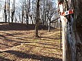
 Route marker in Iévia along VML4.jpg 4,104 × 3,360; 7.01 MB
-
 Route marker VML between waterworks building over Garzeno and L'Avolo.jpg 4,608 × 3,456; 6.88 MB
-
 Route marker VML3 between waterworks building over Garzeno and L'Avolo.jpg 4,608 × 3,456; 9.22 MB
-
 Route marker VML4 between Ponte di Budanghel and Badongheno.jpg 5,322 × 2,661; 6.39 MB
-
 Route markers VML4 and VML3 between Garzeno and L'Avolo.jpg 4,608 × 3,456; 10.71 MB
-
 Route markers VML4 and VML3 between Garzeno and waterworks building.jpg 4,608 × 3,456; 9.73 MB
-
 Rural buildings in Iévia.jpg 4,405 × 2,771; 5.67 MB
-
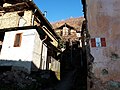
 Street corner of Via Sopra Pozzi and Via Sant'Anna (Garzeno).jpg 4,608 × 3,456; 5.15 MB
-
 Street in Livo, along VML4.jpg 7,296 × 5,472; 9.29 MB
-
 The first building of Monte Stabiè along VML4, arriving from Cragno.jpg 3,725 × 3,061; 6.31 MB
-
 Track to Cagnavo.jpg 4,608 × 3,456; 11.43 MB
-
 Via dei Monti Lariani in Garzeno, route marker.jpg 4,608 × 3,456; 5.76 MB
-
 Via Sant'Anna, seen from intersection with Via Sopra Pozzi.jpg 4,608 × 3,456; 6.43 MB
-
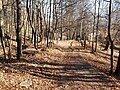
 VML4 between Cragno and Stabiè.jpg 4,608 × 3,456; 10.24 MB
-
 VML4 crosses Lake Como Adventure Park 02.jpg 6,598 × 2,456; 13.32 MB
-
 VML4 crosses Lake Como Adventure Park.jpg 4,608 × 3,456; 9.6 MB
-
 VML4 in Cagnavo 01.jpg 5,322 × 2,661; 6.16 MB
-
 VML4 in Cagnavo 02.jpg 5,322 × 2,661; 8.17 MB
-
 VML4 in Cagnavo 03.jpg 5,322 × 2,661; 6.77 MB
-
 VML4 in Cagnavo 04.jpg 5,322 × 2,661; 7.42 MB
-
 VML4 in Cagnavo 05.jpg 5,322 × 2,661; 7.08 MB
-
 VML4 in Garzeno, direction north.jpg 3,970 × 3,808; 7.05 MB
-
 VML4 in Garzeno, direction south.jpg 4,160 × 3,762; 6.92 MB
-
 VML4 in Iévia.jpg 3,242 × 2,695; 4.62 MB
-
 VML4 leaves Garzeno towards L'Avolo.jpg 4,608 × 3,456; 10.23 MB
-
 VML4 route marker at the margin of Iévia.jpg 4,164 × 3,794; 5.29 MB
-
 VML4 route marker in locality Cragno.jpg 4,608 × 3,456; 11.08 MB
-
 Waterwork building seen coming from L'Avolo along VML4.jpg 4,608 × 3,456; 8.99 MB
-
 Waterworks building above Garzeno (2).jpg 4,608 × 3,456; 8.84 MB
-
 Waterworks building above Garzeno.jpg 4,608 × 3,456; 10.39 MB

_01.jpg)
_03.jpg)


.jpg)

.jpg)


,_along_VML4,_just_before_passing_aside_the_chruch.jpg)
,_where_VML4_hits_the_road_01.jpg)


.jpg)


.jpg)

_02.jpg)