Category:Vlietweg 44, Leiden
| Object location | | View all coordinates using: OpenStreetMap |
|---|
farmhouse in Leiden, Netherlands  | |||||
| Upload media | |||||
| Instance of | |||||
|---|---|---|---|---|---|
| Location | Leiden, South Holland, Netherlands | ||||
| Street address |
| ||||
| Heritage designation |
| ||||
 | |||||
|
This is a category about rijksmonument number 25636
|
| Address |
|
Media in category "Vlietweg 44, Leiden"
The following 10 files are in this category, out of 10 total.
-
 Gebouw links naast woonhuis - Leiden - 20137514 - RCE.jpg 1,200 × 1,195; 372 KB
-
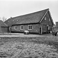
 Leiden - Vlietweg 44.jpg 3,072 × 2,048; 4 MB
-
 Linkerzijgevel woonhuis en stal - Leiden - 20137511 - RCE.jpg 1,188 × 1,200; 342 KB
-
 Overzicht achterzijde - Leiden - 20137512 - RCE.jpg 1,188 × 1,200; 375 KB
-
 Voorgevel - Leiden - 20137508 - RCE.jpg 804 × 1,200; 265 KB
-
 Voorgevel van woonhuis - Leiden - 20137509 - RCE.jpg 1,197 × 1,200; 420 KB
-
 Zijgevel - Leiden - 20137513 - RCE.jpg 1,191 × 1,200; 349 KB
-
 Zijgevel en aanbouw - Leiden - 20137516 - RCE.jpg 1,195 × 1,200; 432 KB
-
 Zijgevel van woonhuis en stal - Leiden - 20137515 - RCE.jpg 1,188 × 1,200; 357 KB
-
 Zijgevel voorhuis van woongedeelte - Leiden - 20137510 - RCE.jpg 1,200 × 1,197; 457 KB


