Category:Volksschule Herderplatz
Deutsch: Wien, Schule am Herderplatz / Herderpark
| This category shows the protected monument with the number 41437 in Austria. (Commons, de, Wikidata) |
| Object location | | View all coordinates using: OpenStreetMap |
|---|
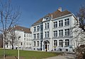
building in Simmering, Austria  | |||||
| Upload media | |||||
| Instance of | |||||
|---|---|---|---|---|---|
| Location | Simmering, Vienna, Austria | ||||
| Street address |
| ||||
| Heritage designation | |||||
 | |||||
Subcategories
This category has only the following subcategory.
Media in category "Volksschule Herderplatz"
The following 4 files are in this category, out of 4 total.
-
 Herderpark und Volksschule Herderplatz.jpg 1,015 × 697; 178 KB
-
 School Herderpark 01, Vienna.jpg 4,650 × 2,944; 7.2 MB
-
 School Herderpark 02, Vienna.jpg 4,510 × 3,163; 6.5 MB
-
 Wien Herderplatz Schule.jpg 1,321 × 1,021; 291 KB


