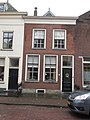
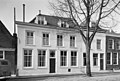
Category:Voorstraat 23, Sommelsdijk
| Object location | | View all coordinates using: OpenStreetMap |
|---|
building in Goeree-Overflakkee, Netherlands  | |||||
| Upload media | |||||
| Instance of | |||||
|---|---|---|---|---|---|
| Location | Sommelsdijk, South Holland, Netherlands | ||||
| Street address |
| ||||
| Located on street |
| ||||
| Heritage designation |
| ||||
 | |||||
|
This is a category about rijksmonument number 29854
|
| Address |
|
Media in category "Voorstraat 23, Sommelsdijk"
The following 3 files are in this category, out of 3 total.
-
 RM29854 Sommelsdijk - Voorstraat 23.jpg 1,944 × 2,592; 1.12 MB
-
 Voorgevels - Sommelsdijk - 20202792 - RCE.jpg 1,200 × 811; 240 KB
-
 Voorgevels - Sommelsdijk - 20202795 - RCE.jpg 1,200 × 810; 238 KB

