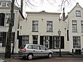
Category:Voorstraat 6, Sommelsdijk
| Object location | | View all coordinates using: OpenStreetMap |
|---|
building in Goeree-Overflakkee, Netherlands  | |||||
| Upload media | |||||
| Instance of | |||||
|---|---|---|---|---|---|
| Location | Sommelsdijk, South Holland, Netherlands | ||||
| Street address |
| ||||
| Located on street |
| ||||
| Heritage designation |
| ||||
 | |||||
|
This is a category about rijksmonument number 29866
|
| Address |
|
Media in category "Voorstraat 6, Sommelsdijk"
The following 3 files are in this category, out of 3 total.
-
 RM29866 Sommelsdijk - Voorstraat 6.jpg 2,592 × 1,944; 1.19 MB
-
 Voorgevel - Sommelsdijk - 20202782 - RCE.jpg 1,200 × 802; 186 KB
-
 Voorstraat vanaf kruising Krakeelstraat - Sommelsdijk - 20202584 - RCE.jpg 1,195 × 1,200; 366 KB

