Category:Voorstraat 86, Dordrecht
| Object location | | View all coordinates using: OpenStreetMap |
|---|
 | |||||
| Upload media | |||||
| Instance of |
| ||||
|---|---|---|---|---|---|
| Location | Dordrecht, South Holland, Netherlands | ||||
| Street address |
| ||||
| Heritage designation |
| ||||
 | |||||
|
This is a category about rijksmonument number 13861
|
| Address |
|
Media in category "Voorstraat 86, Dordrecht"
The following 6 files are in this category, out of 6 total.
-
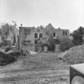
 Achtergevel - Dordrecht - 20062799 - RCE.jpg 1,200 × 1,191; 334 KB
-
 Achtergevel, overzicht - Dordrecht - 20062798 - RCE.jpg 1,200 × 1,198; 330 KB
-
 En hoger, voorgevels - Dordrecht - 20062788 - RCE.jpg 964 × 1,200; 234 KB
-
 Overzicht van de voorgevels - Dordrecht - 20379328 - RCE.jpg 1,200 × 1,199; 264 KB
-
 RM13861 Dordrecht - Voorstraat 86.jpg 1,944 × 2,592; 1.51 MB
-
 Voorgevels - Dordrecht - 20062797 - RCE.jpg 948 × 1,200; 278 KB


