Category:Waalborg (Roderwolde)
| Object location | | View all coordinates using: OpenStreetMap |
|---|
 | |||||
| Upload media | |||||
| Instance of | |||||
|---|---|---|---|---|---|
| Location | Roderwolde, Noordenveld, Drenthe, Netherlands | ||||
| Located on street |
| ||||
| Heritage designation |
| ||||
 | |||||
Nederlands: De Waalborg, De Hoek 1, Roderwolde (gem. Noordenveld, Drenthe), rm 32540
|
This is a category about rijksmonument number 32540
|
Media in category "Waalborg (Roderwolde)"
The following 16 files are in this category, out of 16 total.
-
 Achter- en zijgevel woongedeelte nr. F 283-23 - Roderwolde - 20439156 - RCE.jpg 1,200 × 900; 140 KB
-
 Achtergevels schuur nr. F 282-17 - Roderwolde - 20439158 - RCE.jpg 1,200 × 900; 162 KB
-
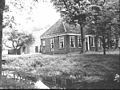
 De Waalborg Roderwolde.jpg 5,184 × 3,456; 3.77 MB
-
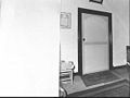
 Deur in de gang nr. F 282-16 - Roderwolde - 20439153 - RCE.jpg 1,200 × 900; 75 KB
-
 Gevelsteen nr. F 282-10 - Roderwolde - 20439163 - RCE.jpg 1,200 × 900; 178 KB
-
 Kamerdeur nr. F 283-24 - Roderwolde - 20439155 - RCE.jpg 1,200 × 900; 54 KB
-
 Kamerdeur nr. F 283-25 - Roderwolde - 20439154 - RCE.jpg 1,200 × 900; 75 KB
-
 Schouw nr. F 282-14 - Roderwolde - 20439166 - RCE.jpg 1,200 × 900; 82 KB
-
 Schouw nr. F 282-15 - Roderwolde - 20439152 - RCE.jpg 1,200 × 900; 74 KB
-
 Voor- en zijgevel nr. F 282-13 - Roderwolde - 20439165 - RCE.jpg 1,200 × 900; 175 KB
-
 Voor- en zijgevel nr. F 282-9 - Roderwolde - 20439162 - RCE.jpg 1,200 × 900; 206 KB
-
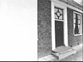 Voordeur nr. F 282-12 - Roderwolde - 20439164 - RCE.jpg 1,200 × 900; 112 KB
-
 Voorgevel nr. F 282-8 - Roderwolde - 20439161 - RCE.jpg 1,200 × 900; 212 KB
-
 Zij- en voorgevel nr. F 282-7 - Roderwolde - 20439160 - RCE.jpg 1,200 × 900; 188 KB
-
 Zijgevel boerderij brug nr. F 282-6 - Roderwolde - 20439157 - RCE.jpg 1,200 × 900; 211 KB
-
 Zijgevel woongedeelte nr. F 282-5 - Roderwolde - 20439159 - RCE.jpg 1,200 × 900; 175 KB


