Category:Waldfriedhof (Bad Homburg vor der Höhe)
This is the category of the Hessian Kulturdenkmal (cultural monument) with the ID 7490 (Wikidata)
|
| Object location | | View all coordinates using: OpenStreetMap |
|---|
| Upload media | |||||
| Instance of | |||||
|---|---|---|---|---|---|
| Location |
| ||||
| Heritage designation | |||||
 | |||||
Subcategories
This category has the following 4 subcategories, out of 4 total.
Media in category "Waldfriedhof (Bad Homburg vor der Höhe)"
This category contains only the following file.
-
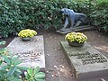 Grabplatte Guenther und Harald Quandt LWS2999.jpg 4,000 × 3,000; 3.5 MB
