Category:Walney Island
Deutsch: Walney Island oder Isle of Walney liegt in der Irischen See westlich der Halbinsel Furness und ist die achtgrößte Insel vor der Küste von England. (→Walney Island)
English: Walney Island, also known as the Isle of Walney, is an island off the west coast of England, at the western end of Morecambe Bay. It forms part of the town of Barrow-in-Furness, and it is separated from mainland Barrow by Walney Channel, a narrow channel which is spanned by the Jubilee Bridge. Walney is the largest island of the Furness Islands group, both in population and size, as well as the largest English island in the Irish Sea. Its population at the 2011 UK Census was 10,651, distributed evenly across the island's two Wards of Walney North and Walney South. (→Walney Island)
Español: La isla de Walney (en inglés, Walney Island, también conocida como Isle of Walney, es la octava isla marina por tamaño de Inglaterra (Reino Unido). (→Isla Walney)
Nederlands: Walney Island is een eiland aan de noordwestkust van Engeland, gelegen in het graafschap Cumbria, aan de noordwestelijke punt van Morecambe Bay. Het eiland maakt deel uit van de stad Barrow-in-Furness, waarmee het sinds 1908 verbonden is door een brug, Jubilee Bridge geheten. De belangrijkste van de vier nederzettingen op Walney Island is Vickerstown, dat door het gelijknamige staal- en wapenbedrijf Vickers werd gebouwd als accommodatie voor de werknemers van de scheepswerf in Barrow-in-Furness. Ook heden ten dage is de bouw van schepen door de scheepsafdeling van het concern BAE Systems, die haar hoofdvestiging in Barrow-in-Furness heeft, nog steeds de belangrijkste bron van werkgelegenheid voor de eilandbewoners. Walney Island, met een oppervlakte van 12,98 km², is een laag en zanderig eiland, dat daarenboven volgens de krant Northwest Evening Mail het winderigste van Groot-Brittannië zou zijn; het eiland bezit aan zijn westkust vijf windmolenparken. Er wonen ruim 10.000 mensen op Walney Island. (→Walney Island)
Norsk nynorsk: Walney Island eller Isle of Walney er den åttande største øya i England. Ho ligg i Irskesjøen, vest for Furnesshalvøya i det nordvestlege England. Fram til 1974 var både øya og halvøya ein del av Lancashire, men i dag høyrer dei til Cumbria. Øya høyrer til kommunen Barrow-in-Furness og er landfast via Walney Bridge, som vart bygd i 1908. (→Walney Island)
Српски / srpski: Вални је једно од Британских острва које припада Уједињеном Краљевству, односно Енглеској. Површина острва износи 13 km². Према попису из 2001. на острву је живело 11388 становника. (→Вални)

island in the United Kingdom   | |||||
| Upload media | |||||
| Instance of | |||||
|---|---|---|---|---|---|
| Location | Cumbria, North West England, England | ||||
| Located in or next to body of water | |||||
| Width |
| ||||
| Length |
| ||||
| Population |
| ||||
| Area |
| ||||
 | |||||
Subcategories
This category has the following 5 subcategories, out of 5 total.
B
- Barrow/Walney Island Airport (4 F)
S
- South Walney (4 F)
V
W
- Walney Bridge (9 F)
- Walney Lighthouse (13 F)
Media in category "Walney Island"
The following 38 files are in this category, out of 38 total.
-
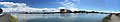 Barrow panorama from Walney July 2017.jpg 13,027 × 2,379; 5.33 MB
-
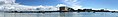
 Barrow-in-Furness - geograph.org.uk - 2000.jpg 640 × 420; 36 KB
-
 Barrow-in-Furness aerial from the south.jpg 4,608 × 3,456; 2.75 MB
-
 Barrow-in-Furness Wikivoyage Banner.jpg 9,876 × 1,420; 2.25 MB
-

-
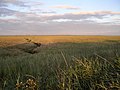 Creephaw Marsh, Walney Island - geograph.org.uk - 224084.jpg 640 × 480; 112 KB
-
 Crook Scar - geograph.org.uk - 160218.jpg 640 × 480; 126 KB
-
 Foreshore at South End Haws - geograph.org.uk - 847048.jpg 640 × 350; 110 KB
-

-
 Hillock Whins Scar, South Walney - geograph.org.uk - 256921.jpg 640 × 480; 139 KB
-
 Information Board - geograph.org.uk - 1434353.jpg 640 × 480; 70 KB
-
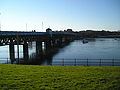 Jubilee.JPG 2,288 × 1,712; 757 KB
-

-
 Looking towards Hilpsford Point - geograph.org.uk - 271150.jpg 640 × 480; 118 KB
-
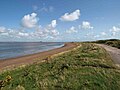
 North Walney Beach - geograph.org.uk - 209813.jpg 640 × 480; 108 KB
-
 Ordnance Survey One-Inch Sheet 88 Barrow in Furness, Published 1947.jpg 8,238 × 9,578; 9.12 MB
-
 Ordnance Survey One-Inch Sheet 88 Barrow-in-Furness, Published 1965.jpg 8,246 × 9,898; 10.65 MB
-
 OrmsgillFromNorthScale 20070529.jpg 1,600 × 1,200; 291 KB
-
 Pebbles on the beach - geograph.org.uk - 1453821.jpg 640 × 480; 90 KB
-
 Pond in the South Walney Nature Reserve - geograph.org.uk - 848347.jpg 640 × 384; 136 KB
-
 Promenade, Walney Island - geograph.org.uk - 665016.jpg 640 × 426; 62 KB
-
-
 Shelly Bars, South Walney Nature Reserve - geograph.org.uk - 148769.jpg 640 × 480; 129 KB
-
 Shope Tree Scar at Sunset - geograph.org.uk - 209761.jpg 640 × 480; 115 KB
-
 Silhouettes of grass.jpg 800 × 600; 223 KB
-
 South Walney Nature Reserve, view ESE - geograph.org.uk - 847017.jpg 640 × 396; 111 KB
-
 South Walney Nature Reserve, view south - geograph.org.uk - 847027.jpg 640 × 427; 144 KB
-
 South Walney Oyster Farm - geograph.org.uk - 839281.jpg 640 × 427; 128 KB
-

-
 The shingle beach at South Walney - geograph.org.uk - 1452994.jpg 640 × 480; 72 KB
-

-
 The Wall - Pink Floyd wasn't ere - geograph.org.uk - 274985.jpg 640 × 479; 50 KB
-

-
 Walney in Lancashire.svg 408 × 599; 93 KB
-
 WalneyInLancashire.png 408 × 599; 62 KB
-
 The Round House, Walney Island - geograph.org.uk - 224072.jpg 640 × 430; 40 KB
-
 View to North end of Walney Island - geograph.org.uk - 268445.jpg 640 × 480; 82 KB
-
 Wylock Marsh, Walney Island - geograph.org.uk - 224093.jpg 640 × 480; 84 KB


