Category:Warmington, Warwickshire
village and civil parish in Stratford-on-Avon, Warwickshire, England | |||||
| Upload media | |||||
| Instance of | |||||
|---|---|---|---|---|---|
| Location | Stratford-on-Avon, Warwickshire, West Midlands, England | ||||
| Population |
| ||||
| Area |
| ||||
| official website | |||||
 | |||||
Subcategories
This category has the following 5 subcategories, out of 5 total.
A
P
Media in category "Warmington, Warwickshire"
The following 87 files are in this category, out of 87 total.
-
 A footpath crosses the M40 - geograph.org.uk - 5763594.jpg 2,700 × 2,025; 337 KB
-
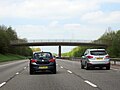
 Bridge over the M40 near Warmington - geograph.org.uk - 2686359.jpg 640 × 430; 51 KB
-
 Caravan Site - geograph.org.uk - 116334.jpg 640 × 427; 89 KB
-
 Cherry Tree Farm Only - geograph.org.uk - 3161774.jpg 2,000 × 1,500; 740 KB
-
 Cornfield by College Farm - geograph.org.uk - 1994383.jpg 1,500 × 943; 233 KB
-
 Daff and farm machinery - geograph.org.uk - 1213135.jpg 640 × 480; 102 KB
-
 Drive nearing the B4086 - geograph.org.uk - 4754146.jpg 640 × 480; 111 KB
-
 Drive way To College Farm - geograph.org.uk - 3488886.jpg 640 × 480; 87 KB
-
 Duck Pond - geograph.org.uk - 4754069.jpg 640 × 480; 66 KB
-
 Field by the motorway - geograph.org.uk - 1994365.jpg 1,500 × 1,000; 257 KB
-
 Field near Warmington - geograph.org.uk - 1992681.jpg 1,500 × 1,000; 189 KB
-

-
 Footpath to Arlescote - geograph.org.uk - 3161723.jpg 2,000 × 1,500; 806 KB
-
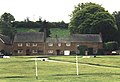
 Goalposts, Warmington village green - geograph.org.uk - 2614836.jpg 1,600 × 1,200; 546 KB
-
 Golden stone - geograph.org.uk - 1519553.jpg 640 × 428; 71 KB
-
 House in Warmington, Warwickshire - geograph.org.uk - 1519576.jpg 640 × 428; 70 KB
-
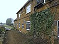
 House on Banbury Road, Warmington - geograph.org.uk - 6077422.jpg 1,846 × 1,158; 1,021 KB
-

-
 Kissing gate to the footpath - geograph.org.uk - 1994370.jpg 1,000 × 1,500; 311 KB
-
 Labelled herbs - geograph.org.uk - 2588948.jpg 3,264 × 2,448; 2.64 MB
-
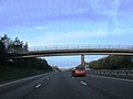
 M40 - footbridge - geograph.org.uk - 3250819.jpg 640 × 430; 33 KB
-
 M40 - geograph.org.uk - 3488914.jpg 640 × 480; 76 KB
-
 M40 - overbridge - geograph.org.uk - 3250823.jpg 640 × 430; 31 KB
-
 M40 Bridge, Warmington - geograph.org.uk - 185848.jpg 640 × 480; 74 KB
-

-
 M40 looking south east - geograph.org.uk - 461169.jpg 640 × 477; 54 KB
-

-

-
 M40 motorway north of Warmington - geograph.org.uk - 3025576.jpg 640 × 480; 58 KB
-
 M40 northbound - geograph.org.uk - 3224343.jpg 640 × 480; 43 KB
-
 M40 northbound - geograph.org.uk - 3224344.jpg 640 × 480; 43 KB
-
 M40 northbound - geograph.org.uk - 3224347.jpg 640 × 480; 43 KB
-
 M40 south near Warmington - geograph.org.uk - 2829653.jpg 640 × 481; 46 KB
-
 Macmillan Way past Hill Farm - geograph.org.uk - 461518.jpg 640 × 477; 122 KB
-
 More mundane Warmington - geograph.org.uk - 461496.jpg 640 × 477; 118 KB
-
 Motel at the Wobbly Wheel - geograph.org.uk - 1213096.jpg 640 × 480; 46 KB
-
 New sewage processing plant - geograph.org.uk - 2732517.jpg 3,648 × 2,736; 2.43 MB
-
 Northbound M40 near Avon Dassett - geograph.org.uk - 4525480.jpg 640 × 427; 226 KB
-
 Northbound M40 near Warmington - geograph.org.uk - 4525478.jpg 640 × 480; 246 KB
-

-
 Northbound M40, Warwickshire - geograph.org.uk - 4525402.jpg 640 × 427; 243 KB
-

-
 Premier Inn, Banbury Road near Warmington - geograph.org.uk - 3366684.jpg 1,024 × 668; 133 KB
-
 Ridge and furrow - geograph.org.uk - 1496163.jpg 640 × 428; 44 KB
-
 Road to Farnborough - geograph.org.uk - 4754076.jpg 640 × 480; 97 KB
-
 Rural view from Edgehill - geograph.org.uk - 3095961.jpg 1,500 × 1,000; 178 KB
-
 Sheep farming - geograph.org.uk - 5193723.jpg 640 × 480; 168 KB
-
 Sheep farming near Arlescote - geograph.org.uk - 5193734.jpg 640 × 480; 144 KB
-
 Soot Lane, Warmington - geograph.org.uk - 3162012.jpg 2,000 × 1,500; 433 KB
-

-
 St Michael's Church, Warmington - geograph.org.uk - 6294605.jpg 1,024 × 768; 207 KB
-
 St. Anne's Well - geograph.org.uk - 3917794.jpg 1,024 × 883; 358 KB
-
 Stile to the footpath - geograph.org.uk - 1994361.jpg 1,500 × 1,000; 372 KB
-
 The B4100 to Warwick - geograph.org.uk - 1992679.jpg 1,500 × 1,000; 153 KB
-
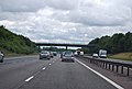
 The M40 near Warmington - geograph.org.uk - 1994355.jpg 1,500 × 1,000; 129 KB
-
 The M40 runs under a minor road - geograph.org.uk - 5763593.jpg 2,700 × 1,977; 383 KB
-
 The path leading down to Arlescote - geograph.org.uk - 2736642.jpg 1,024 × 768; 300 KB
-
 The road to Farnborough - geograph.org.uk - 1992685.jpg 1,500 × 1,000; 256 KB
-
 The road to Warmington - geograph.org.uk - 1992684.jpg 1,500 × 1,000; 342 KB
-
 The route is obvious - geograph.org.uk - 461534.jpg 640 × 477; 61 KB
-
 The Wobbly Wheel - geograph.org.uk - 1213091.jpg 640 × 480; 58 KB
-
 The Wobbly Wheel - geograph.org.uk - 3794464.jpg 3,264 × 2,448; 2.25 MB
-
 The Wobbly Wheel - geograph.org.uk - 3794467.jpg 640 × 480; 111 KB
-
 Track to Fir Tree Farm - geograph.org.uk - 3489900.jpg 2,000 × 1,500; 539 KB
-
 View along the scarp - geograph.org.uk - 461524.jpg 640 × 477; 120 KB
-
 View into the Avon valley - geograph.org.uk - 461515.jpg 640 × 477; 91 KB
-
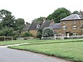
 Village green, Warmington - geograph.org.uk - 1520346.jpg 640 × 428; 61 KB
-
 Village pond, Warmington, Warwickshire - geograph.org.uk - 2614834.jpg 1,600 × 847; 279 KB
-
 Warmington Farm Access Road - geograph.org.uk - 6213045.jpg 1,600 × 1,067; 534 KB
-
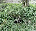
 Warmington Fox Covert - geograph.org.uk - 2732515.jpg 3,648 × 2,736; 1.94 MB
-
 Warmington sewage works - geograph.org.uk - 461174.jpg 640 × 477; 91 KB
-
 Warmington village centre - geograph.org.uk - 1519545.jpg 640 × 428; 56 KB
-
 Warmington Village Green - geograph.org.uk - 106846.jpg 640 × 426; 118 KB
-
 Warmington village green, Warwickshire - geograph.org.uk - 1837227.jpg 800 × 549; 125 KB
-
 Warmington Village Noticeboard - geograph.org.uk - 3153621.jpg 640 × 480; 118 KB
-
 Warmington village pond - geograph.org.uk - 461493.jpg 640 × 477; 88 KB
-
 Warmington-Road To Farnborough - geograph.org.uk - 6213041.jpg 1,600 × 1,067; 369 KB
-
 Warmington-The Falcon - geograph.org.uk - 6213053.jpg 1,600 × 1,041; 538 KB
-
 Warmington-Village Pond - geograph.org.uk - 3153614.jpg 640 × 480; 55 KB
-
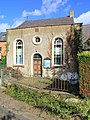 Wesleyan Chapel, Warmington - geograph.org.uk - 3161977.jpg 1,500 × 2,000; 651 KB
-
 Wobbly Wheel (1), Banbury Road near Warmington - geograph.org.uk - 3366648.jpg 1,024 × 656; 169 KB
-
 Farm equipment - geograph.org.uk - 461529.jpg 640 × 477; 98 KB
-
 Fenny Compton Hill - geograph.org.uk - 3998.jpg 640 × 480; 83 KB
-
 Glebe Farm Business Park - geograph.org.uk - 198025.jpg 640 × 480; 85 KB
-

-
 Sheep at Shooter's Hill - geograph.org.uk - 143578.jpg 640 × 480; 241 KB
-
 Warmington - Farnborough Lane - geograph.org.uk - 198032.jpg 639 × 494; 63 KB


,_Banbury_Road_near_Warmington_-_geograph.org.uk_-_3366648.jpg)


