Category:Warning signs in North Yorkshire
Media in category "Warning signs in North Yorkshire"
The following 27 files are in this category, out of 27 total.
-
 Brigade SAAM 2010 (P5090027) (4599388839).jpg 1,536 × 2,048; 1.59 MB
-
 Cattle Grid on the B1266 - geograph.org.uk - 715542.jpg 640 × 410; 50 KB
-
 Electric pole re-used in fencing - geograph.org.uk - 259714.jpg 427 × 640; 79 KB
-
 Extreme Fire Risk - geograph.org.uk - 185918.jpg 640 × 480; 99 KB
-
 Farm Building, Overend Farm - geograph.org.uk - 20655.jpg 640 × 480; 50 KB
-
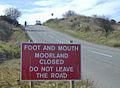 FMD note.jpg 640 × 469; 44 KB
-
 Ford on the River Dove - geograph.org.uk - 108787.jpg 640 × 417; 67 KB
-
 Keep out - geograph.org.uk - 1706263.jpg 640 × 480; 308 KB
-
 Pedestrian Tunnel under railway line - geograph.org.uk - 1726971.jpg 2,816 × 2,112; 2.77 MB
-
 Safety Notice - geograph.org.uk - 469013.jpg 640 × 480; 85 KB
-
 Sat Nav warning sign - geograph.org.uk - 674601.jpg 480 × 640; 273 KB
-
 Sheep in Danger - geograph.org.uk - 175572.jpg 640 × 371; 53 KB
-
 Sign at Beck Hole.jpg 2,400 × 1,800; 2.95 MB
-
 Sign on Fountains Fell. - geograph.org.uk - 262186.jpg 640 × 480; 122 KB
-
 Spofforth Castle (4th August 2018) 037.jpg 5,152 × 3,864; 7.49 MB
-
 The Bay Hotel, Robin Hood's Bay - geograph.org.uk - 448987.jpg 640 × 428; 91 KB
-
 Warning Notice by the railway bridge - geograph.org.uk - 440995.jpg 640 × 480; 95 KB
-
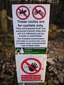 Warning notice on mountain bike trail - geograph.org.uk - 290454.jpg 480 × 640; 122 KB
-
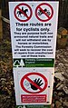 Warning notice on MTB trail (cropped).jpg 388 × 616; 129 KB
-
 Warning notice on Strensall Common - geograph.org.uk - 214304.jpg 480 × 640; 106 KB
-
 Warning sign - geograph.org.uk - 276884.jpg 640 × 480; 93 KB
-
 Warning sign in Austwick bus shelter - geograph.org.uk - 1726751.jpg 640 × 480; 164 KB
-

-
 Warning signs - geograph.org.uk - 439756.jpg 640 × 480; 144 KB
-

-

-
 Weak Road to Stape - geograph.org.uk - 451018.jpg 640 × 428; 86 KB
_(4599388839).jpg)


_037.jpg)


.jpg)


