Category:Washington (state) gubernatorial election maps (set)
States of the United States: Alabama · Alaska · Arizona · Arkansas · California · Colorado · Connecticut · Delaware · Florida · Georgia · Hawaii · Idaho · Illinois · Indiana · Iowa · Kansas · Kentucky · Louisiana · Maine · Maryland · Massachusetts · Michigan · Minnesota · Mississippi · Missouri · Montana · Nebraska · Nevada · New Hampshire · New Jersey · New Mexico · New York · North Carolina · North Dakota · Ohio · Oklahoma · Oregon · Pennsylvania · Rhode Island · South Carolina · South Dakota · Tennessee · Texas · Utah · Vermont · Virginia · Washington · West Virginia · Wisconsin · Wyoming
Guam
Guam
This category is an image set. It should contain only images that have the same style, and should have a parent category that is purely topical.
Media in category "Washington (state) gubernatorial election maps (set)"
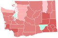
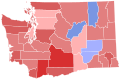
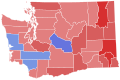
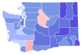
The following 33 files are in this category, out of 33 total.
-
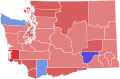 1889 Washington gubernatorial election results map by county.svg 800 × 525; 1.38 MB
-
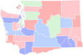 1892 Washington gubernatorial election results map by county.svg 800 × 525; 1.38 MB
-
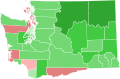 1896 Washington gubernatorial election results map by county.svg 800 × 525; 1.38 MB
-
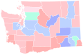
 1908 Washington gubernatorial election results map by county.svg 166 × 124; 36 KB
-
 1912 Washington gubernatorial election results map by county.svg 166 × 124; 38 KB
-
 1916 Washington gubernatorial election results map by county.svg 166 × 124; 38 KB
-
 1920 Washington gubernatorial election results map by county.svg 166 × 124; 38 KB
-
 1924 Washington gubernatorial election results map by county.svg 166 × 124; 38 KB
-
 1928 Washington gubernatorial election results map by county.svg 166 × 124; 38 KB
-
 1932 Washington gubernatorial election results map by county.svg 744 × 497; 372 KB
-
 1936 Washington gubernatorial election results map by county.svg 744 × 497; 372 KB
-
 1940 Washington gubernatorial election results map by county.svg 744 × 497; 372 KB
-
 1944 Washington gubernatorial election results map by county.svg 744 × 497; 372 KB
-
 1948 Washington gubernatorial election results map by county.svg 744 × 497; 372 KB
-
 1952 Washington gubernatorial election results map by county.svg 744 × 497; 372 KB
-
 1956 Washington gubernatorial election results map by county.svg 744 × 497; 372 KB
-
 1960 Washington gubernatorial election results map by county.svg 744 × 497; 372 KB
-
 1964 Washington gubernatorial election results map by county.svg 744 × 497; 372 KB
-
 1968 Washington gubernatorial election results map by county.svg 744 × 497; 372 KB
-
 1972 Washington gubernatorial election results map by county.svg 810 × 535; 61 KB
-
 1976 Washington gubernatorial election results map by county.svg 810 × 535; 61 KB
-
 1980 Washington gubernatorial election results map by county.svg 810 × 535; 61 KB
-
 1984 Washington gubernatorial election results map by county.svg 810 × 535; 61 KB
-
 1988 Washington gubernatorial election results map by county.svg 810 × 535; 61 KB
-
 1992 Washington gubernatorial election results map by county.svg 810 × 535; 61 KB
-
 1996 Washington gubernatorial election results map by county.svg 810 × 535; 61 KB
-
 2000 Washington gubernatorial election results map by county.svg 810 × 535; 61 KB
-
 2004 Washington gubernatorial election results map by county.svg 810 × 535; 61 KB
-
 2008 Washington gubernatorial election results map by county.svg 810 × 535; 61 KB
-
 2012 Washington gubernatorial election by Congressional District.svg 810 × 535; 193 KB
-
 2012 Washington gubernatorial election results map by county.svg 810 × 535; 61 KB
-
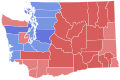
 2016 Washington gubernatorial election results map by county.svg 810 × 535; 61 KB
-
 2020 Washington gubernatorial election results map by county.svg 810 × 535; 61 KB


