Category:Wasserfluh
| Object location | | View all coordinates using: OpenStreetMap |
|---|
Deutsch: Wasserfluh ist ein Pass, der das Thurtal mit dem Neckertal verbindet, im Kanton St. Gallen in der Schweiz.
mountain pass  | |||||
| Upload media | |||||
| Instance of | |||||
|---|---|---|---|---|---|
| Location | canton St. Gallen, Switzerland | ||||
| Elevation above sea level |
| ||||
 | |||||
Media in category "Wasserfluh"
The following 4 files are in this category, out of 4 total.
-
 Brunnadern Neckertal Wasserfluh.jpg 1,600 × 1,200; 661 KB
-
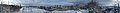 Neutoggenburg.jpg 18,996 × 2,073; 12.04 MB
-
 Wasserfluh Neu-Toggenburg.tif 4,500 × 3,000; 38.67 MB
-
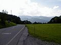 Wasserfluh.jpg 640 × 480; 35 KB
