Category:Water pumping stations in the East Riding of Yorkshire
Ceremonial counties of England: East Riding of Yorkshire · Lincolnshire · Norfolk · Oxfordshire ·
City-counties:
Former historic counties:
Other former counties:
City-counties:
Former historic counties:
Other former counties:
Subcategories
This category has the following 2 subcategories, out of 2 total.
S
- Skeffling Pumping Station (5 F)
W
Media in category "Water pumping stations in the East Riding of Yorkshire"
The following 43 files are in this category, out of 43 total.
-
 Above Hempholme Lock (geograph 5558769).jpg 1,024 × 768; 136 KB
-
 Adlingfleet Drain Pump - geograph.org.uk - 488055.jpg 640 × 480; 110 KB
-
 Adlingfleet Sluice 2011.jpg 2,272 × 1,704; 867 KB
-
 Broomfleet Ponds Pumping Station - geograph.org.uk - 250290.jpg 640 × 480; 109 KB
-
 Cottingham Pumping Station - geograph.org.uk - 951408.jpg 414 × 640; 78 KB
-
 Footbridge over dike - geograph.org.uk - 841323.jpg 480 × 640; 90 KB
-
 Footpath from Hempholme Lock - geograph.org.uk - 1410070.jpg 640 × 480; 107 KB
-
 Hempholme Bridge - geograph.org.uk - 785183.jpg 455 × 640; 105 KB
-
 Hempholme Pumping Station - geograph.org.uk - 114724.jpg 640 × 480; 134 KB
-
 Hempholme Pumping Station - geograph.org.uk - 1407400.jpg 480 × 640; 92 KB
-
 Hornsea Pumping Station - geograph.org.uk - 270903.jpg 640 × 480; 63 KB
-
 Keldgate Reservoir, Cottingham - geograph.org.uk - 1368722.jpg 640 × 480; 62 KB
-
 Keldgate Reservoir, Cottingham - geograph.org.uk - 583216.jpg 640 × 446; 181 KB
-
 Keldgate Reservoir, Cottingham - geograph.org.uk - 945566.jpg 640 × 426; 69 KB
-
 Mickley Dike - geograph.org.uk - 1141908.jpg 640 × 481; 216 KB
-
 New Burstwick Drain Pumping System - geograph.org.uk - 1345052.jpg 640 × 493; 77 KB
-
 Old Lane Waste Water Pumping Station - geograph.org.uk - 1224108.jpg 640 × 480; 59 KB
-
 Parking sign, Wetwang, E Yorks (geograph 4457517).jpg 640 × 447; 211 KB
-
 Pumphouse - geograph.org.uk - 234363.jpg 640 × 426; 129 KB
-
 Pumping House - geograph.org.uk - 391890.jpg 640 × 480; 123 KB
-
 Pumping Station - geograph.org.uk - 72568.jpg 640 × 480; 44 KB
-
 Pumping Station - geograph.org.uk - 821203.jpg 640 × 427; 70 KB
-
 Pumping station pipes - geograph.org.uk - 745188.jpg 480 × 640; 176 KB
-
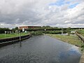
 River Hull at Hempholme Lock (geograph 5501457).jpg 1,600 × 1,065; 506 KB
-
 River Hull New Cut above Hempholme Lock (geograph 5268547).jpg 4,504 × 3,312; 4.29 MB
-
 Seavy Carr Drain and Pumping Station - geograph.org.uk - 1222676.jpg 640 × 480; 50 KB
-
 Seavy Carr pumping station - geograph.org.uk - 745175.jpg 640 × 480; 153 KB
-
 Sewage treatment works - geograph.org.uk - 841321.jpg 640 × 480; 63 KB
-
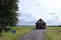
 Skelton pumping station.jpg 426 × 640; 176 KB
-
 Steam engine dry dock pump, Hull - geograph.org.uk - 715568.jpg 433 × 640; 105 KB
-

-
 Strucheon Hill Lock and weir (geograph 5558806).jpg 1,024 × 768; 222 KB
-
 The Pumping Station - geograph.org.uk - 1055661.jpg 640 × 427; 465 KB
-
 Tickton Pumping Station - geograph.org.uk - 827533.jpg 640 × 427; 96 KB
-
 Towns Drain Pumping Station - geograph.org.uk - 1247365.jpg 640 × 480; 32 KB
-
 Waste water pumping station - geograph.org.uk - 3779687.jpg 1,024 × 681; 283 KB
-
 Water pumping station, Etton Fields - geograph.org.uk - 761607.jpg 640 × 480; 169 KB
-
 Water Pumping Station, North Newbald - geograph.org.uk - 182411.jpg 640 × 480; 85 KB
-
 Water Pumping Station, Wetwang (geograph 3907604).jpg 800 × 532; 140 KB
-

-
 West -East Cowick Bore Hole Pumphouse - geograph.org.uk - 192410.jpg 614 × 436; 199 KB
-

-
 Wilfholme Pumping Station - geograph.org.uk - 1541418.jpg 640 × 427; 141 KB
.jpg)


.jpg)


.jpg)
.jpg)


.jpg)


.jpg)
_Lock_(geograph_5558801).jpg)


