Category:Watercolor drawings by Johannes Vingboons
Media in category "Watercolor drawings by Johannes Vingboons"
The following 105 files are in this category, out of 105 total.
-

-
 Bird's-Eye View of Fort Zeelandia and Warehouses, 1635.jpg 1,000 × 665; 278 KB
-
 Zeelandia from Dutch.jpg 3,532 × 1,966; 3.26 MB
-
 AMH-5626-NA Bird's eye view of the city of Judja.jpg 2,400 × 1,591; 796 KB
-
 AMH-6130-NA View of Ambon.jpg 2,400 × 1,579; 457 KB
-
 AMH-6131-NA Map of the city of Atjeh.jpg 2,400 × 1,552; 672 KB
-
 AMH-6132-NA Bird's eye view of the city of Atjeh.jpg 2,400 × 1,677; 564 KB
-
 AMH-6133-NA View of Batticaloa.jpg 2,400 × 2,020; 604 KB
-
 AMH-6138-NA View of Table Bay.jpg 2,400 × 1,651; 536 KB
-
 AMH-6143-NA Map of Table Bay.jpg 2,400 × 1,810; 727 KB
-
 AMH-6144-NA View of the city of Cananor.jpg 2,400 × 1,933; 619 KB
-
 AMH-6145-NA View of Canton.jpg 2,400 × 1,636; 518 KB
-
 AMH-6146-NA Bird's eye view of Eauweck, Cambodia.jpg 2,400 × 1,785; 591 KB
-
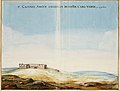
 AMH-6147-NA View of Cefala.jpg 2,400 × 1,785; 554 KB
-
 AMH-6148-NA Bird's eye view of the city of Cochin, India.jpg 2,400 × 1,682; 602 KB
-
 AMH-6150-NA View of Dabul.jpg 2,400 × 1,724; 455 KB
-
 AMH-6151-NA View of the city of Dabul.jpg 2,400 × 1,848; 510 KB
-
 AMH-6152-NA Map of the city of Goa.jpg 8,272 × 5,504; 3.66 MB
-
 AMH-6155-NA Map of the city of Macao.jpg 2,400 × 1,701; 585 KB
-
 AMH-6159-NA View of Galle.jpg 2,400 × 1,740; 408 KB
-
 AMH-6160-NA View of the city of Raiebaagh.jpg 2,400 × 1,652; 477 KB
-
 AMH-6161-NA Bird's eye view of the city of Samboppe, Macassar.jpg 2,400 × 1,715; 636 KB
-
 AMH-6162-NA Bird's eye view of the city of Samboppe, Macassar.jpg 2,400 × 1,750; 524 KB
-
 AMH-6163-NA View of the castle of Visiapour.jpg 2,400 × 1,626; 520 KB
-
 AMH-6164-NA View of Visiapour (according to the title), depicted is Suratte.jpg 2,400 × 1,802; 474 KB
-
 AMH-6165-NA Bird's eye view of Bandanaira.jpg 2,400 × 1,828; 463 KB
-
 AMH-6166-NA Bird's eye view of Colombo and environs.jpg 2,400 × 1,718; 620 KB
-
 AMH-6740-NA View of New Amsterdam.jpg 7,474 × 5,123; 6.95 MB
-
 AMH-6744-NA View of Arguin castle.jpg 2,400 × 1,825; 405 KB
-
 AMH-6749-NA View of Cabo Corso on the Gold Coast.jpg 2,400 × 1,917; 576 KB
-
 AMH-6754-NA Bird's eye view of the city of Santo Domingo.jpg 2,400 × 1,771; 508 KB
-
 AMH-6756-NA View of the island of Gouree on Cape Verde.jpg 2,400 × 1,784; 450 KB
-
 AMH-6757-NA View of Havana.jpg 2,400 × 1,886; 553 KB
-
 AMH-6765-NA View of Sao Luis de Maranhao.jpg 2,400 × 1,606; 408 KB
-
 AMH-6766-NA Map of Sao Luis de Marranhao.jpg 2,400 × 1,631; 573 KB
-
 AMH-6782-NA Floor plan of the fort of Mauritius on Rio San Francisco.jpg 2,400 × 1,677; 547 KB
-
 AMH-6784-NA Map of Pernambuco.jpg 2,400 × 1,869; 712 KB
-
 AMH-6787-NA View of Porto Calvo.jpg 2,400 × 1,640; 448 KB
-
 AMH-6788-NA Map of San Francisco on Santa Domingo.jpg 2,400 × 1,773; 535 KB
-
 AMH-6789-NA Map of Puerto Rico.jpg 2,400 × 1,795; 558 KB
-
 AMH-6790-NA View of Puerto Rico.jpg 2,400 × 1,818; 361 KB
-
 AMH-6793-NA Map of the mouth of the Pousioucq River.jpg 2,400 × 1,624; 523 KB
-
 AMH-6795-NA View of Keulen Fort.jpg 2,400 × 1,625; 334 KB
-
 AMH-6798-NA Bird's eye view of the bay and the fort of Nieuw Vlissingen on Tobago.jpg 2,400 × 1,786; 508 KB
-
 AMH-6799-NA Map of the island of Tamaraca.jpg 2,400 × 1,663; 780 KB
-
 AMH-6800-NA Map of the island of San Thomé.jpg 7,320 × 5,304; 6.24 MB
-
 AMH-6801-NA Chart of Isla da Vaca near Hispaniola, Haïti.jpg 2,400 × 1,772; 548 KB
-
 AMH-6807-NA View of unidentified fort.jpg 2,400 × 1,644; 336 KB
-
 AMH-7710-NA View of Fort Elmina.jpg 2,400 × 1,880; 491 KB
-
 Buenos Aires (Aldus Verthoont, ca 1628).jpg 1,430 × 1,060; 199 KB
-

-

-

-
 Castelo de Arguim, Johannes Vingboons, 1665, Mauritânia - Image 126734.jpg 1,280 × 973; 133 KB
-
 Castelo de Arguim, Johannes Vingboons, 1665, Mauritânia - Image 126736.jpg 1,206 × 1,205; 167 KB
-
 DeRuijter-Goudkust.jpg 2,980 × 1,676; 1.26 MB
-
 1640 Map of Formosa-Taiwan by Dutch 荷蘭人所繪福爾摩沙-臺灣.jpg 8,168 × 5,640; 9.77 MB
-
 AMH-6670-NA Map of the island of Formosa.jpg 2,400 × 1,662; 691 KB
-
 Het Eyland Formosa & Pisca Dores.jpg 1,000 × 696; 439 KB
-
 The Island Formosa and the Pescadores.jpg 1,280 × 885; 575 KB
-
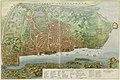
 GezichtOpNieuwAmsterdam.jpg 7,276 × 4,964; 21.65 MB
-
 Havana 1639.jpg 8,708 × 6,275; 4.27 MB
-
 Havana 1639b.jpg 6,471 × 4,975; 20.05 MB
-
 Havana op 't Eyland Cvba. LOC 2003623401.jpg 8,708 × 6,275; 5.96 MB
-
 Havana op 't Eyland Cvba. LOC 2003623401.tif 8,708 × 6,275; 156.33 MB
-
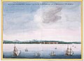
 Havana view 1639.png 677 × 526; 844 KB
-
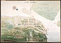
 Iudea-Ayutthaya.jpg 1,006 × 702; 139 KB
-

-
 Johannes Vingboons - 't eylant St. Thome (1665).jpg 1,280 × 933; 281 KB
-
 Johannes Vingboons - 't Kasteel Keulen aan Rio Grande in Brasil (1665).jpg 1,280 × 867; 150 KB
-
 Johannes Vingboons - Aldus verthoon hem 't casteel Argijn uyt der zee (1665).jpg 1,280 × 970; 183 KB
-
-
 Johannes Vingboons - Aldus verthoont het casteel de Mina uyt der zee (1665).jpg 1,280 × 1,022; 196 KB
-
 Johannes Vingboons - Caerte van 't eylandt Tamaraca (1665).jpg 1,280 × 887; 355 KB
-
 Johannes Vingboons - Cart van Cabo Corso geleegen aende Gout Cust in Guinea (1665).jpg 1,280 × 1,022; 268 KB
-
 Johannes Vingboons - D Stadt Loandas Pauli (1665).jpg 1,280 × 907; 239 KB
-
 Johannes Vingboons - De haven van Pharnambucq (1665).jpg 1,280 × 996; 327 KB
-
 Johannes Vingboons - De stadt Couchijn (1665).jpg 1,280 × 897; 261 KB
-
 Johannes Vingboons - Gezicht op Bahia de Todos os Santos (1665).jpg 1,280 × 899; 146 KB
-
 Johannes Vingboons - Gezicht op Serinhaim of Serinhaem (1665).jpg 1,280 × 872; 176 KB
-
 Johannes Vingboons - Gezicht op Tamaricca en Schoppestad (1665).jpg 7,520 × 5,112; 5.14 MB
-
 Johannes Vingboons - Kaart van Fort Maurits bij Rio Santo Francisco (1665).jpg 1,280 × 894; 261 KB
-
 Johannes Vingboons - Maragnon (1665).jpg 7,617 × 5,089; 6.7 MB
-
 Johannes Vingboons - Maragnon in Zuid America ten westen van Brasill (1665).jpg 1,280 × 870; 267 KB
-
 Johannes Vingboons - Mauritius aan de rivier S Franscisco (1665).jpg 1,280 × 894; 165 KB
-
 Johannes Vingboons - O Povaçon De Porto Calvo (1665).jpg 1,280 × 874; 195 KB
-
 Johannes Vingboons - Oispito Santo (1665).jpg 1,280 × 910; 276 KB
-
 Johannes Vingboons - Olinda (1665).jpg 1,280 × 891; 179 KB
-
 Johannes Vingboons - Paraijba (1665).jpg 7,504 × 5,088; 6.16 MB
-

-
 Johannes Vingboons - Plattegrond van Casteel Ceulen (1665).jpg 1,280 × 852; 269 KB
-

-

-
 Johannes Vingboons - Plattegrond van Frederik Stadt (1665).jpg 1,280 × 860; 316 KB
-
 Johannes Vingboons - Plattegrond van Olinda (1665).jpg 1,280 × 905; 313 KB
-
 Johannes-vingboons-11-kasteel-elmina-en-fort-nassau-ghana.jpg 1,280 × 725; 140 KB
-
 Manatvs gelegen op de Noot Riuier-closeup-N01-to-N17.jpg 1,055 × 865; 259 KB
-
 Map of the Western Coast of Taiwan, Tayouan and Points North, c. 1636.jpg 1,000 × 661; 265 KB
-
 Panaitan Prinseneiland old map by Johannes Vingboons.jpg 4,174 × 3,543; 2.63 MB
-
 Plan of Nieuw Vlissingen.jpg 1,280 × 952; 580 KB
-
 Recife-Map1665-ForteCincoPontas.jpg 448 × 405; 179 KB
-
 Recife-Map1665-ForteErnesto.jpg 457 × 459; 215 KB
-
 Recife-Map1665-ForteWaerdemburch.jpg 457 × 420; 120 KB
-
 Atlas Blaeu-Van der Hem - Taioan.jpg 1,875 × 1,198; 1.65 MB
-
 Wikivoyage Banner of Taiwan History.jpg 2,100 × 300; 603 KB


,_depicted_is_Suratte.jpg)


.jpg)


.jpg)
.jpg)
.jpg)
.jpg)
.jpg)
.jpg)
.jpg)
.jpg)
.jpg)
.jpg)
.jpg)
.jpg)
.jpg)
.jpg)
.jpg)
.jpg)
.jpg)
.jpg)
.jpg)
.jpg)
.jpg)
.jpg)
.jpg)
_(cropped).jpg)
.jpg)
.jpg)
.jpg)


