Category:Waterfalls in Cumbria
Subcategories
This category has the following 14 subcategories, out of 14 total.
A
- Ash Gill (36 F)
B
- Birker Force (8 F)
C
- Cauldron Snout (37 F)
- Cautley Spout (19 F)
- Colwith Force (23 F)
- Crammel Linn (27 F)
H
- Hellgill Force (6 F)
L
M
- Moss Force (5 F)
S
- Scale Force (9 F)
- Skelwith Force (35 F)
- Stanley Force (15 F)
- Stock Ghyll Force (27 F)
Media in category "Waterfalls in Cumbria"
The following 200 files are in this category, out of 254 total.
(previous page) (next page)-
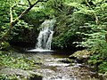
 A waterfall - geograph.org.uk - 725250.jpg 480 × 640; 124 KB
-
 Angletarn Beck water falls - geograph.org.uk - 1524180.jpg 480 × 640; 107 KB
-
 Birks Bridge - geograph.org.uk - 2188.jpg 440 × 640; 64 KB
-
 Buscoe Sike - geograph.org.uk - 1004260.jpg 427 × 640; 271 KB
-
 Buttermere MMB 06.jpg 1,200 × 1,600; 786 KB
-
 Cash Force - geograph.org.uk - 1969221.jpg 2,592 × 1,944; 1.01 MB
-
 Cautley Spout and the Holme Beck valley - geograph.org.uk - 1431569.jpg 403 × 600; 162 KB
-
 Colwith Force - geograph.org.uk - 986883.jpg 640 × 481; 107 KB
-
 Dalegarth Force, Eskdale - The English Lakes - A. Heaton Cooper.jpg 1,162 × 2,985; 1.21 MB
-
 Dockray MMB 03.jpg 4,288 × 2,848; 5.28 MB
-
 Dockray MMB 04 Aira Force.jpg 3,555 × 2,772; 3.48 MB
-
 Dockray MMB 05 Aira Force.jpg 4,155 × 2,754; 4.1 MB
-
 Dry and wet waterfalls, Scordale - geograph.org.uk - 4493453.jpg 640 × 480; 137 KB
-
 Dry waterfall Near Black Knowe - geograph.org.uk - 802525.jpg 480 × 640; 109 KB
-
 DungeonGhyll.jpg 1,536 × 2,048; 1.44 MB
-
 Falls of Whelpo Beck - geograph.org.uk - 947978.jpg 640 × 426; 70 KB
-
 Falls on Aira Beck - geograph.org.uk - 1800373.jpg 640 × 426; 114 KB
-
 Fordingdale Force (geograph 5295148).jpg 1,920 × 1,280; 560 KB
-
 Gentle waterfall on Langstrath Beck - geograph.org.uk - 878727.jpg 640 × 480; 131 KB
-
 Gibson's Spout - geograph.org.uk - 1012095.jpg 640 × 480; 103 KB
-
 How Beck waterfall - geograph.org.uk - 1419182.jpg 640 × 480; 98 KB
-
 Intake Force - geograph.org.uk - 1738173.jpg 626 × 800; 322 KB
-
 Joseph Mallord William Turner - Waterfall of Lodore, Cumberland - Google Art Project.jpg 4,957 × 3,343; 3.95 MB
-
 Levers Waterfall - geograph.org.uk - 242220.jpg 480 × 640; 66 KB
-
 Lockin Garth Force - geograph.org.uk - 1881304.jpg 1,600 × 1,200; 765 KB
-
 Lockin Garth Force - geograph.org.uk - 2343794.jpg 640 × 426; 307 KB
-

-
 Lodore Falls.jpg 1,367 × 2,048; 892 KB
-

-
 Millergill Beck - geograph.org.uk - 737974.jpg 480 × 640; 184 KB
-
 Moorland waterfall and pool, Dufton Fell - geograph.org.uk - 3617515.jpg 640 × 480; 117 KB
-
 Moss Force - Newlands Hause - geograph.org.uk - 37146.jpg 480 × 640; 172 KB
-

-
 Rawthey Gill - geograph.org.uk - 39003.jpg 640 × 409; 69 KB
-
 Rutter Force - geograph.org.uk - 1101340.jpg 640 × 428; 113 KB
-
 Rutter Force - geograph.org.uk - 19099.jpg 640 × 480; 105 KB
-
 Rutter Force and Mill, Westmorland - geograph-2661740.jpg 1,024 × 768; 356 KB
-
 Scalehow Force - geograph.org.uk - 1056156.jpg 480 × 640; 66 KB
-
 Scordale Beck - geograph.org.uk - 4639098.jpg 3,240 × 4,320; 3.76 MB
-
 Small waterfall, Woldgill Burn - geograph.org.uk - 119619.jpg 640 × 480; 81 KB
-
 Small waterfalls emptying into Haweswater - geograph.org.uk - 738077.jpg 540 × 405; 114 KB
-
 Sourmilk Gill - geograph.org.uk - 136148.jpg 480 × 640; 117 KB
-
 Spout Force - geograph.org.uk - 1174217.jpg 425 × 640; 94 KB
-
 Spout Force - geograph.org.uk - 1301271.jpg 480 × 640; 146 KB
-
 Stanley Force. - geograph.org.uk - 39761.jpg 640 × 480; 118 KB
-
 Taylor Gill Force - geograph.org.uk - 1272432.jpg 640 × 480; 108 KB
-
 Taylor Gill Force - geograph.org.uk - 136149.jpg 480 × 640; 108 KB
-
 The Spout - geograph.org.uk - 536840.jpg 640 × 427; 122 KB
-
 The Spout - geograph.org.uk - 536907.jpg 427 × 640; 138 KB
-
 Tom Ghyll waterfall - geograph.org.uk - 748079.jpg 640 × 480; 137 KB
-
 Tranearth Quarry - geograph.org.uk - 886165.jpg 640 × 432; 73 KB
-
 Uldale Force - geograph.org.uk - 1220925.jpg 640 × 427; 100 KB
-
 Uldale Force - geograph.org.uk - 977551.jpg 480 × 640; 97 KB
-

-
 Wall, Breasthigh Road - geograph.org.uk - 305101.jpg 480 × 640; 122 KB
-
 Water Spout near Stockley Bridge - geograph.org.uk - 713663.jpg 427 × 640; 324 KB
-
 Waterfall ,Sleddale Beck - geograph.org.uk - 294184.jpg 480 × 640; 124 KB
-
 Waterfall - geograph.org.uk - 494654.jpg 640 × 463; 159 KB
-
 Waterfall above Haweswater - geograph.org.uk - 632967.jpg 597 × 400; 146 KB
-
 Waterfall Aira Force, National Trust - geograph.org.uk - 2018.jpg 480 × 640; 69 KB
-
 Waterfall and stone hut - geograph.org.uk - 101316.jpg 640 × 480; 176 KB
-
 Waterfall at Head of Miterdale - geograph.org.uk - 514115.jpg 426 × 640; 154 KB
-
 Waterfall at the end of our walk - panoramio (1).jpg 2,000 × 1,502; 1.94 MB
-
 Waterfall at the end of our walk - panoramio.jpg 2,000 × 1,502; 1.67 MB
-
 Waterfall at the Head of Miterdale - geograph.org.uk - 537831.jpg 426 × 640; 323 KB
-
 Waterfall at the top of Hundreds Road.jpg 3,872 × 2,592; 5.43 MB
-
 Waterfall at White Moss - 2023-01-02 (1).jpg 3,392 × 5,088; 14.11 MB
-
 Waterfall at White Moss - 2023-01-02 (2).jpg 2,682 × 4,023; 8.68 MB
-
 Waterfall Black Beck - geograph.org.uk - 101691.jpg 480 × 640; 151 KB
-
 Waterfall Dodd Beck - geograph.org.uk - 175314.jpg 480 × 640; 165 KB
-
 Waterfall in Grain Gill - geograph.org.uk - 619964.jpg 640 × 480; 99 KB
-
 Waterfall in New Water - geograph.org.uk - 413773.jpg 640 × 427; 135 KB
-
 Waterfall in Uldale - geograph.org.uk - 90968.jpg 424 × 640; 49 KB
-
 Waterfall in Upper Eskdale. - geograph.org.uk - 496459.jpg 640 × 426; 273 KB
-
 Waterfall Lingmell Gill - geograph.org.uk - 135812.jpg 480 × 640; 178 KB
-
 Waterfall near Coniston Copper mine youth hostel in 2016.jpg 2,448 × 3,264; 1.86 MB
-
 Waterfall near Grisedale Hause - geograph.org.uk - 510518.jpg 640 × 480; 92 KB
-
 Waterfall near Millerground - Windermere - geograph.org.uk - 70320.jpg 640 × 414; 182 KB
-
 Waterfall near Rawthey Bridge, Cumbria - geograph.org.uk - 1233170.jpg 640 × 480; 134 KB
-
 Waterfall off Murton Fell into Scordale - geograph.org.uk - 330285.jpg 640 × 480; 141 KB
-
 Waterfall on Aira Beck - geograph.org.uk - 1800376.jpg 426 × 640; 86 KB
-
 Waterfall on Ay Gill - geograph.org.uk - 681694.jpg 640 × 480; 106 KB
-
 Waterfall on Gouther Beck - geograph.org.uk - 725539.jpg 640 × 480; 95 KB
-
 Waterfall on Greenup Gill - geograph.org.uk - 499911.jpg 640 × 480; 140 KB
-
 Waterfall on Leck Beck.jpg 480 × 640; 192 KB
-
 Waterfall on Peasey Beck near Beckside (geograph 2384065).jpg 480 × 640; 145 KB
-
 Waterfall on Rannerdale beck. - geograph.org.uk - 116099.jpg 480 × 640; 98 KB
-
 Waterfall on River Nent - geograph.org.uk - 1216446.jpg 480 × 640; 110 KB
-
 Waterfall on Scale Beck - geograph.org.uk - 239616.jpg 480 × 640; 176 KB
-
 Waterfall on the River Duddon - geograph.org.uk - 1578852.jpg 640 × 480; 103 KB
-
 Waterfall on the River Duddon - geograph.org.uk - 1578861.jpg 640 × 480; 78 KB
-
 Waterfall on the River Esk - geograph.org.uk - 493894.jpg 426 × 640; 128 KB
-
 Waterfall on the River Esk - geograph.org.uk - 527016.jpg 426 × 640; 123 KB
-
 Waterfall on the River Esk - geograph.org.uk - 527848.jpg 640 × 426; 114 KB
-
 Waterfall on Troutbeck - geograph.org.uk - 730042.jpg 640 × 427; 111 KB
-
 Waterfall on Wyth Burn - geograph.org.uk - 407914.jpg 640 × 480; 130 KB
-
 Waterfall Ullscarf Gill - geograph.org.uk - 74137.jpg 480 × 640; 131 KB
-
 Waterfall Wren Gill - geograph.org.uk - 677403.jpg 480 × 640; 107 KB
-
 Waterfall, Aira Beck - geograph.org.uk - 100342.jpg 427 × 640; 89 KB
-
 Waterfall, Buscoe Sike - geograph.org.uk - 365126.jpg 480 × 640; 118 KB
-
 Waterfall, Greenup Gill - geograph.org.uk - 486576.jpg 480 × 640; 106 KB
-
 Waterfall, Greenup Gill - geograph.org.uk - 486577.jpg 480 × 640; 131 KB
-
 Waterfall, Hol Beck.jpg 480 × 640; 128 KB
-
 Waterfall, Lingcove Beck - geograph.org.uk - 1320792.jpg 640 × 480; 102 KB
-
 Waterfall, Lingcove Beck - geograph.org.uk - 1320799.jpg 480 × 640; 110 KB
-
 Waterfall, Oxendale Beck - geograph.org.uk - 365134.jpg 640 × 480; 155 KB
-
 Waterfall, Oxendale Beck - geograph.org.uk - 365135.jpg 640 × 480; 143 KB
-
 Waterfall, Rigg Beck - geograph.org.uk - 497491.jpg 480 × 640; 122 KB
-
 Waterfall, Rydal Beck - geograph.org.uk - 1009381.jpg 480 × 640; 140 KB
-
 Waterfall, Seal Gill - geograph.org.uk - 1406011.jpg 480 × 640; 106 KB
-
 Waterfall, Sleddale Beck - geograph.org.uk - 294790.jpg 480 × 640; 140 KB
-
 Waterfall, Spen Gill - geograph.org.uk - 726379.jpg 640 × 480; 82 KB
-
 Waterfall, Todcrags - geograph.org.uk - 294536.jpg 640 × 480; 147 KB
-
 Waterfall, Wyth Burn - geograph.org.uk - 452284.jpg 480 × 640; 133 KB
-
 Waterfalls Garth Gill - geograph.org.uk - 744839.jpg 640 × 480; 95 KB
-
 Waterfalls Lingmel Gill - geograph.org.uk - 135808.jpg 480 × 640; 99 KB
-
 Waterfalls on Clough River - geograph.org.uk - 435748.jpg 640 × 480; 99 KB
-
 Waterfalls on Rydal Beck - geograph.org.uk - 607831.jpg 640 × 480; 115 KB
-
 Waterfalls on Tarn Beck - geograph.org.uk - 1755171.jpg 427 × 640; 134 KB
-
 Waterfalls River Rawthey - geograph.org.uk - 733917.jpg 640 × 480; 125 KB
-
 Waterfalls, High Cup Gill - geograph.org.uk - 604850.jpg 480 × 640; 103 KB
-
 Whelpo Beck near Caldbeck - geograph.org.uk - 73698.jpg 400 × 597; 117 KB
-
 Whitewater Dash - geograph.org.uk - 1081956.jpg 640 × 480; 70 KB
-
 Whitewater Dash - geograph.org.uk - 1519857.jpg 640 × 409; 114 KB
-
 Whitewater Dash - geograph.org.uk - 38854.jpg 412 × 640; 83 KB
-
 Whorneyside Force - geograph.org.uk - 1004299.jpg 427 × 640; 264 KB
-
 (Another) waterfall in Wolf Cleugh - geograph.org.uk - 608989.jpg 480 × 640; 153 KB
-
 A fruitful Rowan by a waterfall - geograph.org.uk - 522423.jpg 480 × 640; 122 KB
-
 A Liza Beck waterfall - geograph.org.uk - 510143.jpg 640 × 480; 116 KB
-

-
 Black Force - geograph.org.uk - 536775.jpg 640 × 427; 121 KB
-
 Black Force - geograph.org.uk - 536910.jpg 427 × 640; 123 KB
-
 Blease Gill - geograph.org.uk - 784175.jpg 426 × 640; 121 KB
-
 Brown Gill - geograph.org.uk - 159549.jpg 640 × 480; 164 KB
-
 Buckstones Jump Waterfall - geograph.org.uk - 607801.jpg 640 × 480; 98 KB
-
 Cam Spout. - geograph.org.uk - 64578.jpg 640 × 419; 83 KB
-
 Cascade, Sourmilk Gill - geograph.org.uk - 445081.jpg 640 × 480; 134 KB
-
 Cash Force Waterfall - geograph.org.uk - 107377.jpg 480 × 640; 125 KB
-
 Cow Dubs Waterfall, Ease Gill - geograph.org.uk - 481858.jpg 640 × 480; 120 KB
-
 Cross Gill - geograph.org.uk - 159544.jpg 640 × 480; 138 KB
-
 Doups Burn - geograph.org.uk - 158420.jpg 640 × 480; 172 KB
-
 Ennerdale - geograph.org.uk - 302814.jpg 426 × 640; 111 KB
-
 Fairy Kettle Waterfall - geograph.org.uk - 338461.jpg 599 × 400; 226 KB
-
 Falls close to the Howk - geograph.org.uk - 504123.jpg 450 × 600; 94 KB
-
 Falls near Low Sweden Bridge - geograph.org.uk - 292889.jpg 480 × 640; 150 KB
-
 Falls on Angle Tarn Beck - geograph.org.uk - 496732.jpg 450 × 600; 93 KB
-
 Falls on Langstrath Beck - geograph.org.uk - 26728.jpg 640 × 480; 111 KB
-
 Force Burn - geograph.org.uk - 158587.jpg 480 × 640; 109 KB
-
 Force Falls at a Medium Level - geograph.org.uk - 369863.jpg 640 × 479; 102 KB
-
 Garrigill Burn - geograph.org.uk - 234075.jpg 480 × 640; 133 KB
-
 High Fall - geograph.org.uk - 648467.jpg 480 × 640; 165 KB
-

-
 How Beck Waterfall - geograph.org.uk - 513207.jpg 426 × 640; 158 KB
-
 How Beck Waterfall. - geograph.org.uk - 496283.jpg 427 × 640; 270 KB
-
 Launchy Gill Force - geograph.org.uk - 504325.jpg 640 × 427; 105 KB
-
 Launchy Gill Force - geograph.org.uk - 504334.jpg 480 × 640; 162 KB
-
 Lockin Garth Force - geograph.org.uk - 440711.jpg 640 × 480; 91 KB
-
 Looking down Sourmilk Ghyll - geograph.org.uk - 636380.jpg 429 × 640; 105 KB
-
 Moss Force - geograph.org.uk - 497394.jpg 480 × 640; 104 KB
-
 Nent Force, Alston - geograph.org.uk - 71435.jpg 640 × 435; 108 KB
-
 Not a natural waterfall. - geograph.org.uk - 110161.jpg 640 × 480; 107 KB
-

-
 Ritsons Force - geograph.org.uk - 248247.jpg 640 × 480; 176 KB
-
 Scalehow Force - geograph.org.uk - 11646.jpg 640 × 412; 59 KB
-
 Small waterfall, Backstone Burn - geograph.org.uk - 119615.jpg 480 × 640; 78 KB
-
 Sour Milk Gill - geograph.org.uk - 287256.jpg 480 × 640; 154 KB
-
 Sour Milk Gill in the rain - geograph.org.uk - 87853.jpg 640 × 480; 102 KB
-
 Sourmilk Gill - geograph.org.uk - 16888.jpg 480 × 640; 134 KB
-
 Sourmilk Gill - geograph.org.uk - 50849.jpg 480 × 640; 111 KB
-

-
 Spout Force - geograph.org.uk - 501969.jpg 450 × 600; 94 KB
-
 Taylorgill Force - geograph.org.uk - 16493.jpg 480 × 640; 154 KB
-
 Taylorgill Force - geograph.org.uk - 333321.jpg 480 × 640; 129 KB
-
 Taylorgill Force - geograph.org.uk - 5448.jpg 480 × 640; 98 KB
-
 The Forces Swindale Beck - geograph.org.uk - 107495.jpg 640 × 363; 74 KB
-

-
 Thornthwaite Force - geograph.org.uk - 121523.jpg 640 × 480; 134 KB
-
 Tom Ghyll Waterfall - geograph.org.uk - 361271.jpg 400 × 600; 91 KB
-
 Uldale Force, River Rawthey, Cumbria - geograph.org.uk - 441191.jpg 425 × 640; 161 KB
-
 Upper Swarthbeck Gill - geograph.org.uk - 72666.jpg 360 × 480; 55 KB
-
 Waterfall ,Ease Gill - geograph.org.uk - 262874.jpg 640 × 480; 124 KB
-
 Waterfall ,Farra Grain - geograph.org.uk - 287957.jpg 480 × 640; 145 KB
-
 Waterfall ,Gaitscale Gill - geograph.org.uk - 379284.jpg 480 × 640; 117 KB
-
 Waterfall ,Stakely Beck - geograph.org.uk - 430753.jpg 640 × 480; 123 KB
-
 Waterfall ,Tarn Head Beck - geograph.org.uk - 393020.jpg 480 × 640; 150 KB
-
 Waterfall - geograph.org.uk - 240108.jpg 480 × 640; 124 KB
-
 Waterfall - geograph.org.uk - 285142.jpg 480 × 640; 157 KB
-
 Waterfall above Dent - geograph.org.uk - 696493.jpg 640 × 480; 125 KB
-
 Waterfall above Glenderaterra Beck - geograph.org.uk - 416374.jpg 480 × 640; 157 KB
-
 Waterfall and Rowan Short Gill - geograph.org.uk - 241937.jpg 480 × 640; 134 KB
-
 Waterfall at Mossy Bottom - geograph.org.uk - 275773.jpg 640 × 480; 188 KB
-

-
 Waterfall Elliptical Crag Pillar - geograph.org.uk - 74761.jpg 480 × 640; 177 KB
-
 Waterfall feeding Ruddy Gill - geograph.org.uk - 353529.jpg 480 × 640; 129 KB
-
 Waterfall Flinter Gill - geograph.org.uk - 277486.jpg 640 × 480; 129 KB
-
 Waterfall Greenburn Beck - geograph.org.uk - 213374.jpg 480 × 640; 117 KB
-
 Waterfall Greenburn Beck - geograph.org.uk - 213375.jpg 480 × 640; 140 KB
-
 Waterfall Greendale - geograph.org.uk - 74348.jpg 480 × 640; 110 KB
-
 Waterfall Head of Miterdale - geograph.org.uk - 74653.jpg 480 × 640; 141 KB
-
 Waterfall Howe Grain - geograph.org.uk - 253704.jpg 480 × 640; 140 KB


.jpg)


,_Roughten_Gill_-_geograph.org.uk_-_98881.jpg)


,_Roughten_Gill_-_geograph.org.uk_-_97697.jpg)


.jpg)


.jpg)
.jpg)


.jpg)


_waterfall_in_Wolf_Cleugh_-_geograph.org.uk_-_608989.jpg)


