Category:Weatherboards in Herefordshire
Ceremonial counties of England: Berkshire · Buckinghamshire · Cambridgeshire · Cheshire · Devon · Dorset · East Sussex · Essex · Gloucestershire · Greater London · Greater Manchester · Hampshire · Herefordshire · Hertfordshire · Isle of Wight · Kent · Lincolnshire · Norfolk · Northamptonshire · Oxfordshire · Shropshire · Somerset · Staffordshire · Suffolk · Surrey · Warwickshire · West Midlands · West Sussex · West Yorkshire · Worcestershire
City-counties:
Former historic counties:
Other former counties:
City-counties:
Former historic counties:
Other former counties:
Media in category "Weatherboards in Herefordshire"
The following 11 files are in this category, out of 11 total.
-
 Ancient barn, Hurstley Farm - geograph.org.uk - 3687366 optimized.jpg 3,152 × 2,003; 6 MB
-
 All Saints Church, Kinsham-geograph.org.uk-2504516.jpg 640 × 480; 166 KB
-
 St. Mary's Catholic church, Broad Oak - geograph.org.uk - 373479.jpg 640 × 480; 91 KB
-
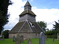
 Pembridge bell tower - geograph.org.uk - 958245.jpg 640 × 480; 73 KB
-
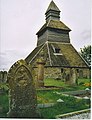
 Pembridge bell tower - geograph.org.uk - 958248.jpg 640 × 480; 78 KB
-
 Pembridge, Church Belfry. - geograph.org.uk - 150524.jpg 489 × 640; 111 KB
-
 St Leonard's church, Yarpole - geograph.org.uk - 532423.jpg 640 × 426; 351 KB
-
 Yarpole - the bell tower - geograph.org.uk - 822552.jpg 480 × 640; 120 KB
-
 Yarpole church - geograph.org.uk - 943524.jpg 640 × 480; 113 KB
-
 Yarpole church - geograph.org.uk - 943528.jpg 480 × 640; 81 KB
-
 Yarpole church bell tower - geograph.org.uk - 532424.jpg 426 × 640; 285 KB


