Category:Weerdesteyn
| Object location | | View all coordinates using: OpenStreetMap |
|---|
castle in the Netherlands  | |||||
| Upload media | |||||
| Instance of | |||||
|---|---|---|---|---|---|
| Location | Langbroek, Utrecht, Netherlands | ||||
| Has part(s) | |||||
| Heritage designation |
| ||||
 | |||||
Nederlands: Kasteel/Huis Weerdestein, Weerdesteyn, Werenstein, Weerenstein
|
This is a category about rijksmonumentcomplex number 530549
|
Ridderhofstede
|
This is a category about rijksmonument number 530550
|
Historische aanleg
|
This is a category about rijksmonument number 530551
|
Bijgebouw
|
This is a category about rijksmonument number 530552
|
Muren met poort
|
This is a category about rijksmonument number 530553
|
Boerderij
|
This is a category about rijksmonument number 530554
|
Hooiberg
|
This is a category about rijksmonument number 530555
|
| Address |
|
Media in category "Weerdesteyn"
The following 22 files are in this category, out of 22 total.
-

-
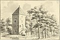
 HUA-202068-Gezicht op een kasteel met een hoge toren.jpg 2,107 × 1,454; 525 KB
-
-

-

-

-
 Kasteel Weerdesteyn Langbroek.jpg 5,217 × 3,478; 18.61 MB
-
 Kasteel Weerdesteyn op Landgoed Weerdesteyn.jpg 4,770 × 3,177; 3.74 MB
-
 Kasteel Weerdesteyn.jpg 4,770 × 3,177; 3.5 MB
-
 KasteelWeerdestein.JPG 2,592 × 1,944; 1.48 MB
-
 Langbroek - Weerdesteyn boerderij RM530554.JPG 4,317 × 2,900; 1.3 MB
-
 Langbroek - Weerdesteyn hooiberg RM530555.JPG 3,456 × 3,340; 1.62 MB
-
 Langbroek - Weerdesteyn keermuur RM530553.JPG 4,107 × 2,600; 1.47 MB
-
 Langbroek - Weerdesteyn parkaanleg RM530551.JPG 4,173 × 3,405; 1.77 MB
-
 Langbroek - Weerdesteyn poort RM530553.JPG 3,306 × 4,470; 1.65 MB
-
 Langbroek - Weerdesteyn poortgebouw RM530552.JPG 2,730 × 4,608; 1.71 MB
-
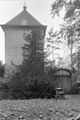
 Langbroek - Weerdesteyn woontoren RM530550.JPG 2,946 × 4,590; 1.7 MB
-

-
 Weerdesteyn (4).JPG 2,000 × 3,008; 1.9 MB
-
 Weerenstein, Poortgebouw - Neerlangbroek - 20163028 - RCE.jpg 802 × 1,200; 270 KB
-
 Werenstein, Toren met poort - Neerlangbroek - 20163027 - RCE.jpg 802 × 1,200; 219 KB
-
 Werenstein, Woontoren - Neerlangbroek - 20163029 - RCE.jpg 810 × 1,200; 307 KB


.JPG)


