Category:Wegkreuz (Haldenstrasse / Höhenweg, Untersiggenthal)
| Object location | | View all coordinates using: OpenStreetMap |
|---|
| NO WIKIDATA ID FOUND! Search for Wegkreuz (Haldenstrasse / Höhenweg, Untersiggenthal) on Wikidata | |
| Upload media |
Media in category "Wegkreuz (Haldenstrasse / Höhenweg, Untersiggenthal)"
This category contains only the following file.
-
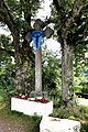 S`blaue Chrüz - panoramio.jpg 2,123 × 3,184; 2.55 MB
