Category:Weil (Upper Bavaria)
Upper Bavarian municipality in the rural district of Landsberg am Lech    | |||||
| Upload media | |||||
| Instance of |
| ||||
|---|---|---|---|---|---|
| Part of |
| ||||
| Location | Landsberg am Lech, Upper Bavaria, Bavaria, Germany | ||||
| Head of government |
| ||||
| Population |
| ||||
| Area |
| ||||
| Elevation above sea level |
| ||||
| Different from | |||||
| official website | |||||
 | |||||
Subcategories
This category has the following 4 subcategories, out of 4 total.
B
D
Media in category "Weil (Upper Bavaria)"
The following 7 files are in this category, out of 7 total.
-
 DEU Weil COA.svg 512 × 654; 2 KB
-
 Wappen von Weil.png 240 × 253; 11 KB
-
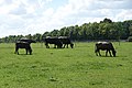 Büffelhof Beuerbach 1.jpg 5,472 × 3,648; 8.92 MB
-
 Büffelhof Beuerbach 2.jpg 5,472 × 3,648; 8.94 MB
-
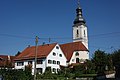 Geretshausen.jpg 5,472 × 3,648; 6.25 MB
-
 Pestenacker, Gasthof Zur Post.jpg 2,560 × 1,920; 2.73 MB
-
 Weil in LL.svg 440 × 608; 1.05 MB


