Category:Welhambridge
English: Welhambridge is a hamlet in the East Riding of Yorkshire, England. It is situated approximately 3 miles (4.8 km) south west of the village of Holme-on-Spalding-Moor and 4 miles (6.4 km) north east of the market town of Howden. It lies around the A614 road bridge over the River Foulness.
hamlet in the East Riding of Yorkshire, England, United Kingdom .jpg) | |||||
| Upload media | |||||
| Instance of | |||||
|---|---|---|---|---|---|
| Location |
| ||||
 | |||||
Media in category "Welhambridge"
The following 8 files are in this category, out of 8 total.
-
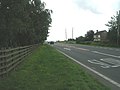 A614 towards Howden (geograph 2024000).jpg 640 × 480; 54 KB
-
 An Electricity Sub-Station - geograph.org.uk - 217705.jpg 640 × 480; 97 KB
-
 Awaiting Collection - geograph.org.uk - 218476.jpg 640 × 480; 98 KB
-
 Field at Arglam - geograph.org.uk - 234180.jpg 426 × 640; 117 KB
-
 Shed on Arglam Lane - geograph.org.uk - 177967.jpg 640 × 480; 91 KB
-
 Sluggish Water - geograph.org.uk - 218611.jpg 640 × 480; 96 KB
-
 The Half Hidden Farm - geograph.org.uk - 218478.jpg 640 × 480; 95 KB
-
 The River Foulness - geograph.org.uk - 218609.jpg 640 × 480; 96 KB


