Category:Welsh Newton
village and civil parish in Herefordshire, United Kingdom  | |||||
| Upload media | |||||
| Instance of | |||||
|---|---|---|---|---|---|
| Location | Herefordshire, West Midlands, England | ||||
 | |||||
Cymraeg: Pentref yn Swydd Henffordd, Gorllewin Canolbarth Lloegr, Lloegr ydy Welsh Newton. (→Welsh Newton)
English: Welsh Newton is a small village and civil parish in the county of Herefordshire, England. It is located close to the border with Wales to which the parish extends towards Monmouthshire. (→Welsh Newton)
Polski: Welsh Newton – wieś w Anglii, w hrabstwie Herefordshire. Leży 23 km na południe od miasta Hereford i 184 km na zachód od Londynu. (→Welsh Newton)

Subcategories
This category has the following 2 subcategories, out of 2 total.
M
Media in category "Welsh Newton"
The following 146 files are in this category, out of 146 total.
-

-

-
 A466 looking north - geograph.org.uk - 2939621.jpg 640 × 480; 55 KB
-

-

-
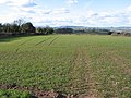
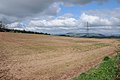 Arable field near Welsh Newton - geograph.org.uk - 3437405.jpg 1,024 × 680; 176 KB
-
 Arable land north of Gwenherrion Cross - geograph.org.uk - 5268799.jpg 1,600 × 901; 700 KB
-
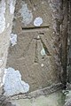 Benchmark, Welsh Newton church - geograph.org.uk - 3667187.jpg 680 × 1,024; 184 KB
-
 Benchmark, Welsh Newton church - geograph.org.uk - 3667189.jpg 680 × 1,024; 213 KB
-
 Buckholt Wood - geograph.org.uk - 3426123.jpg 1,024 × 769; 141 KB
-
 Bus shelter at Welsh Newton - geograph.org.uk - 931754.jpg 640 × 426; 84 KB
-
 Cereal crop - geograph.org.uk - 1315152.jpg 640 × 480; 233 KB
-
 Cereal land - geograph.org.uk - 1315136.jpg 640 × 480; 244 KB
-
 Churchyard compost heap, Welsh Newton - geograph.org.uk - 2779325.jpg 640 × 522; 106 KB
-
 Churchyard cross, Welsh Newton - geograph.org.uk - 5020312.jpg 2,160 × 3,248; 2.55 MB
-
 Churchyard cross, Welsh Newton - geograph.org.uk - 5020316.jpg 2,160 × 3,248; 1.54 MB
-
 Churchyard path, Welsh Newton - geograph.org.uk - 6006918.jpg 1,024 × 768; 298 KB
-
 Common Road - geograph.org.uk - 4252012.jpg 800 × 451; 329 KB
-
 Common Road - geograph.org.uk - 4252013.jpg 800 × 451; 304 KB
-

-
 Cow Parsley and Buttercup - geograph.org.uk - 1315158.jpg 640 × 480; 284 KB
-
 Cross and burial place of St. John Kemble (geograph 6006916).jpg 768 × 1,024; 176 KB
-
-
 Distances from Welsh Newton - geograph.org.uk - 4300430.jpg 800 × 554; 144 KB
-
 Edge of a cereal field - geograph.org.uk - 1315173.jpg 640 × 480; 247 KB
-
 Edge of Yew tree Wood - geograph.org.uk - 4252015.jpg 800 × 451; 206 KB
-
 Electricity pylon - geograph.org.uk - 3437435.jpg 680 × 1,024; 137 KB
-
 Electricity pylons and farmland - geograph.org.uk - 3437423.jpg 1,024 × 680; 127 KB
-
-

-
-
 Field and hedge line view from Llancrwn Triangulation Pillar - geograph.org.uk - 5202852.jpg 4,000 × 3,000; 3.36 MB
-
 Footpath from Common Road - geograph.org.uk - 4252023.jpg 800 × 451; 192 KB
-
 Footpath sign and fields - geograph.org.uk - 6029241.jpg 1,024 × 768; 296 KB
-
 Garage yard, Welsh Newton - geograph.org.uk - 2779144.jpg 575 × 640; 67 KB
-
 Grass and pylons - geograph.org.uk - 1315138.jpg 640 × 480; 212 KB
-
 Grass field and road junction, Welsh Newton - geograph.org.uk - 5903586.jpg 1,024 × 768; 157 KB
-
 Grassland at The Pleck - geograph.org.uk - 1315148.jpg 640 × 480; 247 KB
-
 Grave of St John Kemble, Welsh Newton - geograph.org.uk - 2779357.jpg 640 × 480; 128 KB
-
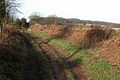
 Green lane and bridleway - geograph.org.uk - 4252019.jpg 800 × 451; 191 KB
-
 Green lane to Welsh Newton - geograph.org.uk - 1204786.jpg 426 × 640; 99 KB
-
 Grit box near Pembridge Castle - geograph.org.uk - 3729973.jpg 800 × 581; 129 KB
-

-

-
 Interior of Welsh Newton church - geograph.org.uk - 3667181.jpg 1,024 × 680; 177 KB
-
 Junction of tracks near The Pleck - geograph.org.uk - 5202860.jpg 4,000 × 3,000; 3.96 MB
-
 Lane by the Llanerch Brook - geograph.org.uk - 1315141.jpg 640 × 480; 270 KB
-
 Lane north-east of Welsh Newton - geograph.org.uk - 1399860.jpg 640 × 480; 240 KB
-
 Llamas in the mist, Welsh Newton - geograph.org.uk - 4300373.jpg 800 × 504; 97 KB
-
 Mally Brook, Welsh Newton - geograph.org.uk - 2779487.jpg 640 × 480; 132 KB
-
 Mallybrook Bungalows, Welsh Newton - geograph.org.uk - 2779164.jpg 640 × 442; 89 KB
-
 Mallybrook Farm, Welsh Newton - geograph.org.uk - 2779167.jpg 640 × 486; 70 KB
-
-

-
 NE boundary of Welsh Newton - geograph.org.uk - 2779183.jpg 640 × 480; 76 KB
-

-
 Northern side of Welsh Newton - geograph.org.uk - 2779133.jpg 640 × 350; 46 KB
-

-
 Outline of a fish, Welsh Newton church - geograph.org.uk - 3667179.jpg 1,024 × 680; 259 KB
-
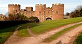
 Pembridge Castle - geograph.org.uk - 3448038.jpg 1,024 × 680; 198 KB
-
 Pembridge Castle - geograph.org.uk - 3729837.jpg 800 × 432; 86 KB
-
 Pembridge Castle - geograph.org.uk - 6002143.jpg 1,024 × 768; 202 KB
-
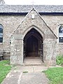 Porch, St Mary the Virgin, Welsh Newton - geograph.org.uk - 6334491.jpg 3,000 × 4,000; 2.22 MB
-
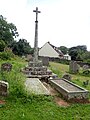
 Preaching cross, Welsh Newton - geograph.org.uk - 2779348.jpg 640 × 480; 110 KB
-
 Preaching Cross, Welsh Newton - geograph.org.uk - 6333532.jpg 3,000 × 4,000; 2.32 MB
-
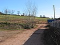
 Private farm track - geograph.org.uk - 1404200.jpg 640 × 480; 233 KB
-
 Recycling area, Welsh Newton - geograph.org.uk - 2779110.jpg 640 × 476; 70 KB
-
 Road junction at Welsh Newton Common - geograph.org.uk - 5202854.jpg 4,000 × 3,000; 4.45 MB
-

-
-

-

-
 Southern boundary of Llancloudy - geograph.org.uk - 4300668.jpg 800 × 610; 140 KB
-
 St Faiths Church Welsh Newton Common - geograph.org.uk - 4333063.jpg 848 × 512; 361 KB
-
 St Mary Church at Welsh Newton - geograph.org.uk - 4329283.jpg 752 × 480; 234 KB
-
 St Mary the Virgin, Welsh Newton - geograph.org.uk - 6333520.jpg 4,000 × 3,000; 2.53 MB
-
 St Mary the Virgin, Welsh Newton - geograph.org.uk - 6334486.jpg 4,000 × 3,000; 2.55 MB
-
 St Mary, Welsh Newton - geograph.org.uk - 5019711.jpg 3,248 × 2,160; 2.39 MB
-
 St Mary, Welsh Newton - geograph.org.uk - 5019744.jpg 3,248 × 2,160; 2.12 MB
-
 St Mary, Welsh Newton - geograph.org.uk - 5020126.jpg 3,248 × 2,160; 3.07 MB
-
 St Mary, Welsh Newton - geograph.org.uk - 5020276.jpg 3,248 × 2,160; 2.18 MB
-
 St Mary, Welsh Newton - geograph.org.uk - 5021009.jpg 3,248 × 2,160; 1.41 MB
-
 St Mary, Welsh Newton - geograph.org.uk - 5021842.jpg 3,248 × 2,160; 1.47 MB
-
 St Mary, Welsh Newton - geograph.org.uk - 5021871.jpg 3,279 × 2,180; 1.28 MB
-
 St Mary, Welsh Newton - geograph.org.uk - 5022277.jpg 3,273 × 2,175; 1.64 MB
-
 St Mary, Welsh Newton - geograph.org.uk - 5022278.jpg 2,160 × 3,248; 1.56 MB
-
 St Mary, Welsh Newton - geograph.org.uk - 5023906.jpg 2,160 × 3,248; 1.72 MB
-
 St Mary, Welsh Newton - geograph.org.uk - 5023954.jpg 2,353 × 3,262; 2.08 MB
-
 St Mary, Welsh Newton - geograph.org.uk - 5024140.jpg 3,277 × 2,179; 1.67 MB
-
 St Mary, Welsh Newton - geograph.org.uk - 5024141.jpg 3,251 × 2,161; 2.06 MB
-
 St.Mary's, Welsh Newton, interior - geograph.org.uk - 6006912.jpg 1,024 × 768; 169 KB
-
 Stained glass window at St Mary the Virgin, Welsh Newton - geograph.org.uk - 6334488.jpg 3,000 × 4,000; 2.24 MB
-
 Stained glass window, Welsh Newton church - geograph.org.uk - 3667195.jpg 680 × 1,024; 195 KB
-
 Stained glass window, Welsh Newton church - geograph.org.uk - 3667198.jpg 680 × 1,024; 177 KB
-
 Stained glass window, Welsh Newton church - geograph.org.uk - 3667199.jpg 680 × 1,024; 174 KB
-
 Start of the 40 zone in Welsh Newton - geograph.org.uk - 4300405.jpg 800 × 600; 164 KB
-
 Telephone box and lanes-meet - geograph.org.uk - 1404213.jpg 640 × 480; 239 KB
-
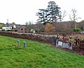
 The church and churchyard, Welsh Newton - geograph.org.uk - 5903589.jpg 1,024 × 768; 189 KB
-
 The Church of St Mary at Welsh Newton - geograph.org.uk - 5202855.jpg 4,000 × 3,000; 3 MB
-
 The churchyard, Welsh Newton - geograph.org.uk - 6006906.jpg 1,024 × 768; 231 KB
-
-
 The Monnow valley 1 - geograph.org.uk - 1315188.jpg 640 × 480; 253 KB
-
 The nave of Welsh Newton church - geograph.org.uk - 3667183.jpg 680 × 1,024; 160 KB
-
 The Old Post Office, Welsh Newton - geograph.org.uk - 2779149.jpg 640 × 554; 111 KB
-
 The Old Rectory, Welsh Newton - geograph.org.uk - 2779159.jpg 640 × 480; 111 KB
-
 The Pleck - geograph.org.uk - 1315146.jpg 640 × 480; 232 KB
-
-
 Three oaks and rape crop - geograph.org.uk - 5268800.jpg 1,600 × 1,600; 1.07 MB
-
 Through the South door .... - geograph.org.uk - 5020336.jpg 2,192 × 3,298; 1.8 MB
-
 Towards Llancloudy from Welsh Newton - geograph.org.uk - 4300596.jpg 800 × 546; 85 KB
-
 Track and footpath off the A466 - geograph.org.uk - 3664012.jpg 680 × 1,024; 309 KB
-
 Track into fields - geograph.org.uk - 1404116.jpg 640 × 480; 247 KB
-

-
 Tractor by a hillside in Welsh Newton - geograph.org.uk - 714826.jpg 640 × 480; 202 KB
-
 Triangulation pillar at Llancrwn - geograph.org.uk - 2741051.jpg 1,024 × 657; 134 KB
-
 Tumbledown barn - geograph.org.uk - 1404140.jpg 640 × 481; 244 KB
-
 View across the Monnow Valley - geograph.org.uk - 5907356.jpg 1,024 × 768; 182 KB
-
 View from Little Hall - geograph.org.uk - 2141559.jpg 640 × 480; 69 KB
-
 View north from the B4521 - geograph.org.uk - 1309457.jpg 640 × 480; 236 KB
-
 View to St. Wolstan's Wood - geograph.org.uk - 1404156.jpg 640 × 480; 259 KB
-
 Welsh Newton boundary sign - geograph.org.uk - 4300337.jpg 800 × 533; 111 KB
-
 Welsh Newton bus shelter - geograph.org.uk - 2779437.jpg 640 × 409; 64 KB
-
 Welsh Newton bus shelter - geograph.org.uk - 3426109.jpg 769 × 1,024; 275 KB
-
 Welsh Newton church - geograph.org.uk - 3667173.jpg 1,024 × 680; 212 KB
-
 St. Faith's church, Welsh Newton - geograph.org.uk - 1404168.jpg 640 × 480; 251 KB
-
 St. Faith's church, Welsh Newton - geograph.org.uk - 1404171.jpg 640 × 480; 271 KB
-
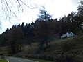
 Welsh Newton Common - geograph.org.uk - 3308835.jpg 1,600 × 1,200; 987 KB
-
 Welsh Newton Common Post Office - geograph.org.uk - 1404180.jpg 640 × 480; 264 KB
-
 Welsh Newton village boundary sign - geograph.org.uk - 2939619.jpg 640 × 480; 78 KB
-
 Welsh Newton War Memorial - geograph.org.uk - 2779220.jpg 640 × 491; 79 KB
-
-
 Wires over the road near Welsh Newton - geograph.org.uk - 3729968.jpg 800 × 600; 163 KB
-
 Arable land in South Herefordshire - geograph.org.uk - 1404123.jpg 640 × 480; 236 KB
-
 Beef cattle at St. Wulstan's Farm - geograph.org.uk - 1404207.jpg 640 × 480; 243 KB
-
 Bridleway to Monmouth - geograph.org.uk - 1404193.jpg 640 × 480; 251 KB
-
 Country road towards Welsh Newton - geograph.org.uk - 714684.jpg 640 × 480; 114 KB
-
 Farmland near Pembridge Castle - geograph.org.uk - 714690.jpg 640 × 480; 151 KB
-
 Farmland near Pembridge Castle - geograph.org.uk - 714696.jpg 640 × 480; 96 KB
-
 Farmland north of Welsh Newton - geograph.org.uk - 714839.jpg 640 × 480; 166 KB
-
 Field of barley - geograph.org.uk - 1404221.jpg 640 × 480; 224 KB
-
-
-
 Gwenherrion Farm - geograph.org.uk - 1404147.jpg 640 × 480; 200 KB
-
 Gwenherrion Farm, Welsh Newton - geograph.org.uk - 110709.jpg 640 × 426; 145 KB
-
 Jacob sheep on a farm at Welsh Newton - geograph.org.uk - 110710.jpg 640 × 426; 105 KB
-
 St Wulstan's Farm, Welsh Newton - geograph.org.uk - 110706.jpg 640 × 426; 112 KB


.jpg)


.jpg)


