Category:West Acre
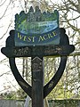
English: West Acre is a village in the King's Lynn and West Norfolk district of the county of Norfolk, England.
village and civil parish in Norfolk, United Kingdom .jpg) | |||||
| Upload media | |||||
| Instance of | |||||
|---|---|---|---|---|---|
| Location | King's Lynn and West Norfolk, Norfolk, East of England, England | ||||
| Area |
| ||||
 | |||||
Subcategories
This category has the following 9 subcategories, out of 9 total.
A
F
- Footpaths in West Acre (2 F)
H
- High House, West Acre (2 F)
W
- West Acre Ford (8 F)
- Westacre Theatre (2 F)
Media in category "West Acre"
The following 200 files are in this category, out of 270 total.
(previous page) (next page)-

-
 A dragon in Heater Plantation near West Acre - geograph.org.uk - 3992500.jpg 4,320 × 3,240; 5.79 MB
-
 A rabbit's eye view of Norfolk farmland - geograph.org.uk - 3420295.jpg 4,320 × 3,240; 5.83 MB
-
 Abbey Farm, West Acre - geograph.org.uk - 5547150.jpg 4,608 × 3,072; 1.78 MB
-
 All Saints Church Notice Board - geograph.org.uk - 5547083.jpg 2,667 × 4,000; 4.91 MB
-

-
 All Saints Church, West Acre - geograph.org.uk - 5547079.jpg 4,608 × 3,072; 1.81 MB
-
 All Saints Church, West Acre - geograph.org.uk - 5547088.jpg 4,608 × 3,072; 1.83 MB
-
 All Saints Church, West Acre - geograph.org.uk - 5547112.jpg 4,608 × 3,072; 1.95 MB
-
 All Saints Church, Westacre - geograph.org.uk - 5333455.jpg 1,600 × 1,067; 651 KB
-
 All Saints Church, Westacre - geograph.org.uk - 5333457.jpg 1,600 × 1,067; 586 KB
-
 Approaching a ford on the River Nar - geograph.org.uk - 1812380.jpg 640 × 480; 144 KB
-
 Approaching Church Green in West Acre - geograph.org.uk - 1810980.jpg 480 × 640; 110 KB
-
 Approaching West Acre on River Road - geograph.org.uk - 1810940.jpg 640 × 480; 128 KB
-

-
 Archaeological dig - geograph.org.uk - 2208345.jpg 640 × 412; 100 KB
-
 Arks but no pigs - geograph.org.uk - 3992434.jpg 4,320 × 3,240; 5.54 MB
-
 Barn conversion in River Road, West Acre - geograph.org.uk - 1810950.jpg 640 × 450; 126 KB
-
 Barn Owl West Acre 1.jpg 4,961 × 3,508; 1.07 MB
-
 Barn Owl West Acre 2.jpg 3,485 × 3,436; 4.21 MB
-
 Between West Acre and Castle Acre - geograph.org.uk - 3962095.jpg 4,320 × 3,240; 6.03 MB
-
 Bird and snake sanctuary - sign - geograph.org.uk - 1812319.jpg 480 × 640; 136 KB
-

-
 Blakeneyhill Plantation - geograph.org.uk - 687058.jpg 640 × 480; 90 KB
-
 Bridge over ditch north of the River Nar - geograph.org.uk - 1812422.jpg 640 × 480; 183 KB
-
 Bridge over the River Nar - geograph.org.uk - 1810945.jpg 640 × 480; 150 KB
-
 Bus shelter on the West Acre to East Walton road - geograph.org.uk - 6169347.jpg 3,456 × 2,592; 3.88 MB
-
 Cattle yard near Soigne Farm, West Acre, Norfolk - geograph.org.uk - 2891005.jpg 4,320 × 3,240; 5.38 MB
-
 Church Green sign - geograph.org.uk - 5547108.jpg 4,608 × 3,072; 1.92 MB
-
 Church Green, West Acre - geograph.org.uk - 5546929.jpg 4,608 × 3,072; 1.99 MB
-
 Church Green, West Acre - geograph.org.uk - 5546935.jpg 4,608 × 3,072; 1.95 MB
-
 Church Green, West Acre - geograph.org.uk - 5547104.jpg 4,608 × 3,072; 2.03 MB
-
 Cottages near West Acre - geograph.org.uk - 589454.jpg 640 × 480; 146 KB
-
 Cottages on Church Green, West Acre - geograph.org.uk - 1810988.jpg 640 × 470; 115 KB
-

-
 Deciduous trees growing beside a drain - geograph.org.uk - 1812274.jpg 640 × 480; 160 KB
-
 Distant cottages at the end of the lane - geograph.org.uk - 2891030.jpg 4,320 × 3,240; 5.55 MB
-

-
 Driveway to Abbey Farm - geograph.org.uk - 1811049.jpg 480 × 640; 116 KB
-
 Driveway to Home Farm near West Acre, Norfolk - geograph.org.uk - 2890968.jpg 4,320 × 3,240; 5.94 MB
-
 Electricity Pylons off Narford Road - geograph.org.uk - 5547203.jpg 2,667 × 4,000; 2.92 MB
-
 Entering West Acre on Greenhill Road - geograph.org.uk - 5546198.jpg 2,667 × 4,000; 6.39 MB
-
 Entering West Acre on River Road - geograph.org.uk - 5544340.jpg 4,608 × 3,072; 1.82 MB
-
 Entering West Acre on River Road - geograph.org.uk - 5545804.jpg 4,608 × 3,072; 1.81 MB
-

-
 Farm track and pylon, near West Acre - geograph.org.uk - 5981915.jpg 1,600 × 1,200; 971 KB
-
 Farm track crossing the Nar Valley Way - geograph.org.uk - 1812449.jpg 640 × 480; 175 KB
-
 Farm track leading to River Nar, west of Castle Acre - geograph.org.uk - 5981901.jpg 4,573 × 3,430; 5.2 MB
-

-
 Field with emerging crop - geograph.org.uk - 4226058.jpg 1,500 × 801; 980 KB
-

-
 Footbridge and ford crossing The River Nar near West Acre - geograph.org.uk - 3769588.jpg 4,320 × 3,240; 5.95 MB
-
 Footbridge over ford on the River Nar - geograph.org.uk - 1812328.jpg 640 × 480; 187 KB
-
 Footbridge over the River Nar - geograph.org.uk - 1812381.jpg 640 × 480; 189 KB
-
 Footpath to Fulmer Lane - geograph.org.uk - 5545644.jpg 3,914 × 2,668; 6.81 MB
-
 Ford off Narford Road - geograph.org.uk - 5546360.jpg 4,608 × 3,072; 1.89 MB
-
 Ford on R Nar at West Acre, Norfolk - geograph.org.uk - 5621262.jpg 5,184 × 2,920; 6.25 MB
-
 Ford on road north from South Acre - geograph.org.uk - 2765606.jpg 3,264 × 2,448; 4.5 MB
-
 Ford on the Nar Valley Way - geograph.org.uk - 2765594.jpg 3,264 × 2,448; 2.83 MB
-
 Ford on the River Nar - geograph.org.uk - 1812337.jpg 640 × 480; 142 KB
-
 Ford on the River Nar - geograph.org.uk - 1812338.jpg 640 × 480; 149 KB
-
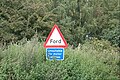 Ford sign off Narford Road - geograph.org.uk - 5546350.jpg 3,827 × 2,548; 6.82 MB
-
 Ford through drainage ditch - geograph.org.uk - 1812352.jpg 640 × 480; 182 KB
-
 Gate on the Nar Valley Way - geograph.org.uk - 1812227.jpg 640 × 480; 148 KB
-

-
 Gateway to parkland around High House, West Acre - geograph.org.uk - 2891053.jpg 4,320 × 3,240; 5.91 MB
-
 Grazing sheep near High House, West Acre - geograph.org.uk - 3420276.jpg 4,320 × 3,240; 6 MB
-
 Greenhill Road sign - geograph.org.uk - 5546508.jpg 4,608 × 3,072; 1.94 MB
-
 Greenhill Road, West Acre - geograph.org.uk - 5546499.jpg 4,608 × 3,072; 1.85 MB
-
 Greenhill Road, West Acre - geograph.org.uk - 5546505.jpg 4,608 × 3,072; 1.99 MB
-
 Greenhill Road, West Acre - geograph.org.uk - 5547111.jpg 4,608 × 3,072; 2.02 MB
-
 Greenhill Road, West Acre - geograph.org.uk - 5981909.jpg 1,600 × 1,200; 1.11 MB
-
 High level water tank near West Acre - geograph.org.uk - 3993060.jpg 4,070 × 2,872; 5.09 MB
-
 Industrial pig farming - geograph.org.uk - 754449.jpg 640 × 480; 67 KB
-
 Lake south-east of Mill House, West Acre - geograph.org.uk - 1813205.jpg 640 × 480; 166 KB
-
 Lakeside picnic area between West Acre and South Acre - geograph.org.uk - 3770463.jpg 4,320 × 3,240; 6.05 MB
-
 LEAVE ONLY FOOTPRINTS TAKE ONLY MEMORIES - geograph.org.uk - 3770453.jpg 4,320 × 3,240; 5.52 MB
-
 Llamas at West Acre - geograph.org.uk - 4682865.jpg 1,920 × 1,440; 894 KB
-
 Looking northwest to West Acre - geograph.org.uk - 604799.jpg 600 × 450; 165 KB
-
 Looking west - geograph.org.uk - 754508.jpg 640 × 480; 84 KB
-

-
 Low Road, West Acre - geograph.org.uk - 5547091.jpg 4,608 × 3,072; 2.09 MB
-
 Mixed hedgerow near West Acre - geograph.org.uk - 3770476.jpg 4,320 × 3,240; 5.76 MB
-
 Narford Road, West Acre - geograph.org.uk - 5544271.jpg 4,608 × 3,072; 1.87 MB
-
 Narford Road, West Acre - geograph.org.uk - 5544579.jpg 4,000 × 2,427; 5.17 MB
-
 Narford Road, West Acre - geograph.org.uk - 5546328.jpg 4,608 × 3,072; 2.04 MB
-
 Narford Road, West Acre - geograph.org.uk - 5552346.jpg 4,608 × 3,072; 1.83 MB
-
 Narford Road, West Acre - geograph.org.uk - 5981906.jpg 1,600 × 1,200; 925 KB
-
 Narford Road. West Acre - geograph.org.uk - 5544549.jpg 4,608 × 3,072; 1.84 MB
-

-
 New housing in West Acre - geograph.org.uk - 1811039.jpg 640 × 480; 110 KB
-
 Next to Heater Plantation, West Acre - geograph.org.uk - 3992467.jpg 4,320 × 3,240; 6.02 MB
-
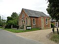 Old chapel, now part of Westacre Theatre - geograph.org.uk - 6169348.jpg 3,456 × 2,592; 3.84 MB
-
 On the Nar Valley Way - geograph.org.uk - 1812276.jpg 480 × 640; 181 KB
-
 On the Nar Valley Way to Castle Acre - geograph.org.uk - 1812256.jpg 640 × 480; 199 KB
-
 On the side of Tumbley Hill, West Acre - geograph.org.uk - 3992448.jpg 4,320 × 3,240; 5.46 MB
-
 Over the hill and into the distance - geograph.org.uk - 687054.jpg 480 × 640; 52 KB
-
 Parallel lines in the barley - geograph.org.uk - 3992116.jpg 4,320 × 3,240; 5.21 MB
-
 Parallel lines in the wheat - geograph.org.uk - 3992138.jpg 4,320 × 3,240; 5.39 MB
-
 Pig fields - geograph.org.uk - 752802.jpg 640 × 480; 79 KB
-
 Post Office in Greenhill Road, West Acre - geograph.org.uk - 1811021.jpg 480 × 640; 153 KB
-
 Priory Barn - geograph.org.uk - 604775.jpg 600 × 450; 151 KB
-

-
 Priory remains in The Nar Valley - geograph.org.uk - 3769584.jpg 4,320 × 3,240; 5.5 MB
-
 Priory ruins on Abbey Farm, West Acre - geograph.org.uk - 1810966.jpg 640 × 480; 153 KB
-
 Pylon and track - geograph.org.uk - 754636.jpg 640 × 480; 102 KB
-
 Restricted Byway to Narford Road - geograph.org.uk - 5546146.jpg 4,608 × 3,072; 1.81 MB
-
 Restricted Byway to River Road - geograph.org.uk - 5544582.jpg 4,608 × 3,072; 2.1 MB
-
 River Nar off River Road - geograph.org.uk - 5547146.jpg 2,667 × 4,000; 7.06 MB
-
 River Nar off River Road - geograph.org.uk - 5547148.jpg 2,667 × 4,000; 6.07 MB
-
 River Nar off River Road - geograph.org.uk - 5548118.jpg 4,608 × 3,072; 1.76 MB
-
 River Road Bridge over the River Nar - geograph.org.uk - 5547215.jpg 4,608 × 3,072; 1.83 MB
-
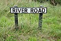 River Road sign - geograph.org.uk - 5545796.jpg 4,608 × 3,072; 1.97 MB
-
 River Road, West Acre - geograph.org.uk - 5544276.jpg 4,608 × 3,072; 1.76 MB
-
 River Road, West Acre - geograph.org.uk - 5544306.jpg 4,608 × 3,072; 1.92 MB
-
 River Road, West Acre - geograph.org.uk - 5544378.jpg 4,608 × 3,072; 1.81 MB
-
 River Road, West Acre - geograph.org.uk - 5544504.jpg 4,608 × 3,072; 1.87 MB
-
 River Road, West Acre - geograph.org.uk - 5544558.jpg 4,608 × 3,072; 1.86 MB
-
 River Road, West Acre - geograph.org.uk - 5544562.jpg 4,608 × 3,072; 1.79 MB
-
 River Road, West Acre - geograph.org.uk - 5545701.jpg 4,608 × 3,072; 1.81 MB
-
 River Road, West Acre - geograph.org.uk - 5545719.jpg 4,608 × 3,072; 1.83 MB
-
 River Road, West Acre - geograph.org.uk - 5547143.jpg 4,608 × 3,072; 1.78 MB
-
 River Studio, West Acre - geograph.org.uk - 5544516.jpg 4,608 × 3,072; 2.03 MB
-
 River Studio, West Acre - geograph.org.uk - 5544525.jpg 4,608 × 3,072; 1.82 MB
-
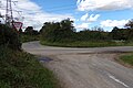
 Road between West Acre and Castle Acre - geograph.org.uk - 6169384.jpg 3,456 × 2,592; 1.78 MB
-
 Road between West Acre and East Walton - geograph.org.uk - 6169338.jpg 3,456 × 2,592; 2.1 MB
-
 Road to Swaffham from West Acre - geograph.org.uk - 6169369.jpg 3,456 × 2,592; 1.85 MB
-
 Roadsign on Narford Road - geograph.org.uk - 5544291.jpg 2,667 × 4,000; 4.24 MB
-
 Sandy Lane sign - geograph.org.uk - 5544362.jpg 4,608 × 3,072; 1.66 MB
-
 Sandy Lane sign - geograph.org.uk - 5546942.jpg 4,608 × 3,072; 1.99 MB
-
 Sandy Lane, West Acre - geograph.org.uk - 5544357.jpg 4,608 × 3,072; 1.86 MB
-
 Sandy Lane, West Acre - geograph.org.uk - 5545706.jpg 4,608 × 3,072; 1.79 MB
-
 Sandy Lane, West Acre - geograph.org.uk - 5546939.jpg 4,608 × 3,072; 1.81 MB
-
 Shades of dark green in Norfolk - geograph.org.uk - 3992147.jpg 4,320 × 3,240; 5.48 MB
-
 Shades of green in Norfolk - geograph.org.uk - 3992080.jpg 4,320 × 3,240; 5.9 MB
-

-
 Sheep in the grounds of High House, West Acre - geograph.org.uk - 2891088.jpg 4,320 × 3,240; 5.98 MB
-
 Sign to West Acre Gardens and Home Farm - geograph.org.uk - 2890946.jpg 4,320 × 3,240; 5.99 MB
-
 Signpost on the B1153 - geograph.org.uk - 5545724.jpg 2,565 × 3,861; 4.53 MB
-
 Signpost on the B1153 - geograph.org.uk - 5545809.jpg 2,667 × 4,000; 6.82 MB
-
 Spring green - geograph.org.uk - 778146.jpg 480 × 640; 119 KB
-

-
 Thatched Bus Shelter - geograph.org.uk - 454380.jpg 640 × 480; 108 KB
-
 The B1153 at West Acre - geograph.org.uk - 5545790.jpg 4,608 × 3,072; 2.08 MB
-
 The B1153 at West Acre - geograph.org.uk - 5545792.jpg 4,608 × 3,072; 1.92 MB
-
 The B1153 at West Acre - geograph.org.uk - 5546468.jpg 4,608 × 3,072; 1.85 MB
-
 The B1153 at West Acre - geograph.org.uk - 5546496.jpg 4,608 × 3,072; 1.83 MB
-

-

-

-
 The in-church War Memorial plaques at West Acre - geograph.org.uk - 4590429.jpg 3,456 × 2,592; 3.55 MB
-

-
 The Nar Valley south of West Acre - geograph.org.uk - 1810975.jpg 640 × 538; 181 KB
-
 The Nar Valley Way through Mill Covert - geograph.org.uk - 1812428.jpg 640 × 480; 217 KB
-

-
 The Post Office in West Acre - geograph.org.uk - 1811017.jpg 640 × 480; 109 KB
-
-
 The River Nar south of West Acre - geograph.org.uk - 1810948.jpg 480 × 640; 178 KB
-

-
 The road to West Acre - geograph.org.uk - 6169368.jpg 3,456 × 2,592; 2.13 MB
-
 The sign of the West Acre Stag public house - geograph.org.uk - 6169351.jpg 3,456 × 2,592; 2.43 MB
-
-

-
 The War Memorial at West Acre - geograph.org.uk - 4590414.jpg 3,456 × 2,592; 3.88 MB
-

-
 The West Acre Theatre (detail) - geograph.org.uk - 1810958.jpg 480 × 640; 161 KB
-
 The West Acre Theatre - geograph.org.uk - 1810954.jpg 640 × 480; 123 KB
-
 The West Acre Theatre - geograph.org.uk - 1810960.jpg 640 × 480; 128 KB
-
 The West Acre Theatre - geograph.org.uk - 2466303.jpg 640 × 481; 68 KB
-
 This little piggy went to market - geograph.org.uk - 3992411.jpg 4,320 × 3,240; 5.9 MB
-
 This way to West Acre - geograph.org.uk - 1812388.jpg 640 × 480; 175 KB
-
 Three Sisters - geograph.org.uk - 778128.jpg 640 × 480; 84 KB
-
 Through the barn - geograph.org.uk - 754474.jpg 640 × 480; 45 KB
-
 Timber stack and track to Broom Covert - geograph.org.uk - 5981943.jpg 1,600 × 1,200; 711 KB
-
 To Castle Acre on the Nar Valley Way - geograph.org.uk - 1812279.jpg 640 × 480; 183 KB
-
 To Castle Acre on the Nar Valley Way - geograph.org.uk - 1812435.jpg 640 × 480; 224 KB
-
 To Soigne Farm - geograph.org.uk - 873636.jpg 480 × 640; 82 KB
-
 To West Acre on the Nar Valley way - geograph.org.uk - 1812297.jpg 640 × 480; 140 KB
-
 To West Acre on the Nar Valley way - geograph.org.uk - 1812461.jpg 640 × 480; 222 KB
-
 To West Acre through Mill Covert - geograph.org.uk - 1812438.jpg 640 × 480; 217 KB
-
 Track down Tumbley Hill near West Acre - geograph.org.uk - 3770468.jpg 4,320 × 3,240; 5.76 MB
-
 Track off Narford Road - geograph.org.uk - 5546341.jpg 4,608 × 3,072; 2.01 MB
-
 Track to Big Wood - geograph.org.uk - 3962068.jpg 4,320 × 3,240; 5.58 MB
-
 Track to Mill House - geograph.org.uk - 1812264.jpg 640 × 480; 174 KB
-

-
 Tree surgeon's business premises - geograph.org.uk - 6169334.jpg 3,057 × 2,415; 1.67 MB
-
 Trees and track - geograph.org.uk - 754526.jpg 480 × 640; 99 KB
-
 Tumbeyhill Road, West Acre - geograph.org.uk - 5546423.jpg 4,608 × 3,072; 1.91 MB
-
 Tumbley Hill Road near West Acre Gardens - geograph.org.uk - 2890959.jpg 4,320 × 3,240; 5.63 MB
-
 Tumbleyhill Road sign - geograph.org.uk - 5545807.jpg 4,608 × 3,072; 1.89 MB
-
 UK WestAcre.jpg 788 × 1,678; 329 KB
-
 Unequal dancing partners - geograph.org.uk - 604787.jpg 450 × 600; 142 KB
-
 Unnamed lane past Mill House, West Acre - geograph.org.uk - 1813201.jpg 640 × 480; 151 KB
-

-
 View across the bird and snake sanctuary - geograph.org.uk - 1812323.jpg 640 × 480; 174 KB
-

-

-
 View south-west along unnamed rural lane - geograph.org.uk - 1812373.jpg 640 × 449; 144 KB
-
 Walkers along a restricted byway - geograph.org.uk - 4226068.jpg 1,500 × 988; 2.03 MB
-
 Warren Farm, east of West Acre - geograph.org.uk - 1812359.jpg 640 × 480; 135 KB


_-_geograph.org.uk_-_1811032.jpg)


_-_geograph.org.uk_-_1810958.jpg)


