Category:West Bagborough
English: West Bagborough is a village and civil parish in Somerset, England, situated north of Taunton in the Taunton Deane district. The village has a population of 394.
village and civil parish in Somerset, England  | |||||
| Upload media | |||||
| Instance of | |||||
|---|---|---|---|---|---|
| Location | Somerset West and Taunton, Somerset, South West England, England | ||||
 | |||||
Subcategories
This category has the following 3 subcategories, out of 3 total.
H
W
- West Bagborough War Memorial (2 F)
Media in category "West Bagborough"
The following 181 files are in this category, out of 181 total.
-
 A choice of routes - geograph.org.uk - 5443541.jpg 6,000 × 4,000; 6.7 MB
-
 A tumulus on the skyline, Wills Neck - geograph.org.uk - 6085486.jpg 1,600 × 1,200; 759 KB
-
 Aisholt Common - geograph.org.uk - 4056223.jpg 1,024 × 768; 221 KB
-
 Approaching Wills Neck and trigpoint - geograph.org.uk - 2654166.jpg 4,320 × 2,432; 3.39 MB
-
 Arable land, Shopnoller - geograph.org.uk - 2885689.jpg 640 × 360; 227 KB
-
 Bagborough House - geograph.org.uk - 6114011.jpg 1,024 × 813; 175 KB
-
 Barn, Smokeham Farm - geograph.org.uk - 1188042.jpg 640 × 489; 122 KB
-
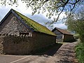 Barns at Hearn Farm (2) - geograph.org.uk - 1279673.jpg 640 × 480; 111 KB
-
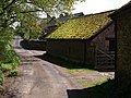 Barns at Hearn Farm - geograph.org.uk - 1279608.jpg 640 × 480; 110 KB
-
 Bashford Farm - geograph.org.uk - 5487930.jpg 6,000 × 4,000; 6.27 MB
-
 Bean field near East Combe - geograph.org.uk - 3514067.jpg 1,024 × 768; 171 KB
-
 Birches Corner - geograph.org.uk - 1140776.jpg 640 × 480; 122 KB
-
 Bracken covered top of Lydeard Hill - geograph.org.uk - 3710979.jpg 1,024 × 747; 352 KB
-
 Bridleway on Bagborough Hill - geograph.org.uk - 1188027.jpg 640 × 480; 146 KB
-
 Byway on the Quantocks Ridge - geograph.org.uk - 4056234.jpg 1,024 × 768; 308 KB
-
 Byway to Triscombe - geograph.org.uk - 4055933.jpg 1,024 × 768; 309 KB
-
 Cattle grid at Triscombe Stone car park - geograph.org.uk - 6085467.jpg 1,200 × 1,600; 1.01 MB
-
 Channel to Channel (420) - geograph.org.uk - 4468110.jpg 600 × 800; 187 KB
-
 Channel to Channel (421) - geograph.org.uk - 4468119.jpg 800 × 600; 174 KB
-
 Channel to Channel (422) - geograph.org.uk - 4468123.jpg 600 × 800; 184 KB
-
 Channel to Channel (423) - geograph.org.uk - 4468139.jpg 600 × 800; 121 KB
-
 Channel to Channel (424) - geograph.org.uk - 4468141.jpg 800 × 600; 183 KB
-
 Channel to Channel (425) - geograph.org.uk - 4468142.jpg 800 × 600; 134 KB
-
 Channel to Channel (426) - geograph.org.uk - 4468145.jpg 800 × 600; 150 KB
-
 Channel to Channel (427) - geograph.org.uk - 4468148.jpg 800 × 600; 124 KB
-
 Channel to Channel (428) - geograph.org.uk - 4468156.jpg 800 × 600; 154 KB
-
 Channel to Channel (429) - geograph.org.uk - 4468158.jpg 800 × 600; 129 KB
-
 Channel to Channel (430) - geograph.org.uk - 4468160.jpg 800 × 600; 151 KB
-
 Channel to Channel (431) - geograph.org.uk - 4468163.jpg 800 × 600; 184 KB
-
 Channel to Channel (432) - geograph.org.uk - 4468168.jpg 800 × 600; 173 KB
-
 Channel to Channel (433) - geograph.org.uk - 4468171.jpg 800 × 600; 157 KB
-
 Combe Florey , Field - geograph.org.uk - 6259024.jpg 6,000 × 4,000; 6.36 MB
-
 Combe Florey , Grassy Field - geograph.org.uk - 6259023.jpg 6,000 × 4,000; 6.65 MB
-
 Combe Florey , Grassy Field - geograph.org.uk - 6259025.jpg 6,000 × 4,000; 6.79 MB
-
 Combe Florey , Grassy Field - geograph.org.uk - 6259043.jpg 6,000 × 4,000; 7.44 MB
-
 Combe Florey , Grassy Field - geograph.org.uk - 6259044.jpg 6,000 × 4,000; 6.43 MB
-
 Common Lungwort, West Bagborough - geograph.org.uk - 1187613.jpg 640 × 462; 46 KB
-
 Cottage at London Cross - geograph.org.uk - 3708482.jpg 1,024 × 768; 158 KB
-
 Cottages, West Bagborough - geograph.org.uk - 6114055.jpg 1,024 × 798; 210 KB
-
 Diverging routes below Wills Neck - geograph.org.uk - 5444565.jpg 6,000 × 4,000; 7.51 MB
-
 Drove road along the Quantock Ridge - geograph.org.uk - 943482.jpg 640 × 480; 426 KB
-
 Farmland by West Bagborough - geograph.org.uk - 5487056.jpg 6,000 × 4,000; 5.18 MB
-
 Farmland through the woodland screen - geograph.org.uk - 5444432.jpg 6,000 × 4,000; 5.49 MB
-
 Fence corner on Lydeard Hill - geograph.org.uk - 5492725.jpg 6,000 × 4,000; 4.66 MB
-
 Footpath, Triscombe - geograph.org.uk - 1884668.jpg 640 × 480; 209 KB
-
 Footpath, Triscombe - geograph.org.uk - 1884675.jpg 640 × 480; 228 KB
-
 Green lane - geograph.org.uk - 231156.jpg 640 × 480; 96 KB
-
 Hillside above Smokeham Farm - geograph.org.uk - 5444009.jpg 6,000 × 4,000; 6.28 MB
-
 Hillside above West Bagborough - geograph.org.uk - 5487947.jpg 6,000 × 4,000; 5.95 MB
-
 Hillside below the car park - geograph.org.uk - 5492677.jpg 6,000 × 4,000; 4.41 MB
-
 Hillside near Triscombe - geograph.org.uk - 5444578.jpg 5,528 × 3,836; 5.25 MB
-
 Hillview Industrial Estate, West Bagborough - geograph.org.uk - 3709325.jpg 1,024 × 768; 198 KB
-
 Interloper in a field of sheep - geograph.org.uk - 5490547.jpg 6,000 × 4,000; 7.34 MB
-
 Junction of paths by Bagborough Plantation - geograph.org.uk - 6083290.jpg 1,600 × 1,200; 1.09 MB
-
 Junction of paths south of The Slades - geograph.org.uk - 6083297.jpg 1,600 × 1,200; 953 KB
-
 Kennel Lane - geograph.org.uk - 1279741.jpg 480 × 640; 133 KB
-
 Lane Near The Blue Ball Inn, Triscombe - geograph.org.uk - 1440433.jpg 640 × 480; 103 KB
-
 Lane past Hearn Farm - geograph.org.uk - 1279704.jpg 480 × 640; 120 KB
-
 Lane to Red Post (geograph 5990816).jpg 4,288 × 2,848; 2.3 MB
-
 Lane to Shopnoller - geograph.org.uk - 1187450.jpg 480 × 640; 108 KB
-
 Lane, Lower Aisholt - geograph.org.uk - 1187716.jpg 640 × 480; 107 KB
-
 Light Gate - geograph.org.uk - 4056232.jpg 1,024 × 768; 275 KB
-
 Lodge and gate, Triscombe House - geograph.org.uk - 3709653.jpg 1,024 × 768; 170 KB
-
 Looking north from Wills Neck - geograph.org.uk - 6085470.jpg 1,600 × 1,200; 721 KB
-

-
 Lydeard Hill (2) - geograph.org.uk - 1140784.jpg 640 × 480; 107 KB
-
 Lydeard Hill (3) - geograph.org.uk - 1140794.jpg 640 × 448; 80 KB
-
 Lydeard Hill (4) - geograph.org.uk - 1140801.jpg 640 × 460; 99 KB
-
 Lydeard Hill - geograph.org.uk - 1140777.jpg 640 × 480; 87 KB
-
 Lydeard Hill - geograph.org.uk - 5492732.jpg 6,000 × 4,000; 5.59 MB
-
 Lydeard Hill and Exmoor ponies - geograph.org.uk - 6083279.jpg 1,600 × 1,200; 957 KB
-
 Lydeard St Lawrence , Grassy Field - geograph.org.uk - 6259020.jpg 6,000 × 4,000; 6.74 MB
-
 Lydeard St Lawrence , Grassy Field - geograph.org.uk - 6259021.jpg 6,000 × 4,000; 7.29 MB
-
 Minor road to Bishop's Lydeard - geograph.org.uk - 3709378.jpg 768 × 1,024; 280 KB
-
 Mossy beeches, Muchcare - geograph.org.uk - 1187665.jpg 640 × 386; 98 KB
-
 New house, near Triscombe - geograph.org.uk - 3709677.jpg 1,024 × 768; 160 KB
-
 New Road - geograph.org.uk - 3710914.jpg 1,024 × 785; 171 KB
-
 Oak by the path near Stockham - geograph.org.uk - 1279722.jpg 640 × 466; 94 KB
-

-
 Pasture land on Lydeard Hill - geograph.org.uk - 3711164.jpg 1,024 × 768; 285 KB
-
 Path across the moorland on Lydeard Hill - geograph.org.uk - 6083277.jpg 1,600 × 1,200; 733 KB
-
 Path back to access land - geograph.org.uk - 5443609.jpg 6,000 × 4,000; 7.48 MB
-
 Path below Wills Neck - geograph.org.uk - 5444428.jpg 6,000 × 4,000; 7.06 MB
-
 Path crossroads, east of Wills Neck - geograph.org.uk - 4055985.jpg 1,024 × 775; 235 KB
-
 Path in Bagborough Plantation - geograph.org.uk - 5444001.jpg 6,000 × 4,000; 6.97 MB
-
 Path leading off Wills Neck - geograph.org.uk - 5443577.jpg 6,000 × 4,000; 5.82 MB
-
 Path on Lydeard Hill - geograph.org.uk - 1140809.jpg 640 × 480; 113 KB
-
 Path on Lydeard Hill - geograph.org.uk - 5492713.jpg 6,000 × 4,000; 4.82 MB
-
 Path to Will's Neck - geograph.org.uk - 5559712.jpg 3,456 × 2,304; 1.99 MB
-
 Path up to Wills Neck - geograph.org.uk - 5443594.jpg 6,000 × 4,000; 4.94 MB
-
 Paths converging between Lydeard Hill and Middle Hill - geograph.org.uk - 6083282.jpg 1,600 × 1,200; 1.02 MB
-
 Paths on Lydeard Hill - geograph.org.uk - 1140812.jpg 640 × 480; 92 KB
-
 Paths on Marrow Hill - geograph.org.uk - 5443519.jpg 6,000 × 4,000; 5.65 MB
-
 Ponies on Wills Neck - geograph.org.uk - 5443566.jpg 6,000 × 4,000; 5.76 MB
-
 Pony on Will's Neck - geograph.org.uk - 5559717.jpg 2,792 × 1,957; 1,008 KB
-
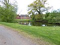
 Pool, Bagborough Plantation - geograph.org.uk - 2756453.jpg 2,592 × 1,944; 2.17 MB
-
 Quantock Roses. - geograph.org.uk - 159404.jpg 640 × 475; 129 KB
-
 Rambling branches above Muchcare Wood - geograph.org.uk - 5492790.jpg 6,000 × 4,000; 5.44 MB
-
 Rising Sun, West Bagborough - geograph.org.uk - 5825309.jpg 1,024 × 683; 151 KB
-
 Rising Sun, West Bagborough.jpg 568 × 425; 78 KB
-
 Rock Farm, West Bagborough - geograph.org.uk - 4353117.jpg 2,592 × 1,944; 1.18 MB
-
 Rock Lane - geograph.org.uk - 3709688.jpg 1,024 × 773; 319 KB
-
 Sheep below West Bagborough - geograph.org.uk - 5490520.jpg 6,000 × 4,000; 4.32 MB
-
 St Pancras, Bagborough - geograph.org.uk - 5487051.jpg 5,410 × 3,754; 7.07 MB
-
 Standing water under the trees - geograph.org.uk - 5443616.jpg 6,000 × 4,000; 6.83 MB
-
 Stout Lane (2) - geograph.org.uk - 1141165.jpg 640 × 480; 131 KB
-
 Stout Lane (3) - geograph.org.uk - 1141202.jpg 640 × 480; 159 KB
-
 Stout Lane (4) - geograph.org.uk - 1141217.jpg 640 × 480; 149 KB
-
 Stout Lane (5) - geograph.org.uk - 1141396.jpg 640 × 480; 127 KB
-
 Stout Lane - geograph.org.uk - 1140850.jpg 640 × 471; 126 KB
-
 Sunset and sunrise at West Bagborough - geograph.org.uk - 4460020.jpg 800 × 618; 124 KB
-
 Taunton Deane , Countryside Scenery - geograph.org.uk - 5573808.jpg 6,000 × 4,000; 7.72 MB
-
 Taunton Deane , Crop Field - geograph.org.uk - 4286259.jpg 4,288 × 2,848; 6.57 MB
-
 Taunton Deane , New Road - geograph.org.uk - 4286247.jpg 4,288 × 2,848; 6.52 MB
-
 Taunton Deane , Shopnoller Road - geograph.org.uk - 4286256.jpg 4,288 × 2,848; 6.47 MB
-
 Taunton Deane , The A358 - geograph.org.uk - 4286242.jpg 4,288 × 2,848; 5.67 MB
-
 Taunton Deane , The A358 - geograph.org.uk - 4286245.jpg 4,288 × 2,848; 6.34 MB
-
 Taunton Deane , The Drove - geograph.org.uk - 5573806.jpg 6,000 × 4,000; 6.14 MB
-
 Taunton Deane , The Drove - geograph.org.uk - 5573807.jpg 6,000 × 4,000; 6.46 MB
-
 Taunton Deane , The Drove - geograph.org.uk - 5573810.jpg 4,000 × 6,000; 6.76 MB
-
 Telephone kiosk at West Bagborough - geograph.org.uk - 885486.jpg 640 × 480; 99 KB
-

-
 Thatched cottage and garden, West Bagborough - geograph.org.uk - 6114037.jpg 1,024 × 802; 273 KB
-
 Thatched cottage on the road to Triscombe - geograph.org.uk - 3709667.jpg 1,024 × 768; 177 KB
-
 The barrow and trig pillar on Wills Neck - geograph.org.uk - 6085474.jpg 1,600 × 1,065; 589 KB
-
 The Blue Ball Inn, Triscombe - geograph.org.uk - 5444851.jpg 6,000 × 4,000; 6.89 MB
-
 The churchyard, West Bagborough - geograph.org.uk - 6113996.jpg 1,024 × 823; 332 KB
-
 The northern side of Wills Neck - geograph.org.uk - 5443547.jpg 6,000 × 4,000; 5.22 MB
-
 The Rising Sun, West Bagborough - geograph.org.uk - 2756459.jpg 2,592 × 1,944; 1.42 MB
-
 The Rising Sun, West Bagborough - geograph.org.uk - 3709352.jpg 1,024 × 768; 181 KB
-
 The sign for the Blue Ball Inn - geograph.org.uk - 1884702.jpg 480 × 640; 123 KB
-
 The top of Lydeard Hill - geograph.org.uk - 5492692.jpg 6,000 × 4,000; 4.64 MB
-
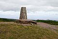
 The trig pillar on Wills Neck - geograph.org.uk - 6085473.jpg 1,600 × 1,200; 901 KB
-
 The Triscombe Stone - geograph.org.uk - 6085465.jpg 1,200 × 1,600; 1.04 MB
-
 Tilbury Farm - geograph.org.uk - 3709364.jpg 1,024 × 772; 173 KB
-
 Track on Lydeard Hill - geograph.org.uk - 3710946.jpg 1,024 × 768; 316 KB
-
 Track on Wills Neck - geograph.org.uk - 4055946.jpg 1,024 × 768; 224 KB
-
 Track on Wills Neck - geograph.org.uk - 4055975.jpg 1,024 × 768; 226 KB
-
 Track to London Farm - geograph.org.uk - 3708497.jpg 1,024 × 768; 228 KB
-
 Trig point on Wills Neck - geograph.org.uk - 4055962.jpg 1,024 × 774; 238 KB
-
 Trig point on Wills Neck - geograph.org.uk - 5443552.jpg 6,000 × 4,000; 4.63 MB
-
 Trig point, Wills Neck - geograph.org.uk - 2756445.jpg 2,592 × 1,944; 1.28 MB
-
 Triscombe - geograph.org.uk - 5825302.jpg 1,024 × 683; 229 KB
-
 Triscombe Stone - geograph.org.uk - 1357344.jpg 640 × 480; 94 KB
-
 Triscombe Stone - geograph.org.uk - 4055928.jpg 768 × 1,024; 263 KB
-
 Triscombe Stone - geograph.org.uk - 5443533.jpg 6,000 × 4,000; 6.26 MB
-
 Tumulus on Lydeard Hill - geograph.org.uk - 5492757.jpg 6,000 × 4,000; 4.72 MB
-
 Tumulus on Wills Neck - geograph.org.uk - 5443572.jpg 6,000 × 4,000; 4.58 MB
-
 Turning for Triscombe - geograph.org.uk - 3709334.jpg 1,024 × 768; 221 KB
-
 Valley south of Aisholt Common - geograph.org.uk - 6083286.jpg 1,600 × 1,200; 873 KB
-

-
 View from above Luxborough Farm - geograph.org.uk - 3711157.jpg 1,024 × 768; 201 KB
-
 View towards Hinkley Point - geograph.org.uk - 5569675.jpg 1,024 × 803; 165 KB
-
 View towards Lydeard Hill - geograph.org.uk - 4280813.jpg 640 × 426; 58 KB
-
 View towards Wills Neck - geograph.org.uk - 4280810.jpg 800 × 533; 77 KB
-
 Village house, West Bagborough - geograph.org.uk - 3709339.jpg 1,024 × 768; 193 KB
-
 West Bagborough - geograph.org.uk - 5487937.jpg 5,761 × 3,841; 4.84 MB
-
 West Bagborough village hall - geograph.org.uk - 885477.jpg 640 × 480; 73 KB
-
 West Somerset , The Drove Road - geograph.org.uk - 5573812.jpg 6,000 × 4,000; 6.45 MB
-
 Will's Neck trig point - geograph.org.uk - 5559707.jpg 3,456 × 2,304; 800 KB
-
 Wills Neck - geograph.org.uk - 3300147.jpg 2,592 × 1,944; 1.66 MB
-
 Wills Neck summit - geograph.org.uk - 4280720.jpg 640 × 426; 59 KB
-
 Wood Barton, Heathfield - geograph.org.uk - 3710927.jpg 1,024 × 768; 224 KB
-
 Woodland edge, Shopnoller - geograph.org.uk - 1187491.jpg 640 × 480; 132 KB
-
 Woodland path above Triscombe - geograph.org.uk - 5444837.jpg 6,000 × 4,000; 7.02 MB
-
 Woodland path in Bagborough Plantation - geograph.org.uk - 5443604.jpg 6,000 × 4,000; 7.27 MB
-
 Woodland track on Lydeard Hill - geograph.org.uk - 3710990.jpg 1,024 × 768; 286 KB
-
 Worn paths on the Quantocks - geograph.org.uk - 4056228.jpg 1,024 × 768; 219 KB
-
 Aisholt Common - geograph.org.uk - 1187829.jpg 640 × 480; 108 KB
-
 Aisholt Common - geograph.org.uk - 231161.jpg 640 × 480; 97 KB
-
 Approaching West Bagborough - geograph.org.uk - 1141288.jpg 480 × 640; 128 KB
-
 Cottages at Seven Ash - geograph.org.uk - 159400.jpg 640 × 476; 80 KB
-
 Lydeard Hill car park, Quantock Hills - geograph.org.uk - 109129.jpg 568 × 425; 89 KB
-
 Rock Farm - geograph.org.uk - 109149.jpg 568 × 425; 123 KB
-
 Shopnoller Farm, Shopnoller - geograph.org.uk - 163576.jpg 640 × 477; 129 KB
-
 Smokeham Farm - geograph.org.uk - 109152.jpg 568 × 425; 113 KB
-
-
 Tilbury Farm, Bagborough - geograph.org.uk - 109134.jpg 568 × 425; 109 KB
-

-
 Triscombe Quarry - geograph.org.uk - 618173.jpg 640 × 480; 99 KB
-
 Wills Neck Summit - geograph.org.uk - 7101.jpg 640 × 352; 45 KB


_-_geograph.org.uk_-_1279673.jpg)


_-_geograph.org.uk_-_4468110.jpg)
_-_geograph.org.uk_-_4468119.jpg)
_-_geograph.org.uk_-_4468123.jpg)
_-_geograph.org.uk_-_4468139.jpg)
_-_geograph.org.uk_-_4468141.jpg)
_-_geograph.org.uk_-_4468142.jpg)
_-_geograph.org.uk_-_4468145.jpg)
_-_geograph.org.uk_-_4468148.jpg)
_-_geograph.org.uk_-_4468156.jpg)
_-_geograph.org.uk_-_4468158.jpg)
_-_geograph.org.uk_-_4468160.jpg)
_-_geograph.org.uk_-_4468163.jpg)
_-_geograph.org.uk_-_4468168.jpg)
_-_geograph.org.uk_-_4468171.jpg)


.jpg)


_-_geograph.org.uk_-_1140784.jpg)
_-_geograph.org.uk_-_1140794.jpg)
_-_geograph.org.uk_-_1140801.jpg)


_-_geograph.org.uk_-_1141165.jpg)
_-_geograph.org.uk_-_1141202.jpg)
_-_geograph.org.uk_-_1141217.jpg)
_-_geograph.org.uk_-_1141396.jpg)


