Category:West Hythe
hamlet in Kent, United Kingdom | |||||
| Upload media | |||||
| Instance of |
| ||||
|---|---|---|---|---|---|
| Location | Hythe, Folkestone and Hythe, Kent, South East England, England | ||||
 | |||||
Subcategories
This category has only the following subcategory.
M
- St Mary's church, West Hythe (2 F)
Media in category "West Hythe"
The following 25 files are in this category, out of 25 total.
-
 A nice place to rest a while - geograph.org.uk - 1353195.jpg 640 × 480; 200 KB
-
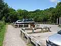 Car park near West Hythe Bridge - geograph.org.uk - 1357370.jpg 640 × 480; 146 KB
-
 Level crossing on the R.H.D.R. - geograph.org.uk - 408590.jpg 640 × 480; 66 KB
-
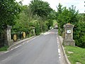 Looking N over West Hythe Bridge - geograph.org.uk - 1353495.jpg 640 × 480; 277 KB
-

-
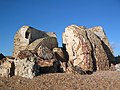 Remains of Martello Tower 19 - geograph.org.uk - 355745.jpg 640 × 480; 115 KB
-
 Royal Military Canal - geograph.org.uk - 786594.jpg 640 × 452; 93 KB
-
 Royal Military Canal - geograph.org.uk - 786596.jpg 640 × 447; 70 KB
-

-
 Royal Military Canal pillbox, Port Lympne, Kent.jpg 2,992 × 2,992; 2.41 MB
-
 Sheep graze near Selby Farm - geograph.org.uk - 454552.jpg 640 × 480; 115 KB
-
 The hills near West Hythe - geograph.org.uk - 264.jpg 640 × 480; 64 KB
-
 The Royal Military Canal Path - geograph.org.uk - 1356715.jpg 640 × 480; 201 KB
-

-
 View of The Roughs from the canal path - geograph.org.uk - 1352743.jpg 640 × 480; 184 KB
-
 At the top of the Roller Coaster - geograph.org.uk - 34600.jpg 640 × 480; 88 KB
-
 Botolphs Bridge - geograph.org.uk - 408586.jpg 640 × 480; 66 KB
-
 Botolphs Bridge Inn - geograph.org.uk - 408584.jpg 640 × 480; 62 KB
-
 Botolphs Bridge Inn, near West Hythe - geograph.org.uk - 1413717.jpg 640 × 480; 66 KB
-

-

-
 Road-sign in West Hythe village - geograph.org.uk - 21447.jpg 640 × 547; 115 KB
-
 Romney Marsh from Port Lympne Zoo - geograph.org.uk - 686573.jpg 640 × 433; 55 KB
-
 The Mansion at Port Lympne - geograph.org.uk - 231168.jpg 640 × 427; 96 KB
-
 Works, Donkey Street - geograph.org.uk - 408588.jpg 620 × 465; 48 KB


