Category:West Winch
village and civil parish in Norfolk, UK  | |||||
| Upload media | |||||
| Instance of | |||||
|---|---|---|---|---|---|
| Location | King's Lynn and West Norfolk, Norfolk, East of England, England | ||||
| Area |
| ||||
 | |||||
Subcategories
This category has the following 3 subcategories, out of 3 total.
Media in category "West Winch"
The following 157 files are in this category, out of 157 total.
-
 A bit of farming going on - geograph.org.uk - 5843124.jpg 1,024 × 681; 66 KB
-

-
 A large cultivated field, Setchey - geograph.org.uk - 2610548.jpg 640 × 480; 169 KB
-
 A U-bend in Mill Road, Setchey - geograph.org.uk - 2610556.jpg 640 × 480; 185 KB
-

-
 A10 heading north - geograph.org.uk - 466852.jpg 640 × 480; 96 KB
-
 A10 to Setchey - geograph.org.uk - 5588376.jpg 1,600 × 1,200; 316 KB
-
 A10, outskirts of West Winch - geograph.org.uk - 5685168.jpg 640 × 428; 79 KB
-
 A10, Setchey - geograph.org.uk - 5685157.jpg 640 × 428; 107 KB
-
 A10, West Winch - geograph.org.uk - 5685173.jpg 640 × 428; 109 KB
-
 A10, West Winch - geograph.org.uk - 5685182.jpg 640 × 428; 96 KB
-
 Abbey Farm, West Winch - geograph.org.uk - 577921.jpg 3,008 × 2,000; 2.82 MB
-

-

-
 Back Lane, West Winch - geograph.org.uk - 2229682.jpg 640 × 480; 114 KB
-
 Black railings on Back Lane, West Winch, King's Lynn - geograph.org.uk - 2475295.jpg 2,848 × 2,136; 3.11 MB
-
 Brook Farm by Rectory Lane - geograph.org.uk - 6328265.jpg 1,600 × 1,067; 429 KB
-
 Bus shelter at West Winch - geograph.org.uk - 5984893.jpg 1,600 × 1,142; 840 KB
-
 Collection of telephone boxes - geograph.org.uk - 466848.jpg 640 × 480; 98 KB
-

-
 Common Close, West Winch - geograph.org.uk - 2229686.jpg 640 × 480; 100 KB
-
 Cottage beside the River Nar, Setchey - geograph.org.uk - 2610558.jpg 640 × 480; 157 KB
-
 Cottages beside Mill Road, Setchey - geograph.org.uk - 2610568.jpg 640 × 480; 172 KB
-
 Drainage ditch - geograph.org.uk - 5030848.jpg 640 × 426; 32 KB
-
 East View Park Homes, West Winch - geograph.org.uk - 6328310.jpg 1,600 × 1,067; 280 KB
-
 Electricity pylons beside Setchey Road - geograph.org.uk - 2610458.jpg 640 × 480; 130 KB
-
 Esso station in West Winch.jpg 3,000 × 2,000; 1.01 MB
-
 Farm units off Setch Road - geograph.org.uk - 4664598.jpg 1,600 × 1,064; 307 KB
-
 Farmland - geograph.org.uk - 5033500.jpg 640 × 426; 34 KB
-
 Farmland by River Nar - geograph.org.uk - 5842961.jpg 1,024 × 681; 94 KB
-
 Farmland north of the River Nar, Setchey - geograph.org.uk - 2610529.jpg 640 × 480; 250 KB
-
 Farmland, Hall Road, West Winch - geograph.org.uk - 2475312.jpg 2,848 × 2,136; 3.08 MB
-
 Fen-scape, Setchey - geograph.org.uk - 2610552.jpg 640 × 480; 173 KB
-

-
 Fenland east of Setchey - geograph.org.uk - 2610504.jpg 640 × 480; 214 KB
-
 Field by A10, West Winch - geograph.org.uk - 6328243.jpg 1,600 × 1,123; 403 KB
-
 Field by Rectory Lane - geograph.org.uk - 6328264.jpg 1,600 × 1,067; 311 KB
-
 Field by the A10, West Winch - geograph.org.uk - 6328308.jpg 1,600 × 1,175; 284 KB
-
 Fields and electricity pylons, Setchey - geograph.org.uk - 2610459.jpg 640 × 480; 150 KB
-
 Fields beside the River Nar, Setchey - geograph.org.uk - 2610520.jpg 640 × 480; 248 KB
-
 Fields south of West Winch - geograph.org.uk - 2610462.jpg 640 × 480; 133 KB
-
 Fir Tree Drive, West Winch - geograph.org.uk - 2229718.jpg 640 × 480; 109 KB
-
 Firtree Drive, West Winch - geograph.org.uk - 2229677.jpg 640 × 480; 108 KB
-
 Flat farmland - geograph.org.uk - 5033498.jpg 640 × 341; 25 KB
-
 Flat field - geograph.org.uk - 5030851.jpg 640 × 328; 23 KB
-
 Flowers on the Nar Valley Way, Setchey - geograph.org.uk - 2610528.jpg 640 × 480; 239 KB
-
 Flytip near Setch Road, Setchey - geograph.org.uk - 2289358.jpg 760 × 570; 162 KB
-

-
 Footpath by the Nar - geograph.org.uk - 5596090.jpg 1,600 × 1,200; 482 KB
-
 Forecourt with car sales, Setchey - geograph.org.uk - 5984887.jpg 1,600 × 895; 182 KB
-
 Gas pipeline marker, Chequers Lane - geograph.org.uk - 6328253.jpg 1,600 × 1,095; 373 KB
-
 Gate on the bank of The River Nar near Setchy - geograph.org.uk - 3953805.jpg 4,320 × 3,240; 5.96 MB
-
 Hall Lane, West Winch - geograph.org.uk - 577792.jpg 3,008 × 2,000; 2.54 MB
-

-
 Harvested fields east of Setchey - geograph.org.uk - 2610477.jpg 640 × 480; 186 KB
-
 Harvested fields east of Setchey - geograph.org.uk - 2610499.jpg 640 × 480; 178 KB
-
 Horses along the Nar Valley Way - geograph.org.uk - 5467956.jpg 800 × 539; 105 KB
-
 Horses by Rectory Lane - geograph.org.uk - 6328282.jpg 1,600 × 1,067; 358 KB
-
 House building, West Winch - geograph.org.uk - 6328307.jpg 1,600 × 1,060; 233 KB
-
 House on Chequers Lane - geograph.org.uk - 6328256.jpg 1,600 × 1,067; 516 KB
-
 Houses by Rectory Lane - geograph.org.uk - 6328276.jpg 1,600 × 1,067; 283 KB
-
 Industrial buildings, Setchey - geograph.org.uk - 2610546.jpg 640 × 480; 153 KB
-
 Layby by the A10 - geograph.org.uk - 5588360.jpg 1,600 × 1,178; 226 KB
-
 Mallard on the River Nar, Setchey - geograph.org.uk - 2610523.jpg 640 × 480; 184 KB
-
 Manure pile by Rectory Lane - geograph.org.uk - 6328277.jpg 1,600 × 1,067; 299 KB
-
 Mill Road next to the River Nar - geograph.org.uk - 5467468.jpg 800 × 612; 169 KB
-
 Moto cross track, West Winch - geograph.org.uk - 5545409.jpg 640 × 370; 33 KB
-
 Nar Valley Way - geograph.org.uk - 5588385.jpg 1,600 × 1,200; 337 KB
-
 Nar Valley Way sign - geograph.org.uk - 807623.jpg 480 × 640; 90 KB
-

-
 National School building, West Winch - geograph.org.uk - 2108546.jpg 640 × 454; 155 KB
-

-
 Old Milestone - geograph.org.uk - 2730223.jpg 768 × 1,024; 319 KB
-
 Old Milestone - geograph.org.uk - 2730233.jpg 1,024 × 768; 317 KB
-
 Old Oak by the roadside At Setchey - geograph.org.uk - 2229694.jpg 640 × 480; 115 KB
-
 Old Rover on Mill Road - geograph.org.uk - 5588382.jpg 1,600 × 1,248; 305 KB
-
 OS Flush Bracket 10777 Setchey - geograph.org.uk - 1888607.jpg 1,024 × 819; 284 KB
-
 Paddock gate south of West Winch - geograph.org.uk - 3769032.jpg 4,320 × 3,240; 5.84 MB
-

-
 Public convenience, I think not^ - geograph.org.uk - 2289364.jpg 760 × 570; 194 KB
-
 Pylon by River Nar - geograph.org.uk - 5842956.jpg 1,024 × 743; 84 KB
-
 Pylon by River Nar - geograph.org.uk - 5843126.jpg 1,024 × 681; 114 KB
-
 Pylon in an arable landscape - geograph.org.uk - 5033501.jpg 640 × 572; 43 KB
-
 Pylon in the mist - geograph.org.uk - 5030847.jpg 640 × 426; 38 KB
-
 Railway line crossing the River Nar - geograph.org.uk - 5467950.jpg 800 × 579; 133 KB
-
 Rectory Lane towards A10 - geograph.org.uk - 6328279.jpg 1,600 × 1,067; 433 KB
-
 Reeds growing in the River Nar, Setchey - geograph.org.uk - 2610530.jpg 640 × 480; 216 KB
-
 River Nar - geograph.org.uk - 5585902.jpg 1,600 × 1,200; 316 KB
-
 River Nar - geograph.org.uk - 5588388.jpg 1,600 × 1,200; 330 KB
-
 River Nar at Setchey - geograph.org.uk - 2229722.jpg 640 × 480; 118 KB
-
 River Nar at Setchey Bridge - geograph.org.uk - 5984882.jpg 1,600 × 1,066; 673 KB
-
 Roadside flowers, Long Lane, West Winch - geograph.org.uk - 2475260.jpg 2,848 × 2,136; 3.15 MB
-
 Root vegetables by Chequers Lane - geograph.org.uk - 6328248.jpg 1,600 × 1,067; 430 KB
-
 School Cottages and church, West Winch - geograph.org.uk - 2108564.jpg 480 × 640; 150 KB
-
 School Cottages in West Winch - geograph.org.uk - 2108558.jpg 640 × 480; 119 KB
-
 Setchey Primitive Methodist chapel - geograph.org.uk - 2229701.jpg 640 × 480; 143 KB
-
 Shop and Post Office in West Winch - geograph.org.uk - 2108568.jpg 640 × 480; 84 KB
-
 Silvertree Way, West Winch - geograph.org.uk - 2229674.jpg 640 × 480; 102 KB
-

-

-
 St Mary's church in West Winch - geograph.org.uk - 2108582.jpg 640 × 480; 147 KB
-
 St Mary's church in West Winch - geograph.org.uk - 2108586.jpg 480 × 640; 138 KB
-

-

-

-

-

-

-

-

-
 St Mary, West Winch, Norfolk - Chancel - geograph.org.uk - 1920564.jpg 1,000 × 667; 120 KB
-
 St Mary, West Winch, Norfolk - East end - geograph.org.uk - 1920559.jpg 1,000 × 662; 123 KB
-
 St Mary, West Winch, Norfolk - Font - geograph.org.uk - 1920584.jpg 647 × 1,000; 103 KB
-
 St Mary, West Winch, Norfolk - geograph.org.uk - 1920551.jpg 1,000 × 677; 211 KB
-
 St Mary, West Winch, Norfolk - geograph.org.uk - 1920552.jpg 1,000 × 683; 243 KB
-
 St Mary, West Winch, Norfolk - geograph.org.uk - 1920557.jpg 725 × 1,000; 235 KB
-
 St Mary, West Winch, Norfolk - Interior - geograph.org.uk - 1920561.jpg 1,000 × 666; 125 KB
-
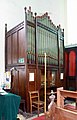 St Mary, West Winch, Norfolk - Organ - geograph.org.uk - 1920585.jpg 641 × 1,000; 155 KB
-
 St Mary, West Winch, Norfolk - Porch - geograph.org.uk - 1920560.jpg 1,000 × 706; 264 KB
-
 St Mary, West Winch, Norfolk - Pulpit - geograph.org.uk - 1920574.jpg 660 × 1,000; 129 KB
-
 St Mary, West Winch, Norfolk - Wall monument - geograph.org.uk - 1920572.jpg 999 × 1,000; 124 KB
-
 St Mary, West Winch, Norfolk - Wall monument - geograph.org.uk - 1920575.jpg 651 × 1,000; 105 KB
-
 St Mary, West Winch, Norfolk - West doorway - geograph.org.uk - 1920556.jpg 1,000 × 706; 266 KB
-
 St Mary, West Winch, Norfolk - West end - geograph.org.uk - 1920567.jpg 1,000 × 677; 121 KB
-
 St Mary, West Winch, Norfolk - Window - geograph.org.uk - 1920568.jpg 664 × 1,000; 261 KB
-

-

-
 Sugar beet harvest under way - geograph.org.uk - 6328240.jpg 1,600 × 1,067; 355 KB
-
 Sugar beet heap on Setch Road - geograph.org.uk - 3769041.jpg 4,320 × 3,240; 5.48 MB
-
 Sugar beet pile by Chequers Lane - geograph.org.uk - 6328238.jpg 1,600 × 1,067; 360 KB
-
 Swan on the River Nar - geograph.org.uk - 5467474.jpg 800 × 541; 125 KB
-
 Swans on the River Nar near Setchey - geograph.org.uk - 2229669.jpg 640 × 480; 112 KB
-
 Swans on the River Nar near Setchey - geograph.org.uk - 2229671.jpg 640 × 480; 121 KB
-
 The Fens by River Nar - geograph.org.uk - 5843123.jpg 1,024 × 580; 74 KB
-
 The Nar Valley Way near Setchey - geograph.org.uk - 3953831.jpg 4,320 × 3,240; 5.96 MB
-
 The River Nar east of Setchey - geograph.org.uk - 2610525.jpg 640 × 480; 174 KB
-
 The River Nar west of Setchey Bridge - geograph.org.uk - 2610475.jpg 640 × 480; 202 KB
-
 The Winch public house - geograph.org.uk - 2229713.jpg 640 × 480; 102 KB
-
 The Winch public house, West Winch - geograph.org.uk - 6328312.jpg 1,600 × 1,036; 378 KB
-
 The Winch. - geograph.org.uk - 5525239.jpg 640 × 480; 80 KB
-

-

-
 Transformer in Rectory Lane, West Winch - geograph.org.uk - 2108535.jpg 640 × 480; 103 KB
-
 View along Mill Road, Setchey - geograph.org.uk - 2610565.jpg 640 × 480; 158 KB
-

-

-
 View along the River Nar west of Setchey - geograph.org.uk - 2610570.jpg 640 × 480; 194 KB
-

-

-
 View towards Bridge House, Setchey - geograph.org.uk - 2610469.jpg 640 × 480; 173 KB
-
 View towards Chase Farm, Setchey - geograph.org.uk - 2610517.jpg 640 × 480; 179 KB
-
 West Winch Post Office - geograph.org.uk - 2108570.jpg 640 × 480; 116 KB
-

-
 West Winch Towermill - geograph.org.uk - 466840.jpg 480 × 640; 100 KB
-

-
 West Winch village sign - geograph.org.uk - 256659.jpg 392 × 640; 93 KB
-
 William Burt Centre at West Winch - geograph.org.uk - 256655.jpg 640 × 456; 99 KB


_-_geograph.org.uk_-_2108604.jpg)


