Category:Westbury, Shropshire
English: Westbury is a village and parish in Shropshire, England. It lies 8 miles west of the town of Shrewsbury, very close to the border with Wales.
village and civil parish in Shropshire, United Kingdom  | |||||
| Upload media | |||||
| Instance of | |||||
|---|---|---|---|---|---|
| Location | Shropshire, West Midlands, England | ||||
| Area |
| ||||
 | |||||
Subcategories
This category has the following 4 subcategories, out of 4 total.
S
- Stoney Stretton (3 F)
W
- Whitton Hall, Shropshire (1 F)
- Winsley, Shropshire (4 F)
Media in category "Westbury, Shropshire"
The following 200 files are in this category, out of 318 total.
(previous page) (next page)-

-

-
 A barn full of bales - geograph.org.uk - 3227248.jpg 891 × 668; 309 KB
-
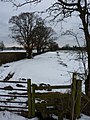
 A bridge and stile across a drainage ditch - geograph.org.uk - 3405038.jpg 1,142 × 857; 320 KB
-
 A change of purpose - geograph.org.uk - 2384167.jpg 640 × 480; 96 KB
-
 A field above Haywood Farm - geograph.org.uk - 3226508.jpg 1,142 × 857; 354 KB
-
 A field barn near Diptreehills - geograph.org.uk - 3227028.jpg 1,142 × 857; 296 KB
-
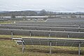
 A new solar farm - geograph.org.uk - 4645393.jpg 640 × 426; 47 KB
-
 A rather damp byway above Broomhill - geograph.org.uk - 3227267.jpg 734 × 979; 405 KB
-
 A rather vague footpath - geograph.org.uk - 3405040.jpg 1,306 × 979; 241 KB
-
 A slurry silo beside Broomhill Wood - geograph.org.uk - 3227252.jpg 1,142 × 857; 364 KB
-
 Above Monksfields Farm - geograph.org.uk - 3225834.jpg 1,142 × 857; 360 KB
-
 Alberbury and Shropshire plain - geograph.org.uk - 489635.jpg 640 × 480; 94 KB
-
 America - geograph.org.uk - 464774.jpg 640 × 427; 73 KB
-
 Ancient barn at Whitton Farm - geograph.org.uk - 3405524.jpg 1,142 × 857; 381 KB
-

-
 Approaching entrance to Monksfield - geograph.org.uk - 4599240.jpg 640 × 478; 81 KB
-

-
 Approaching Vennington Farm from the north - geograph.org.uk - 3405502.jpg 1,240 × 930; 310 KB
-
 Arable farmland - geograph.org.uk - 2093729.jpg 640 × 480; 83 KB
-
 Ash tree on the lane east of Forest Farm - geograph.org.uk - 3227025.jpg 857 × 1,142; 320 KB
-
 Ash trees and a country lane - geograph.org.uk - 3225823.jpg 734 × 979; 352 KB
-
 B4386 at Lower House Farm - geograph.org.uk - 3680354.jpg 640 × 453; 49 KB
-
 B4386 at Woodside - geograph.org.uk - 3680368.jpg 640 × 404; 41 KB
-
 B4386 entering Yockleton - geograph.org.uk - 3680255.jpg 640 × 407; 50 KB
-
 B4386 through Nox - geograph.org.uk - 3680247.jpg 640 × 412; 65 KB
-
 B4386 through Yockleton - geograph.org.uk - 3680258.jpg 640 × 473; 55 KB
-
 B4387 leaving Westbury - geograph.org.uk - 4605408.jpg 640 × 393; 95 KB
-
 Barn at Trefnant Hall Farm - geograph.org.uk - 4605473.jpg 640 × 480; 115 KB
-
 Barn conversion - geograph.org.uk - 2797081.jpg 640 × 480; 65 KB
-
 Barn gable at Forest Farm - geograph.org.uk - 3227014.jpg 857 × 643; 305 KB
-
 Bend at entrance to Marche Manor - geograph.org.uk - 4599376.jpg 640 × 433; 141 KB
-
-
 Bend with crash barrier - geograph.org.uk - 4605291.jpg 640 × 423; 84 KB
-
 Between the railway and A458 - geograph.org.uk - 4431521.jpg 640 × 426; 40 KB
-
 Bin on the bend - geograph.org.uk - 4605240.jpg 640 × 426; 90 KB
-
 Bridge on the west of Yockleton - geograph.org.uk - 4494166.jpg 1,600 × 1,200; 1.65 MB
-
 Bridleway up Causemountain - geograph.org.uk - 3405903.jpg 857 × 1,142; 401 KB
-
 Broxton Wood by B4386 - geograph.org.uk - 4494203.jpg 1,600 × 962; 1,012 KB
-
 Building work at Vron Gate (1) - geograph.org.uk - 4497121.jpg 1,600 × 1,600; 1.62 MB
-
 Building work at Vron Gate (2) - geograph.org.uk - 4497124.jpg 1,600 × 1,200; 1.2 MB
-
 Burley Place - geograph.org.uk - 3405493.jpg 1,142 × 857; 319 KB
-
 Burley Place across the fields - geograph.org.uk - 3405486.jpg 1,142 × 857; 290 KB
-
 Byway junction above Broomhill - geograph.org.uk - 3227270.jpg 979 × 734; 405 KB
-
 Cables crossing B4386 near Siteley - geograph.org.uk - 3680364.jpg 640 × 356; 40 KB
-
 Cae Howel - geograph.org.uk - 651583.jpg 640 × 480; 59 KB
-

-
 Chapel at Vron Gate - geograph.org.uk - 2093713.jpg 640 × 480; 81 KB
-
 Chicken shed, Silverdale Farm - geograph.org.uk - 4645402.jpg 640 × 426; 38 KB
-
 Corner of a field and a stile - geograph.org.uk - 3226995.jpg 1,142 × 857; 406 KB
-
 Cottage beside the B4386 road - geograph.org.uk - 5929590.jpg 1,024 × 768; 420 KB
-
 Cottage in Vennington - geograph.org.uk - 2093714.jpg 640 × 480; 73 KB
-
 Cottages at the turning for Westley - geograph.org.uk - 3423520.jpg 1,306 × 979; 422 KB
-
 Cottages at turning for Westley - geograph.org.uk - 3680385.jpg 640 × 480; 67 KB
-
 Cottages on the road to Whitton Hall - geograph.org.uk - 3405568.jpg 1,142 × 857; 420 KB
-
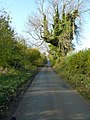
 Country lane in Westbury, Shropshire, England.jpg 640 × 480; 59 KB
-
 Crossroads on B4386 north of Stoney Stretton - geograph.org.uk - 4494178.jpg 1,600 × 1,198; 1.26 MB
-
 Cutting between Vennington and Vron Gate - geograph.org.uk - 4497116.jpg 1,600 × 1,200; 1.64 MB
-

-
 Date on the chapel at Vron Gate - geograph.org.uk - 4497131.jpg 1,600 × 1,200; 1.73 MB
-
 Derelict farm buildings - geograph.org.uk - 2093720.jpg 640 × 480; 90 KB
-
 Down the bridleway towards Whitton Hall - geograph.org.uk - 3405900.jpg 1,306 × 979; 319 KB
-
 Driveway Entrance - geograph.org.uk - 690572.jpg 640 × 427; 78 KB
-
 Driveway to the church, Westbury - geograph.org.uk - 4910775.jpg 2,048 × 1,536; 754 KB
-
 Dutch barn at Holly Farm - geograph.org.uk - 3227279.jpg 1,142 × 857; 355 KB
-
 Dutch barn near Haywood Farm - geograph.org.uk - 3226506.jpg 1,142 × 857; 404 KB
-
 Earthwork - geograph.org.uk - 4431545.jpg 640 × 426; 41 KB
-
 Edge - geograph.org.uk - 515563.jpg 640 × 480; 74 KB
-
 Edwardian wallbox at Forest Farm - geograph.org.uk - 3227012.jpg 857 × 1,142; 396 KB
-
 Entering Westbury at Causdale - geograph.org.uk - 4605393.jpg 640 × 412; 61 KB
-
 Entering Westbury on B4386 - geograph.org.uk - 3680371.jpg 640 × 439; 93 KB
-
 Entering Yockleton - geograph.org.uk - 1338062.jpg 640 × 480; 58 KB
-

-

-
 Entrance to Blackmore reservoir - geograph.org.uk - 2093708.jpg 640 × 480; 131 KB
-
 Entrance to Caus Castle Farm - geograph.org.uk - 4605278.jpg 640 × 480; 100 KB
-
 Entrance to Mountain Farm - geograph.org.uk - 3225813.jpg 979 × 734; 363 KB
-
 Entrance to The Hazels - geograph.org.uk - 4605212.jpg 640 × 480; 82 KB
-
 Entrance to Upper Trefnant - geograph.org.uk - 4605484.jpg 640 × 325; 88 KB
-
 Entrance to Yockleton Business Park - geograph.org.uk - 4494169.jpg 1,600 × 1,598; 1.54 MB
-
 Farm buildings at Broomhill - geograph.org.uk - 3227261.jpg 1,142 × 857; 417 KB
-
 Farm buildings at Vron Gate - geograph.org.uk - 4599386.jpg 640 × 302; 57 KB
-
 Farm land at Whitfield - geograph.org.uk - 2560543.jpg 640 × 480; 67 KB
-
 Farm land near Little Heyford - geograph.org.uk - 2560568.jpg 640 × 480; 76 KB
-
 Farm track on a hillside - geograph.org.uk - 2093699.jpg 640 × 480; 97 KB
-
 Farmland - geograph.org.uk - 4633157.jpg 640 × 426; 57 KB
-
 Farmland by the Cambrian line - geograph.org.uk - 4431460.jpg 640 × 426; 57 KB
-
 Farmland near Nox - geograph.org.uk - 4431448.jpg 382 × 640; 42 KB
-
 Farmland south of Wattlesborough - geograph.org.uk - 4645391.jpg 640 × 426; 49 KB
-
 Farmland, Stretton Heath - geograph.org.uk - 4645405.jpg 640 × 426; 48 KB
-
 Field and snow east of the B4386 - geograph.org.uk - 3424732.jpg 1,142 × 857; 376 KB
-

-

-
 Field by The Cambrian Line - geograph.org.uk - 4431453.jpg 640 × 426; 44 KB
-
 Field by The Cambrian Line - geograph.org.uk - 4431456.jpg 640 × 426; 35 KB
-
 Field edge path with a view - geograph.org.uk - 3226999.jpg 1,142 × 857; 320 KB
-
 Field edge view at The Edge Triangulation Pillar - geograph.org.uk - 5233683.jpg 4,000 × 3,000; 4.8 MB
-

-
 Fields and woods south of Wattlesborough Heath - geograph.org.uk - 5028828.jpg 1,600 × 683; 104 KB
-
 Fields by the railway line, west of Yockleton - geograph.org.uk - 4562281.jpg 1,600 × 958; 221 KB
-
 Fields north of the railway line, near Yockleton - geograph.org.uk - 4558131.jpg 1,600 × 771; 163 KB
-
 Fields south of Whitley Crest, from the railway - geograph.org.uk - 5028819.jpg 1,600 × 736; 123 KB
-
 Firlands - geograph.org.uk - 4431451.jpg 640 × 426; 39 KB
-
 Firlands - geograph.org.uk - 4431452.jpg 640 × 426; 62 KB
-
 Firlands, north of Yockleton - geograph.org.uk - 5029177.jpg 1,600 × 856; 101 KB
-

-

-
 Footpath through a stubble field - geograph.org.uk - 3226986.jpg 1,142 × 857; 288 KB
-
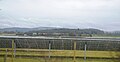
 Footpath through solar panels - geograph.org.uk - 4645398.jpg 640 × 426; 49 KB
-
 Footpath to Halfway House - geograph.org.uk - 3405037.jpg 857 × 1,142; 346 KB
-
 Footpath^ What footpath^ - geograph.org.uk - 3405484.jpg 1,142 × 857; 313 KB
-
 Former Public House^ - geograph.org.uk - 487517.jpg 640 × 480; 239 KB
-
 Glyn - geograph.org.uk - 4633153.jpg 640 × 426; 36 KB
-
 Grazing land - geograph.org.uk - 4645390.jpg 640 × 426; 45 KB
-
 Half Way up the Hill - geograph.org.uk - 819529.jpg 640 × 480; 67 KB
-
 Hargrave Bank trig - geograph.org.uk - 3225818.jpg 857 × 1,142; 389 KB
-
 Heading down to Whitton Hall - geograph.org.uk - 3405539.jpg 857 × 1,142; 389 KB
-
 High on Long Mountain - geograph.org.uk - 3225827.jpg 1,142 × 857; 295 KB
-
 Hill running into Vennington - geograph.org.uk - 4599369.jpg 524 × 640; 142 KB
-
 House on the eastern end of Aston Hill - geograph.org.uk - 3406140.jpg 1,306 × 979; 225 KB
-
 Houses in Nox - geograph.org.uk - 4494138.jpg 1,600 × 1,200; 1.25 MB
-

-
 Lane during a shower - geograph.org.uk - 2093703.jpg 640 × 480; 98 KB
-
 Lane junction in NCR 81 - geograph.org.uk - 2093711.jpg 640 × 480; 82 KB
-
 Lane just east of Springfields - geograph.org.uk - 4605217.jpg 640 × 434; 56 KB
-

-
 Lane passing the old Rose and Crown - geograph.org.uk - 4605442.jpg 640 × 335; 142 KB
-
 Level Crossing - geograph.org.uk - 172104.jpg 640 × 480; 109 KB
-
 Level crossing near Wattlesborough - geograph.org.uk - 4605412.jpg 640 × 415; 76 KB
-
 Looking into England - geograph.org.uk - 766825.jpg 640 × 426; 66 KB
-
 Looking into Wales - geograph.org.uk - 538932.jpg 640 × 480; 65 KB
-
 Looking west towards Heldre Hill - geograph.org.uk - 4497181.jpg 1,600 × 961; 893 KB
-
 Loton Park - geograph.org.uk - 414744.jpg 639 × 480; 96 KB
-
 Lower Farmhouse, Vennington.jpg 1,598 × 1,600; 1.65 MB
-
 Lower Wallop Farm - geograph.org.uk - 4605249.jpg 640 × 480; 88 KB
-
 Lower Wallop Farm from the road at Broomhill - geograph.org.uk - 3227255.jpg 1,142 × 857; 414 KB
-
 Lower Winnington Farm - geograph.org.uk - 582843.jpg 640 × 480; 107 KB
-
 Main line to Shrewsbury - geograph.org.uk - 2093724.jpg 640 × 480; 137 KB
-
 Making Hay - geograph.org.uk - 870307.jpg 640 × 425; 83 KB
-
 Marche Farm - geograph.org.uk - 4645389.jpg 640 × 426; 44 KB
-
 Marche Farm near Halfway - geograph.org.uk - 2560514.jpg 640 × 480; 79 KB
-
 Marche Lane crossing the railway - geograph.org.uk - 4599379.jpg 640 × 359; 96 KB
-
 Middle Farm, Vennington - geograph.org.uk - 3405513.jpg 1,142 × 857; 279 KB
-
 Middletown, view from the railway southwards - geograph.org.uk - 4561088.jpg 1,318 × 852; 355 KB
-
 Minor road junction east of Vennington - geograph.org.uk - 3405517.jpg 1,306 × 979; 280 KB
-
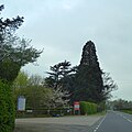
 Monkey puzzle tree at Blackmore - geograph.org.uk - 4497143.jpg 1,600 × 1,200; 1.34 MB
-
 Monksfield entrance - geograph.org.uk - 4599243.jpg 640 × 341; 99 KB
-
 Nearly at the top of Hargrave Bank - geograph.org.uk - 3225815.jpg 1,142 × 857; 323 KB
-

-
 Not even very suitable for Land Rovers - geograph.org.uk - 3406139.jpg 1,142 × 857; 347 KB
-

-
 Old Toll House, Winnington Green - geograph.org.uk - 6114983.jpg 600 × 450; 279 KB
-
 On Causemountain - geograph.org.uk - 3406131.jpg 1,469 × 1,102; 309 KB
-
 Ordnance Survey Cut Mark - geograph.org.uk - 4953418.jpg 503 × 640; 93 KB
-
 Ordnance Survey Flush Bracket 12145 - geograph.org.uk - 5233711.jpg 4,000 × 3,000; 4 MB
-
 Park Farm - geograph.org.uk - 4645410.jpg 640 × 426; 36 KB
-
 Part of Yockleton village - geograph.org.uk - 2697199.jpg 640 × 480; 83 KB
-
 Partonwood - geograph.org.uk - 4633159.jpg 640 × 384; 34 KB
-
 Passing Mountain Farm - geograph.org.uk - 4599314.jpg 640 × 410; 68 KB
-
 Penyfron cottages - geograph.org.uk - 3225814.jpg 1,142 × 857; 490 KB
-
 Poultry shed - geograph.org.uk - 4431540.jpg 640 × 321; 50 KB
-
 Primitive Methodist chapel at Vron Gate - geograph.org.uk - 4497128.jpg 1,600 × 1,066; 1.11 MB
-

-
 Private track left, bridleway straight on - geograph.org.uk - 3405897.jpg 1,240 × 930; 397 KB
-
 Railway at Yockleton - geograph.org.uk - 3845039.jpg 1,280 × 851; 324 KB
-
 Remains of Shrawardine Castle - geograph.org.uk - 464683.jpg 640 × 427; 82 KB
-
 Ring of trees - geograph.org.uk - 4431518.jpg 640 × 426; 44 KB
-
 Road approaching Vron Gate - geograph.org.uk - 4599317.jpg 640 × 447; 76 KB
-
 Road junction at Plantation Holding - geograph.org.uk - 4599306.jpg 640 × 480; 88 KB
-
 Road junction at Winnington - geograph.org.uk - 4605443.jpg 640 × 517; 84 KB
-
 Road junction for Rowley - geograph.org.uk - 4599245.jpg 640 × 413; 77 KB
-
 Road junction on Long Mountain - geograph.org.uk - 3225829.jpg 1,142 × 857; 347 KB
-
 Road passing Plantation Holding - geograph.org.uk - 4497157.jpg 1,600 × 800; 807 KB
-
 Road to Westbury through Blackmore - geograph.org.uk - 4599312.jpg 640 × 419; 108 KB
-
 Rolling hillside - geograph.org.uk - 4431512.jpg 640 × 426; 31 KB
-
 Roman Road on Hargrave Bank - geograph.org.uk - 3225812.jpg 734 × 979; 340 KB
-
 Royal Hill - geograph.org.uk - 462362.jpg 640 × 491; 103 KB
-
 Sheep pens beside the road - geograph.org.uk - 3225832.jpg 1,142 × 857; 423 KB
-
 Shop, cafe and post office - geograph.org.uk - 652325.jpg 640 × 480; 48 KB
-
 Shropshire Farmland - geograph.org.uk - 4431484.jpg 640 × 426; 44 KB
-
 Shropshire Field - geograph.org.uk - 4431494.jpg 640 × 426; 34 KB
-
 Silos at Upper House Farm - geograph.org.uk - 2384139.jpg 640 × 480; 59 KB
-
 Skirting The Wood - geograph.org.uk - 666986.jpg 640 × 398; 113 KB
-
 Small bridge on west of Westbury - geograph.org.uk - 4497094.jpg 1,600 × 1,200; 1.65 MB
-
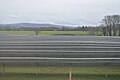
 Solar Farm - geograph.org.uk - 4645399.jpg 640 × 426; 56 KB
-
 Solar panels - geograph.org.uk - 4645394.jpg 640 × 426; 49 KB
-
 Solar panels - geograph.org.uk - 4645395.jpg 640 × 426; 46 KB
-
 Solar panels - geograph.org.uk - 4645397.jpg 640 × 426; 48 KB
-
 Solar panels - geograph.org.uk - 4645401.jpg 640 × 333; 32 KB
-
 Someone's got to give way^ - geograph.org.uk - 4605246.jpg 640 × 429; 122 KB
-
 South of the Cambrian line - geograph.org.uk - 4645409.jpg 640 × 426; 52 KB
-
 St Mary's C of E Primary School - geograph.org.uk - 3424772.jpg 1,142 × 857; 355 KB
-
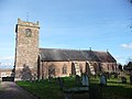
 St Mary's church at Westbury - geograph.org.uk - 4494221.jpg 1,600 × 1,200; 1.25 MB
-
-

-
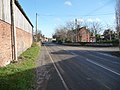
 Station Road, Westbury, Shropshire - geograph.org.uk - 1923066.jpg 1,600 × 1,179; 424 KB
-
 Steplis on minor road - geograph.org.uk - 4605426.jpg 640 × 480; 95 KB
-
 Steplis sign and entrance - geograph.org.uk - 4605427.jpg 640 × 313; 58 KB
-

-
 Straight road near Lower Trefnant - geograph.org.uk - 4605468.jpg 640 × 421; 104 KB


_-_geograph.org.uk_-_4497121.jpg)
_-_geograph.org.uk_-_4497124.jpg)


