Category:Westcott Barton
village and civil parish in West Oxfordshire, Oxfordshire, England  | |||||
| Upload media | |||||
| Instance of | |||||
|---|---|---|---|---|---|
| Location | West Oxfordshire, Oxfordshire, South East England, England | ||||
 | |||||
English: Westcott Barton, also spelt Wescot Barton or Wescote Barton, is a village and civil parish on the River Dorn in West Oxfordshire about south of Banbury. Westcott Barton's main area of housing is on the eastern boundary of the parish and contiguous with the village of Middle Barton in the neighbouring parish of Steeple Barton. The toponym has three modern spellings: the civil parish is "Westcot Barton", the village tends to be spelt "Westcott Barton" and a large house in the village is called "Westcote Barton" Lodge.
Subcategories
This category has only the following subcategory.
C
Media in category "Westcott Barton"
The following 8 files are in this category, out of 8 total.
-
 Enstone Road - geograph.org.uk - 6232962.jpg 640 × 480; 93 KB
-
 Farmland north of Middle Barton - geograph.org.uk - 5193027.jpg 640 × 480; 205 KB
-
 Ford on Fox Lane, Middle Barton - geograph.org.uk - 5193016.jpg 640 × 480; 240 KB
-
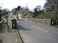 Westcott Barton, The Enstone Road Bridge - geograph.org.uk - 360994.jpg 640 × 480; 102 KB
-
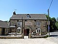 Westcot Barton-The Fox Inn - geograph.org.uk - 6194123.jpg 1,600 × 1,200; 553 KB
-
 Old Milestone (geograph 6114623).jpg 965 × 1,425; 252 KB
-
 Westcott Barton - geograph.org.uk - 6194119.jpg 1,600 × 1,200; 658 KB
-
 WestcottBarton TheFox.JPG 3,000 × 2,000; 820 KB


.jpg)

